
-
 62440 Hits
-
 93.1% Score
-
 41 Votes
|
|
Mountain/Rock |
|---|---|
|
|
48.80545°N / 113.73918°W |
|
|
Mountaineering |
|
|
9321 ft / 2841 m |
|
|
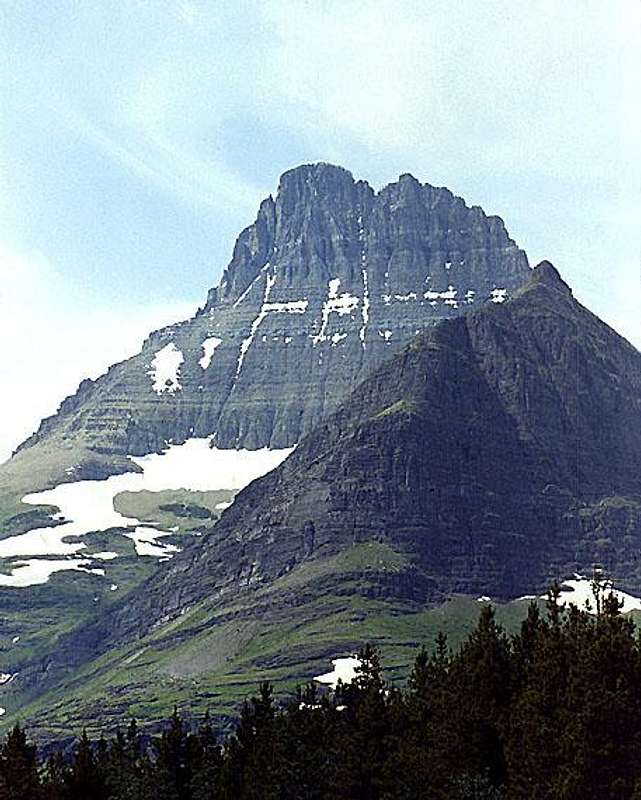
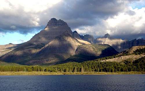 The classic view of Mount Wilbur from the east across Swiftcurrent Lake. Photo by csmcgranahan
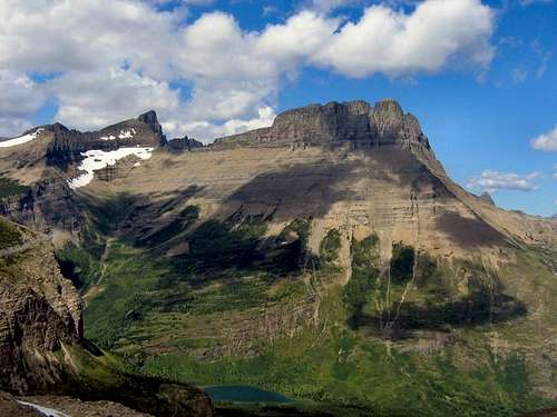 From the south
Overview
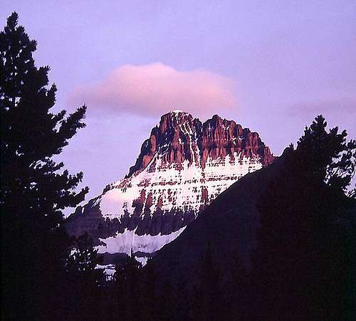 Early morning light on Mount Wilbur
 The north face of Mount Wilbur
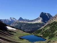
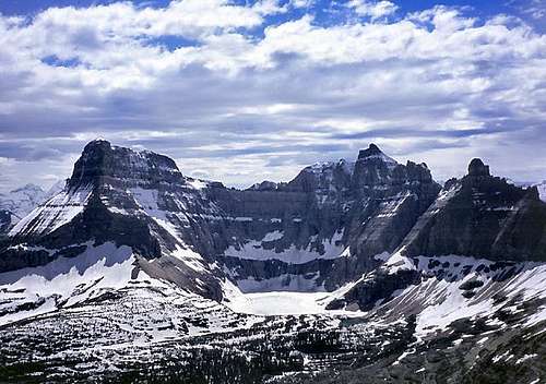
Viewed from the east, Mount Wilbur appears to be a fantastic freestanding fin of rock. In fact, the mountain has a roughly three-sided pyramid shape with relatively wide north and south faces. A long very jagged west ridge extends behind the impressive east face. There are five described routes on the east face and one on the north face. I do not know if the south face or the west ridge has been climbed.
Mount Wilbur was named in 1885 by G. B. Grinnell , for E. R. Wilbur, one of his partners in the Forest and Stream Publishing Company. Grinnell was one of the pioneers influential in the establishment of Glacier National Park. The mountain was known as "Heavy Shield" by the local Native Americans. The first ascent of Mount Wilbur was made via the East Face (variation unknown) on 20 August 1923 by Norman Clyde.
The first winter ascent was made in late November of 1969 by Jim Anderson, Pat Callis, Jurg Hofer, Mark Levitan, Jim Kanzler, and Cep Pogrebe via the East Face, Thin man and Chimney routes. (CLIMBING MAGAZINE, March-April 1975)
Views from Mount Wilbur
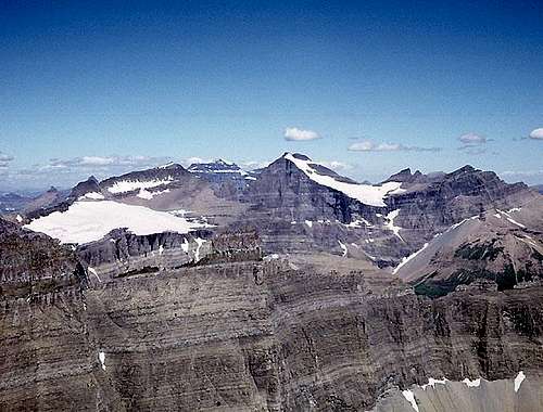 View north from the summit of Mount Wilbur
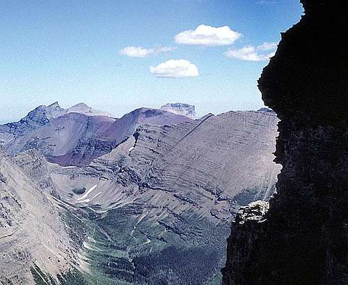 View NE from Mount Wilbur
 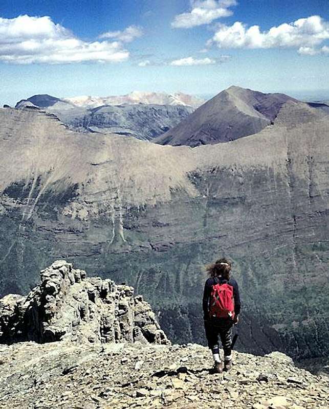 View east from Mount Wilbur summit
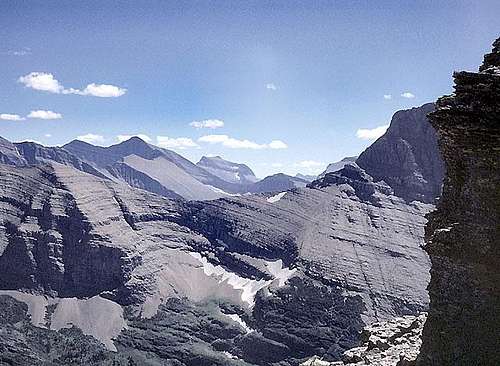 View S - SW from Mount Wilbur
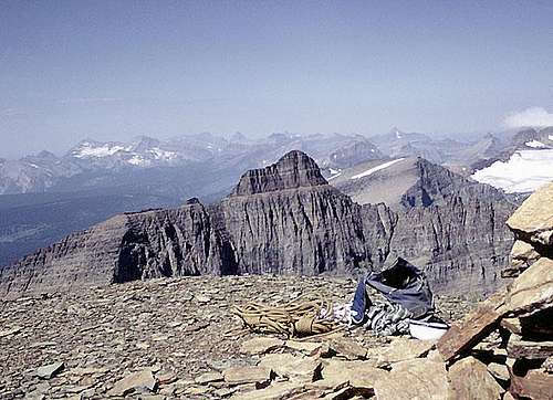 View northwest from Mount Wilbur
Getting There
 Across Swiftcurrent Lake.
Mount Wilbur is located in the Many Glacier area of Glacier National Park in northwestern Montana. Access is through the Many Glacier Entrance on the east side of the Park.
 From the northeast.
See maps Park map link here : Glacier National Park Home Page Many Glacier Area The road is not maintained for winter travel, but is usually open quite early in the spring. The road status can be checked at: Park Road Info
Red Tape
Current Entrance Fees Registration for day climbs in Glacier National Park is recommended, but not mandatory. Outdoor Activity Page Includes links to boating, bicycling, fishing, etc. and the regulations applying to each.
Routes Overview
GUIDEBOOK: A CLIMBER'S GUIDE TO GLACIER NATIONAL PARK; J. Gordon Edwards SPECIAL CONSIDERATIONS: Because of the nature of the rock, there are special considerations regarding climbing in Glacier National Park, and grading systems unique to the Park have been developed. Please see this Fact Sheet for further details: GNP Rock & Grading Systems All the routes described on Mount Wilbur are day climbs involving about 4,500 feet of elevation gain and distance 4 miles, half of this by trail.
 Mount Wilbur from the east.
EAST FACE The East Face routes are accessed via the Red Rock Falls Trail (see Many Glacier Trails Map: Many Glacier Area). There seems to be very little difference in difficulty between the five routes on the east face. All are class 4 and 5 chimney or gully climbs. Only the Thin Man's Pleasure Route has an outstanding feature separating it from the others.
The Direct Route, North Couloir Route, and Central Couloir Route are approached by entering the cirque at the base of the East Face and climbing more or less directly up the north side of deepest gully on the face (below the deepest notch at the top of the face). Some fairly difficult climbing including one overhang is encountered on this lower part of the face.
The three routes diverge at the base of a red rock band where the face steepens. 1) The Direct Route is a chimney climb directly to a notch at the top of the face via the left fork of the main gully. It is described as a straightforward chimney climb with an overhang at the top. 2) The North Couloir Route follows the right fork of the gully and leads via easy class 3 climbing to a more northerly notch at the top of the face. Class 4 climbing is then necessary to traverse to the summit. 3) The Central Couloir Route ascends between the Direct and North Couloir Routes and involves a couple of pitches with dangerously downsloping holds, but is indicated by Edwards to be the easiest of these three routes.
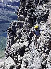
The Chimney Route and the Thin Man's Pleasure Route are approached over the broad shoulder at the left side of the east face. 4) The Chimney Route follows a deep chimney to a ledge that brings one to the notch at the base of the summit block. 5) The Thin Man's Pleasure Route (GMS IV(5) ML) climbs a chimney next to the Chimney Route. At the top is an overhanging roof with small hole leading through (see photo below). One climbs through the hole then up a shallow gully to gain the same ledge as the Chimney Route. An excellent trip report and photos: TRIP REPORT Climbing on the East Face
 Below Thin Man & Chimneys. Below Thin Man & Chimneys. |
 The Thin Man Roof. The Thin Man Roof. |
 Crazy"Jump Move"(Not mandatory.) Crazy"Jump Move"(Not mandatory.) |
NORTH FACE The Northwest Face Route is accessed from Iceberg Lake (see Many Glacier Trails map: Many Glacier Area). This is described as an extremely difficult climb involving many overhanging chimney pitches. It was first climbed in 1961 by Tom Choate, Renn Fenton, and Gil Averill and was not known to have been repeated as of 1989.
When To Climb
Summer season after most of the snow is gone from the East Face.
 Mount Wilbur with early...
Mountain Conditions
Weather Page an overview with a link to the local forecast. Webcam Page
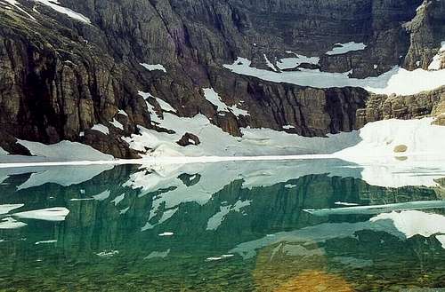
Iceberg Lake
 Iceberg Lake Cirque
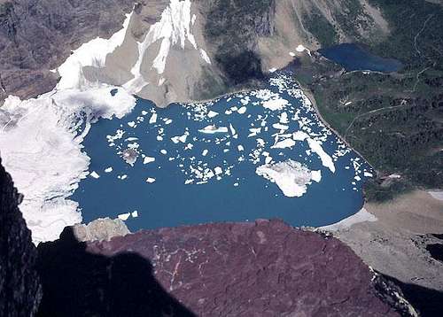 Iceberg Lake
Because of the orientation of the cirque and the exceptionally steep walls, the lake remains frozen until well into the summer and normally contains icebergs most of the summer.
The hike to the lake is mostly through fairly open terrain with fabulous views of Mount Wilbur and Pinnacle Wall. It is about 4.7 miles with 1,200 feet of elevation gain from Many Glacier to the lake. Links: Big Sky Fishing.com - an excellent trail description with many photos (note - there are no fish in Iceberg Lake - it is frozen too much of the year) Trip Report - a private party trip report with some nice photos
 Iceberg Lake
 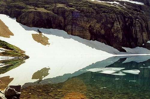 Iceberg Lake
 Camping
Backcountry Camping Page Includes trail status reports, campground availability, daily backcountry bulletins, and a backcountry blog. Car Camping Page There are also many campgrounds just outside the Park on both the west and east sides. Camping on the Blackfeet Reservation is restricted to established campgrounds only.
External Links
Glacier National Park Homepage Glacier Mountaineering Society Non-government Glacier National Park Information
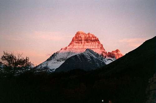
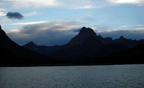 After SunsetPhoto by csmcgranahan