
|
|
Mountain/Rock |
|---|---|
|
|
40.51370°N / 105.63209°W |
|
|
Larimer |
|
|
Hiking |
|
|
Summer |
|
|
12040 ft / 3670 m |
|
|
Overview
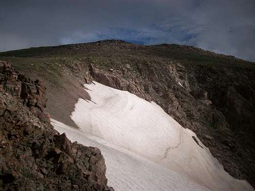 Skull Point is on the left
Elevation: 12040’
Elevation Gain: 3020’ (Stormy Peaks TH)
Mileage: 7 miles (Stormy Peaks TH)
Latitude: N40 30.837
Longitude: W105 37.815
Reaching Skull Point
Skull Point is best reached from Sugarloaf Mountain or Icefield Pass, climbing it from Mummy Pass would take you through a forest of willows and marches for nearly a mile. From Sugarloaf, it may save some time to lose elevation and scout out the western point. From Icefield Pass, it should be obvious which is the actual Skull Point, and requires a straightforward walk to the base of the granite blocks that make up the summit. Getting to the cracked ‘skull’ that comprises of the summit requires some pretty easy scrambling, nothing exceedingly difficult. In the crack of the skull is a register I have placed there.Class 2 Grade II
If you were only to look at one picture...
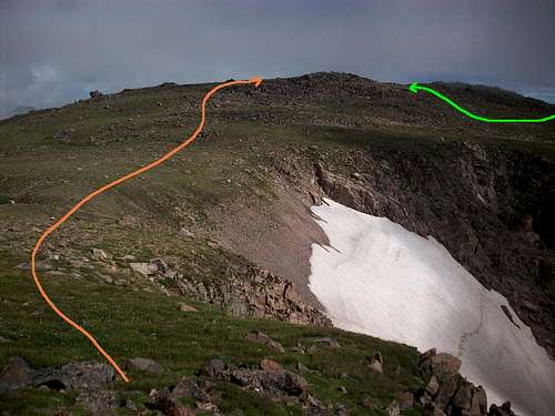 Orange is from Icefield Pass, green is from Sugarloaf Mountain
Getting There
The simplest way to climb this point is from the Stormy Peaks THThe Stormy Peaks Trailhead is located just east of CSU's Pingree Park campus. Reaching it from US 34 involves taking N Larimer County Road 27 north several miles to Masonville. Take a left at the stop sign and drive NW ~7miles to the intersection with the Pennock Pass road (LCR 44H). This road is closed in the winter so beware. After driving west about 15 miles, you will intersect the Pingree Park road (LCR 131/13). This road will take you to the gate of the campus; the TH is just to your left.
From CO 14, take LCR 131 across the river 10 miles to the TH.
Red Tape
You will be hiking in the Comanche Peak Wilderness and RMNP, so it would be in your best interest to follow the regulations. The section of the trail to the RMNP boundary is non-motorized.Be advised to start early as afternoon thunderstorms are ALWAYS a danger.
Comanche Peak Wilderness regulations
Camping
The nearest campsites to the TH is the Tom Bennett campground, which also serves as the Mummy Pass/Cirque&Emmaline Lakes TH. There are 12 sites.The nearest backcountry sites are at Stormy Peaks North (group), Stormy Peaks South and Lost Falls(WF)
External Links
RMNP The Complete Hiking GuideSP for Dunraven TH