
|
|
Mountain/Rock |
|---|---|
|
|
40.27920°N / 105.6531°W |
|
|
12668 ft / 3861 m |
|
|
Thatchtop Overview
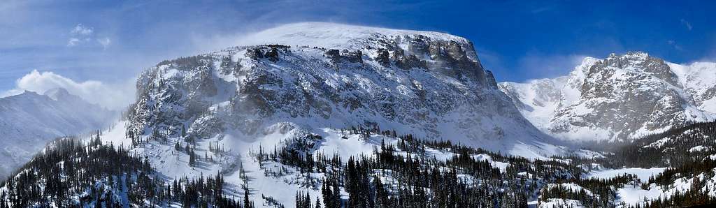
Resting quietly in a sea of perfect symmetry, Thatchtop (12,668-ft) stands guard over the entrance to arguably the two most beautiful drainages in Rocky Mountain National Park. Thatchtop is a fairly large mountain with a spherical summit plateau, located between the spectacular Loch Vale and Glacier Gorge drainages. Most of Thatchtop’s lower slopes are ringed with rugged cliffs while the upper slopes are talus laden, providing easy class 2 hiking.
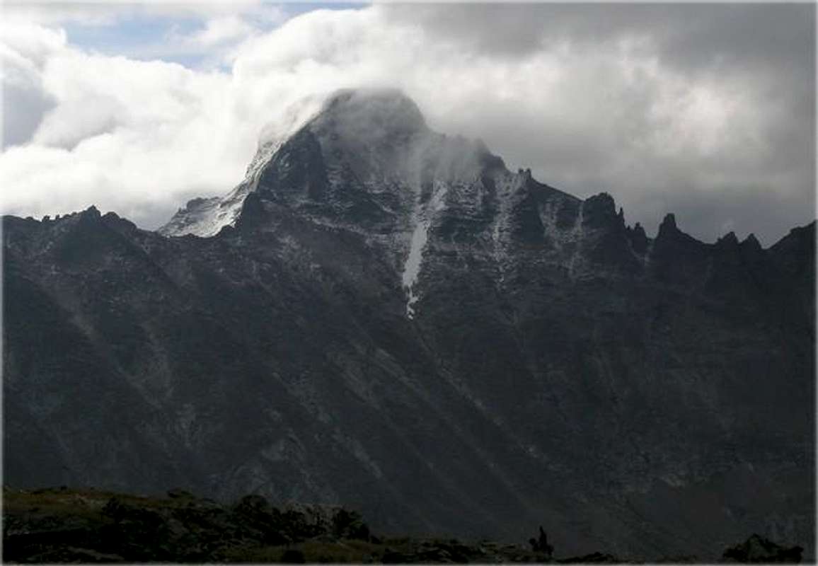
For those few (15-20 ascents a year) that take the time to explore huge the conical summit area, one can argue that Thatchtop is merely an extension of Powell Peak’s, (13,208-ft) long northeast ridge. One can also argue that Thatchtop lacks any real mountaineering interest. But one thing we can all agree on; Thatchtop’s summit views provide the sobering reality that you are in a special place. Never mind the zillions of Cottoneer’s that make Alberta Falls or Mills Lake their final destination, Thatchtop’s summit view will make you forget about all that stuff. That view will make you realize that this place is big enough for all of us, and you just so happen to be one of the lucky ones that have the physical and mental endurance to see it all from 12,668-ft.
Glacier Gorge Overview
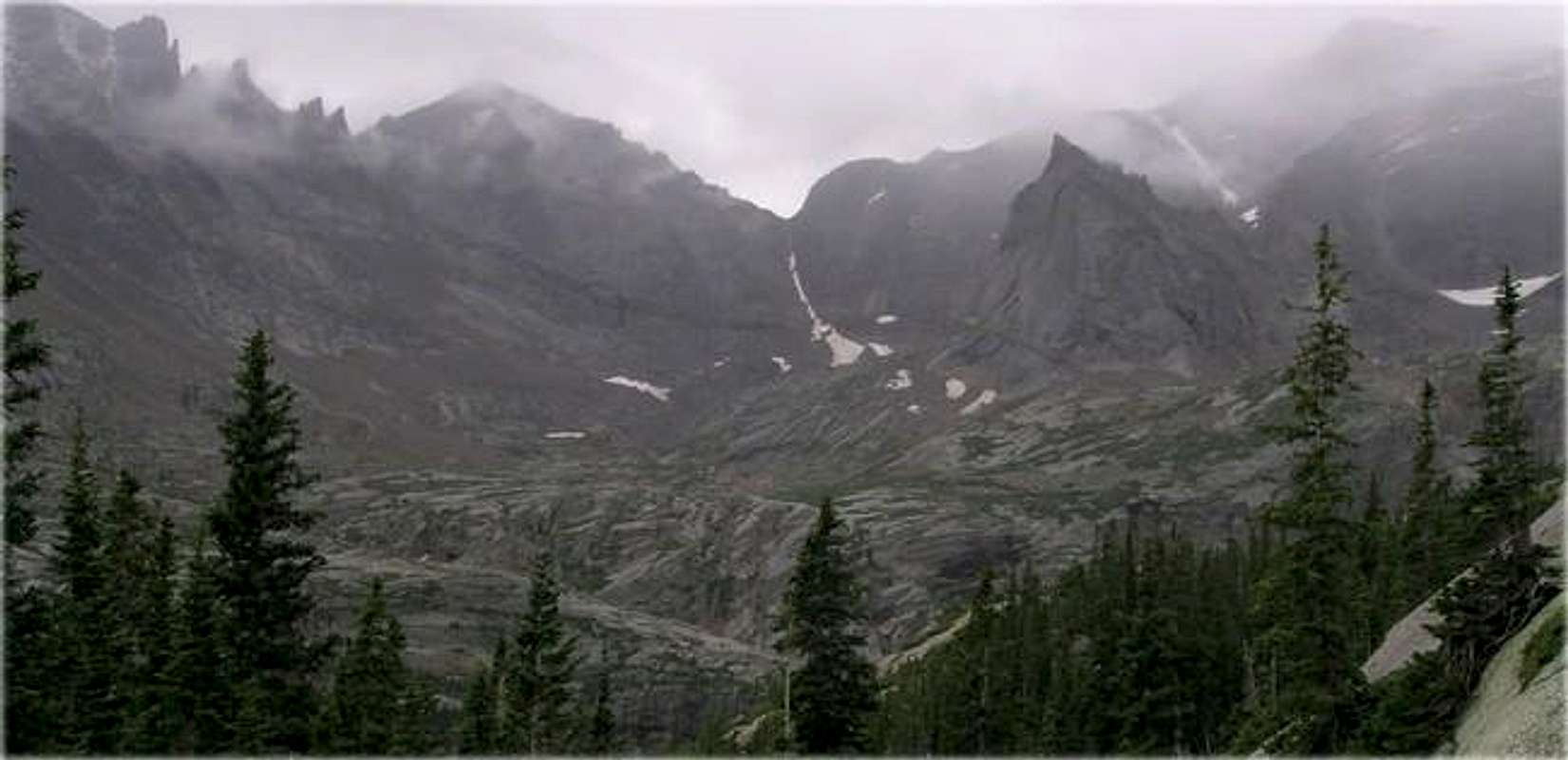
There is no other word that describes the enormity of the Glacier Gorge U-shaped valley better than “epic.” I thought long and hard looking for the right word. Words like “perfection” or “awe-inspiring” first come to mind, but then I saw the view of McHenry’s Peak from Black Lake…that’s when “epic” was forever engraved in my head. I have climbed over 100 mountains in Colorado and only the Pierre Lakes Basin (southeast side of Capitol Peak) and the Kebler Pass area in the West Elk Wilderness rendered as much scenic beauty as Glacier Gorge.The diverse landscape of Rocky Mountain National Park was created over a billion years ago and to present day displays some of nature's finest handiwork. The majority of Glacier Gorge’s scenic beauty came from powerful glaciers. These glaciers were formed when huge snowdrifts were compacted into ice by their own weight, thus freezing tons of rock and debris within its mass. Over the last 10,000 to 15,000 years, these glaciers slowly scraped and carved mountain summits into towering peaks, leaving behind a myriad of 1000-ft rock faces. These glaciers slowly continued to slide down the mountains leaving behind the perfect V-shaped valley we now know as Glacier Gorge.
There is not a better place to view the glacier evidence other than Black Lake. From here it’s obvious that a geologically powerful event took place for the enormity of it all is spectacular to view. From Black Lake an impressive collection of towering rock faces and pinnacles can be viewed, like The Arrowhead, McHenry’s Peak, The Spearhead, Pagoda Mountain, Chiefs Head and the Keyboard of the Winds.
Getting There
The following is a recap for getting to the shuttle parking lot from the entrance (fee station) to the park.
The Glacier Gorge TH is at 9,240-ft and provides access to Glacier Gorge, Lock Vale Trail and the North Longs Peak Trail. From the park headquarters go 1.2 miles to Beaver Meadows entrance station. Continue only .02 mile to the Bear Lake Road and turn left. Follow the Bear Lake Road to the vast Moraine Park area and continue about 5 miles to the Glacier Gorge parking area on the left. It is well marked and there is ample parking.
Red Tape/Camping
Camping within the boundaries of Rocky Mountain National Park Is permitted only in designated campsites with a permit. This would be considered backcountry camping. These campsites vary in popularity so calling to find out availability is recommended. For example, the one spot to camp up in Glacier Gorge is booked for every day of the summer on the first day they allow reservations. In contrast, there are a few spots in Wild Basin that you can get maybe a few days out. The cost is $15.00. Here are a few good links showing the designated campsites within The Park. Designated campsites #1 Desinated campsites #2 You can get a backcountry bivy permit if you are doing technical climbing.Mountain Conditions
Click image to enlarge
Click here to view a 7-day forecast for Thatchtop

wuedesau - Sep 14, 2004 7:39 am - Hasn't voted
Untitled CommentProbably the oldest rocks cropping out in the Rocky Mountain National Park were created over a billion years ago. The formation of the Rocky Mountains took place much later. The present landscape originated (mainly) in the last ice age (as you mention it) that ended about 15.000 years ago. Therefore the Glacier Gorge should be U-shaped (as it can be seen on the topo map) and not V-shaped.
Nevertheless the Thatchtop page is very well made. Hope to see more photos of it.
Cheers, Klaus