
-
 6313 Hits
-
 87.76% Score
-
 25 Votes
|
|
Mountain/Rock |
|---|---|
|
|
46.41745°N / 14.84656°E |
|
|
Hiking, Skiing |
|
|
Spring, Summer, Fall, Winter |
|
|
5525 ft / 1684 m |
|
|
Overview
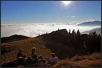
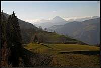
 On the summit of Komen
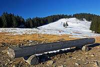 Nice ski terrains on Travnik
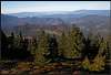
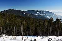 Komen and Golte from Travnik
In the eastern part, Kamnik & Savinja Alps are stretching also beyond the river of Savinja. While Raduha is still a strong massif, exceeding 2000 meters, the main ridge towards the east lowers considerably. But till Smrekovec it still succeeds to reach altitudes which are above the timberline. An excellent panoramic path - Slovenska transverzala - goes all the time by this ridge.
While Travnik, the first more independent summit east of Raduha, is a bit separate, the three summits of Smrekovec narrow ridge are very popular with hikers. But there the story begins on the eastern part, on Smrekovec, where the popular mountain hut stands. The hut is reachable with car and from there hikers usually decide to go either only those 30 minutes on the panoramic summit of Smrekovec, or close to 2 hours by the whole ridge towards the west on Komen and by the same route back. In any case a pleasant hike in any time of season!
The summits in the ridge from Travnik to Smrekovec are also excellent ski touring goals, but the tours are flat and in winter remote from the starting points which can be reached by car. So, coming from the west, from the summit of the also popular Travnik, 1637 m, the first, and highest elevation of Smrekovec ridge is Komen, 1684 m. Only its top is rocky, then soon the ridge takes a form of a grassy meadow. Then the ridge lowers shortly below the timberline, but soon rises up again on the summit of Krnes, 1613 m. The continuation towards the east is again mixed grassy and forrested. Finally the grassy Smrekovec, 1577 m rises. That is the last higher elevation in the ridge. After Smrekovec the slopes lower down in all directions considerably, even if the area east of it is still quite broad. South of Smrekovec massif lies the high plateau of Golte. Both massifs join on Kal saddle, 1318 m.
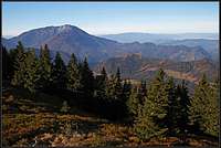
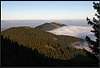
Panorama from the ridge
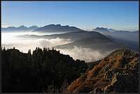 The view from Komen towards the west
From Smrekovec ridge we have a very nice view all around. The most attractive scenery is on the west where we can see the main summits of Kamnik & Savinja Alps and some main summits of Karavanke/Karawanken range. Towards the north there is the hilly Koroška region and in the distance the high, rounded ranges of Lavanttal Alps. Towards the east the hills Slovenian landscape can be seen and towards the south the nearby Golte plateau and in the distance the higher summits all the way to Snežnik.
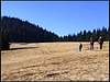
 Resting on Komen Resting on Komen |
 Uršlja gora Uršlja gora |
 Peca and Lavanttal Alps Peca and Lavanttal Alps |
The Only Extinct Volcano On the Territory of Slovenia
 Komen and its andesite rocks
Smrekovec ridge (so, the range from below Bela peč on the west to Kal saddle on the east) is famous in Slovenia also due to the fact that it is the only extinct volcano in the country. Yes, you will hardly notice any volcanic nature of these summits. Everything is died out, rounded and due to low altitude covered with grass. Still, on the very ridge you will see for the Southern Alps, which are mostly made of limestone rocks, unusual dark volcanic rocks. And so, you will also understand why on these mountains all water is flowing on the surface. Many streams of water are flowing from the ridge down towards the south and north, not sinking below the surface. In spring and early summer the ridge is also rich with unique vegetation. Volcanic activity in this area was during the Upper Oligocene age. The activity was a consequence of the colision of African (Adriatic) tectonic plate and Eurasian plate. The area was at that time submerged in sea, where lava bursts came out from the so-called Smrekovec trench (it goes north of the main ridge). As bursts were not very strong, lava soon cooled up and petrified into andesite plates and andesitic tuff (solidified ash). Andesite decayes quickly if on the surface, so these mountains are very rich with fertile soil.
Getting There
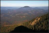
 Driving up from Ljubno
See the main page of Kamnik & Savinja Alps how to reach the valley of Savinja river. By the valley you drive to Ljubno. The walk on top from there is long, but you can drive further on till Dom na Smrekovcu (hut). The second trailhead is on Planina (south of Komen), we park near the highest farms, on some 900 m. The third trailhead is the parking place below Koča na Travniku, 1637 m. It can also be reached by a mountain road from Ljubno. Hiking tours may also start in Črna na Koroškem or on mountain roads above the town. It is best to drive up on Ludranski vrh or by the valley of Bistra creek. On the eastern side you can drive by the main valley up to Bele vode and further on to Kramarica and left to Dom na Smrekovcu. Or start walking earlier.
Routes Overview
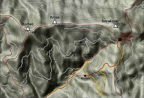
Summer hikes
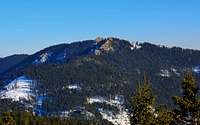
1. Smrekovec from Dom na Smrekovcu (the hut). From the hut by a good marked path towards the NW, then deter right (inscription) and ascend by an open slope on top. 30 min. Just an easy hike up.
 Smrekovec Smrekovec |
2. Komen from Dom na Smrekovcu. From the hut you go towards the NW until the marked path reaches the main ridge. From there on the direction is W. Forrested sections are exchanging with crossing nice meadows. In good 1 h 30 min you reach the grassy ridge below Krnes. This summit is just a panoramic rock on the northern side of the ridge.
 Hiking Hiking |
 Krnes Krnes |
From Krnes you continue westwards. If you go by the ridge there are some ups and downs, the other path goes from the end of the meadow also horizontally by the southern side. In good 30 minutes you are on broad meadows below Komen. The highest point is some 10 minutes up on the rocky edge which is again very panoramic. You return to the hut by the same route or you can descend considerably on the southern side and return then by mountain roads towards the east.
3. Towards Raduha. Many people take the whole ridge towards the west, continuing from Komen also on Travnik and then further on towards Koča na Loki below Raduha. If you visit the summit of Raduha it is possible to return in one day, but that makes little sense. It is better to plan a round tour over these mountains and sleep once in any of the huts on Smrekovec ridge, Travnik or below Raduha.
4. All summits can be also reached from the south. Some paths are marked, other non marked. The terrain is easy and on the slopes just some 400 meters below the main ridge you have many farms, live and abandoned ones. Those farms are connected by some mountain roads, going more or less horizontally across the slope.
5. The main ridge is also reached by many paths from the north. There again a mountain road crosses the slopes on the altitudes between 1100 m and 1200 m. From this road the paths, mainly non-marked, go up on Travnik, Komen, Krnes and the saddles in between. So, what you basically need is a good map and then it is mostly up to you how you choose the hike.
Tour skiing
Ski tours can be done from all the summits of the main ridge. In the lower part mountain roads are used. The most usual ski tours are:
- From Smrekovec - to the hut and further down by the road.
- From Krnes to Kugovnik farm and further down into MaČkin kot.
- From Komen towards the east by the main ridge or towards the west on Hlipovec saddle and then southwards by the road.
- From Travnik towards the south and then by the road into the valley of Žep creek.
- Along the main ridge further towards the west./li>
Map: Kamniške in Savinjske Alpe. Planinska zveza Slovenije. 1:50000.
Red Tape
 On the ridge
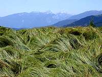 The grassy Smrekovec
Smrekovec highland ridge is a part of the Natura 2000 – a programme of the European Commission for the conservation of natural habitats and of wild fauna und flora. The countryside of Smrekovec is recognized as a value of European importance. Because of the volcanic nature of rocks in spring and early summer on these mountains several specific, rare flowers can be found. They represent almost 10 % of all flora in Slovenia, what proofs the area’s high biotic diversity. 26 of them are endangered.
Mountain huts
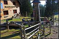 Dom na Smrekovcu
Dom na Smrekovcu, 1377 m. It stands on the edge of Roma pasture and has 50 beds plus 10 beds in a common room. Opened also in winter. In dry seasons it is available by car. You drive to the hut either from Mozirje via Šmihel and Bele vode or from Ljubno via Ljubenske Rastke. Otherwise on foot you have to walk to it several hours: 3 h from Črna, 4 h from Ljubno, 4.5 h from Šoštanj.
Koča na Travniku, 1637 m. It stands in Veliki Travnik, just below the summit with the same name. It has 16 meds plus 6 in a common room. It can be reachable by a mountain road from Ljubno. Otherwise on foot it's also 2.5 to 3 h to reach it.
When to Ascend?
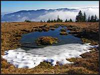
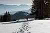 Winter
Smrekovec ridge can be reached any time of a year. Very nice is mountain spring there, and of course autumn too. In winter and early spring ski tours can also be done from all summits.
Your Help Is Needed
- Any winter experience? Or a ski tour?
- Have you crossed the whole ridge?
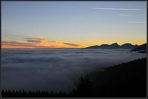 Smrekovec sunset