


-
 2856 Hits
-
 82.48% Score
-
 15 Votes
|
|
Mountain/Rock |
|---|---|
|
|
45.63550°N / 7.36327°E |
|
|
Hiking |
|
|
Spring, Summer, Fall, Winter |
|
|
8796 ft / 2681 m |
|
|
Note
|
La montagna chiama i suoi figli, ed essi rispondono fedelmente al suo appello… Osvaldo Cardellina, Diario alpinistico, 1964-65 Page texts: @ OsvaldoCardellina "Osva", passed away on May 2, 2022. Page owners: Christian Cardellina e Osvaldo Cardellina. Any updates from September 12, 2022: Antonio Giani, page administrator, friend and climbing companion. Testi della pagina: @ OsvaldoCardellina "Osva", scomparso il 2 maggio 2022. Proprietari pagina: Christian Cardellina e Osvaldo Cardellina. Eventuali aggiornamenti dal 12 settembre 2022: Antonio Giani, amministratore della pagina, amico e compagno di salite. |
Overview
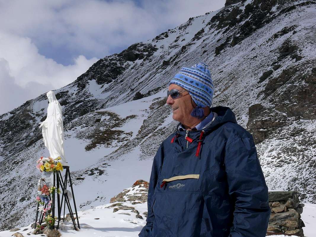
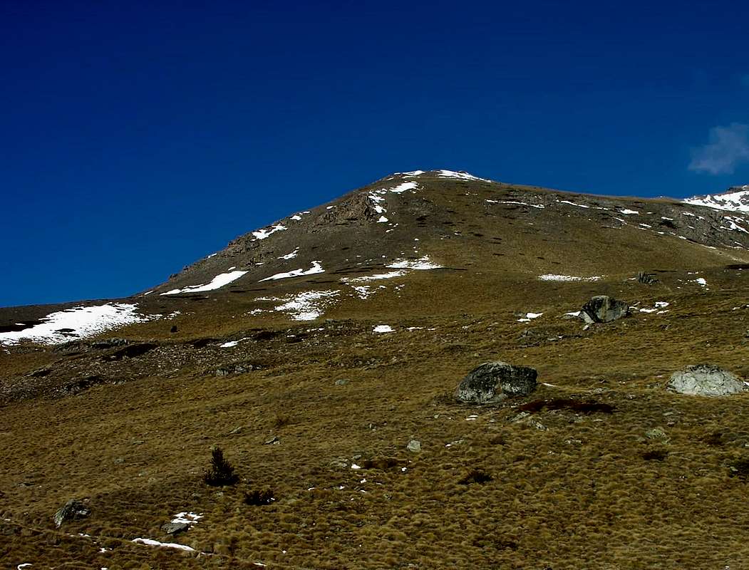
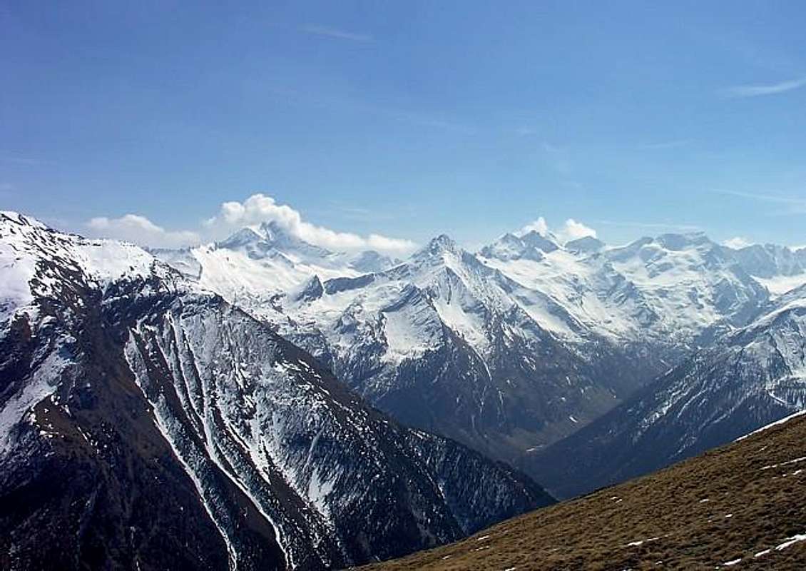
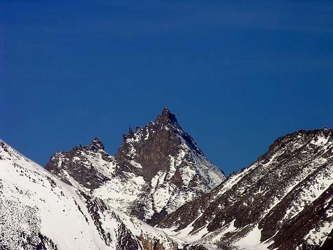
This Summit is located at the end of the long Buttress South-southwest of Punta Garin (3.451m) that reaches the Tip of the Arpisson (3.035m), designed to divide the walloon of the same name in the West from the well-largest Grauson. From this last the crest splits sending its natural continuation in the same direction towards the "Cornas dell'Arpisson" (little Horns of Arpisson) and above the Hamlet of Epinel (1.436m), just before reaching the Tourist Center of Cogne (1.534m). By Southern Ante Top of Punta Arpisson deviates toward Southeast a secondary ridge that reaches the rounded promontory of Tsaplana (2.681m). In fact this Summit known in ancient times with other names (Testa Chapiana 2.675 meters in B & V 1896, Tsaplanne dialect and signage local also Tête de Chaplane also Cha Plane (Flat Head) or Testa Chiapana or Tîta Tsa Planne also called Pointe Chaplan(n)e) basically consists of a modest rise of the same ridge, whence it is easy to reach the highest Punta of Arpisson. The same dominates the Fraction Crétaz (1.534m), immediately after that of Epinel, and looming in the ancient Village Gimillan (1.787m) "lying" right under his Southern Slopes. Even its height is varied over time going from 2.675 meters to 2.678 meters and finally, in the Maps today, in 2.681 meters, not for a new and sudden orogeny but only for the best measurements, even if there is to be noted that in the past, then not much wrong. Facing the Gran Paradiso massif which opens completely to the South highlighting its gleaming glaciers, especially that of the Tribolazione that "flows" towards Valnontey. On top overlooking a beautiful Madonna, fiberglass, which protects the Village of Cogne (the ancient Roman Conia, where he forged coins of the Empire; but to the "Cogneins" perhaps makes more pleasure deriving from the Franco-Celtic word meaning Coing or corner). Beyond these amenities, but binding still the same because one visit post trip Cogne never hurts. This is one of the most beautiful hikes from the point of view of the entire panorama Cogne Valley. Also, having a height of almost 900 meters from Gimillan the Summit offers a good opportunity to immediately start to the season, but also at the end. in fact, its sun exposure allows frequent it almost immediately finding little snow or simply well-turned, for which reason it fits very well even at Snowshoes. Generally constitutes half end in itself, the proximity and relative ease of ascent with Punta Arpisson and the nearby Col Pila Southwest allow to increase the gap with additional 350 meters. Certainly much better known than 30-40 years ago, has become quite popular excursion, although here there are certainly not the masses. Easy path, however, requires the knowledge of the way to make that requires a bypass to the east and then the Northeast for overcome a steep rocky slope. In winter or with snow high care must be taken to crossing a couloir suffered under the Summit; in the crossing of the same fact can cause snowslide, with more than 6/700 meters below the feet to the Pila Waterfalls (around 2.050 meters) into the Low Grauson Walloon. You can connect with this last climbing or descending from Alpe Tchezeu (1.818m) on the route that leads to Alp Ecloseur Pila (2.021m) through steep ridges grassland today completely free of the path (up to 30 years ago there was a track now covered by vegetation); or with a very ancient and long path of pasture that cutting the Cote de Lavà in the lower part led progressively to the Alps Creuzet and Grauson Vieux (2.244m, 2.273m), beyond the Torrent du Lessert which in this section is called Grua. But even this path, which definitely connected with these pastures to Arpisson going from Pila Southwest Pass (about 3.028 m), has long been abandoned reduced to slender track you need to know to identify knowing the area very well. However both are not recommended and are mentioned here only to witness the ancient transits amongst the Alps.
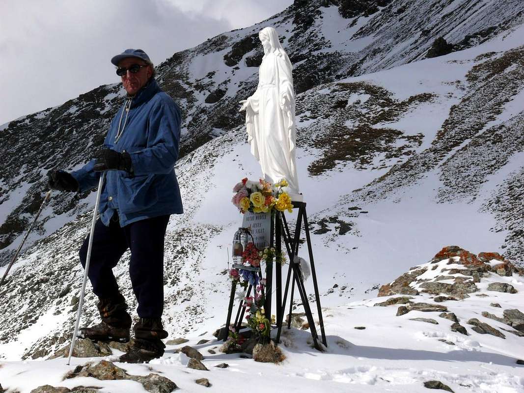
Questa Sommità é situata al termine del lungo Contrafforte Sud-sudovest della Punta Garin (3.451 m) che raggiunge la Punta di Arpisson (3.035 m), atto a dividere l'omonimo vallone ad Occidente da quello ben più esteso del Grauson all'opposto. Da quest'ultima la cresta spartiacque si sdoppia inviando la sua naturale prosecuzione nella medesima direzione verso le "Cornas dell'Arpisson" e sopra la Frazione di Epinel (1.436 m), appena prima di raggiungere il Centro Turistico di Cogne (1.534). Dall'Antecima Meridionale della Punta di Arpisson si distacca verso Sudest una cresta secondaria che raggiunge il tondeggiante promontorio della Tsaplana (2.681 m). In effetti questa Sommità conosciuta anticamente anche con altri nomi (Testa Chapiana 2.675 metri in B&V 1896, Tsaplanne in dialetto e nella cartellonistica locale ma anche Tête de Chaplane o Cha Plane (Testa Piatta) o Tîta Tsa Planne ed ancora Pointe Chaplan(n) e) in pratica consiste in un modesto rialzo della medesima cresta, donde risulta facilmente raggiungibile la più alta Punta di Arpisson. La stessa domina la Frazione di Crétaz (1.534 m), subito dopo quella di Epinel, ed incombe sullo antico Villaggio di Gimillan (1.787 m), "adagiato" proprio sotto i suoi Versanti Meridionali. Anche la sua altezza é variata nel tempo passando da 2.675 metri a 2.678 metri ed infine, nelle Carte attuali, a 2.681 metri, non per una nuova ed improvvisa orogenesi bensì esclusivamente per migliori misurazioni, anche se vi é da constatare che poi nel passato di molto non sbagliavano. Fronteggia il Massiccio del Gran Paradiso che si apre completamente a Mezzogiorno mettendo in evidenza i suoi lucenti ghiacciai, soprattutto quello della Tribolazione che "scorre" verso la Valnontey. Sulla sommità domina una bella Madonna, in vetroresina, che protegge l'abitato di Cogne (l'antica Conia dei Romani, dove forgiavansi le monete dell'Impero; ma ai "Cogneins" forse fà più piacere la derivazione dalla parola Franco-Celtica Coing significante angolo, geograficamente parlando). Al di là di queste amenità, ma legandosi pur sempre alle medesime perché una visita post gita in Cogne non fà mai male, questa é una tra le più belle escursioni dal punto di vista panoramico dell'intera Valle di Cogne. Inoltre, avendo un dislivello di quasi 900 metri da Gimillan alla Sommità, offre una buona opportunità in inizio di stagione, ma anche al termine. infatti la sua esposizione solare permette di frequentarla quasi subito trovando poca neve oppur semplicemente ben trasformata, per la qual cosa s'adatta molto bene anche alle Racchette da neve. Generalmente costituisce meta fine a sé stessa, ma la vicinanza e relativa facilità di salita alla Punta di Arpisson ed al vicino Col di Pila Sudovest permettono di aumentare il dislivello con ulteriori 350 metri circa. Sicuramente molto più conosciuta rispetto a 30/40 anni orsono, è diventata escursione piuttosto frequentata, anche se qui non si registrano certamente le masse. Di percorso facile, necessita però la conoscenza della via da effettuare richiedente un aggiramento verso Est e poi Nordest per superare una ripida scarpata rocciosa. In inverno e con neve alta bisogna far attenzione all'attraversamento d'un canalone subito un 6/700 metri sotto i piedi sopra le Cascate dell'Alpe Pila (2.050 metri circa) internamente al Vallone del Basso Grauson. Si può effettuare il collegamento con quest'ultimo salendo oppure scendendo dall'Alpe Tchezeu (1.818 m) sulla via dell'Ecloseur che porta all'Alpe Pila (2.021 m) tramite ripidi costoni prativi oggigiorno completamente privi di sentiero (fino a 30 anni orsono esisteva una traccia ora ricoperta dalla vegetazione); oppure con un antichissimo e lungo sentiero di pascolo che tagliando la Cote de Lavà nella parte più bassa portava progressivamente alle Alpi Créuzet e del Grauson Vieux (2.244 m, 2.273 m), al di là del Torrent du Lessert che in questo tratto assume il nome di Grua. Ma anche questo sentiero, che sicuramente collegava questi alpeggi con quello di Arpisson passando dal Colle di Pila Sudovest (circa 3.028 metri), é stato da molto tempo abbandonato riducendosi ad esile traccia individuabile soltanto conoscendo molto bene la zona. Comunque ambedue sono sconsigliabili e son qui citati esclusivamente per testimoniare gli antichi transiti tra le Alpi.
First Ascents
- In the Summit: Unknown.
- In Winter: Unknown.
BY CAR:
- From Turin or Milan: Motorway A5. Exit in Aosta Ovest. Drive to the near Aymavilles; follow in the direction of Cogne Valley. Or Exit Aosta East to Gr. Brissogne and St. Marcel. From Switzerland: through the Grand St. Bernard Tunnel or the homonym Pass). Drive to Aosta, then follow Courmayeur direction on SS.26. Just after Sarre, turn to the left, in the direction of Cogne Valley, the main side valley in the South after the City of Aosta.
- From France: through Mont Blanc Tunnel or Petit St. Bernard Pass). It isn't necessary to enter in Motorway A5, you can drive through SS.26 Aosta direction. Before arriving at the Village of Sarre, follow the sign and turn right towards the Valley of Cogne.
- Specific Roads After Aymavilles Municipality, the SR.47 crosses the Villages of Vieyes (1.158m; ancient small Sainct Grat Church with various frescoes), Epinel (1.436m) and Crétaz (1.534m) and after about 25 Km. arrives at Cogne (1.534m; important Seat of P.N.G.P. since 1922). Follow the road signs for Gimillan and Lillaz (renowned three waterfalls); arrived at a round-about, recently built in proximity of the St. Anthony Chapel, go left along the scenic route leading to the Villages of Montroz (1.702m), Gimillan (1.787m); 1,5 and 3 Km. after Cogne. Usually no parking problem neeighbor the bell tower of a little chapel in center, also near the bridge above Gimillan Torrent (small parking).
BY PLANE:
- Aeroporto "Corrado Gex" Saint Christophe (Aosta).
Approach & Route
From Gimillian center (1.787m) agrees, passing the small road that double the Bell tower on the left near an old and beautiful stone fountain, go up to the upper parking lot at the Playground (1.814m) or continue even through the narrow asphalt road to the sign ban in altitude 1.850 meters about, just before a small votive chapel of 1926. Here we start with a route n° 3/TVC, reaching the tiny Village of Pian di Teppe (1.923m).
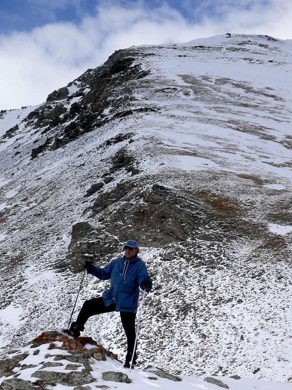
Note: you can avoid this stretch by a small path-shortcut into the woods that goes between this alp and this more in bottom of Serve 1.923m, arriving at an intersection shortly before the next fork); from this point, where also ends the farm road, follow it to the Northwest the same to the junction around 1.970/80 meters where you leave, continuing the same into the Vallon below Arpisson. Instead continue to the right (Northeast; wooden signpost on a tree) with path n° 3B; after a long diagonal one enters a loop that runs through a small and secondary walloon with an exposed path you reach a wooded area before an esplanade with scattered blocks. Turning to the North with hairpin bends you reach the point 2.247 meters under a rock feature; leave the same on the left and again with direction Northeast reach the hairpin 2.362 meters which came shortly before the ancient Alp Perché (2.398m; abandoned and in ruins). Continue for a short time with this direction but then change in Northwest reaching a strip of crumbling rocks (2.503m) which easily crosses; immediately below the path, becoming steeper, runs along the right bank of a grassy gully (attention to the crossing in case of snow or very consistent) to fold in toward the southwest in the direction of a grassy plateau just below the top. A short right turn leads to the statue of the Madonna on the Summit (EE/F; 2h'00/2h'30 but in winter even 3h'00/4h'00 from Gimillan Hamlet).
![]()
Easy terminal part to the Top
Da Gimillian centro (1.787 m) conviene, passando nella piccola via che doppia il Campanile sulla sinistra presso una vecchia fontana in pietra, salire al parcheggio superiore presso il Parco Giochi (1.814 m) oppure proseguire ancora tramite la stretta stradina in asfalto fino al cartello di divieto in altitudine 1.850 metri circa, poco prima d'una piccola Cappella votiva del 1926. Qui si parte con un sentiero n° 3/TVC, che raggiunge il minuscolo Villaggio di Pian di Teppe (1.923 m).
Nota: si può evitare questo tratto tramite un un piccolo sentiero-scorciatoia dentro il bosco che sale tra questa alpe e la sottostante di Serve 1.923 m, arrivando ad un incrocio di poco precedente il successivo bivio); da questo punto, dove termina anche la strada poderale, si segue verso Nordovest il medesimo fino al bivio 1.970/80 metri circa ove lo si abbandona, proseguendo lo stesso verso il Vallone di Arpisson. Continuare invece sulla destra (Nordest; cartello indicatore in legno sopra un albero) con il sentiero n° 3B; dopo un lungo diagonale si entra in un ansa che attraversa un valloncello secondario e con percorso esposto si raggiunge una zona alberata precedente una spianata con blocchi sparsi. Volgendo a Settentrione con stretti tornantini s'arriva al punto 2.247 metri sotto una caratteristica roccia; lasciare la stessa sulla sinistra e nuovamente con direzione Nordest pervenire al tornante 2.362 metri che precede di poco l'antica Alpe Perché (2.398 m; abbandonata ed in rovina). Continuare ancora per breve tempo con questa direzione, ma poi cambiare in Nordovest raggiungendo una fascia di rocce sgretolate (2.503 m) che facilmente s'attraversa; subito appresso il sentiero, diventando più ripido, costeggia la sponda orografica destra di un canalone erboso (attenzione alla traversata in caso di neve alta o poco consistente) per ripiegare progressivamente verso Sudovest in direzione d'un plateau erboso giusto al di sotto della Sommità. Una breve svolta a destra conduce presso la statua della Madonna posta sulla Cima (EE/F; 2h'00/2h'30, ma d'inverno anche 3h'00/4h'00 da Gimillan).
![]()
Last steps to the Summit

Difficulty and Equipment
This route can be considered EE (Experts Hikers) and EE/A in winter.L'itinerario è classificato EE e EE/A in inverno.
![]()
Hiking gear but with crampons if in hard snow.
Da escursionismo ma con ramponi se con neve dura.
Mountain Condition
- Meteo: you can find all the needed informations at the official site of the Valle d'Aosta Region:
- Valle d'Aosta Meteo
Books and Maps
- "Racchette da Neve a Cogne" di Ezio Savin e Luca Zavatta l'Escursionista Editore Novembre 2003.
- "80 itinerari di Escursionismo Alpinismo e Sci Alpinismo in Valle d'Aosta", di Osvaldo Cardellina, Ed. Musumeci, Giugno 1977 (in Italian); seconda Ed. Luglio 1981; terza Ed. Luglio 1984; (in French), prima Ed. Febbraio 1978; seconda Ed. Marzo 1980.
- "Guida del Monte Emilius" di Osvaldo Cardellina Editore in collaborazione con il Club Alpino Italiano Sezione di Aosta Dicembre 1978.
- "Guida dei Monti d'Italia – Emilius-Rosa dei Banchi-Parco del Mont Avic" di Giulio Berutto e Lino Fornelli - Club Alpino Italiano/Touring Club Italiano, Marzo 2005.
- "Diari Alpinistici" di Osvaldo Cardellina e Indice Generale accompagnato da Schedario Relazioni Ascensioni 1964-2020 (unpublished).
 |
 |
 |
 |
- Kompass Gran Paradiso Valle d'Aosta "Sentieri e rifugi-Carta turistica" 1:50000.
- L'Escursionista "Valle di Cogne Carta dei Sentieri" (n° 10) 1:25.000.
- L'Escursionista "Tour de la Vallée de Cogne Grand Paradis" Carta dei sentieri 1:25.000.
- IGC-Istituto Geografico Centrale "Gran Paradiso La Grivola Cogne" Carta 1:25000.
- Hapax "Les Sentiers" Comunità Montana Monte Emilius luglio 2000 1:25.000.
Important Information
- REGIONE AUTONOMA VALLE D'AOSTA the official site.
- FONDAZIONE MONTAGNA SICURA Villa Cameron, località Villard de la Palud n° 1 Courmayeur (AO) Tel: 39 0165 897602 - Fax: 39 0165 897647.
- SOCIETA' GUIDE ALPINE DI COGNE Tel. 347/9473526 – 328/1373728.
- A.I.NE.VA. (Associazione Interregionale Neve e Valanghe).
Useful numbers
- Soccorso Alpino Cogne (SAR) Tel. 3482685406.
- Protezione Civile Valdostana località Aeroporto n° 7/A Saint Christophe (Ao) Tel. 0165-238222.
- Bollettino Meteo (weather info) Tel. 0165-44113.
- Unità Operativa di Soccorso Sanitario Tel. 118.