Overview
![]() East Side of Ulrichshorn - Photo by om East Side of Ulrichshorn - Photo by om |
|
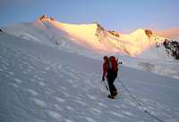
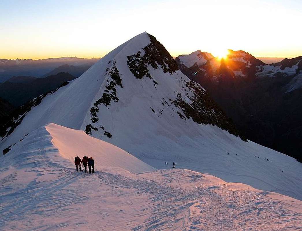
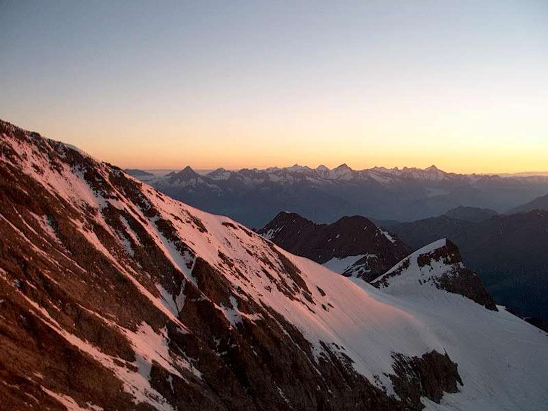
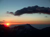
![]() | ![]() | ![]() | ![]() | ![]() |
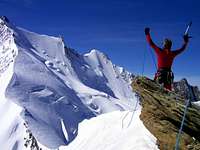
| On the Windjoch | Ulrichshorn at sunrise | Pennine Alps at sunrise | Mischabel Massif | Sunset below Windjoch |
Ulrichshorn (3925 m) is a summit with a wonderful panorama, especially the impressing view towards the NE Face of the Lenzspitze and the Nadelgrat.
From the Mischabelhütten, you can reach the summit of the Ulrichshorn very easily. You can combine a visit of this mountain with an ascent of the Nadelhorn via the normal route.
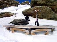
According to Jan there is even a bench on the summit.
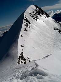
![Ulrichshorn]() North Side of Ulrichshorn and a part of the normal route - Photo by jck North Side of Ulrichshorn and a part of the normal route - Photo by jck |
Routes
SW Ridge from the Windjoch: G 2, 30 min., 80 hm, 2 h from the Mischabelhütte
N Ridge from the Riedpass: G 2, 1 h, 460 hm, 3 1/2 h from the Bordierhütte
*
Climber's Logs
Getting There
To the Ulrichshorn:
You can come from the Mischabelhütten
You can come from the Bordierhütte
To the Mischabelhütten:
You reach the Mischabelhütten from Saas Fee in 4 h (on foot, 1540 hm). From Saas Fee, you go on the marked way (sign at the church) in western direction to the end of the Torrentbach. You traverse an avalanche barrier by a tunnel. You ascend over the bridge and zigzag via Trift and Schönegge to the end of the ridge which comes down from the Distelhorn to the SW (P. 2448,6m, 1 3/4 h). The way goes up further to P. 2688m and the S flank of the Distelhorn to the foot of the Fallglacier, about 3000m (1 1/4h). Clear signs show the way through rock, which you climb northern above the Fallglacier. Via a rock rib, you reach in zigzag the hut (1 h).
If you use the cable car to Hannigalp, the ascent takes 3/4 h less. After an horizontal traverse to the Torrentbach, you go up below the Distelhorn E flank to Schönegge, where you meet the route, described above. (3-3,5 h, 1030 hm). Pay attention at the beginning at the summit station of the cable car: Interpret the sign to the Mischabelhütten correctly and do not turn right and do not go up, but keep on the main road/way which goes horizontally at the beginning!
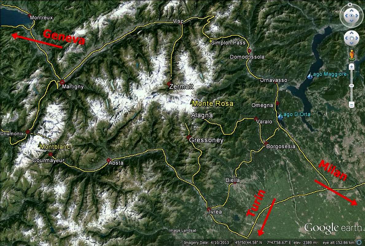
You reach Saas Fee (1790m) with car or bus from Visp/Brig.
Saas Fee is a modern holiday village, surrounded by many 4000m mountains and huge glaciers. You are not allowed to drive by car through the village. You must park at the main parking place at the entrance to the village.
Brig is the main city of the upper Wallis and the junction of the trains:
Bern-Lötschberg-Simplon-Domodossola
Furka-Oberalppass (Andermatt/Disentis, Glacierexpress)
Brig-Visp-Zermatt
Lake of Geneva-Milano
In Brig, many busses arrive as well:
Simplon-Gondo
Saastal
Blatten
Mund
Rosswald
You reach Visp/Brig by car:
from the West: From Geneva (airport) on the A1 to Lausanne, on the A9 via Montreux, Martigny and Sion to Sierre. From Sierre the road no. 9 with direction to Brig. But at Visp, you turn already right to the S with directin to the Saaser valley. In Stalden, you turn left and leave the Zermatter valley to the right. Here, the Saaser valley beginns. Via Saas Baalen and Saas Grund, you reach Saas Fee.
from the North: from Bern on the A6 to Spiez, from here the road to Kandersteg, at Kandersteg, you drive your car on a train and go by train through a tunnel; end of the tunnel: Goppenstein; you continue the road to the S and reach the main road from Sierre. On the crossroad, you turn left (E) and reach Visp. From here, continue as route a.
from the East: from Bregenz on the A13 to Chur; turn off at Reichenau and continue the road no. 19 to Brig/Visp via Flims - Sedrun - Andermatt - Gletsch - Fiesch. From Visp, continue as described in a.
from the South: either from Como on the A2 via Bellinzona to Airollo, then road no.2 till Hospental and here to the left on the road no. 19 to Brig/Visp or from Arona till the end von the A26 and then the E62 via Domodóssola to Brig.
To the Bordierhütte:
You reach the Bordierhütte from Gasenried in 4 h (1230m) and from St. Niklaus in 5 h (1740hm). You have to traverse a glacier which is marked in summer by poles.
From Gasenried, you go on the road to the chapel of Schalbettu, on the way over the Riedbach and zigzag through the forest to the moraine of Alpja (2099m). On the moraine crest, you go the way up to 2500m where you reach the glacier. You do not enter the glacier, but go up to the SW, zigzag the hang up till you reach 2700m by a traverse. Here you descent to the glacier (sign) and traverse this glacier to the E to the moraine. You traverse the moraine below the hut. On the other side (signs) you got to the hut. For the descent: the beginning of the way after the glacier is marked clearly. This is the ascent also in winter. If the conditions are good, you can also go from the summit station Seetalhorn via the ski-run and the hangs of the Riedberg to the glacier. But you have to pay attention to the traverse of the moraine!
You reach Gasenried via a small road from St. Niklaus. St. Niklaus is located in the middle of the Mattertal. You can go there by car, bus or train from Visp/Brig. If you come by car from Visp, turn right at Stalden and leave the Saasertal to your left. To Visp/Brig as described above.
Infos
![]() View of the Pennine Alps - Photo by Hiltrud Liu View of the Pennine Alps - Photo by Hiltrud Liu |
Phone:++41(0)900300300
Travel agency: ++41(0)512258444
Ticket Shop
TOURIST CAMP in Saas Grund: Saaser Hütte Adler
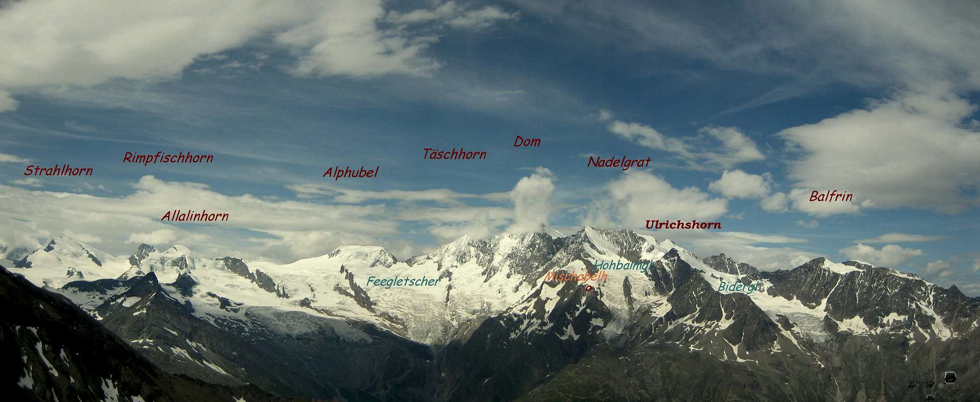
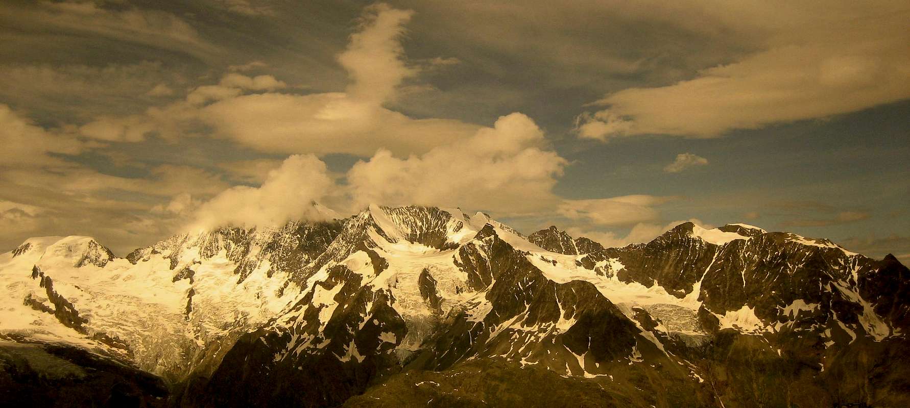
* Panoramic View of Monte Rosa and the Mischabel Group - Photo by Lodewijk
Monte Rosa (4634 m) - Strahlhorn (4190 m) - Rimpfischhorn (4198 m) - Allalinhorn (4027 m) - Alphubel (4205 m) - Täschhorn (4491 m) - Dom (4545 m) - Lenzspitze (4290 m) - Nadelhorn (4327 m) - Stecknadelhorn (4241 m) - Hohberghorn (4219 m) - Ulrichshorn (3920 m) - Dürrenborn (4035 m)
![]() Monte Rosa, Strahlhorn, Rimpfischhorn, Allalinhorn, Alphubel, Täschhorn, Dom, Nadelgrat, Ulrichshorn Monte Rosa, Strahlhorn, Rimpfischhorn, Allalinhorn, Alphubel, Täschhorn, Dom, Nadelgrat, Ulrichshorn |
Maps&Books
* Ulrichshorn - Photos by Ivona, pierofrattoni, chandra, andrea.it and georgen
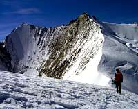
![]() | ![]() | ![]() | ![]() | ![]() |
| E Side | S Side - Hohbalm Glacier | Sunrise above Weissmies | W Side | N Side - Ried Glacier |
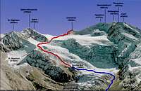
![]() GOOGLE MAP Mischabel Group - Ulrichshorn - Photo from Antonio Giani GOOGLE MAP Mischabel Group - Ulrichshorn - Photo from Antonio Giani |
Banzhaf/Biner/Burgener, Alpinführer Walliser Alpen 4/5, Vom Theodulpass zum Simplon.
Hermann Biner, Hochtouren im Wallis. Vom Trient zum Nufenenpass. 2nd ed. 1996. ISBN 3-859022-160-5
Michael Waeber, Walliser Alpen. DAV-Gebietsführer. 12th ed. Munich 1999. ISBN 3-7633-2416-X.
Accomodation
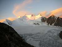
* On the way to Ulrichshorn - Photos by om, Hiltrud Liu, Rahel Maria Liu, klimsmurf and andre hangaard
![Riedgletscher]() Riedgletscher Riedgletscher | ![Ulrichshorn]() Ulrichshorn and Hohberghorn Ulrichshorn and Hohberghorn | ![The beautiful Northeastface...]() Windjoch - 2001 Windjoch - 2001 | ![North-east ridge of...]() NE Ridge and Ulrichshorn NE Ridge and Ulrichshorn | ![The Mischabel hut up at...]() Mischabel Hut Mischabel Hut |
(3329 m)
![]() | The MISCHABELHÜTTEN are situated on a rockrib, which separates the Hohbalmglacier from the little Fallglacier.
Since 1975 there exists a new bigger hut above the old one, which still keeps beds.
From the huts you have a wonderful view towards Saas Fee and the Weissmiesgroup. |
130 beds from June to October
40 beds in the old hut from November to May (open)
guarded from June to October
phone: ++41/27/9571317
e-mail: mischabelhuetten@ssf.ch
BORDIERHÜTTE (2886 m)
44 beds
guarded from mid-June to mid-September
phone: ++41(0)27/9561909
![]() Nadelgrat and the East Side of Ulrichshorn - Photo by Hiltrud Liu Nadelgrat and the East Side of Ulrichshorn - Photo by Hiltrud Liu |
Link MountainArea
![]() | MountainArea |
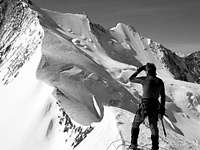
![]() | ![]() | ![]() | ![]() | ![]() | ![]() | ![]() |
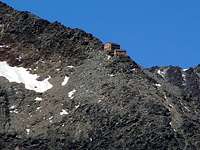
| Orchid | Windjoch | A cloudy day | A bench on the summit - 2007 | In clouds | Sunset | Nice flower |
Google Map
![]() Google Map - Mont Blanc and Matterhorn - Photo from markhallam Google Map - Mont Blanc and Matterhorn - Photo from markhallam |


 23426 Hits
 95.51% Score
 53 Votes
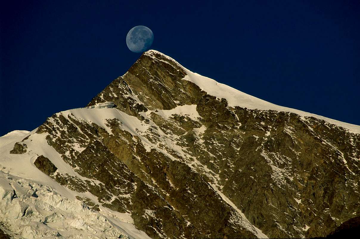 East Side of Ulrichshorn - Photo by om


 North Side of Ulrichshorn and a part of the normal route - Photo by jck


 View of the Pennine Alps - Photo by Hiltrud Liu
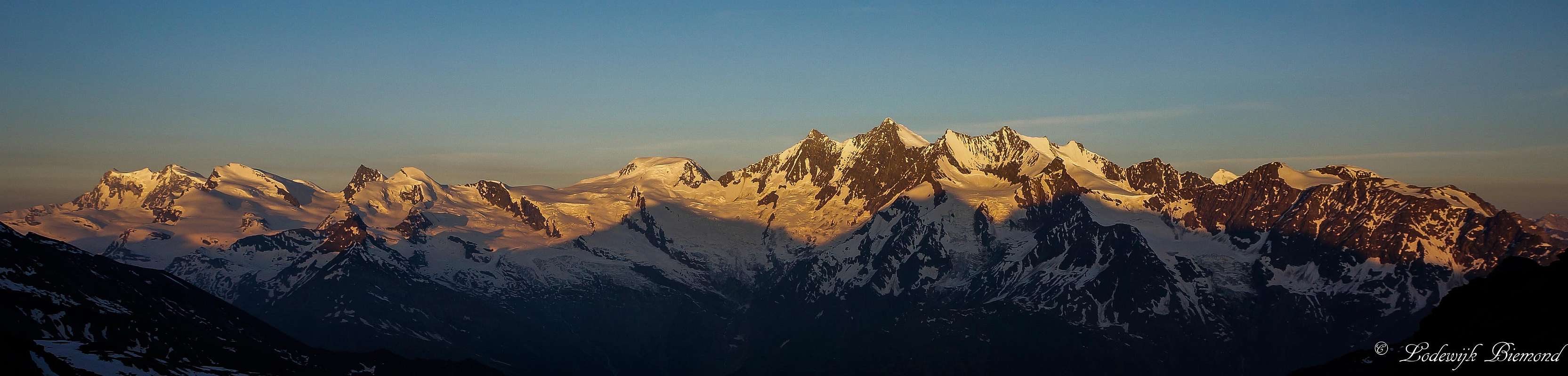 Monte Rosa, Strahlhorn, Rimpfischhorn, Allalinhorn, Alphubel, Täschhorn, Dom, Nadelgrat, Ulrichshorn
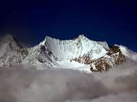


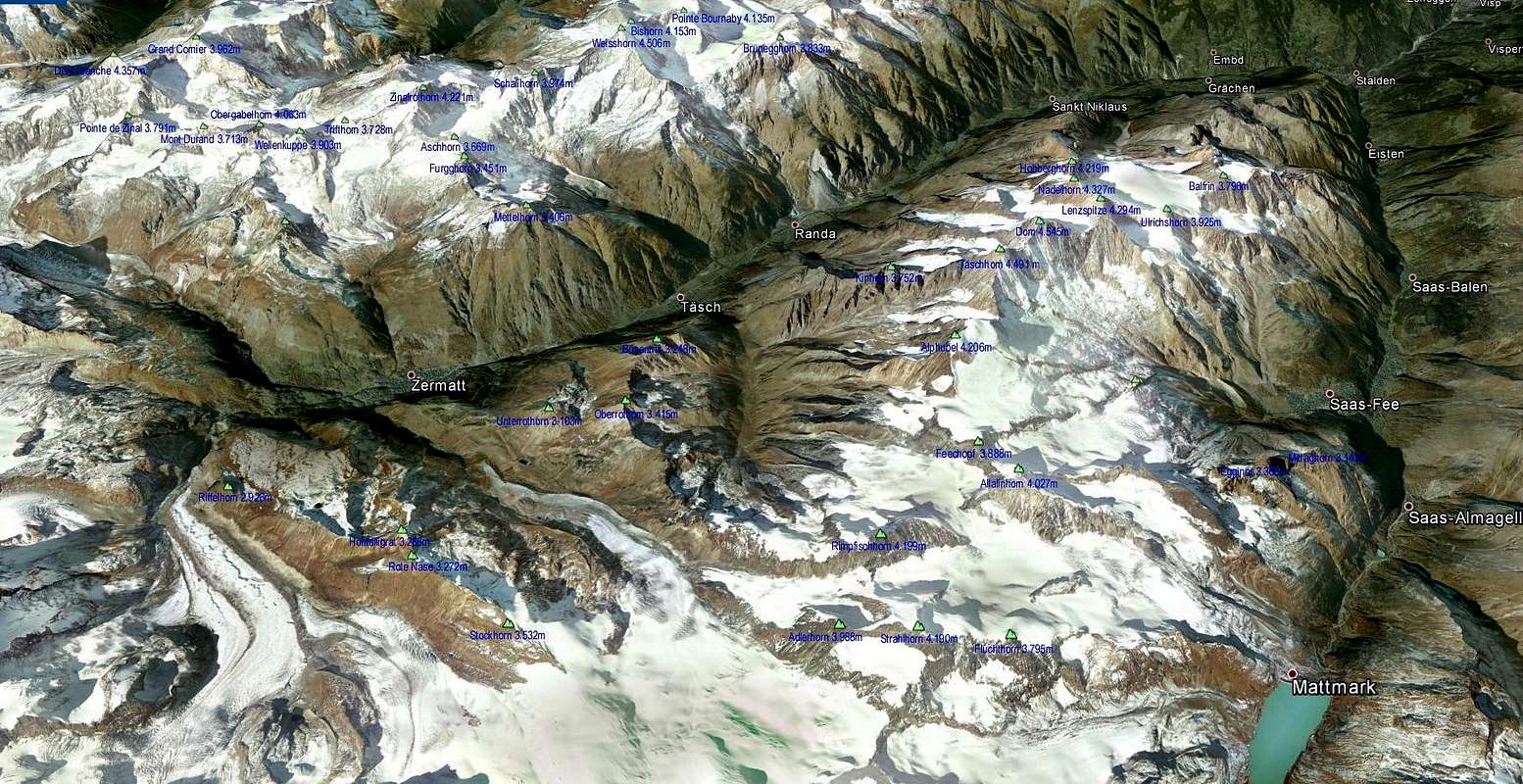 GOOGLE MAP Mischabel Group - Ulrichshorn - Photo from Antonio Giani
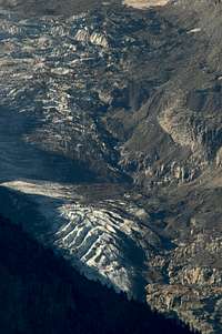 Riedgletscher
 Ulrichshorn and Hohberghorn
 Windjoch - 2001
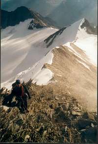 NE Ridge and Ulrichshorn
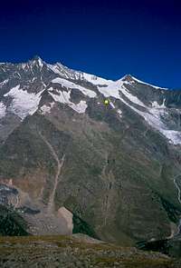 Mischabel Hut

 Nadelgrat and the East Side of Ulrichshorn - Photo by Hiltrud Liu
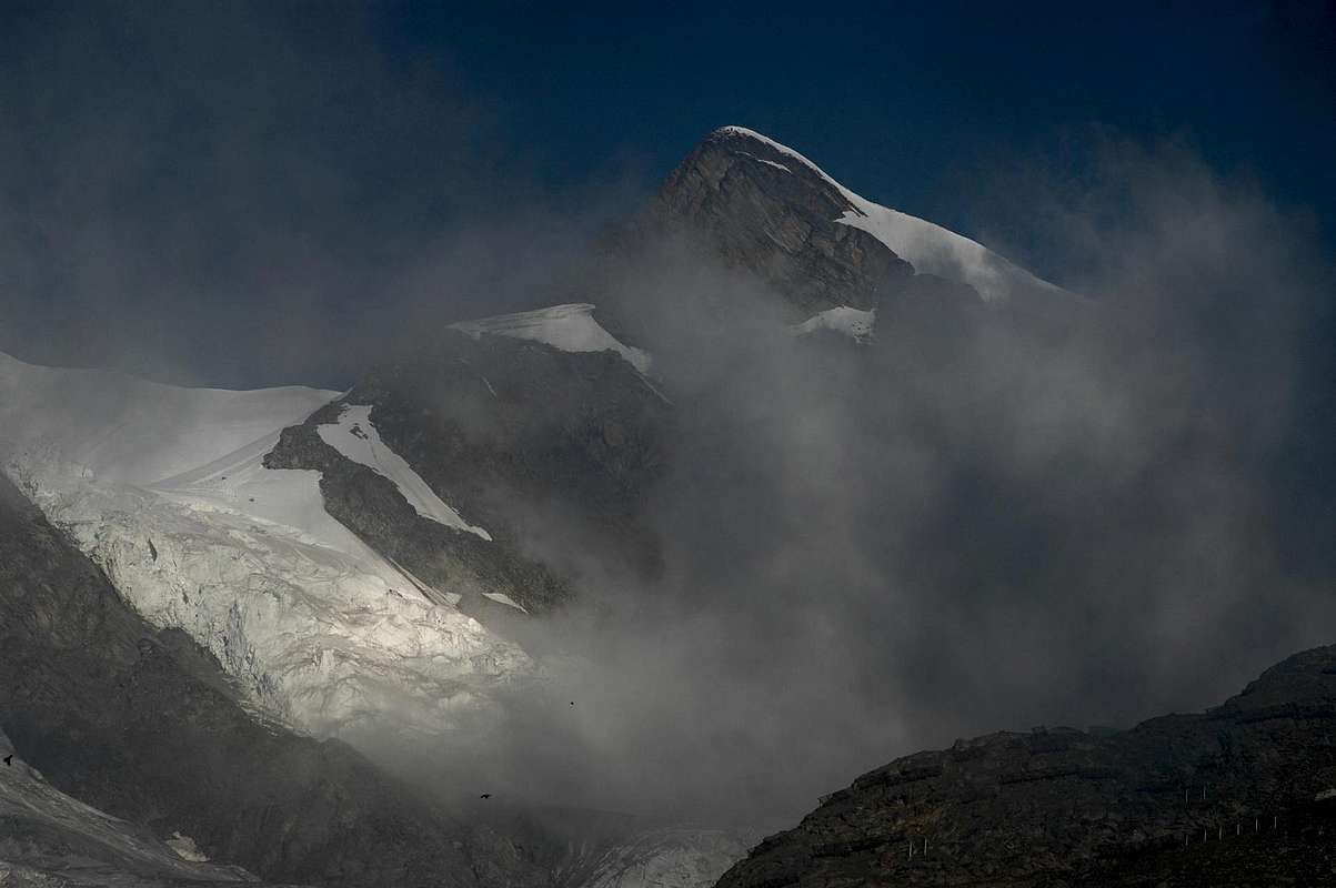


 Google Map - Mont Blanc and Matterhorn - Photo from markhallam