Overview
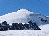
![Fluchthorn]() View down the allalin glacier
View down the allalin glacier![Weisshorn]() Weisshorn and Allalin Pass
Weisshorn and Allalin Pass
The Fluchthorn (3795m) is situated amid the splendour of the Mischabel
Group of the Pennine Alps in the beautiful Valais Region of Switzerland.
Dwarfed by the 4000+ m Strahlhorn, Rimpfischorn and Allalinhorn
summits the Fluchthorn is often ignored by climbers eager to climb its
loftier neighbours.
However, as acclimatisation peak, or training peak to hone glacier skills,
or if the weather is unfavourable on the higher peaks; the Fluchthorn
offers a pleasant relatively safe snow /ice climb.
Care, however, should be taken as there are a number of large crevasses on
the Allalin Glacier. Also, route finding in the mist can be problematic.
There are good views throughout the route with impressive glacier scenery
on the approach to the summit.
There are wonderful views of the Weisshorn, down the Allalin Glacier to
the Weissmies Group and to the distant Bernese as well the neighbouring
Strahlhorn, Rimpfischorn and the Allalinhorn.
The panorama from the summit is breathtaking.
The mountain is best approached from the Britannia Hut from Saas Fee.
Getting There
![Britannia Hut]() Britannia Hut
Britannia HutSaas Fee
The Saas Valley is easy to reach with good rail and Postbus links from the airports.
From the railway station at Brigg or Visp take the regular Postbus service to Saas Fee.
Britannia Hut
The Britannia Hut is normally reached by taking the cable from Saas Fee to
Felskin (2989m) and then following the marked Alpine way to the Britannia
Hut SAC (3030m) approximately 30min.
Red Tape
No Red Tape as such but some red snow.......!
![Fluchthorn]() Fluchthorn and a sand covered Allalin Glacier
Fluchthorn and a sand covered Allalin Glacier Accommodation
The Britannia Hut (3030m) SAC
Tel.: (+41) 028.572288, 113 beds
External Links and Maps
Maps
1:50000 Swisstopo No 5006 Matterhorn Mischabel
Saas info. Weather and Live web cam
Routes
The normal route (F+/PD-) starts from the Britannia Hut and descends west
down to the Hohlaub Glacier initially following the normal route of the
Strahlhorn onto the Allalin Glacier skirting under the Hohlaubgrat of the
Allalinhorn and then toward the east wall of the Rimpfischorn.
Once the glacier flattens out beneath the Allalinpass, leave the normal
route of the Strahlhorn and head east/south east heading to the southern
most point of the rock outcrop at point 3451m.
From here either head south skirting beneath the west slopes of the
Fluchthorn to the Fluchtpass (3724m) and then on to the summit.
Alternatively from point 3451m,if conditions are favourable, ascend the
North Slopes of the Fluchthorn on snow/ice to about 40 degrees.
The Fluchthorn can also be climbed during the ascent of the North East
Ridge of the Strahlhorn (AD).

 View down the allalin glacier
 Weisshorn and Allalin Pass
 Britannia Hut
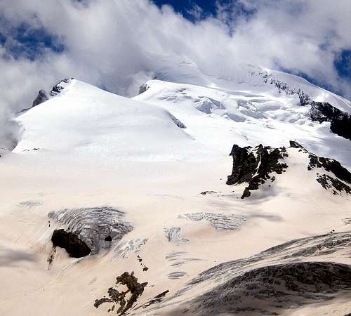 Fluchthorn and a sand covered Allalin Glacier

Mauntainfreak - Jan 7, 2016 4:22 pm - Hasn't voted
Climbing with skisThis photo was taken climbing the Fluchthorn with the skis (click it to enlarge): In the photogallery you can see the photos of the trip.