
-
 4895 Hits
-
 80.49% Score
-
 12 Votes
|
|
Mountain/Rock |
|---|---|
|
|
32.70630°N / 111.4064°W |
|
|
Pinal |
|
|
Hiking |
|
|
Spring, Fall, Winter |
|
|
4209 ft / 1283 m |
|
|
Overview
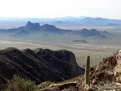
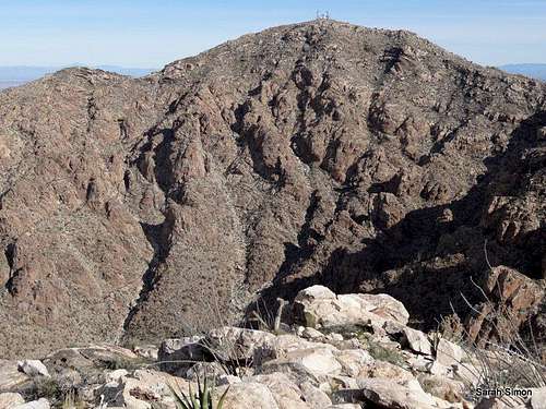
Looking across the interstate at Picacho Peak and "Razorback Ridge" | 2 Feb 2013
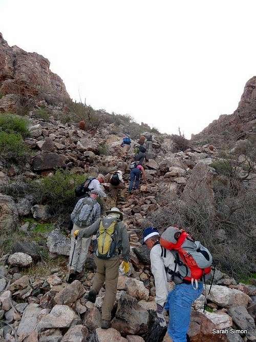
Unofficially named “South Newman Peak,” UN 4209 is a scrappy little desert companion to neighboring big sibling Newman Peak in the Picacho Mountains of southern Arizona. Sitting across the highway from well-known Picacho Peak, with its state park and crowds, “South Newman Peak” sees few visitors. It not only lacks an official USGS name, but it is a pain to get to by road (see “Getting There” for details). The peak sits roughly halfway between Tucson and Phoenix, just of I-10 – many drive by this peak, but few set foot on the summit.
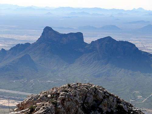
The views all around from this summit are fantastic, but the world seems to drop off to the west and the horizon goes on forever! Picacho Peak and neighboring “Razorback Ridge” loom darkly across the interstate, and big neighbor Newman Peak rises ruggedly to the northeast.
Rank: 4027th highest peak in Arizona
Prominence: 549 feet
USGS Quad: Newman Peak
SUMMIT VIEWS:
 |  |  |  |
Getting There
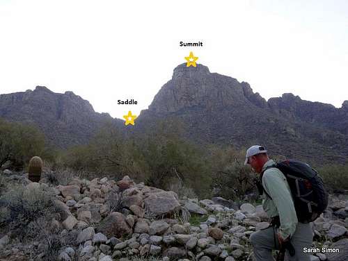
Below the summit of "South Newman Peak" | 2 Feb 2013
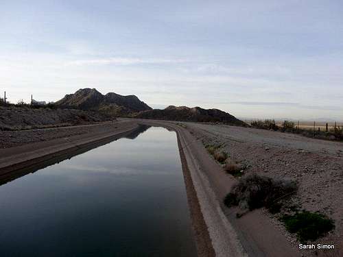
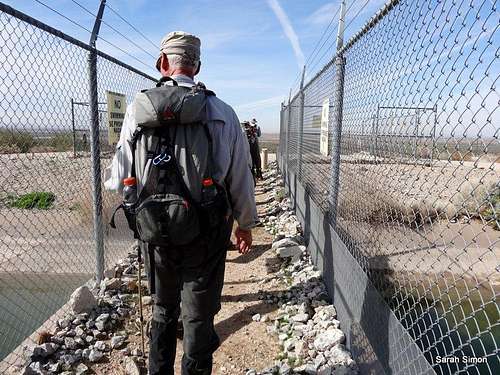
Crossing the canal
Getting to the base of this peak is, quite frankly, insane. A patchwork of landownership and a rabbit warren of un-marked, unmapped roads makes it nearly impossible for me to describe the driving directions in any detail. The necessity of crossing the canal limits the access options. Pay close attention to Scott Surgent’s driving directions to the southern access for Newman Peak.
In particular, note that as of my visit in February 2013, the Park Link Road access over the railroad tracks is indefinitely closed to traffic.
Parking Details
Elevation: 1280 feet
Latitude: 32.7121
Longitude: -111.4244
Vehicle Requirements: High clearance 4x4 required. Stock vehicles will do fine, but some of the monsoon washouts are getting pretty crazy. There is room for 4-5 vehicles if you are all in the same party (and not worried about blocking one another in).
Route
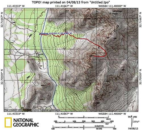
Map to the summit of "South Newman Peak" from the west | Map created April 2013
Northwestern Gully
Roundtrip Distance: 4.4 miles
Elevation Gain: 2,930 feet
YDS Rating: Class 2
Bushwhack Rating: Desert B1
In contrast to the driving directions to reach the base of this peak, the hiking route is exceedingly simple.
· From the parking area, head east up the canal berm and cross the canal via a narrow concrete bridge.
· Follow an old dirt road east, passing a borrow pit (mining).
· You may note two cairned social paths diverging: The northern route hearing toward Newman Peak, the southern fork heading to
“South Newman.”
· Take the right fork, crossing a drainage, heading to the saddle that sits to the right of the summit of “South Newman.”
· Begin ascending the drainage to this saddle. It steepens and becomes rocky, but the scampering should never exceed Class 2+. Give prickly plants a wide berth.
Upon reaching the saddle, simply fishhook trending southwest up to the summit. Look for a weakness in the cliffbands just above the saddle for easiest passage. Keep an eye out for loose rock and be careful not to kick anything down on your partners.
 |  |  |  |
 |  |  |  |
 |  |  |  |
Red Tape
Heading up the gully
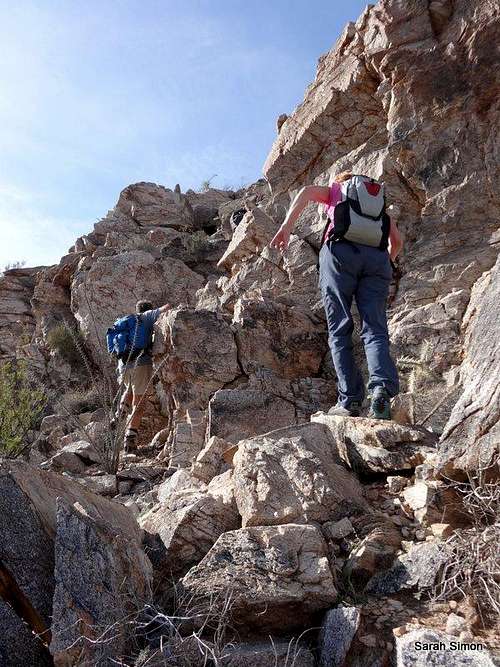
Cliff weakness to gain summit
Weather & Seasons
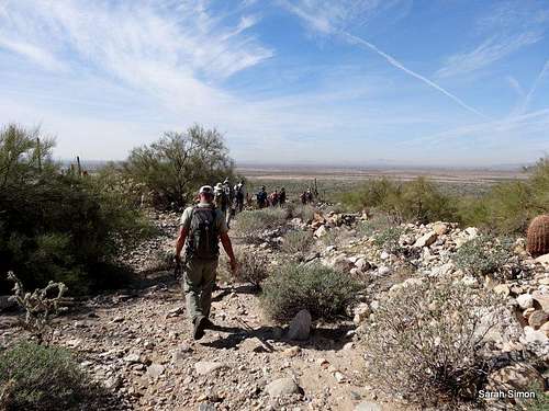
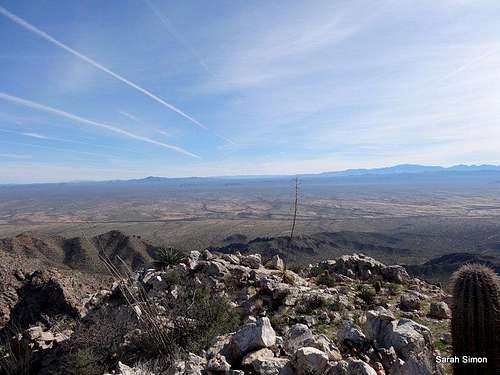
Down on the desert flats
 Click for weather forecast | Fall through spring are ideal times to visit this peak. Winter days here are typically sunny and mild, with cold nights. Springtime may bring wildflower blooms, especially poppies. Summers here are dreadfully – even dangerously – hot. If you insist on hiking this peak in the summer, start at daybreak and bring a lot of water plus sun protection. |  Click for weather forecast |
Camping
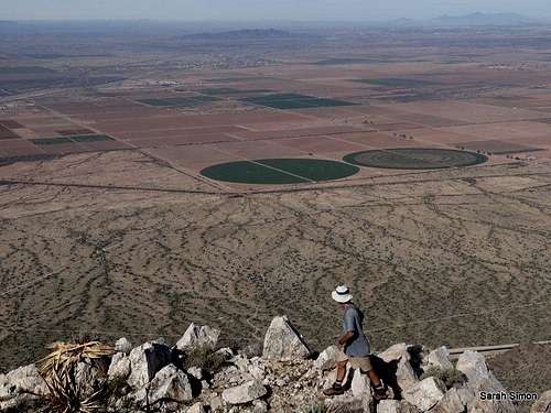
Nice open views west from the summit | 2 Feb 2013
Many visitors to this area will either live in or be visiting the Arizona cities of Phoenix or Tucson. For those wishing to stay near the mountain, below is information about camping in the Picacho Peak State Park. Note that services are very limited at Interstate 10 Exit 219, with no hotels and just restaurant, shop and truck stop.
Picacho Peak State Park Campgrounds
Be forewarned that these campsites are all in close proximity to an interstate as well as a busy railroad.
Per the park website: Picacho Peak State Park’s campgrounds have a total of 85 sites for both tent and RV camping. All sites are first come-first served. Access to all sites is paved. Sites are fairly level and are located in a natural Sonoran Desert setting. Both back-ins and pull-throughs are available. No maximum size limit (except no tractor trailers allowed). All sites offer a picnic table and barbeque/fire ring. Many sites also offer ramadas, and some of the sites are handicapped-accessible. Use of the dump station is included in price for camping. Potable water is available at the dump station. Quiet hours are from 10 pm to 6 am. Generator use is not permitted during these hours. There are two modern, handicapped-accessible restroom and shower buildings available at no additional charge for campers.
- 62 sites have electric hook-ups
- 25 do not have electric hook-ups
- Water & sewage RV hook-ups are not available
- Two bath facilities provide hot showersExternal Links
Crossing the canal
Please notify me via Additions and Corrections of any external trip reports or other useful material that should be added here.