MrWasatch
Offline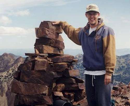
| Gender/Age | Male, 51 years old |
|---|---|
| Location | Syracuse, Utah, United States |
| Power | 68 |
| Vote Weight | 73.3% |
| Occupation | Project Manager |
| Website | http://www.micksmtn.20m.com |
A Little About Me
My Images
My Mountains & Rocks (5)
- Bald Mountain (Wasatch) Wasatch Range (South)
- Mount Ogden Wasatch Range (North)
- Spanish Fork Peak Wasatch Range (South)
- Thurston Peak Utah County Highpoints
- Willard Peak Utah County Highpoints
My Routes (16)
- Brighton Traverse Mount Wolverine & Mount Tuscarora
- Broads Fork Broads Fork Twin Peaks
- Farmington Ridge Thurston Peak
- Georges Hollow Mount Wire (Big Beacon)
- Lake Hardy South Thunder Mountain
- Payson Lakes - Loafer Mtn. Trail Santaquin Peak
- Pioneer Park Mount Wire (Big Beacon)
- Right Fork of Maple Canyon Spanish Fork Peak
- Skyline Trail (North Ogden Pass) Ben Lomond
- South Ridge Cascade Mountain
- South Slopes Bald Mountain (Wasatch)
- via Ben Lomond Willard Peak
- via Red Pine White Baldy
- West Ridge (Avenues) Little Black Mountain
- West Slopes Grandeur Peak
- Willard Basin Willard Peak
My Trip Reports (3)
- Dromedary Peak North Ridge Mt. Dromedary
- Spanish Fork - Right Fork/Maple Canyon Spanish Fork Peak
- White Baldy Northwest Ridge White Baldy
Climber's Logs I've Signed (58)
Mountains & Rocks (58)
- North Peak Wasatch Range (South)
- Hidden Peak (Utah) Little Cottonwood Canyon
- Flat Top Mountain (UT) Ultra-prominence Peaks of the 48 States
- Mount Wire (Big Beacon) Wasatch Range (North)
- Little Water Peak Wasatch Range (Central)
- Reynolds Peak Wasatch Range (Central)
- Bald Mountain (Wasatch) Wasatch Range (South)
- Santaquin Peak Wasatch Range (South)
- Mount Wolverine & Mount Tuscarora Wasatch Cottonwood Ridge
- Flagstaff Mountain Wasatch Cottonwood Ridge
- Willard Peak Utah County Highpoints
- Grandeur Peak Wasatch Range (Central)
- Mount Millicent Wasatch Cottonwood Ridge
- Mount Baldy (UT) Wasatch Alpine Ridge
- Sugarloaf Peak Wasatch Alpine Ridge
- Mount Aire Wasatch Range (Central)
- Lookout Peak Wasatch Range (North)
- Kessler Peak Wasatch Cottonwood Ridge
- Naomi Peak Utah County Highpoints
- Mount Majestic (Clayton Peak) Wasatch Cottonwood Ridge
- Honeycomb Cliffs Wasatch Cottonwood Ridge
- Thurston Peak Utah County Highpoints
- Frary Peak (Antelope Island) Utah Western Desert Ranges
- Grandview Peak Wasatch Range (North)
- Ben Lomond Wasatch Range (North)
- Mount Ogden Wasatch Range (North)
- Cascade Mountain Wasatch Range (South)
- Provo Peak Wasatch Range (South)
- Mount Raymond Wasatch Range (Central)
- Red Baldy Wasatch Alpine Ridge
- South Thunder Mountain Wasatch Alpine Ridge
- White Baldy Wasatch Alpine Ridge
- Mount Watson Western Uinta / Lakes Roadless Area
- Mt. Timpanogos (UT) Wasatch Range (South)
- Mt. Peale Utah County Highpoints
- Notch Peak Utah Western Desert Ranges
- Deseret Peak Utah County Highpoints
- Box Elder Peak Wasatch Range (South)
- Bald Mountain Western Uinta / Lakes Roadless Area
- Angels Landing Zion National Park
- American Fork Twin Peaks Utah County Highpoints
- Mount Starr John Muir Wilderness
- Mount Whitney California County Highpoints
- Wheeler Peak Nevada County Highpoints
- Medicine Bow Peak Snowy Range
- Mount Evans Colorado 14ers
- Mount Massive Colorado 14ers
- Mount Elbert Colorado 14ers
- Hayden Peak High Uintas Wilderness
- Devil's Castle Wasatch Alpine Ridge
- Lone Peak Wasatch Alpine Ridge
- Pfeifferhorn Wasatch Alpine Ridge
- Mount Nebo Utah County Highpoints
- Mt. Dromedary Wasatch Cottonwood Ridge
- Sundial Peak Wasatch Cottonwood Ridge
- Mount Superior & Monte Cristo Wasatch Cottonwood Ridge
- Kings Peak Kings-Emmons Ridge
- Broads Fork Twin Peaks Wasatch Cottonwood Ridge
My Lists
Content loading here...
Messages I Posted/ Editable Objects
Reviews I Posted/Reviews Posted to my Gear
Objects Others Have Attached to My Objects
Content loading here...
Photos Others Have Attached to My Objects
Content loading here...