
|
|
Mountain/Rock |
|---|---|
|
|
49.21254°N / 19.83587°E |
|
|
Hiking |
|
|
Spring, Summer, Fall, Winter |
|
|
6125 ft / 1867 m |
|
|
Overview
|
| At Siwy Zwornik, a four-kilometre-long lateral ridge branches off from the main ridge of the Tatras to run north between the Starorobociańska and Pyszniańska (the upper part of the Kościeliska) valleys. Beyond nearby Siwa Przełęcz (Grey Saddle) at 1812m, the ridge bears the name of Ornak, after what once was an adjacent pasture called Hala Ornak. The ridge of Ornak ends at Iwaniacka Przełęcz – the pass at 1459m to the south of which rises the massif of Kominiarski Wierch. The ridge is usually climbed as part of a route leading to or back from Bystrá (the highest summit in the Western Tatras) or Starorobociański Wierch (the highest summit of the Western Tatras in the territory of Poland), or at least the pass between the two peaks (which affords a view towards the Liptov Basin and the Low Tatras behind it, not to mention an excellent view of Bystrá). |
|
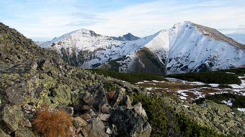
| However, the highest summit of the Ornak ridge – especially when the day is short, in late autumn – may become a destination in itself since it has an interesting geology and extraordinary shape. The ridge has two major summits: Ornak at 1854m and Zadni (Rear) Ornak at 1867m, both of which are made of Triassic quartzitic sandstone – one of the hardest and rather rare Tatra rocks. What makes Zadni Ornak interesting, despite its prominence being a mere 55m, is its location at the end of a triple-crested part of the ridge combined with the rock type yielding talus, which results in the rocky character of the summit. The rock formations just east of the main summit of Zadni Ornak (sometimes along with the main summit) are often called Siwe Skały (Grey Rocks). |
|
A 360-degree panorama from the summit of Zadni Ornak can be seen on www.panoramy.wyprawy.org.
Getting There, Routes & Maps
Both trailheads – the Chochołowska and Kościeliska valleys – are located several kilometres west of the town of Zakopane, by road 958, at the boundary of the Tatra Mountains National Park. To find out how to get to Zakopane, you can have a look here.
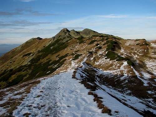
 Dolina Starorobociańska and Ornak ridge (right)
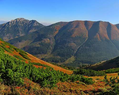
If you start your hike at Siwa Polana at the mouth of the Chochołowska Valley (car park, bus terminus), it should take less than 4.5hr to reach Zadni Ornak via Dolina Starorobociańska (the valley of Old Labour), whose name reflects the fact that metal minerals were mined in the side of Ornak as early as the 15th century. Net elevation gain will be 960m. Another option is the routes via Iwaniacka Pass – beginning at the mouth of either the Kościeliska or the Chochołowska valley. The last variant is the longest (about five hours' walk up). The stretch between Iwaniacka Pass and the top of the Ornak ridge is pretty steep, so an ascent can be a little taxing in the sun, whereas a descent can be very slippery as ice and snow tend to linger there. You can make you hike shorter if you stay overnight at one of the two nearby mountain huts. (Please scroll down to the Accommodation chapter.)
Maps by several publishers are available at bookshops, souvenir shops and street stands in Zakopane. I would recommend the plastic 1:25,000 map of the Polish and Slovak Tatras by WiT. It has a large scale, is waterproof, durable and cheap. There is also an excellent hiker's guidebook by Józef Nyka, unfortunately available only in Polish.
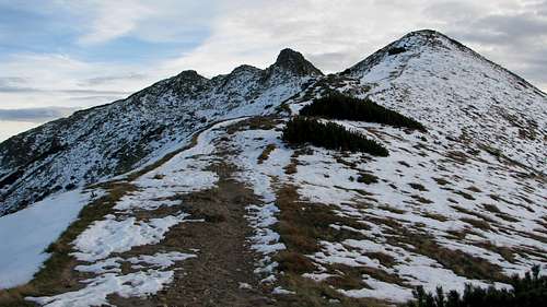
 Across Iwaniacka Pass
Red Tape
You have to pay for entry to the Tatra Mountains National Park – the fee is currently (year 2015) a bit more than an equivalent of €1 per day. The park rules are quite strict. In a nutshell, you are only allowed to walk along the marked trails and bivouacking is not permitted.
 Early June
When To Go
 Ornak ridge in autumn
To avoid the crowds, it is advisable to go in late spring or in autumn. Under winter conditions, the route that should be safer from avalanches is the one from the Ornak Hut ('Schronisko na Hali Ornak') via Iwaniacka Pass – you will need the experience and basic gear.
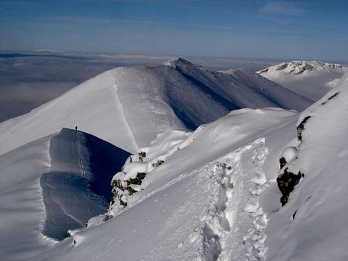
 In March (from E)
Mountain Conditions & Rescue
|
|
Accommodation
|
Glossary: Wszystkie miejscowości - All villages and towns
Wybierz rodzaj obiektu - Choose accommodation type
Apartamenty – Self-catering flats/apartments
Szałasy i domki - Chalets Ośrodki wypoczynkowe – Lower standard hotels / guesthouses / holiday camps Pensjonaty – B&B/guesthouses
Wille – B&B/guesthouses Wynajem pokoi – Guesthouses Hotele – Hotels (varied standard) Campingi - Campsites
Motele – Motels Pola namiotowe – Rudimentary campsites
Noclegi/Kwatery/Zakwaterowanie - Accommodation
Szukaj - Search
|

|

|

|