
|
|
Mountain/Rock |
|---|---|
|
|
49.23155°N / 19.90976°E |
|
|
Hiking, Skiing |
|
|
Spring, Summer, Fall, Winter |
|
|
6962 ft / 2122 m |
|
|
Overview
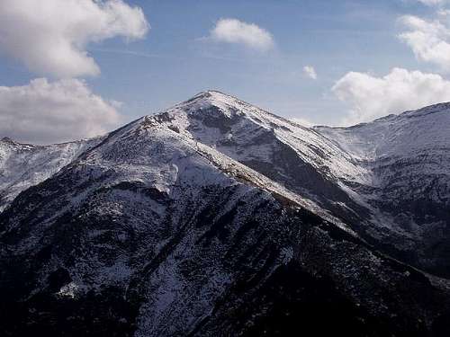
| Czerwone Wierchy (Polish) Červené vrchy (Slovak) Vörös-hegyek (Hungarian) | |||||||||||||||||||||||||||||||||||||||||||||||||||||
|
|||||||||||||||||||||||||||||||||||||||||||||||||||||
| Glossary: wierch/vrch = peak, turnia = crag, grzbiet/hrebeň = ridge, przełęcz/sedlo = saddle, dolina = valley, potok = creek, żleb = couloir | |||||||||||||||||||||||||||||||||||||||||||||||||||||
Krzesanica
Małołączniak
The Blue TrailDistance: 7.5km Time: 3.5h (up) Elevation Gain: 1170m Extra elevation gain on Małołączniak-Krzesanica-Ciemniak: total 110m (time: 0.5h) Back down to bus stop/car park from Ciemniak/Małołączniak: 2.5h 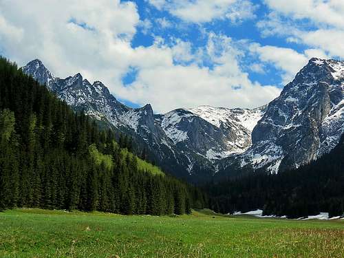
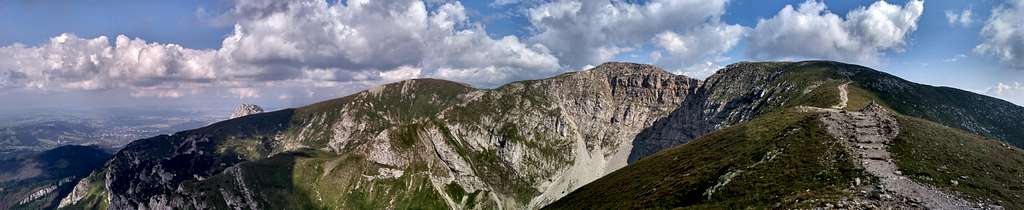
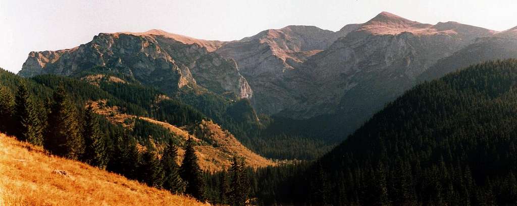
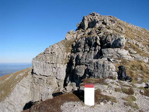
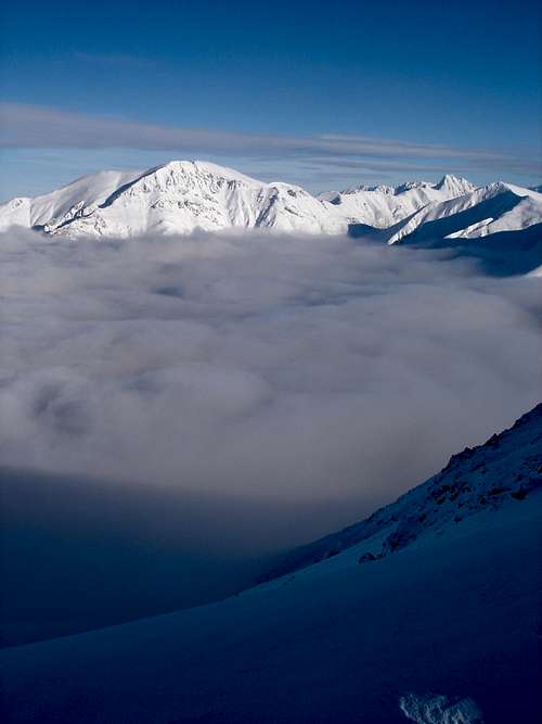
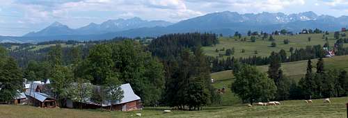
While in Zakopane, get on any of the frequently running minibuses heading for Dolina Kościeliska/Chochołowska and get off at the stop called Gronik. The trailhead is a couple of hundred metres back in the direction of Zakopane. If you come by car, you can park it right at the trailhead, which is at the mouth of the Valley of Mała Łąka (Little Meadow). The trail leads rather gently up the stream until after about 20 minutes you get to the junction with the yellow trail. Then a steeper part follows, which takes you to a broad pass named Przysłop Miętusi, where two trails intersect in the middle of a clearing. The place is watched over by the characteristic Eljaszowa Turnia (Eljasz's Crag). Przysłop Miętusi is a good spot to have a snack (two rest spots with a wooden table and benches: one in the middle picture above and the other at the edge of the forest) and admire a dramatic view of the north, craggy walls of Czerwone Wierchy. To the west, there is an interesting view of Kominiarski Wierch.
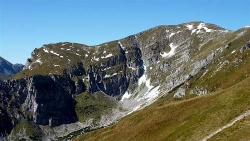
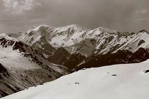
Having left Przysłop Miętusi the blue trail turns into a narrow path, which sticks to the eastern flank of the Miętusia Valley and runs more or less along the contour line of 1200m, through a spruce forest. It is now really hard to imagine but in the 19th century this part of the trail served the miners who excavated iron ore in the tunnels dug into the rock below your feet. The iron was then smelted where today the lower cable car station stands. An alternate name of our blue trail is the Miner Track... After three quarters of an hour our trail climbs up the slope a little, still less than a hundred metres, then again continues almost horizontally. Spectacular views open up towards the huge, glacially moulded steps of the Litworowa and Mułowa valleys, which form the headwall of the Miętusia Valley that is called Wielka Świstówka. All the three cirques are devoid of tarns as this is karst terrain.
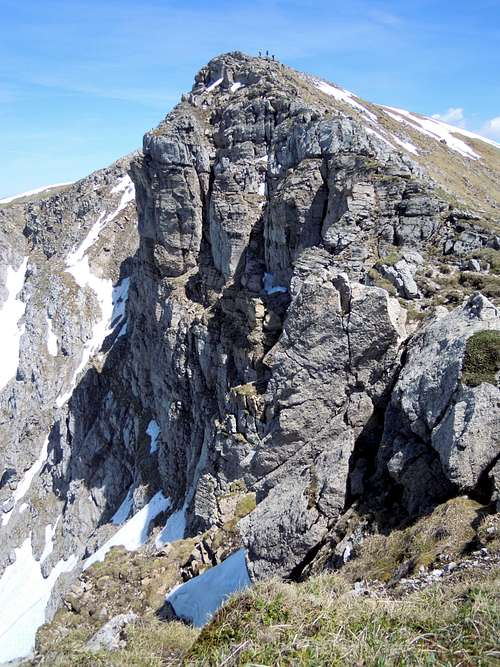
But our trail, unfortunately, doesn't go up the steps leading to the cirques (that would be more than YDS class 4), but turns left to enter a wide couloir named Kobylarzowy Żleb (Kobylarz's Couloir), just like the rib and the crag on its left. There's lots of scree, some interesting flora in the early summer, and even about twenty metres of steel chain to secure your passage by the only point en route where it is impossible to proceed without using your hands. But for the chains, this steep and rather slick slab of limestone (approximately a dozen metres tall) would make for a Class 4 (YDS) climb. But the chains have converted this point into just a Class 3 problem. While walking above the upper end of the chains, be careful not to kick a stone on someone climbing down there.
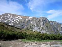
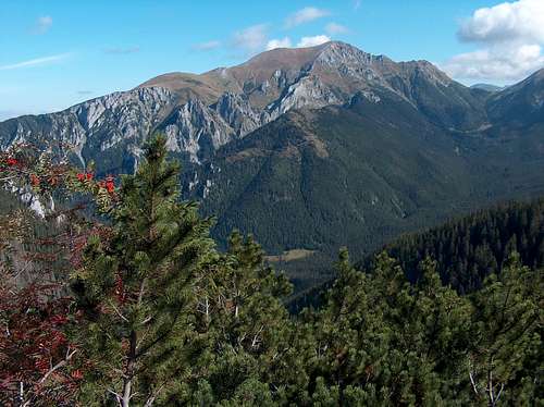
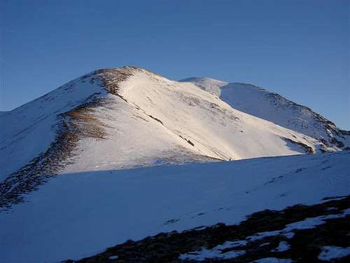
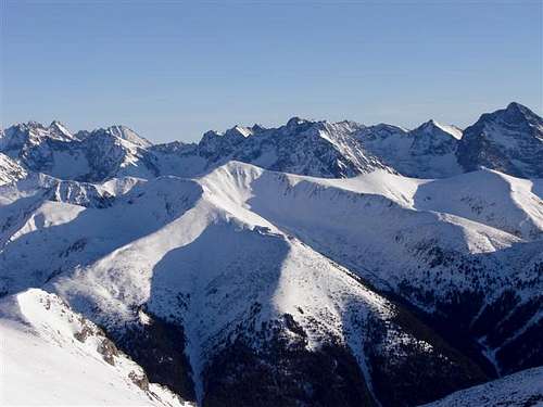
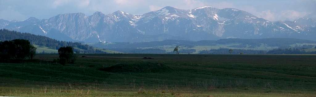
Having hiked around 3 hours, you finally reach the gently sloping top of Czerwony Grzbiet (Red Ridge). Another nice place to have a little rest and an interesting view of the nearby Giewont across the Little Meadow Valley. On the other side of the ridge, several kilometres to the west, beyond the Polish-Slovak border rises the grand ridge of the so called Orawa Tatras, in Slovakia known as the Roháče.
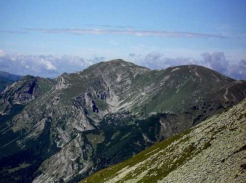
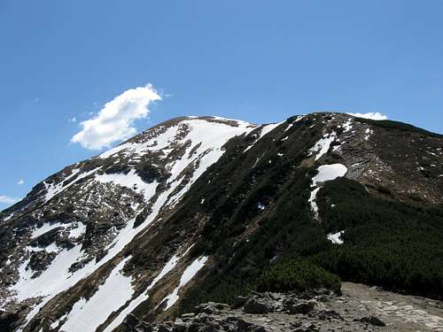
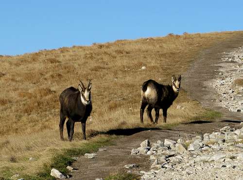
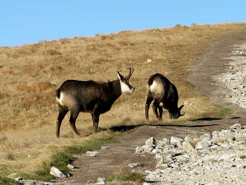
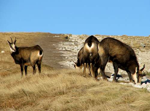
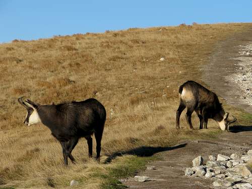
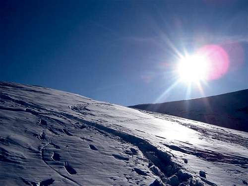
The last - rather gentle although about 250m up anyway and a bit tiring - section of the trail will take you over the Red Ridge to the very summit of Małołączniak in less than half an hour. The summit offers an outstanding panorama of the Slovak High Tatras. 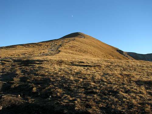 The uppermost stretch of the blue trail with the summit of Małołączniak The uppermost stretch of the blue trail with the summit of Małołączniak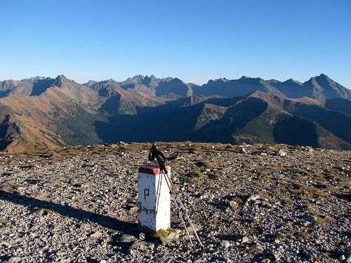 The High Tatras viewed from the summit of Małołączniak The High Tatras viewed from the summit of MałołączniakThe ChamoisAn hour or two before sunset, when almost all hikers have gone, encounters with chamois are highly likely. (Once I was lucky to face a bold young buck that barred the trail, hissing at me and kicking the ground with his front hoof so that I wouldn't dare get closer to his two female companions.)
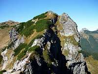
Ciemniak
Kopa Kondracka
|


Maps
As for analogue maps, several versions are available at bookshops, souvenir shops and street stands in Zakopane. One of the best options is the plastic 1:25,000 map of the Polish and Slovak Tatras by WiT.
Getting There
Zakopane sits at the foot of the Tatra Mountains about 100 km south of Kraków, where there is an international airport. (The city of Kraków certainly boasts one of the most interesting old towns in East Central Europe.) It should take you less than two hours to drive from Kraków to Zakopane, but at weekends or in high season it often takes more than 3.5hrs, which is more or less how long a journey by train lasts. As for the buses, check out this website. (The station adjoins the central railway station "Kraków Główny".)
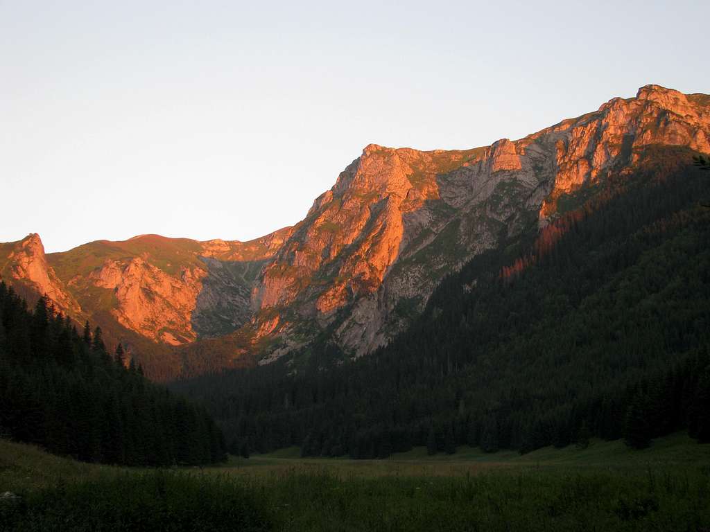
 In Tichá dolina
Red Tape
In Poland you have to pay for entry to the Tatra Mountains National Park – the fee is currently (2024) a bit less than an equivalent of €2 per day. The park rules are quite strict. In a nutshell, you are only allowed to walk along the marked trails. Rock climbing in the Western Tatras is forbidden for nature conservation reasons.
In Slovakia you don't pay an entry fee but the trails are closed from 1 November to 15 June. Here are the detailed regulations for diverse activities.
Accommodation
|
Glossary Noclegi/Kwatery/Zakwaterowanie - Accommodation Apartamenty – self-catering flats/apartments Domki - chalets Ośrodki wypoczynkowe – lower standard hotels / guesthouses / holiday camps Pola namiotowe – rudimentary campsites Wille – B&B/guesthouses Campingi - campsites Motele – motels Pensjonaty – B&B/guesthouses Wynajem pokoi – guesthouses Hotele – hotels (varied standard) |
|


|
Mountain Conditions & Rescue
Czerwone Wierchy seem to be incapable of creating any problems but several dozen people have perished on them. Most of the accidents have happened in wintry conditions (which does not necessarily mean winter, summer snow occasionally occurs too), but the summer fog has led to fatal accidents also as some people have fallen down the northern craggy walls after taking the wrong turn while trying to descend. Mountain rescue team's phone number: (+48) 601 100 300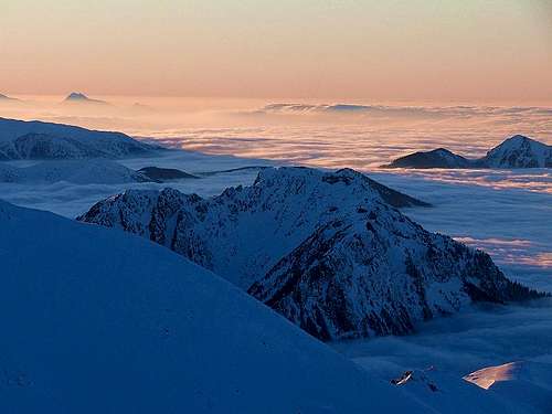
- WEBCAM looking towards Czerwone Wierchy
- Live webcam views & current weather conditions in the Polish Tatras
- Weather forecast for Zakopane on meteo.imgw.pl
- Weather forecast for Zakopane on AccuWeather.com
- Avalanche danger
- Conditions on the trails
Select External Links
- Letter to NP Management requesting that ban on climbing on the Great Crag should be lifted in winter (in Polish)
- Guidebook Tatry Polskie by Józef Nyka (unfortunately available only in Polish)
SzaniUherkovich - Sep 10, 2013 2:03 pm - Hasn't voted
Hungarian namesJacek, Did I already mention it? Konrád-púp / Kondracka Kopa Kis-réti-hegy / Małołaczniak Vésett-kő / Krzesanica Sötét-hegy / Ciemniak Cheers, Szani
yatsek - Sep 10, 2013 5:58 pm - Hasn't voted
Re: Hungarian namesKöszönöm Szani!
SzaniUherkovich - Sep 11, 2013 3:52 am - Hasn't voted
Re: Hungarian namesWelcome! Later I will add some photos about these 4 hills, too