


-
 16298 Hits
-
 84.82% Score
-
 19 Votes
|
|
Mountain/Rock |
|---|---|
|
|
49.19292°N / 19.70535°E |
|
|
Hiking, Mountaineering, Mixed, Scrambling, Via Ferrata |
|
|
Spring, Summer, Fall, Winter |
|
|
7146 ft / 2178 m |
|
|
Overview
Baníkov (Slovak) Banówka (Polish) Bánya-hegy (Hungarian)
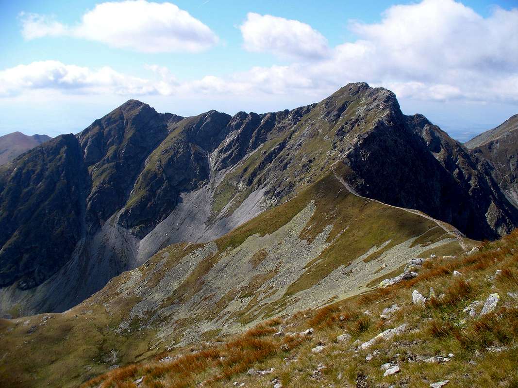
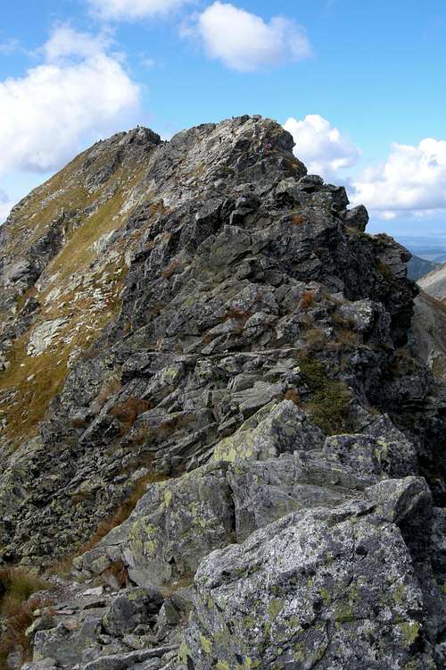
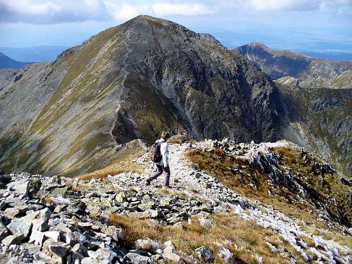
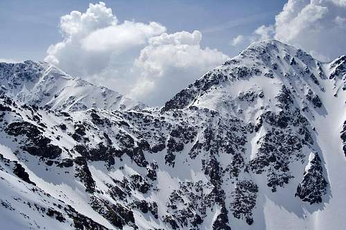
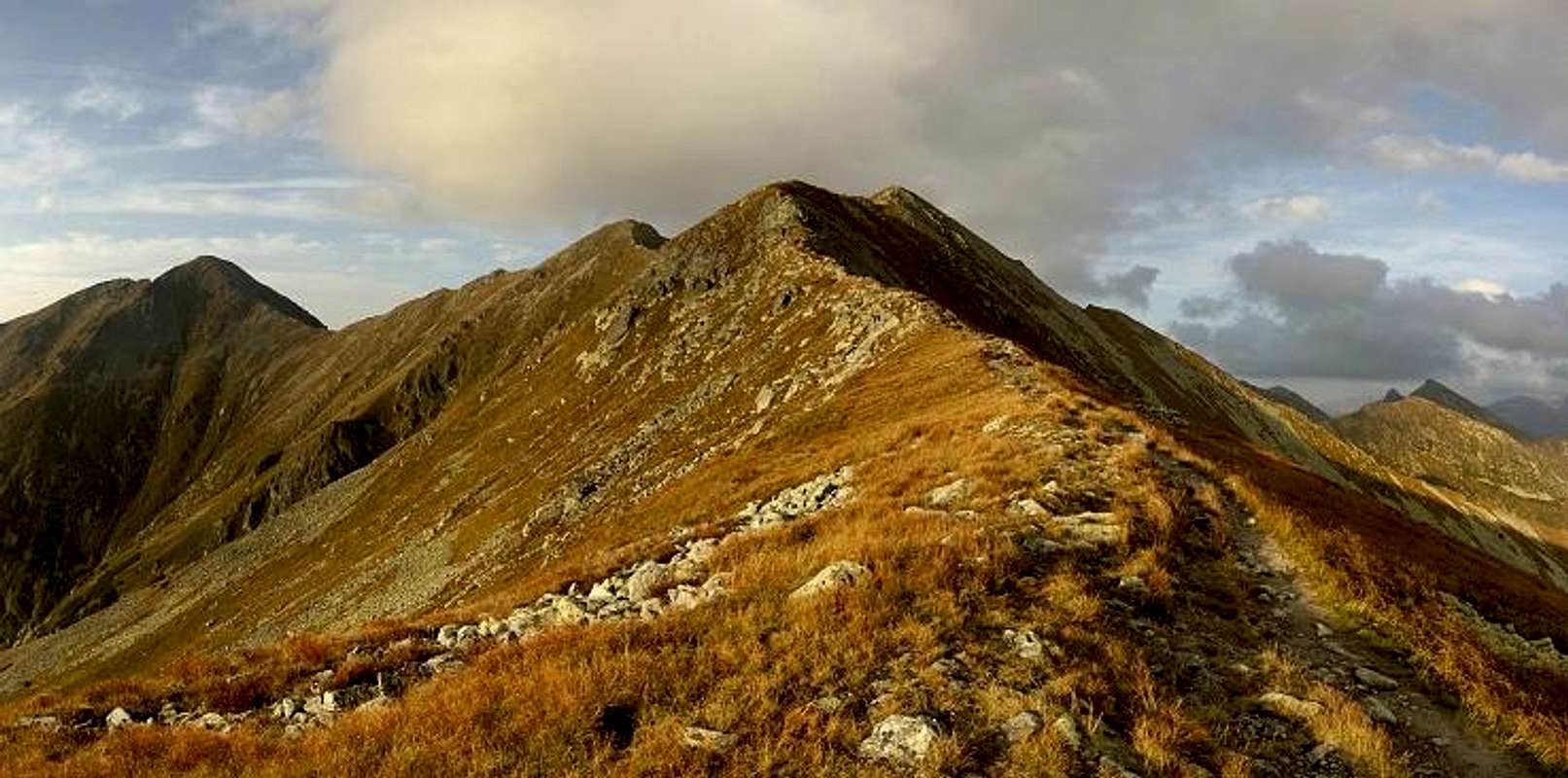
One of the two most attractive summits in the Western Tatras, in their western part which Slovak people call the Roháče, Baníkov is the highest summit in the main ridge of the Western Tatras. (Its name derives from a Hungarian/Slovak word for "a mine/miner" - a couple of centuries ago the slopes of Baníkov, like those of other mountains in the area, were prospected for ore.) Its main attraction is the several hundred metres of narrow crest, part of the main ridge of the Western Tatras, running east from the main summit. No, we are not talking of the Alps. But the ridge is fairly airy and in wet or wintry weather conditions the climbing can become pretty dangerous. Such a piece of jagged granite ridge is a rarity in this quarter of the Tatras (even as far as the High Tatras are concerned, such a thing is a rarity in terms of what is legally available, that is to say on the net of the marked trails within the National Park). Here is how Józef Nyka, renowned writer of the Tatra hiker's guidebooks, sees it: "...an interesting crest climb over good rock, with many craggy steps, notches and smooth slabs, generally high exposure." (translation by yatsek) The uppermost section of the mighty side ridge of Ráztoka/Rozsocha (green stripes leading to Žiarska Hut) between Baníkov and Jalovecký Príslop 2,142m, which runs from Banikov to the south (photo above) is also fairly narrow and its east face is precipitous. The western face of Baníkov, down which the ridge trail continues towards the westernmost reaches of the Tatras, is the gentle side of the mountain. A descent to Baníkovské sedlo (Baníkov Saddle) at 2,040m takes just over 20 minutes. But mountains, like people, can have more than one face. Many unprepared climbers have been injured or killed on Baníkov, mostly in wintertime, of whom many if not the most were Czech. The Slovaks have a joke: Two non-Czech climbers are walking below a cornice of snow at Baníkov, and one of them says: "Hey, don't utter a word in Czech. It could trigger an avalanche."
|
|
|
|
Red Tape
Fortunately, border crossing is no problem at all any more but the national park rules are quite strict. In Slovakia, you don't pay an entry fee but you're not allowed to roam the park in winter/spring. Here are the detailed regulations for various fun activities.
The hiker must know that offtrails in Slovakia is tolerated only for mountain-climbing when accompanied by a registered mountain guide, or holding a licence of UIAA club. But not all zones. Natura 2000 zones are strictly forbidden. The north side of Baníkov, with the area of the lakes of Rohačká Dolina is such zone. However, Baníkov is served by many very convenient official trails.
Getting There

- Rohačká Dolina starting point: From Poland, cross to Slovakia at the road toll at Sucha Hora, to reach Oravice and Zuberec. From Slovakia, reach Zuberec via Zilina and Dolný Kubín.
- Jamnická or Žiarska Dolina starting points: From Poland, very long way... from Krakow, prefer the border point at Chyżne. From Silesia, choose Korbielow or Rajcza/Novot. Reach Dolný Kubín and circumvent Tatras. From Slovakia, via Dolný Kubín and Liptovsky Mikulas.
- By public transports - all points mentioned above are reachable by bus from Liptovsky Mikulas or Zuberec
Routes
Baníkov can be visited in several ways. Here are 3 loops from different valleys: * Loop via Žiarska Dolina: Reach Žiarska Chata, in which you can spend the night the evening before. Take the green trail climbing west to Jalovecké Sedlo, and follow the ridge to the top of Baníkov. Leave it following east the ridge to Hrubá Koba and Tri Kopy. You can descend to the hut via Smutné Sedlo, or, if you feel like, extend the hike till Plačlivý, returning via Žiarské Sedlo. In this case, the loop might be more appropriate in the opposite direction, as you might spend more time on Plačlivý.
 |
 |
 |
 |
 |
 |
 |
 |
 |
Maps
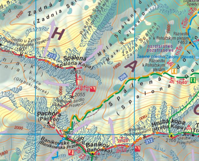
- plastic 1:25,000 map of the Polish and Slovak Tatras by WiT
- Slovak map by VKU Harmanec, sheet 112, Roháče (1:50,000)
- freemap.sk online map
- hiking.sk online map
- online map of Western Tatras on Mapytatr
Accommodation
- Camping is strictly forbidden in both national parks: TPN (Poland) and TANAP (Slovakia)
- There is one campsite near the entrance of the valley Račková Dolina, in Pribylina
- Mountain huts : - Ťatliakova chata - reopened in 2017 (it used to function as a buffet), about 3 km NE of the summit. - Chata Zverovka, Rohačká Dolina (near Zuberec), Slovakia. This "mountain hut" is rather a hostel because accessible by road. For this reason, it is advisable to book as early as possible. - Žiarska chata, Žiarska dolina (near Žiar), Slovakia. This is a very beautiful newly-rebuilt hut, in a very nice location. It's possible to cycle up to this place. This starting point is ideal for the one who wants to climb Volovec together with Ostrý Roháč and Placlivé.
Mountain Conditions & Rescue
- In Slovakia - unlike in Poland - those who do not carry commercial insurance have to pay for any rescue services rendered by Mountain Rescue Service (HZS). Mountain rescue team phone number: Slovakia (HZS) 18 300
- Forecast for Žiarska Hut at 1325m
- Mountain conditions, including avalanche danger level, on HZS site
- Webcam on Lomnický štít
- AccuWeather forecast for the town of Zuberec at approx. 750m, a dozen km northwest of Ostrý Roháč: