
|
|
Mountain/Rock |
|---|---|
|
|
49.18864°N / 19.84258°E |
|
|
Hiking |
|
|
Spring, Summer, Fall, Winter |
|
|
7375 ft / 2248 m |
|
|
Written anew in September 2021.
Overview
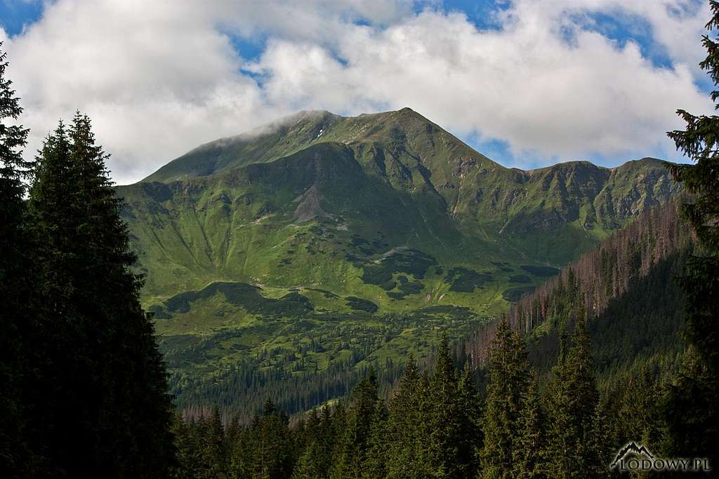
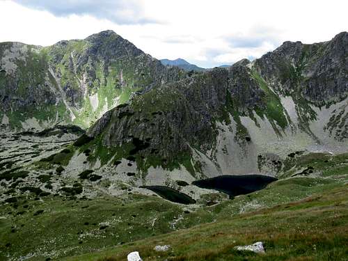
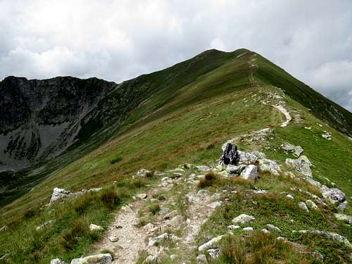
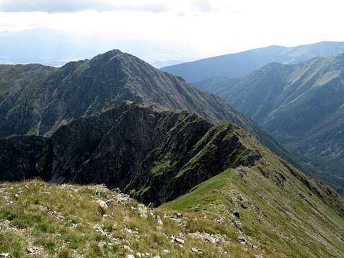
Bystrá (Bystra in Polish) at 2248m is the highest peak in the Western Tatras and - with a prominence of 562m - the second most prominent peak in all of the Tatra Mountains. It looks best when looked at from the north although it stands half a kilometre south of the main ridge of the mountains, in Slovak territory. In Poland, until the end of the 19th century Bystrá, or rather Bystra (the Polish a is a shorter sound than the Slovak á), was called Pyszna (which translates as proud or great, or literally delicious), after a great mountain pasture in summer and a skier's paradise in winter lying just north of Bystra in the uppermost part of the Kościeliska Valley, which is now closed for hikers and skiers, and left for bears and other wildlife as a nature reserve. Looking at Bystra from the north, you may mistake the actual summit for Błyszcz (Blyšť in Slovak) at 2159m, which is the point, without any prominence, where the Bystrá ridge connects to the main ridge of the Tatra Mountains. 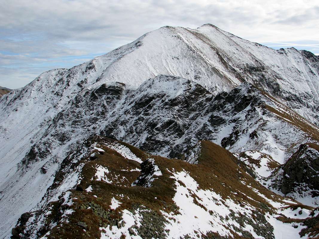
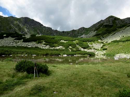
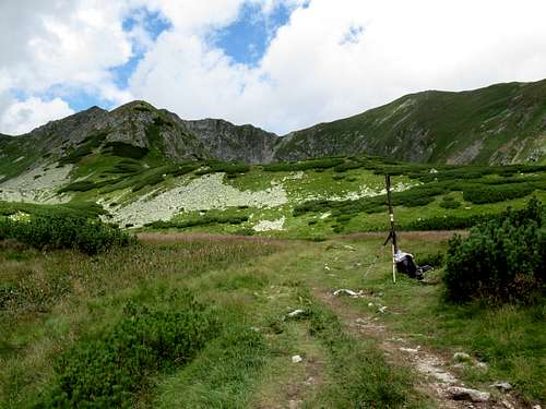
Bystrá sends two massive ridges, separated by the valley of Bystrá brook, in a southerly direction. The western ridge, on which Nižná Bystrá (known in Poland as Niżna Bystra or Zadnia Kopa) at 2163m is located, is pretty jagged. Slovaks call it Grúň, which simply means ridge. From this ridge a short spur (Hrbáč/Garbate) extends to the southeast. The spur separates two cirques cradling small tarns and forming the head of the Bystrá Valley.
The eastern ridge, grassy and rather mundane, looks similar to most of the lateral ridges in the Western Tatras. As a result, when you arrive in the uppermost part of the Bystrá Valley, your attention gets caught by Grúň and Nižná Bystrá, and it is really hard to believe that the highest peak in sight is that grassy apex to the east of them.
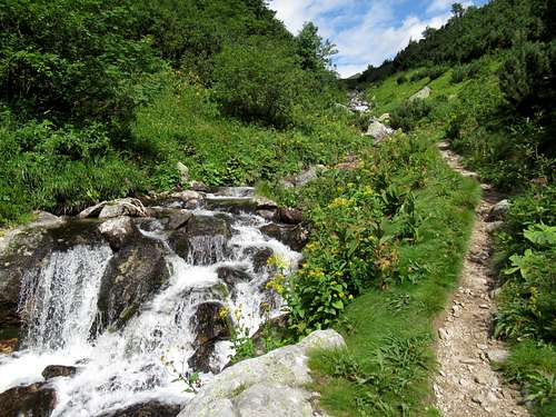
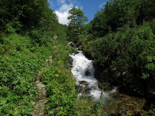
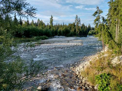
Bystrá/Bystra translates as rapid – the summit borrowed its name from the stream that has its sources just south of it. And the stream is aptly named. Its valley is unusual in that its upper section lies a few hundred metres higher than those of the adjacent valleys (Račkova to the west and Kamenistá to the east). So most of the stream has a very high gradient and it does flow fast.
|
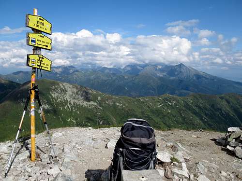
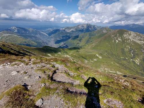
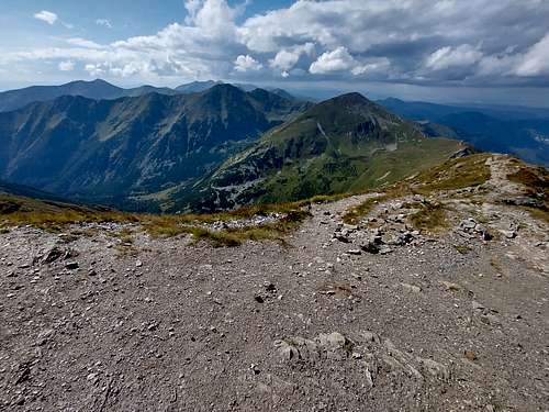
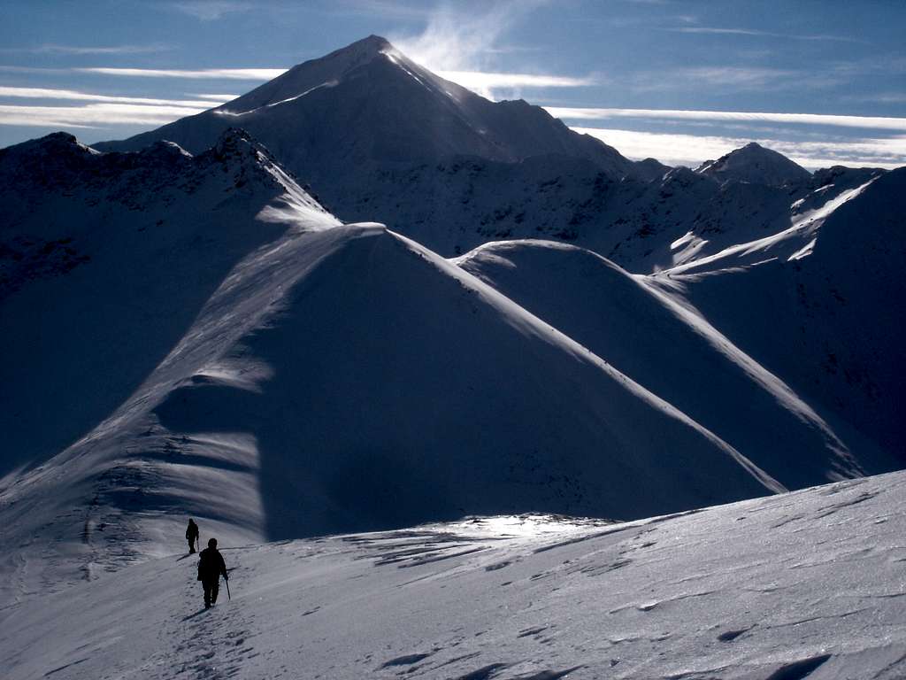
Summit Views
|
Being the highpoint of the Western Tatras, Bystrá commands panoramic views:
In the south, beyond the Liptov Basin, the Low Tatras form the skyline. 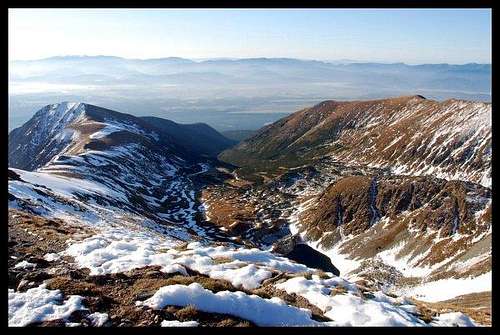
|
Getting There, Trails & Accommodation
Liptovský Mikulaš, the capital town of the Liptov region lying south of the Western Tatras, is easily accessible by both road (D1 motorway) and rail (one of the oldest railway lines in Europe; several Intercity and fast trains a day). There are hundreds of guesthouses, dozens of hotels, and several campsites in Liptov. 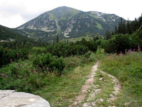
The Slovak trailheads are located between the village of Pribylina and the resort of Podbanské along road 537. If you rely on public transport, you can get there by bus from Liptovský Hrádok. Then if you decide on the second option in the table below, you will have to - after getting off in Pribylina - walk nearly 4km more to get to the campsite at the mouth of the Račkova Valley. The bus to Podbanské may be signed for Pribylina-Permon. ('Permon' is a hotel in Podbanské.)
In Poland, both trailheads - at the mouths of the Chochołowska and the Kościeliska valleys - are located several kilometres west of the town of Zakopane, by road 958, at the boundary of the Tatra Mountains National Park. To find out how to get to Zakopane, you can have a look here. You can make you hike shorter if you stay overnight and set off from the mountain hut in either valley. (Please see here.) 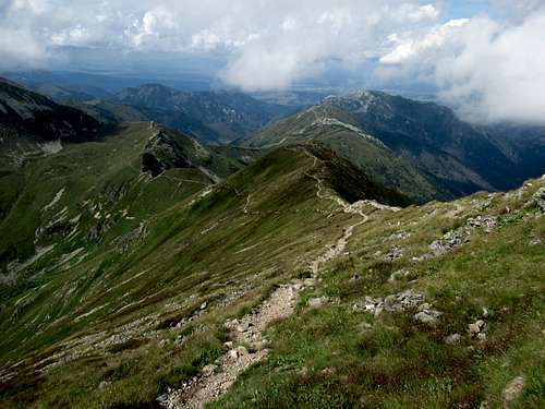
|
Maps
As for paper maps, there are plenty of options. I would recommend the plastic 1:25,000 map of the Polish and Slovak Tatras by WiT. It has a large scale, is waterproof, durable and cheap.
Red Tape
Border crossing is no problem but the national park rules are quite strict in both Slovakia and Poland. You are not allowed to leave the waymarked trail, which means that Nižná Bystrá is off-limits. In Poland, you pay a small entry fee (less than €1.5 in 2021), but you can walk all year round. In Slovakia, there is no entry fee but the higher elevation trails are closed from 1 November to 15 June. (Here are the detailed regulations for various activities.) The summmit of Bystrá lies 0.5km off the international border, but it is highly unlikely that you will be stopped or fined if you come from the north and return the same way. |
Mountain Conditions & Rescue
In Slovakia - unlike in Poland - those who do not carry commercial insurance have to pay for any rescue services rendered by Mountain Rescue Service (HZS). Also, bear in mind that the brown bear lives here.
|