
|
|
Mountain/Rock |
|---|---|
|
|
38.62910°N / 109.3173°W |
|
|
7055 ft / 2150 m |
|
|
Overview
The suggested route will begin at Professor Creek, route find through a colorful, but hot desert, surrounded by many incredible towers, make an invigorating and challenging climb to the top of the majestic Adobe Mesa*. If you would like, you can combine the climb of Adobe Mesa with a descent of Professor Creek, and you can descend through narrows of the canyon laced with waterfalls, slippery slides, and wading and swim holes, and back to the trailhead. This one trip truly has everything, from climbing a mountain, walking through the desert, canyoneering, technical climbing, and waterfalls. On this page, only Adobe Mesa will be discussed. See the Professor Creek Canyon page for information of Professor Creek. *For those that are unfamiliar with the term mesa, it is Spanish for table. It is used in this region to describe a flat-topped and steep sided mountain. Note: Adobe Mesa is sometimes known as Castle Mountain.
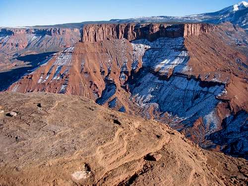 Adobe Mesa from Castleton Spire
Getting There
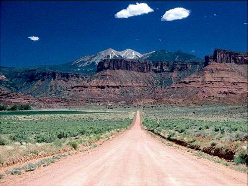
Drive along State Highway 128 north from Moab or south from Cisco to the Professor Creek Road between mile markers 18 and 19. The gravel road branches south from the highway and is marked "Ranch Road-Dead End". Drive the Professor Creek Road to its end and park. The gravel road is about two miles long and is good for all vehicles.
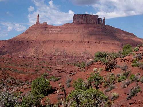 View from the trailhead. Castle Rock (left) and the Priest (far right)
Route Overview
Getting to the base of Adobe Mesa is a maze of drainages and gullies. You must have and know how to use a topo map to follow this route. The route to the summit of the mesa is not too difficult, but it is a bit tedious and strenuous. The views are well worth the climb, however. CLICK HERE FOR ROUTE PAGE The distance to the rim Adobe Mesa from the trailhead is just under six miles, with 2700 feet elevation gain, but it seems longer. A fantastic loop hike is to combine Adobe Mesa with Professor Creek (see link in the overview section). If you plan on climbing Adobe Mesa and descending Professor Creek, plan on getting a pre-dawn start. Crossing the desert in the heat of the day is not pleasent in warm weather. The best plan of action is to cross the desert and climb the mesa in the cool of the morning and then descend the refreshingly wet Professor Creek in the heat of the afternoon. CLICK HERE FOR THE ROUTE PAGE The routes described above offer the best adventures on the mountain. There are other possibilities as well. A very rough old 4wd track, sometimes used by mountain bikers accesses parts of the mesa from the NE, but the route is not near as varied or exciting as the ones descibed above.
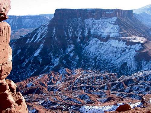 Adobe Mesa from the east
Other Activities
This is out door paradise. There is much to do in this immediate area. Right near the trailhead is the famous "Moab Daily" river run along the Colorado River. Only a few miles away are Fisher Towers and Castle Rock, two nearby famous climbing areas. Arches National Park is a 30 minute drive. There are many canyons in the area to hike as well. They will not be included here since this is a mountain website, but it is recommended that you purchase Canyon Hiking Guide to the Colorado Plateau, or for technical canyons, Technical Slot Canyon Guide to the Colorado Plateau, both by Michael Kelsey. Just a few miles away in this desert region, are the La Sal Mountains, which have cool forest, much area above timberline, alpine lakes, and even permanent snowfields. This is a land of contrast, and it is amazing that you can experience both snowfields to 110F desert heat in just a few miles.
Red Tape
The trailhead has been closed to camping. Other than that, there is no red tape.
When To Climb
For Adobe Mesa alone, late March through May and September through early or late November are best. Summers are hot, and winter snow does sometimes linger on the north facing route. If you want to combine Adobe Mesa with Professor Creek, then May, September, and October are the best months. Walking through the desert is extremely hot in the summer, but you still want fairly warm weather since you will get completely soaked in Professor Creek and rappeling through the waterfalls.
 April on Adobe Mesa
Camping
Even though the trailhead is on public land, the nearby ranch has been successful in closing the area to camping by the BLM. The supposed reason is because of beer parties during the Moab Jeep Safari and Spring Break. There are many no-fee, but designated campsites along Onion Creek. The turnoff to Onion Creek is just south of mile marker 21 on Highway 128 and is only a few miles from Professor Creek.
Mountain Conditions
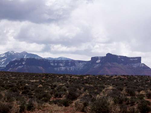
 Adobe Mesa, far right.
For current road, camping, and trail conditions, contact: Bureau of Land Management Moab Field Office 82 East Dogwood Moab, UT 84532 435-259-2100 WEATHER FORECAST Weather and climate data for the Cisco/Dewey Bridge is below. *National Weather Service Data 1952-2004.
| MONTH | AVE HIGH | AVE LOW | REC HIGH | REC LOW | AVE PRECIP (in) |
| JAN | 38 | 10 | 64 | -36 | .55 |
| FEB | 48 | 19 | 73 | -24 | .41 |
| MAR | 59 | 26 | 84 | 3 | .69 |
| APR | 70 | 35 | 95 | 12 | .67 |
| MAY | 81 | 44 | 105 | 22 | .64 |
| JUN | 92 | 52 | 111 | 33 | .41 |
| JUL | 99 | 60 | 113 | 42 | .50 |
| AUG | 96 | 58 | 110 | 38 | .74 |
| SEP | 87 | 47 | 107 | 23 | .70<TD |
| OCT | 73 | 35 | 94 | 9 | 1.06 |
| NOV | 55 | 23 | 80 | -5 | .76 |
| DEC | 41 | 14 | 71 | -25 | .53 |