
-
 5469 Hits
-
 71.06% Score
-
 1 Votes
|
|
Mountain/Rock |
|---|---|
|
|
38.96184°N / 107.0455°W |
|
|
Gunnison |
|
|
Hiking |
|
|
Spring, Summer, Fall, Winter |
|
|
11269 ft / 3435 m |
|
|
Anthracite Mesa Overview
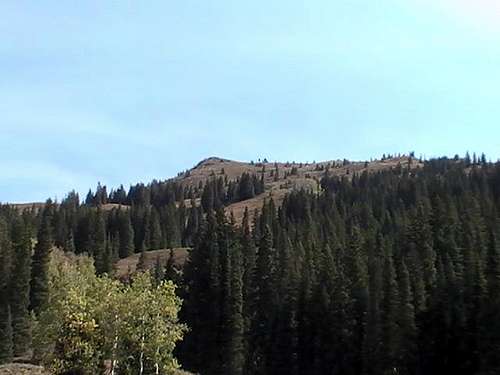 Summit from the East side
In-depth Details
Here are more details:Elevation: 11,269 ft.
CO Peak Rank: 1656
Range: Elk (Ruby Range)
Counties: Gunnison
Quadrangle: Oh-Be-Joyful
Coordinates: 38.9622°N, -107.0456°W
Prominence: 329'
Saddle: 10,940 ft.
Proximate Parent: Gothic Mountain
Line Parent: Mount Baldy
Isolation: 1.92 miles
YDS Class Rating: 1
Getting There
From Buena Vista, make a left onto US 285. From there make a right onto US 50 up and over Monarch Pass and continue onto Gunnison. From Gunnison go North onto US 135 to Crested Butte. From here, make a left onto Slate River Road (County road 739A).From Aspen, head East onto US 82 over Independence Pass to Twin Lakes. From here, make right towards Buena Vista. From there make a right onto US 50 up and over Monarch Pass and continue onto Gunnison. From Gunnison go North onto US 135 to Crested Butte. From here, make a left onto Slate River Road (County road 739A).
 Many false summits from the East side
Go up slate river road for about 2.5 miles or until you see a unmarked abandoned road-like trail. It is located essentially right by the cut-off for Gunsight Pass. Anyway, the abandoned grown out road will zig-zag you a three miles about until you get to the summit. This is considered to be the easiest way up.
You could also go to Gothic from Crested Butte and hook-up to Washington Gulch. Once your at the top you could follow a small pack trail or just bushwhack your way up the summit. Its no more than a half mile from that route. Washington Gulch is a easy 4WD road so take note on that.
Red Tape
This is not wilderness area, but please pack it in and pack it out because this area is so rare and delicate that only a few people that leave their trash could change it. Besides that no permits required. Motorized vehicles and mountain bikes are not permitted off road/trail.Camping
You have a few options to camp.You could camp in Oh-Be-Joyful or at one of the pull-offs along Slate River Road. Also Gothic has a few tent sites, but thats pretty much it. There are tons of places to camp along the Kebler Pass road, but that might be to far for some people.