
-
 17976 Hits
-
 86.14% Score
-
 23 Votes
|
|
Mountain/Rock |
|---|---|
|
|
39.02000°N / 106.844°W |
|
|
Hiking, Mountaineering, Scrambling |
|
|
Spring, Summer, Fall, Winter |
|
|
13348 ft / 4068 m |
|
|
Overview
Malemute Peak lies within the Maroon Bells-Snowmass Wilderness across from Castle Peak as it reaches a height of 13,348ft. It is a part of the rugged, red and rotten Elk Range near Aspen, Colorado. This peak is a ruggedly steep summit with fairly long sweeping ridges on three of its sides. Sitting across Montezuma Basin from its larger neighbors in Castle Peak and Conundrum Peak, it is often overlooked but offers a nice, short scramble to a summit offering views of all the surrounding high Elk peaks. You usually won't find anyone else on this peak even though the ascent takes just a couple hours. There isn't really a "standard" route up this peak, but the best route would be the northwest ridge from the jeep road high up in Montezuma Basin. This is one of the more famous basins in Colorado as it creates a horseshoe of peaks including Conundrum and Castle along with Point 13,848. This line of peaks makes one of the most beautiful panoramas you'll find anywhere in the Elk Range.
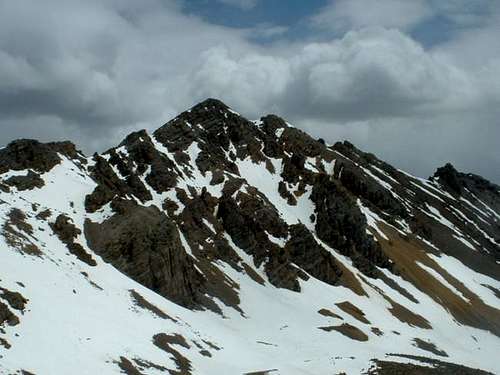
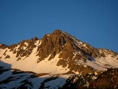 Malemute Peak from the Cathedral Lake Trail | 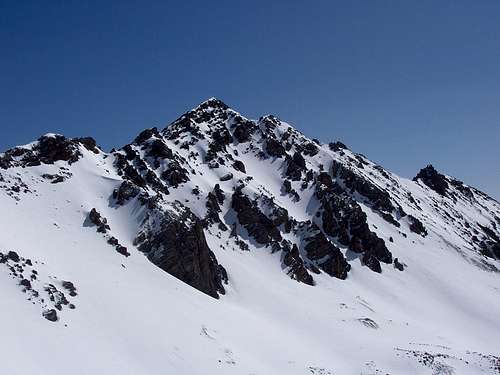 Malamute Peak from the route up Castle Peak | 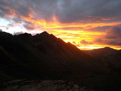 Sunrise over Malemute Peak |
Getting There
From Aspen:
From the center of town continue west on Colorado Highway 82 until you get just outside of town to a roundabout. Once in the roundabout continue almost the entire way around to the Castle Creek Road. Continue on this road for eight miles, passing the ghost town of Ashcroft to the end of the pavement where the road crosses Castle Creek. The road is normally closed here but a dirt road veers off to the right next to a set of signs. This is the Montezuma Basin Road (AKA Pearl Pass Road), which can be driven all the way to 12,800 feet for close access to Castle and Conundrum Peaks! You can either park here, or continue up into Montezuma Basin with a 4WD vehicle. Note that the ascent of Malemute Peak effectively quadruples without a 4WD. The Montezuma Basin road starts out fairly mellow as it passes a small tarn about a half-mile from the paved Castle Creek Road. The road then fords Castle Creek which will require 4WD to cross. Beyond the ford, the road winds through the trees along the south side of the creek to 11,000 feet where it re-crosses the creek on a nice bridge. Beyond this bridge, the road gets considerable worse and begins switchbacking steeply up. At the third switchback from the bridge, the Montezuma Basin road continues off to the right, while the Pearl Pass Road continues left. Many people park here but you can continue to the right and park at the last switchback before the end of the road at 12,575 feet just below the old Montezuma Mine. From this point, Malemute Peak is directly above you to the northeast. The terminus of the NE ridge of Castle Mountain is directly across the valley.
From Glenwood Springs:
Continue south on Colorado Highway 82 for approximately forty-five minutes towards Aspen until you reach the roundabout just outside of town. Once in the roundabout, follow the same directions as above.
 View at the start of the Montezuma Basin Road | 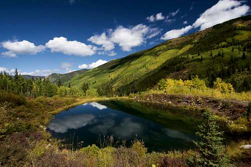 Small tarn along the 4WD Road |
Route - West Ridge Class 2
From the Montezuma Mine at 12,600 feet, begin hiking directly up the talus to the NNE for 150 feet or so to the base of a large buttress. Cut left and follow the base of these cliffs and continue ascending loose rock up the obvious gully once on the west side of the large buttress. Reach a tiny 12,950 foot notch at the top of the buttress where you will see the west ridge of Malemute just a short scramble away. Scramble for 5-10 minutes to the northeast towards a small 13,075 saddle in the ridge. From this point, it's a 0.2 mile walk east along the ridge crest to the summit. Any class 3 difficulties can be avoided by dropping to the left (north) side of the ridge a few feet. From the summit you command a view of all the centennials in the area including a spectacular view of Cathedral Peak and its namesake lake to the north.
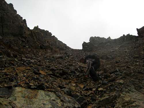 Ascending the loose gully next to the low buttress | 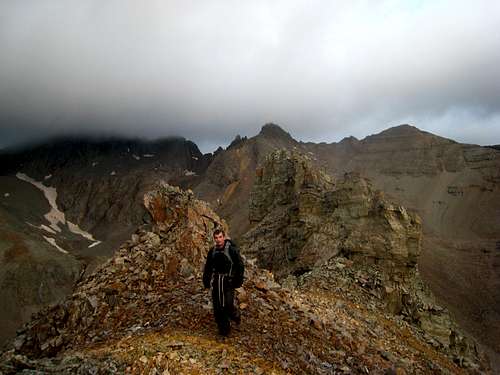 Walking on the west ridge | 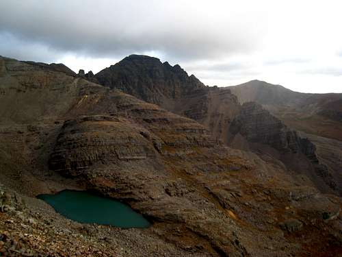 Cathedral Peak from Malemute |
Map
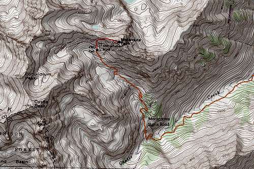
ORANGE: Montezuma Basin 4WD Road - Class 1
RED: Malemute Peak West Ridge - Class 2
When To Climb
This peak can be climbed in all seasons. The best time to climb would be from late June through September. Snow is found at most times of the year in Montezuma Basin so come prepared with snow climbing gear. Usually August and September are snow free though and you'll just need some trekking poles and summer wear. In winter, skis would be excellent to use for getting up the 4WD road however the Montezuma Basin is notorious for huge deadly avalanches in winter and is typically always avoided. Only when the snow conditions are very stable do people venture into this basin.
 Malemute Peak in June | 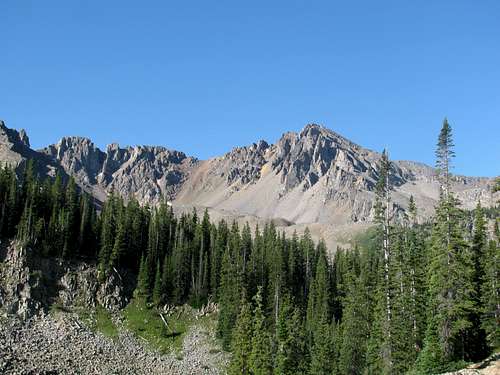 Malamute Peak in August |
Camping/Red Tape
There is camping below Montezuma Basin along Castle Creek. For more information and regulations contact the local ranger station in Glenwood Springs at 970-319-2670. You can also car camp in many places along the Montezuma Basin Road. No permits or fees to visit the area.