
-
 46324 Hits
-
 85.35% Score
-
 20 Votes
|
|
Mountain/Rock |
|---|---|
|
|
39.02420°N / 107.1228°W |
|
|
Gunnsion |
|
|
Hiking, Mountaineering, Skiing |
|
|
Spring, Summer |
|
|
13528 ft / 4123 m |
|
|
Raggeds Wilderness Overview
The Raggeds Wilderness, located in the Elk Mountains, contains 65,019 acres of land and was designated in 1980. It's boundaries are the Crystal River, Schofield Pass, Kebler Pass and Colorado 133, from the north, east, south and west, respectively. The northwestern corner of the Raggeds Wilderness is occupied by the Raggeds Range, a subrange of the Elk Mountains. The center of the Raggeds Wilderness is dominated by twin Treasure Mountain and Treasury Mountain massif. Finally, the southeast corner is occupied by the Ruby Range, another subrange of the Elk Mountains accessible from the town of Crested Butte, Colorado.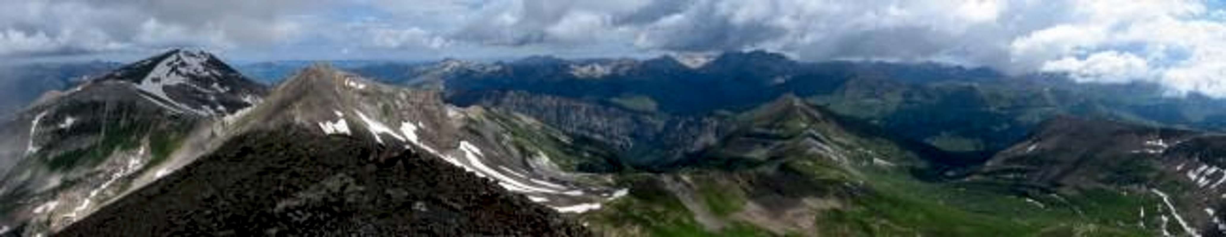
Treasure Mountain, UN13407, and the mighty Elk Mountains, from left to right, from the summit of Treasury Mountain. Photo: JonBradford
Treasure Mountain Overview
Treasure Mountain is the highest of all three Treasure Mountains in Colorado. Treasure Mountain is located almost 5 miles southeast of Marble, Colorado in the Elk Mountains. Treasure is the highpoint of the Raggeds Wilderness and forms the divide between Crystal River and Yule Creek. Treasure Mountain is a tricentennial thirteener coming in at the 235th highest and 25th most prominent peak in the state.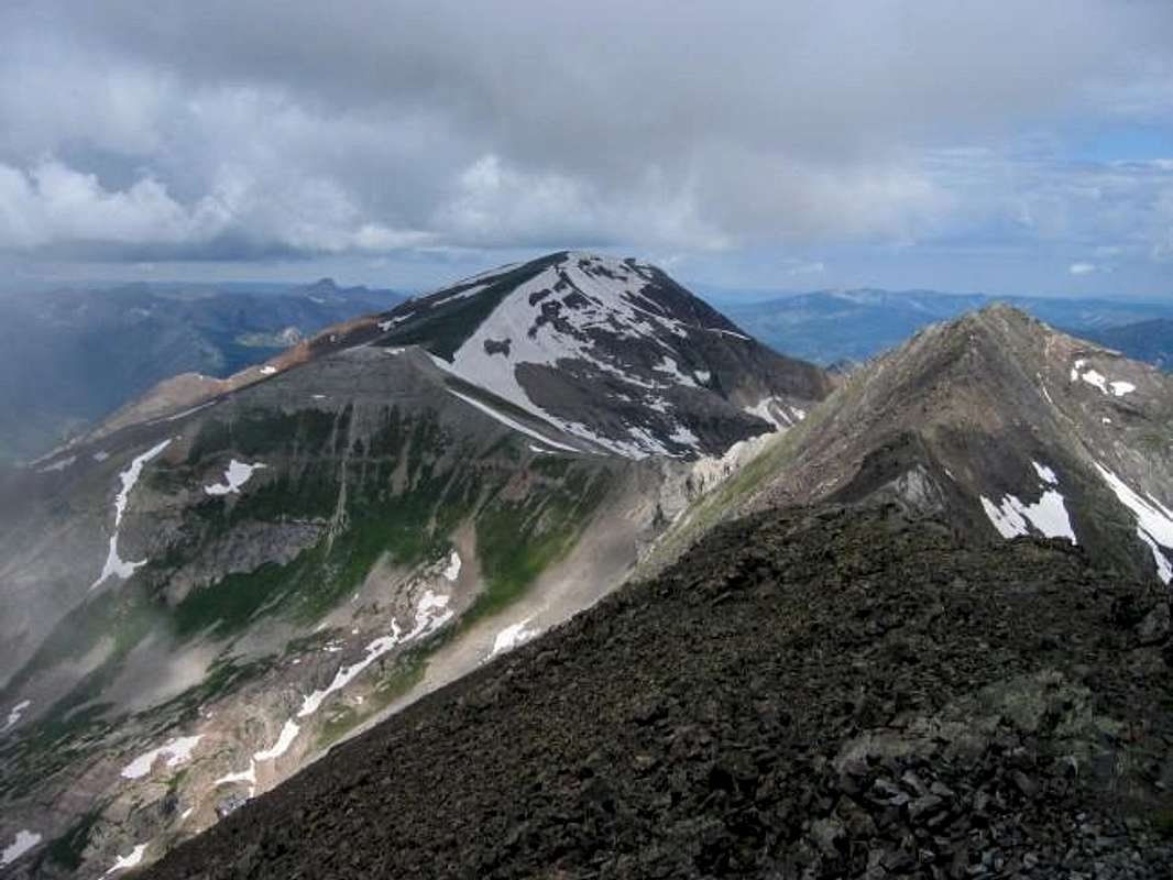
Treasure Mountain & UN13407, from left to right, from the summit of Treasury Mountain. Photo: JonBradford
None of the five routes listed below are technical, but the views from the summit are spectacular. From the summit, one can see the massive San Juan Range, the Maroon Bells-Snowmass Wilderness and the surrounding Raggeds Wilderness.
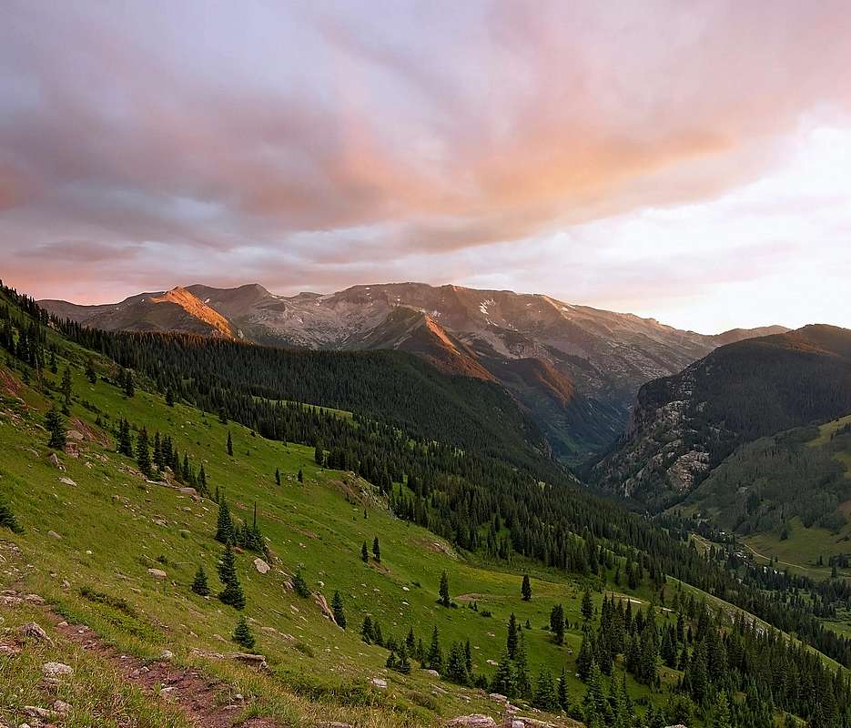
Trasure Mountain from Lead King Basin. Photo: Kane
Getting There
Since Treasure is so massive there are five routes all accessible via Marble, Colorado.| Route Name | ||||||
| Southeast Ridge | ||||||
| Northwest Ridge | ||||||
| West Face | ||||||
| Treasure Mountain Couloirs | ||||||
| West Face Direct |
Since all the routes, except West Face Direct, are described elsewhere, only the West Face Direct route is described here.
West Face Direct:
Drive Highway 133 from Paonia or Carbondale. Turn east onto a well-signed road leading to Marble on the north side of McClure Pass. Drive 6 miles to a stop sign in Marble. Turn right onto Quarry Road. Drive 2.6 miles and park at the base of Mud Gulch. This is the same trailhead for both Marble Peak and Whitehouse Mountain. Follow the Yule Creek Trail to the base of Treasure Mountain's southwest face. Climb the drainage past Yule Lakes to Treasure Mountain's summit.
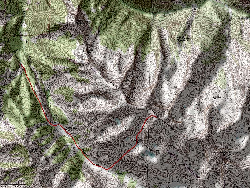
Treasure Mountain's West Face Direct Route. Click to enlarge.
Red Tape
Northern Section of the Raggeds Wilderness:White River National Forest
Old Federal Building, Box 948
Glenwood Springs, CO 81602
303-945-2521
Southern Section of the Raggeds Wilderness:
Gunnison Ranger District
216N. Colorado
Gunnison, CO 81230
970-641-0471
Mountain Conditions
7 Day Forecast for Marble, COColorado Avalanche Information Center (CAIC)
Roaring Fork Avalanche Center
Camping
Camp at a trailhead or lodging is available in Marble, CO.External Links
Colorado Prominence Peak ListTrip Report
References
1. Guide to Colorado Mountains2. Beyer J (1968) Trail and Timberline. 598: 224
3. Dawson's Guide to Colorado Backcountry Skiing, Volume 1