
|
|
Mountain/Rock |
|---|---|
|
|
39.38121°N / 120.11992°W |
|
|
Nevada |
|
|
Hiking |
|
|
Spring, Summer, Fall, Winter |
|
|
6680 ft / 2036 m |
|
|
Overview
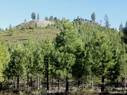
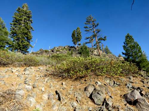
Zoom shot of the summit area
Boca Hill is a lookout point on the west side of the Boca Reservoir and the east side of the Prosser Creek Reservoir along the I-80 corridor in the Sierra Nevada mountains of California. Standing only 6,680’, Boca Hill is certainly not a lofty mountain in the Lake Tahoe Basin. However, it has a prominence of 880’, providing excellent views from all sides.
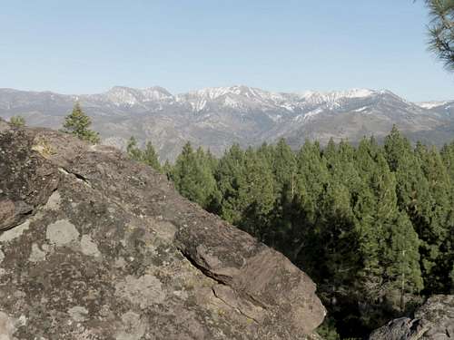
View towards the Mount Rose Wilderness from the summit of Boca Hill
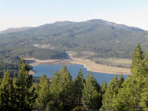
View northeast to Verdi Peak and Ladybug Peak
Boca Hill can be approached from either the east or the west. But it is typically approached from the east because the eastern approach is only a few minutes drive off of Interstate 80. The name Boca Hill actually references the Boca Reservoir on the east side of the hill.
Hiking Boca Hill seems pretty simple, albeit not that well marked, so having a Google Earth™ map with you is helpful to ensure you on the correct roads. It can be done as a loop hike from the east that is about 4 miles round trip.
Boca Hill can essentially be hiked any time of year. However, the mountain does get snow in winter, and might be difficult to approach during December through February. Summers are typically pretty hot, and if hiking here during the summer, it is recommended early in the morning or during the evening. It is an excellent spot to watch the sunset. The best time to hike here is in the spring or fall.
Getting There
For the eastern approach, get off of I-80 at exit 194 for Hirschdale Road. This is about 25 miles west of Reno, Nevada and 107 miles northeast of Sacramento, California. Pass the train tracks and less than half a mile later look for the sign to Forest Service Road 73 on the left, which is on the south side of the Boca Reservoir, and crosses the dam. Follow this road for 1 ½ miles until the pavement ends. Park at a small dirt parking area just past the end of the pavement.For the western approach, take the 89 North exit in Truckee, and about a half mile north of I-80, take a right on Prosser Dam Road accessed at a traffic circle. Take this road for about three miles and it crosses the dam. After it cross the dam, the road turns north. Follow the road north for less than a quarter mile, and park at an intersection with a dirt road. There are power poles on the right. The road is at 39.383, -120.136.
Route Information
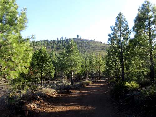
From the east, there is an excellent loop hike that swings around to the southwest side of Boca Hill and comes back down the northeast side. It is about the same distance as going out and back. From the parking area, an obvious road starts up the mountain. Take the road for about half a mile. On the left, there is a road that says “Road Closed”.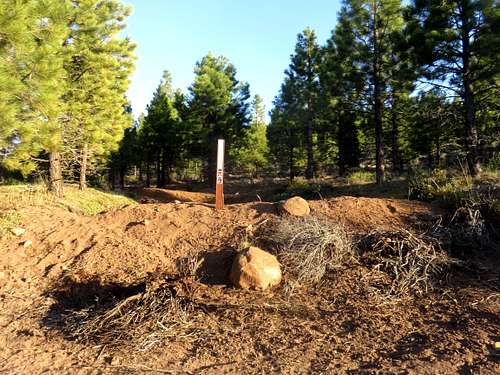
Entrance to the summit road
However, this road is actually the summit road, and is only closed to motor vehicles. For the loop, you can take this road, or continue on the main road. If continuing on the main road, the road continues northwest for another half mile. Then there is a road heading back to the south, right towards Boca Hill. Take this road towards the summit block, and there are a couple options. You can take this road for about 2/3rds of a mile, and a side road on the left leads up to the summit. Or you can just head straight up to the summit through some moderate brush. The summit is rocky area above the road.
On the road towards Boca Hill
Heading up the brush towards the west face of Boca Hill
The road down is pretty straightforward. It was overgrown when I was there on April 17, 2015, but we didn’t have to much trouble following it back to the parking area.
This loop is about 4 miles round trip if taking the road all the way up, with a one-way elevation gain of a little over 1,000’.
From the west, take the road as it heads northeast. After about 0.4 miles you reach a junction. A road on the right winds up and reaches the summit road on the northwest side of Boca Hill. This will reach the summit in a little under 2 ¼ miles, gaining about 900’.