
|
|
Area/Range |
|---|---|
|
|
39.09000°N / 120.035°W |
|
|
Hiking, Trad Climbing, Sport Climbing, Toprope, Bouldering, Skiing |
|
|
Spring, Summer, Fall, Winter |
|
|
6225 ft / 1897 m |
|
|
Overview
"No prosaic description can portray the grandeur of 40 miles of rugged mountains rising beyond a placid lake in which each shadowy precipice and each purple gorge is reflected with a vividness that rivals the original."
~ Herbert Hoover, in a letter to his sister May written during Lake Tahoe geological expedition, August 1895
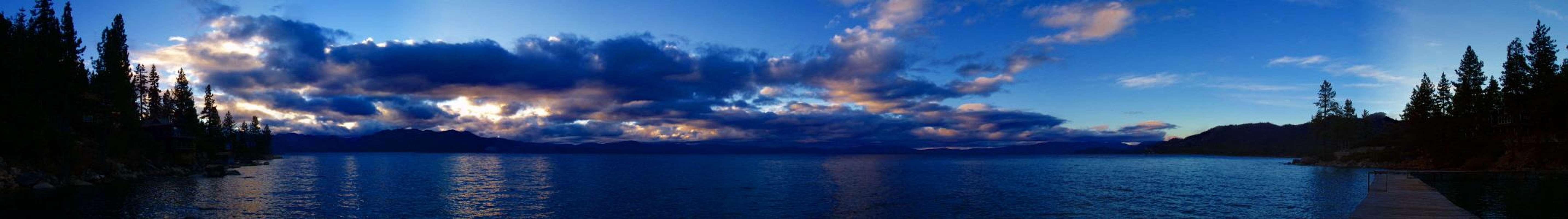
Located in the Sierra Nevada mountains and straddling the California-Nevada state line, Lake Tahoe is the one of the largest and deepest alpine lakes in the world. The lake's elevation averages 6,225 feet, and surrounding peaks reach heights of up to 10,880 feet. It is 22 miles long, 12 miles wide, has 72 miles of shoreline, and is 1,645 feet deep. Its sapphire and turquoise blue waters are crystal clear; in some areas you can see up to 80 feet under the surface! To some it is thus known as "The Lake of the Sky." Most of the land around the lake (80%) is managed by the US Forest Service as the "Lake Tahoe Basin Management Unit". The Lake Tahoe BMU is not an official Forest, but it functions as one.
The Lake Tahoe Basin offers some of the finest year-round outdoor recreation opportunities in the United States, if not the world. From summitting peaks and skiing down them to boating and relaxing on beaches, Tahoe's got it all. The possibilities are endless, but here are a few ideas besides the ever-popular hiking, rock climbing, and skiing:
Snowboarding, snowshoeing, mountain biking, wind surfing, floating down the Truckee River, kayaking around Emerald Bay, take a dinner cruise on a paddle boat, fishing, gambling (on the Nevada side, of course!), touring Vikingsholm Castle, touring the Tallac Historic Site, biking from South Lake to Camp Richardson and having an ice cream, touring the Ponderosa (remember the TV show "Bonanza"?), going on a hot air balloon ride, and last, but not least, viewing the fish underneath the surface of the water at the Stream Profile Chamber located at the Taylor Creek Visitor Center.
  |
Getting There
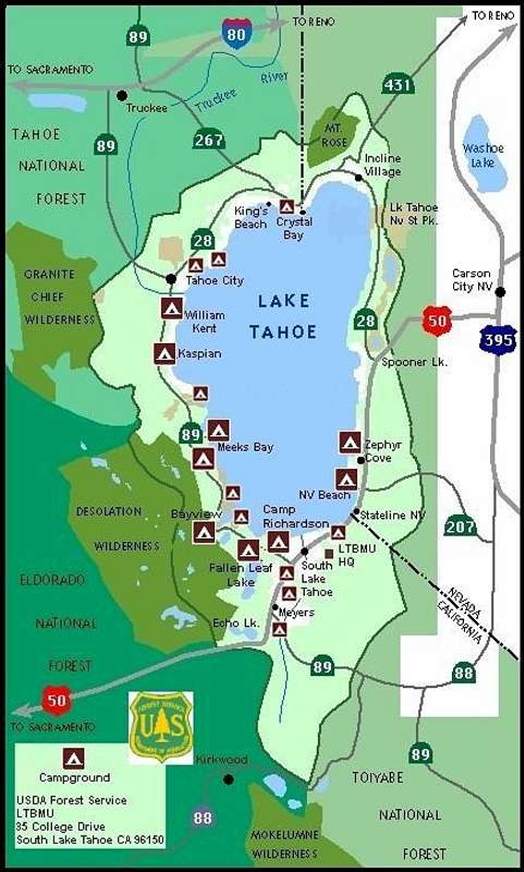
Lake Tahoe Basin Map
North Lake Tahoe can be reached via Interstate 80 and then south on Highway 89 or 267. South Lake Tahoe can be reached via Highway 50 which skirts around the south and eastern sides of the lake. Highway 28 circles the lake to the north and intersects with Highway 89 which then goes around the west side of the lake. Together, Highways 50, 28, and 89 make a circle around the entire lake.
The nearest big city with an international airport is Reno, NV.
Link to a detailed map of the area
Purchase maps of the area
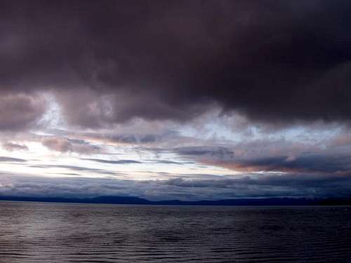
Weather & WebCams
Current Weather Observations at South Lake Tahoe
Current Weather Observations at Truckee (just north of Lake Tahoe)
Lake Tahoe WebCam
Heavenly Ski Resort WebCam
Camping
There are abundant camping opportunities around Lake Tahoe. My personal favorites are Fallen Leaf Lake and D.L. Bliss State Park.
Camping Info
For reservations at National Forest Campgrounds, please visit www.ReserveUSA.com or call 1-877-444-6777
For reservations at State Park Campgrounds, please visit www.ReserveAmerica.com or call 1-800-444-7275
For Camp Richardson visit www.camprichardson.com
For the KOA Campground visit www.LakeTahoeKOA.com
Hiking
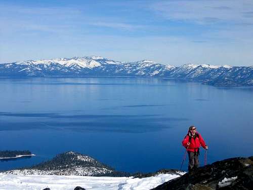
There are a myriad of hiking trails in the Lake Tahoe Basin area. You can hike the entire 165-mile Tahoe Rim Trail or just spend a day and hike up to Mt. Tallac or Mt. Rose.
The Desolation Wilderness to the west of the lake contains 63,960 acres of wilderness with 123 miles of hiking trails. Free day-use permits are required in the wilderness. Overnight permits require a fee of $5/person/night with a max of $10/person. Because this is a busy wilderness area in the summertime, quotas are in place from Memorial Day through September and group size is limited to 12 in the wilderness.
Granite Chief and Mt. Rose Wilderness Areas are also near Lake Tahoe and also provide many miles of hiking trails.
Hiking Trail Info
Wilderness Areas around Lake Tahoe
History and Etymology

Archeologists believe that the first people came to the lake at least 9,000 years ago, seasonally at first. Later, semi-permanent communities developed. The Washoe Tribe of Nevada and California will tell you that it cannot be said when the first people came to the lake, as the Washoe have always been at Tahoe.
The lake was known only to the Washoe Native American tribe until it was “discovered” by General John C. Fremont in 1844. The origin of the name "Tahoe" has some controversy, however, it is probably derived from the Washoe Tribe's term "Da ow ga" or simply "the lake." Early Euro-Americans heard the Washoe pronunciation, and the variation "Tahoe" was soon applied.
External Links
USFS Website for the Lake Tahoe Basin Management Unit
California State Parks Website
Nevada State Parks Website
Regional Weather Forecast for the Lake Tahoe area
League to Save Lake Tahoe
Tahoe Rim Trail Association
Geology and Natural History of Lake Tahoe
South Lake Tahoe Chamber of Commerce
Tahoe City Chamber of Commerce
For More Info, please contact

USFS Office in South Lake
USDA Forest Service
Lake Tahoe Basin Management Unit
35 College Drive
S. Lake Tahoe, CA 96150
(530) 543-2600
Hours: M-F 8-4:30
Taylor Creek Visitor Center
(530) 543-2674
Located 3 miles north of South Lake Tahoe, California, on the lake side of Hwy. 89. It is past the Tallac Historic Site and the turn off for Fallen Leaf Lake. Open weekends only starting Memorial Weekend till mid-June. Then beginning mid-June the Visitor Center will be open 7 days a week through the end of September.
tarol - Sep 2, 2006 7:06 pm - Hasn't voted
Lake Tahoe Basin PageHi, I noticed not much work has been done on this page. I would love to do this page as I once worked at Lake Tahoe and have a lot of knowledge about the basin. Let me know if it's up for adoption. Thanks. ~ Sequoia
Klenke - Apr 17, 2007 12:01 am - Hasn't voted
Add TallacYou should attach Mt. Tallac to this page.