
|
|
Mountain/Rock |
|---|---|
|
|
39.31833°N / 119.92083°W |
|
|
Washoe |
|
|
Hiking |
|
|
Spring, Summer, Fall, Winter |
|
|
9897 ft / 3017 m |
|
|
Overview
Tamarack Peak is a prominent mountain in the skyline of South Reno. You can often see it between Slide Mountain and Mount Rose. It sits about 1,000 feet above the Mount Rose Summit parking area, and can be reached via a short approach hike and scramble. There is no main trail leading to the summit, but getting to the summit isn't too difficult because you do not have to climb through dense forest once you get to the scrambling. In addition, the total distance is between 3 1/2 to 7 miles total whichever route you take.
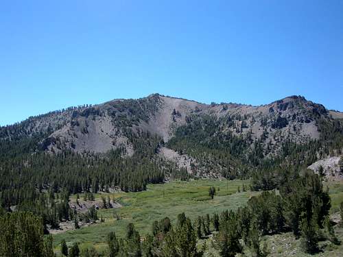 Looking back at Tamarack Peak from high up on the Mount Rose Trail
Tamarack Peak can be climbed during most of the year. People often snowshoe it in winter. In fact, because there is no major trail to the summit, it is probably better to climb when temperatures are a little more moderate (May-June, Oct-Nov).
Getting There
Getting to the trailhead to reach Tamarack Peak is easy. From Reno take 395 to the Mount Rose Highway (431). Take 431 until you reach the Mount Rose Summit Parking Area (8,911'). The route to the summit starts at the west edge of the parking lot at the same place as the Mount Rose Trail. This is the start of the main routes to the summit. However, there are at least three different routes you can take to get to the point where you climb to the ridge.
1) From Mount Rose Trail to the summit ridge
One Way Distance: ~2 miles
Elevation Gain: ~1000 feet
The primary way to climb Tamarack Peak is by taking the Mount Rose trail and finding one of several different routes you can take to the summit ridge.
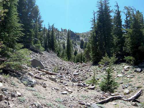
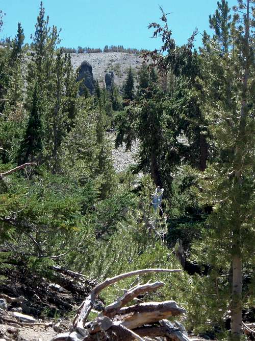
From the Mount Rose Summit parking area, you take the trail for the first 1 1/2 miles until you see openings in the forest that can take you up to the ridge. Bushwhack up the forest up about 500-600 feet or so to the ridge and you will find yourself relatively close to the summit. Then you can just walk to the top. It is not recommended that you descend the same way you came up. Descend via the south ridge and it is about 4 miles round trip. Or you can descend via the northwest ridge and it is 5 1/2 miles round trip.
Possible routes to the summit ridge
 East side approach
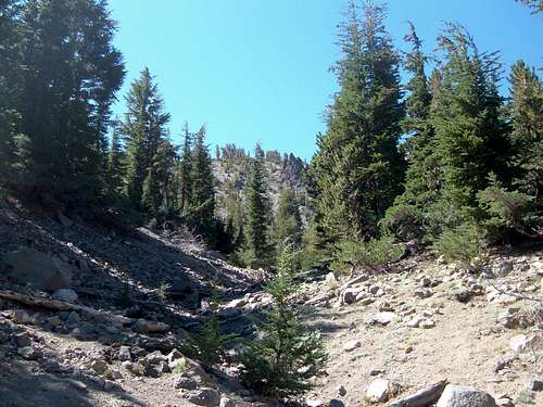 Straight up approach
 West side approach
2) South Ridge
One Way Distance: ~1.75 miles
Elevation Gain: 950 feet
This is the most straightforward, simple way up to Tamarack Peak. Take the new Mount Rose Trail for a little over 3/4 mile. Right after the trail enters the forest, head straight up the south ridge of Tamarack. This is pretty much forest, but there are open spots so it isn't brushy. At certain points, a trail is evident, although it kind of fades in and out. Once you leave the Mount Rose Trail, it is a little over a mile up to the summit. The rule for this route is to simply go up! Descend the same way or the Northwest Ridge for a little longer hike.
3) Northwest Ridge
One Way Distance: ~3.5 miles
Elevation Gain: ~1,100 feet
This is a day hike up from the Mount Rose Summit parking area. In the beginning, the trail to Tamarack Peak is the same as the trail to Relay Peak. The trail to Relay Peak is marked at the entry to the trail. From the trailhead, you take the trail southwest for about 2/3rds of a mile until it reaches the service road. Take a right and follow the service road for just over 2 miles and you will see a sign for the trail to the Old Mount Rose Trail. At this point, you bushwhack up the ridge directly to the right of the Old Mount Rose Trail. You have about 550 feet of elevation gain to go at this point, but the route is fairly straightforward.
Red Tape
No red tape, but watch for fire danger signs during high fire season.