-
 16753 Hits
-
 86.93% Score
-
 25 Votes
|
|
Mountain/Rock |
|---|---|
|
|
36.13176°N / 115.49254°W |
|
|
Scrambling |
|
|
Spring, Fall, Winter |
|
|
6780 ft / 2067 m |
|
|
Overview

Anya Jingle on the summit of Bridge Point
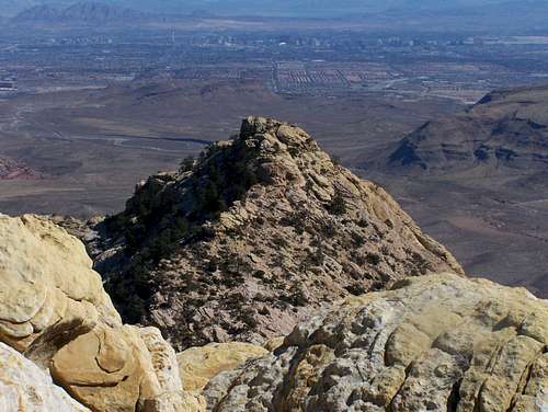
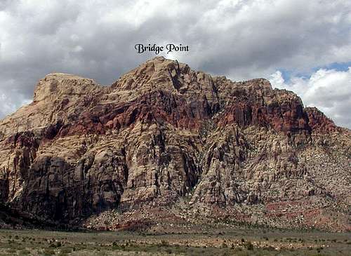
1: Bridge Point's summit seems more prominent than Bridge Mountain's from many points along the Scenic Drive. Although Bridge Mountain is about 200' higher than Bridge Point, it is behind Bridge Point when seen from the road, and, from much of the road, easily obscured by Bridge Point. In fact, from much of the road, Bridge Mountain's summit isn't visible because Bridge Point obscures it.
2: On the USGS La Madre Mountain quadrangle, "Bridge Mountain" is over where Bridge Point is, leading one to think that Bridge Mountain is that spectacularly banded peak rising just to the west of the road. But Bridge Mountain proper is the dome-like formation west of Bridge Point.
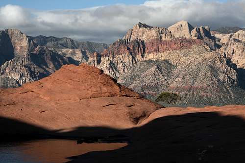
From Red Cap
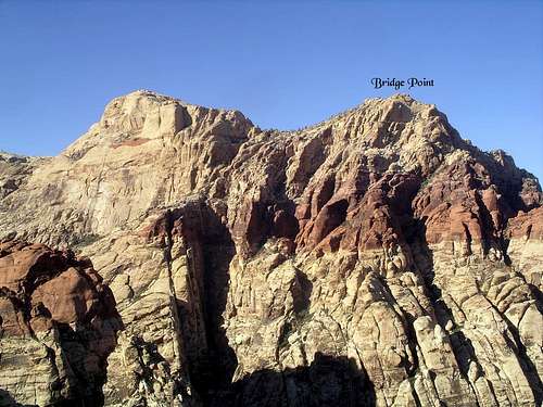
Bridge Point and Bridge Mountain
The truth is that Bridge Point is merely a subpeak, albeit quite a massive one, of Bridge Mountain, and the entire formation is considered to be Bridge Mountain. But because of its striking appearance and highly visible location, and because of the fact that people seeking the summits of the two peaks generally do so via two very different routes (Bridge Mountain from the west and Bridge Point from the east), people have given Bridge Point the status of a separate peak.
Although I've seen this peak listed as being 6639' (the elevation originally given on this page) and 6450' (in a guidebook by someone I respect a lot and whose beta is always solid), a look at a topo map shows that the summit is between and 6760' and 6800' contours. Thus, I have given the elevation here as 6780'.
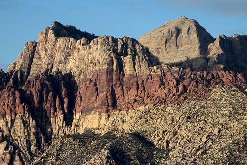
Bridge Mountain and Bridge Point
Routes
The standard scrambling route to Bridge Point is a Class 3 one from Pine Creek Canyon. Attached to this page is a detailed route page for this scramble.
The Bridge Mountain massif has numerous technical routes. Along the way to the scrambling route to Bridge Point's summit, one will pass by or near spots such as Brass Wall, Out of Control Area, and Straight Shooter Wall. However, since Bridge Point refers to a specific peak and not the massif itself, pages for those spots are not attached here but can be found attached to the Bridge Mountain page currently maintained by redsplashman23.
Getting There
From Summerlin, follow Charleston Boulevard (SR 159) west to the entrance to the Scenic Loop through Red Rock Canyon National Conservation Area (entry fee). Drive 10-11 miles to the large, signed parking area for Pine Creek Canyon.
159 is also accessible from the west via SR 160.
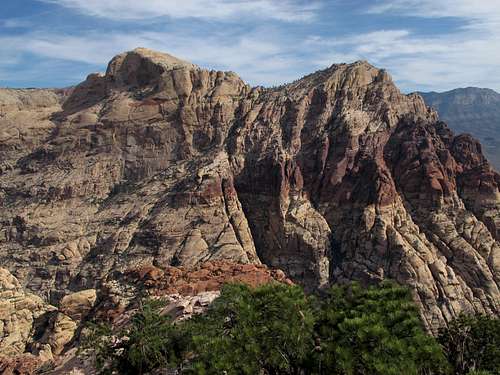
Bridge Point
Red Tape
There is a daily entrance fee of $7 per vehicle (2013). Annual and interagency passes are available (the Interagency Pass, AKA the America the Beautiful Pass, grants access to all federal fee areas for a year).
Hours the Scenic Drive is open:
Note: these hours are subject to change. To be safe and sure, contact the park before visiting.
Hours the Scenic Drive is open:
| November through February | 6 a.m. to 5 p.m. |
| March | 6 a.m. to 7 p.m. |
| April through September | 6 a.m. to 8 p.m. |
| October | 6 a.m. to 7 p.m. |
Note: these hours are subject to change. To be safe and sure, contact the park before visiting.
The BLM (the agency that manages this area) allows dogs in the backcountry. Please keep them leashed and pick up their feces.
South Face of Bridge Point
When To Climb
Spring and fall are the best. Winter is not bad, but temperatures can be cold and the canyons can be icy. Summer ascents are not advisable because even with a predawn start, you are likely to be caught in the scorching heat during the return. The canyons can offer shade and running water, but the exposed sandstone is like an oven.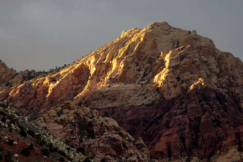
Sunset on Bridge Point