
-
 3727 Hits
-
 85.25% Score
-
 21 Votes
|
|
Mountain/Rock |
|---|---|
|
|
38.04725°N / 122.72102°W |
|
|
Marin |
|
|
Hiking |
|
|
Spring, Summer, Fall, Winter |
|
|
1066 ft / 325 m |
|
|
Overview

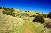
West from Buckelew Ridge
This is a seldom visited area. You may meet a few people in Devil's Gulch but the only folks you're likely to meet on the ridge are cattle! Devils Gulch is a mostly forested canyon but once you swing up an easy switchback it opens to grassy views of the west Marin high country. The easy route is approximately 7 miles round trip and about a 1,000' gain.
Getting There
From Hwy. 101 in Larkspur take the Sir Francis Drake Blvd. exit west 3.8 miles to "The Hub" (the big intersection) in San Anselmo. Continue to the left (west) on Sir Francis Drake Blvd. another 12.5 miles through Samuel P. Taylor State Park to the off-road parking on the left at the Devils Gulch sign.Route
Devils Gulch
Red Tape
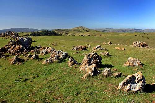
Buckelew Ridge plateau
When to Climb

Buckelew Ridge east view
Camping

North end of Buckelew Ridge looking back towards the high point on the right