
-
 13900 Hits
-
 80.94% Score
-
 14 Votes
|
|
Mountain/Rock |
|---|---|
|
|
37.99378°N / 122.49947°W |
|
|
Marin |
|
|
Hiking |
|
|
Spring, Summer, Fall, Winter |
|
|
1058 ft / 322 m |
|
|
Overview
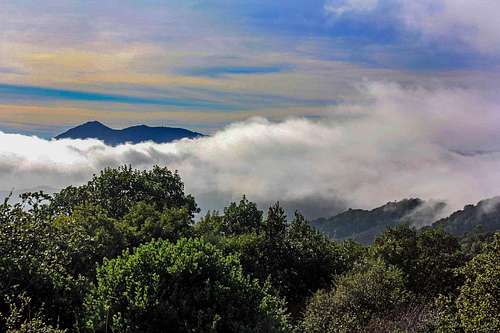
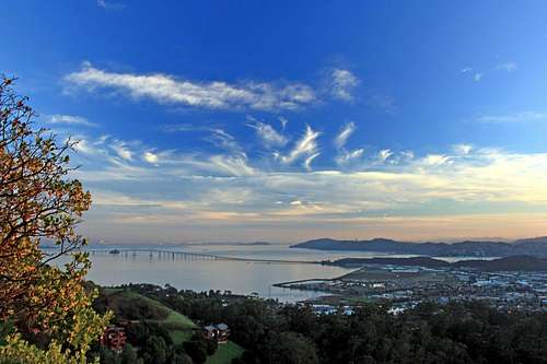
Mt. Tam from San Pedro Mtn.
With many of the trail heads starting right out of local neighborhoods this is a very popular destination for mountain bikers, hikers and trail runners. San Pedro is great for short hikes and gives you that feeling of "off in the mountains" even though it is largely surrounded by an urban setting.
Links to San Pedro Mountain Open Space Preserve and China Camp State Park
Getting There
Take North San Pedro Road exit east.These 2 approaches are basically the same road looping around the mountain from central San Rafael to north San Rafael.
The maps in the route section show access points from North San Pedro Rd., China Camp and Point San Pedro Rd.
Gold Hill is the most popular trail head out of San Rafael. It starts out in Harry Barbier Park.
Gold Hill trail head: Coming from north on Hwy. 101 take the Central San Rafael exit 1 block to Mission St.. Go left under the freeway 2 blocks to Grand Ave.. Turn left and go north on Grand to Locust Ave.. Turn right on Locust for .15 a mile where it junctions with Magnolia and turn left on Locust following it a half mile to roads end.
Coming from south on Hwy 101 take the Central San Rafael exit and turn right on 2nd St. at the 1st light. Go 1 block (getting in the left lane) and turn left on Grand Ave.. Follow the rest of the directions above.
![San Pedro Ridge]()
San Pedro Ridge ![Mt. Tamalpais from San Pedro Mtn.]()
Mt. Tam from the top of Gold Hill.There are too many routes and starting points to spend time covering them on this page. Generally speaking almost all the routes to the top involve roughly 1 to 2 hours round trip with 2 or 3 miles and 900 to 1000 ft of gain. There are also trails that run relatively level around the mountain at different elevations. Below are links to the maps from San Pedro Mountain Open Space and China Camp State Park which pretty much covers the main trails on the mountain.
For San Pedro Mountain Open Space map click here and then click on San Pedro Mtn.
From China Camp State Park map click here.![Red Tape sign]()
China Camp State Park red tapeClick on these pics to view red tape for San Pedro Mountain Open Space Preserve (San Pedro Ridge) and China Camp State Park.
Routes

San Pedro Ridge
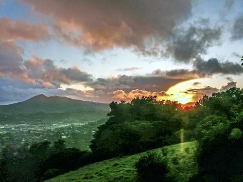
Mt. Tam from the top of Gold Hill.
For San Pedro Mountain Open Space map click here and then click on San Pedro Mtn.
From China Camp State Park map click here.
Red Tape

China Camp State Park red tape
The same rules apply for China Camp State Park as San Pedro Ridge except no dogs allowed and the park is open from sunrise to sunset.
Fee fi fo fum!
The China Camp sign to the right is posted at only one trail head out of China Camp. Since folks can enter the state park from all over the place it would seem to be something of a paper tiger.

San Pedro Mtn. red tape
When to Hike
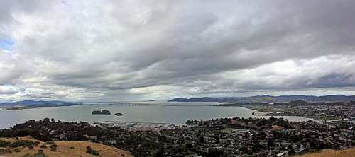
Storm Clouds over San Pablo Bay
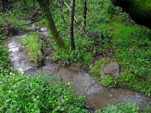
Seasonal stream from Gold Hill
Camping
San Pedro Mtn. south view