
|
|
Route |
|---|---|
|
|
37.21753°N / 112.92383°W |
|
|
Hiking |
|
|
Spring, Summer, Fall, Winter |
|
|
Less than two hours |
|
|
Hike |
|
|
Overview
Clear Creek has carved a beautiful slickrock valley in the eastern parts of Zion National Park. Visitors who enter the park from the east, travel on Route 9 through this scenic valley. Between the park’s east entrance and the Zion-Mt. Carmel Tunnel, Route 9 provides access to many side valleys and canyons that drain into the Clear Creek Valley. While exploring some of the canyons requires technical skills, many of the valleys can be hiked. There are, however, no established trails and no signs on the road for these hikes.The hike for Cascading Falls starts at the western entrance of the small tunnel on Route 9. You will encounter a couple of minor obstacles in the beginnings of the hike. These include a small step and a steep slickrock slope. Both of these obstacles can be negotiated without any technical skills. As you go higher, the valley gets narrower until it turns into an overgrown slot canyon which marks the end of the hike. Going further will require much bushwhacking.
 Map |
Getting There
Please note that there are no signs on the road for this hike. The small tunnel on Route 9 makes it easy to identify the start of the hike.From the town of Springdale, drive east on Route 9. Go through the Zion-Mt. Carmel Tunnel (the long tunnel) and continue east. You will soon reach the small tunnel and can park by the road at the western entrance of the tunnel.
GPS Coordinates for the entrance into the Cascading Falls Valley from Route 9 are:
37 degree, 13.052 minute North
112 degree, 55.430 minute West
Route Description
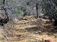
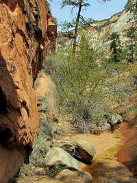
Hike Statistics: My GPS did not work in this canyon. It took me 1 hour and 40 minutes to do the hike (roughly 2 miles roundtrip). Trailhead elevation is 5240 ft and the elevation at the end of the hike is probably 5680 ft.From the place you parked, at the western entrance of the small tunnel, go to the north side of Route 9 and descend the road embankment to reach the bottom of the valley. You will find yourself in an area with many trees and bushes.
 Start of Hike |
Head north at the bottom of the valley. The vegetation becomes sparse.
 Beginnings of Hike |
You will soon reach the small step. A rock at the left (west) side of the step will help you go above it.
 Step |
Continue north at the bottom of the valley.
 |  |
You will then reach the steep slickrock slope which is probably a few tens of feet high. You can go directly up the slope. Be careful. A slip and fall here can have serious consequences.
 Looking up | 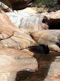 Looking Down |
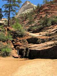
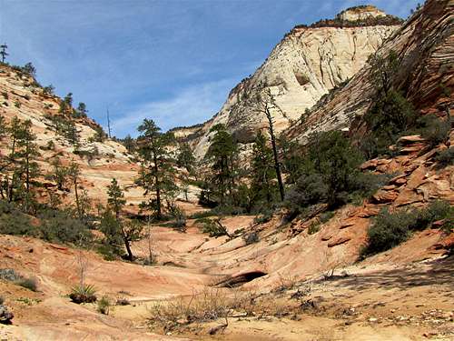
Above the slope, the valley will be wide and open.
 | |||
 |  | 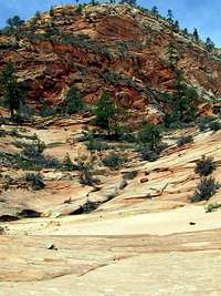 |  |
 | |||
 | |||
Turn around and enjoy the view to the south every now and then.
 Looking South |
As you go higher, the valley becomes narrower.
 |  | 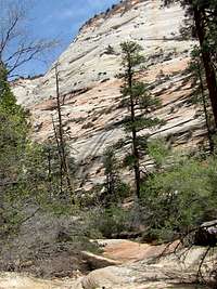 |
It eventually turns into an overgrown tight valley where the hike ends.
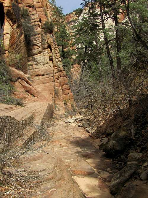 Narrow |  Narrow |
 Narrow |  Narrow |
Weather & When to Hike
See the forecast for Springdale, UTSummer may be too hot to hike. The best time is Spring & Autumn. Winter in this area is mild.
Red Tape
Day hikes do not need a permit.When I checked with the Back Country Desk at the park headquarters, I was told that day hikes into non-technical canyons do not need a permit. I recommend that you personally check with the park before hiking.
See link below for all rules and regulations:
http://www.nps.gov/zion/index.htm