
|
|
Route |
|---|---|
|
|
37.33988°N / 113.0757°W |
|
|
Hiking |
|
|
Spring, Summer, Fall |
|
|
Most of a day |
|
|
Hike |
|
|
Overview
Wildcat Canyon Trail is located in the Kolob Terrace portion of Zion National Park. It is 5.8 miles long taking you through forested highlands connecting Wildcat Trailhead to West Rim Trailhead. While the highlands are beautiful, they are not the typical walls and canyons that you expect to see in Zion National Park. In two areas, however, the trail gives you views of Wildcat Canyon and Russell Gulch. The slicrock summit of Pine Valley Peak is well visible at Wildcat Trailhead.Please note that the trail that goes from Hop Valley Trailhead to Wildcat Trailhead is not part of the Wildcat Canyon Trail. This trail is known as The Connector Trail and will not be discussed here.
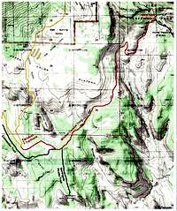 Map |
Getting There
From the southern entrance of Zion National Park in Springdale, UT, drive 13.5 miles west on Route 9 to the town of Virgin. Turn north and follow the Kolob Terrace Road 16 miles to the Wildcat TrailheadThis is a narrow paved road. Parts of it are closed in winter, see link below:
Kolob Terrace Road Conditions November Through May.
Route Description
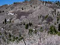
At Wildcat Trailhead, you will have great views of the slickrock summit of Pine Valley Peak.
 Pine Valley Peak |
Follow the trail over Pine Valley Plateau, a grassy plateau that is covered by pine trees and sits at an elevation of 6800-6900 ft. From behind the trees, you might get views of The North Guardian Angel and Pocket Mesa.
 Pocket Mesa |  Pine Valley Peak |  North Guardian Angel |
After 0.95 miles, you will reach the junction of The Connector Trail. Turn left (continue on Wildcat Canyon Trail). After another 0.15 miles you will see the junction of the Northgate Peaks Trail on the right. Continue straight on Wildcat Canyon Trail. You will find yourself in a beautiful pine forest.
 Pine Forest |  Pine Forest |  Pine Forest |
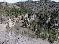
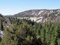
The trail slowly goes up in elevation. At a place where the trees do not get in the way, you will get some views of Russell Gulch. The jagged summits of The West Temple & Mt. Kinesava will be visible to the south. Northgate Peaks and South Guardian Angel can be seen to the southwest.
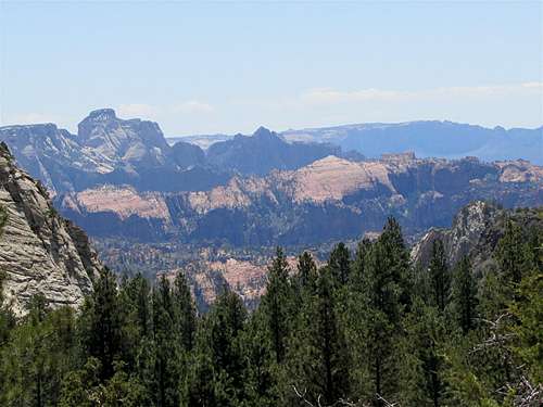 West Temple & Mt. Kinesava | |
 Russell Gulch | 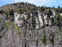 Russell Gulch |
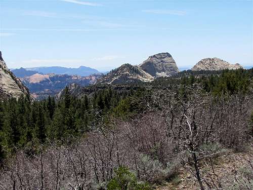 South Guardian Angel & Northgate Peaks | |
You will then reach a grassy sloped plateau.
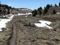 Grassy Sloped Plateau |  Grassy Sloped Plateau | 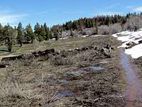 Grassy Sloped Plateau |
At the top of the sloped plateau you will reach the 7300 ft high point. A pond may be noted on the south side.
 Pond |
The trail then slowly goes down into the drainage of Wildcat Canyon
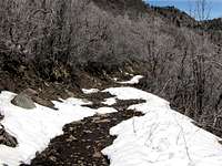 Descending |
Where there is a break in the vegetation, you will get views of Wildcat Canyon.
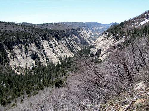 Wildcat Canyon | |
 Wildcat Canyon | 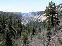 Wildcat Canyon |
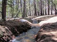
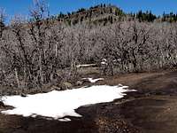
There is supposedly a spring in the black talus fields around the trail. When I was in the area on April 22 snowmelt water ran down every slope making it difficult to identify the spring.
 Where the Spring is |
You will then reach the upper ends of Wildcat Canyon and will have to cross the Wildcat Creek (a.k.a. Blue Creek)
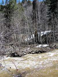 Wildcat Creek |
After crossing the creek, the trail slowly goes up a forested slope. You can still get some views of the upper walls of Wildcat Canyon.
 Wildcat Canyon Wall | 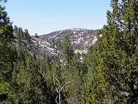 Forested Slope | 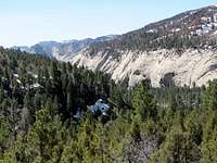 Wildcat Canyon Wall |
You will soon reach the junction of the West Rim Trail. Turn left and go 0.1 miles to reach West Rim Trailhead. A high point known as Lava Point will be in view.
 Lava Point |
Red Tape
You must pay park entrance fee. Please be ware that there are no fee booths on Kolob Terrace Road. You must pay in Springdale or elsewhere.No permits needed for day hikes. See link below for all rules and regulations:
http://www.nps.gov/zion/index.htm