-
 15650 Hits
-
 75.81% Score
-
 6 Votes
|
|
Mountain/Rock |
|---|---|
|
|
47.43320°N / 120.85751°W |
|
|
Chelan |
|
|
Scrambling |
|
|
Spring, Summer, Fall |
|
|
6666 ft / 2032 m |
|
|
Peak Overview
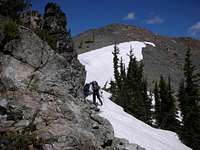
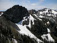
Devils Head is the rounded peak at the end of the ridge connecting Bean Peak and Volcanic Neck in Washington's Teanaway Country. It derives its name from the elevation (Point 6666), but is aptly named due to the volcanic nature of the surrounding landscape. Jutting far out over Ingalls Creek Valley, Devil's Head sits closer to the southeast side of Mt. Stuart than any other subpeak in the area, and provides an outstanding view of the Ulrich's Couloir and Cascadian Couloir routes on Mt. Stuart. It is a moderate scramble, mostly Class 2, although in early season (up through June), an ice ax will be required for cross-country travel. Total elevation with ups and downs: About 4000 feet. Round-trip distance: About 12 miles.Getting There
Drive Interstate 90 east from Seattle, getting off at Cle Elum exit #85. Take a left off the ramp, and merge with Highway 970 heading east towards Blewett Pass. Go about 5 miles to the Teanaway River Road. At the fork (29 Pines Campground), go right up the North Fork Teanaway River Road to the Beverly Creek Road. Turn right, and park at road's end, about 3700 feet. Hike the Beverly Creek trail for about 1/4 mile to the Bean Creek junction, and head right up Bean Creek. In about 3 miles, come to Bean Creek Basin. Hike to the head of the basin, aiming for the right shoulder of Bean Peak. Drop over the shoulder into the basin separating Bean Peak and Volcanic Neck, heading for the right shoulder of Volcanic Neck. Once you've gained the ridge, follow another 1/2 mile to the summit of Devils Head.Red Tape & Camping
Once you've attained the should of Bean Peak, you are officially in the Alpine Lakes Wilderness. Self-serve permits are available at the trailhead.There are numerous campsites with running water in Bean Creek Basin, and in the basin between Volcanic Neck and Bean Peak.
Parking at the trailhead requires a Northwest Trail Park Pass ($5/day, $30/year). An interagency pass ($80/year), which is also good for access to all US national parks, is also valid for parking purposes.
External Links
The closest year-round Forest Service ranger station is in Cle Elum, about 30 miles from Snoqualmie Pass. Contact information:Cle Elum Ranger District
West 2nd Street
Cle Elum, WA 98922
(509) 674-4411
Snow conditions are available from the Summit at Snoqualmie Ski Areas (of which Alpental is one) at the following website:
Summit at Snoqualmie Snow Conditions
Also, webcams are available from the Washington State Department of Transportation at: Snoqualmie Pass Web Cam


