|
|
Mountain/Rock |
|---|---|
|
|
47.34201°N / 121.01323°W |
|
|
Hiking |
|
|
5720 ft / 1743 m |
|
|
Overview
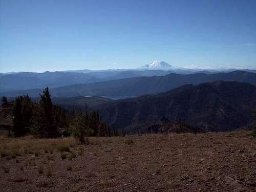
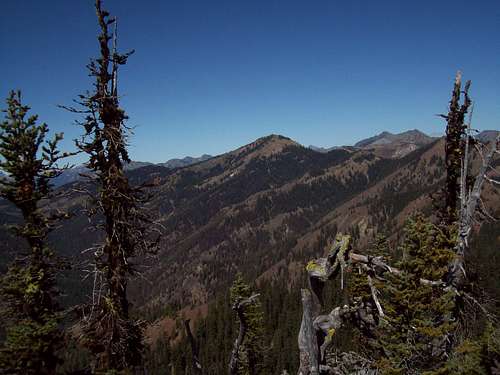
Elbow Peak which is located in the Teanaway Region of Cascades is a moderately known hiking destination with a summit that contains great views of the Cascades. Ranked #81 on the Wenatchee Mountain Back Court List, Elbow Peak is a popular stopping point in a peak bagger quest to do many of the Teanaway area mountains. The mountain can be reached by the Yellow Hill Trail from the south and is often combined with Yellow Hill and Jolly Mountain. The views on the summit of Elbow are excellent. On a clear day Mount Rainier can clearly be seen from the south and Mount Stuart to the northeast. Chimney Rock and Mount Daniel can be seen to the west, and even Mount Adams can barely be seen to the due south.
Some notes that should be shared about Elbow Peak. Elbow Peak is listed as 5673 on a USGS map but this is clearly wrong because the actually summit are is more north and is marked with higher contours. As for the actually summit, this is of point of controversy. There are three spot on the peak that come within a couple of feet of east of. The northeast side of the summit area show the little contour area. It is hidden behind the trees and has great views of Stuart. The grassy area looks slightly higher and has great shots of Mount Rainier to the south and many of the southern peak. My advise here is explore all the areas as I did to make sure you have the true summit.
As for the shortest route to Elbow it will be none on the Yellow Hill Trail (5 miles one way 3100 elevation gain) that leaves from the south. The trail start from the south aa a road/trail combination. Often the trail branches from the road's switchbacks and heads up steeply only to connect to the road later in the hike. At the highpoint of the ridge the road end and the trail begins from here on. The trail then traverses just east of the true summit of Yellow Hill before dropping down a gap. The rise again before falling slightly onto a narrow ridge. Some caution should be used here especially in winter or early spring during high avalanche danger. Once crossing the narrow ridge the trail will then head directly to within feet of the true summit area. From there hit all the possible areas with your GPS. There is no USGS marker on the true summit or a summit log.
Getting There
VIA THE YELLOW HILL TRAILHEAD: Located between the town of Teanaway and Route 97 take Teanaway road north roughly 7 miles to the intersection with the West Fork Teanaway Road. Make a left on the West Fork Teanaway Road and follow it a half mile to the Middle Fork Teanaway Road. Make a right on that road and follow the road (dirt) roughly 2 1/2 miles until you seen a sign should the Yellow Hill Trailhead on your right. Continue about 100 yards to a parking area.Red Tape
No Red Tape yet.Camping
There is plenty of backcountry camping/ bivy sack opportunities in this area. If connecting a lot of summits on your trip during the summer, Jolly Mountain might be the best place to set up a bivy sack (provided there is no threat of rain or thunderstorms.External Links
Weather ConditionsHere are what the weather conditions would be from nearby Cle Elum. alt="Click for Cle Elum, Washington Forecast" height=60 width=468>


