
-
 11403 Hits
-
 83.69% Score
-
 17 Votes
|
|
Area/Range |
|---|---|
|
|
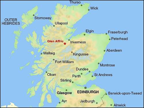
57.28769°N / 5.11514°W |
|
|
Hiking, Mountaineering, Scrambling |
|
|
Spring, Summer, Fall, Winter |
|
|
3881 ft / 1183 m |
|
|
OVERVIEW
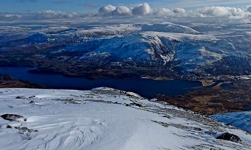
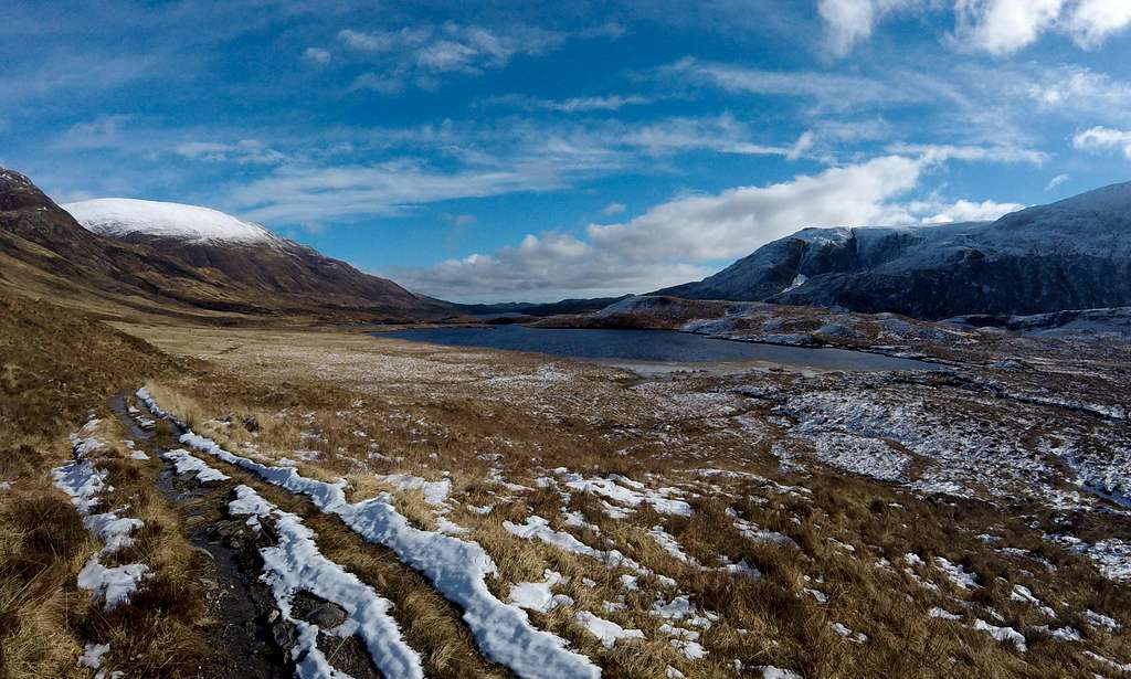
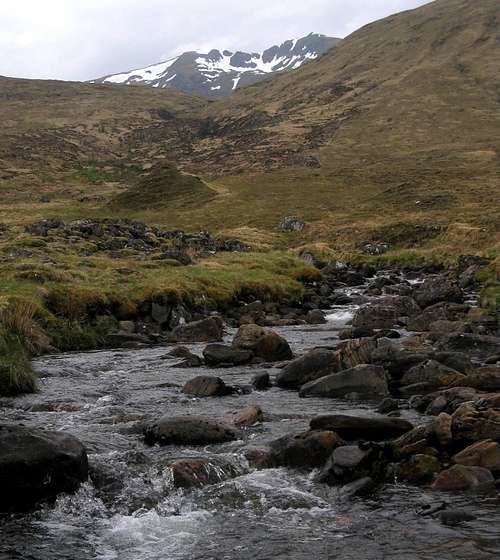
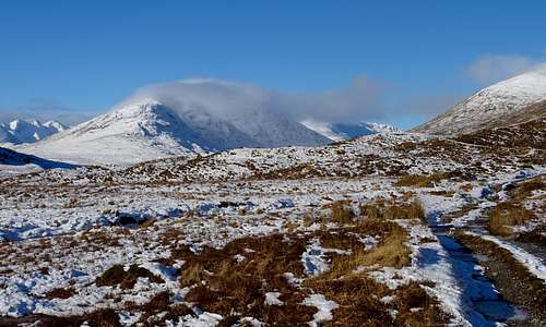
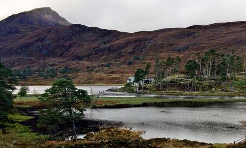
Looking down from the range onto Glen and Loch Affric in winter
The range is small. Tiny even in comparison with the rest of the Highlands. There is a mere 20km (12 miles) of crest between the western summit of Sgurr nan Ceathreamhnan at the western extremity and that of Toll Creagach at the far eastern end. The main spine of the range runs roughly west to east and is crowned by the presence of some 12 significant mountain tops. Another 4 tops adorn narrow spurs projecting away from the main spine to the north, into Glen Cannich – where there is the largest lake in the region: Loch Mullardoch. A further 3 tops project to the south, into Glen Affric – where there are two smaller lakes: Loch Beinn a’Mheadhoin and Loch Affric.
At first glance of the map the range seems undistinguished, being so small and apparently lost in the veritable ocean of much larger ranges to the west and north-west and to the south and south-east. However, there are a number of features which give the little mountain chain some significance:
- The highest mountains Carn Eige 1183m and twin Mam Sodhail (just two meters lower) are also the highest in all of the very large landmass to the north of the Great Glen, right up to the far tip of Scotland, at John O’Groats. This landmass includes the more well-known Torridonian giants such as Liathach and Beinn Eighe (and the An Teallach massif).
- Eight of the summits, including the ‘twins’,have ‘Munro’ status - that is to say they are over 3000ft high and have a certain prominence, to enable distinction as a separate mountain, as opposed to a mere ‘top’. The degree of prominence was largely aesthetic and from the perspective of the late Sir Hugh Munro (1856-1919) who was the first to define his ‘tables’ – but has subsequently become a highly controversial issue and (to the consternation of hordes of Munro-baggers) the definitions keep being changed – with summits being added and subtracted from the list, seemingly at the whim of whoever is in charge at the time. At time of writing, the list stands at some 282 summits and 227 mere ‘tops’.
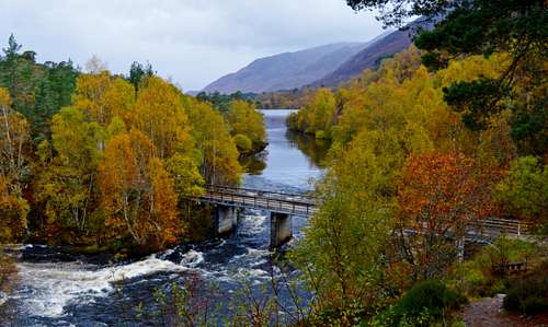
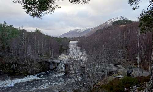
- Another powerful attraction for this little range is that it forms the northern boundary to Glen Affric, which is reputed to be the most beautiful glen in all of Scotland. In 2017 I made an all season study of the area with separate one week visits in winter, spring, summer and autumn. And I can confirm that it is the most beautiful glen I have seen in over 40 years of Scottish trips. Under snow it is pretty special. It is pretty amazing when the vivid yellow Broom and purple Rhododendrons are in flower in the spring. But the autumn colors are quite sensational and this has turned out to be the most beautiful time of year for me. See link to Glen Affric in colour Album.
- The Glen Affric Range provides good objectives for mountaineering and walking in all seasons. Most of the mountains are remote and ascent likely to add up to a long day requiring a degree of fitness - or even take 2-3 days with a walk in and out to be thrown in. Because of the remoteness (which is an attraction) the hills can be a serious proposition even in summer. In winter conditions, with short hours of daylight, potential for savage weather and avalanche danger thrown in, the seriousness steps up several other orders of magnitude.
- Finally there is a lot of history in Glen Affric. Of interest to any dog-lovers, the much loved breed of Golden Retrievers were first bred in the area by an 18th Century philanthropist, who also planted some of the amazing forests to be seen - and built the village of Tomich, in addition to a number of other historical buildings on his famous Guisachan Estate. See Golden Retrievers section below.
![Glen Affric in summer]()
Glen Affric in the summer...![Glen Affric in autumn]()
...in the autumn![Glen Affric in winter]()
...and in the winter
GETTING THERE
Access to Glen Affric:
 Glen Affric in relation to the rest of Scotland | 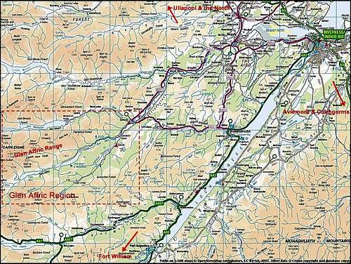 Road connections for Glen Affric - click image twice to enlarge & see detail |
Inverness is a small city and the administrative center for the large but sparsely populated Scottish Highland region. It has road connections to Ullapool and the far north of Scotland. It is connected to the south via the A82 which runs down the Great Glen, alongside Loch Ness, to Fort William and then onward via various other routes to Glasgow and Edinburgh. Another connection to the south follows the A9, which links to Aviemore and the Cairngorm Mountains before going further south to Perth, Stirling, Edinburgh and Glasgow.
Inverness is connected to the north and south by rail. It also has a small airport, with air connections to a variety of destinations in the UK and Ireland, in addition to Amsterdam and a few other European destinations on a seasonal basis.
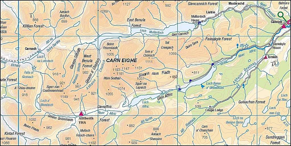
Map of Glen Affric Range
Access to Glen Affric Range:
From Glen Affric (the south):
Glen Affric main car-park is ‘pay and display’ (ticket dispenser taking £1 coins at time of writing). It is situated alongside the section of the River Affric which connects the two beautiful Lochs (Lakes) of Affric to the west and Beinn a’Mheadhoin to the east (see Lakes section below). This car-park provides access to the central and western parts of the main range and also is the way-point marking the end of the second of four one day stages of the Affric to Kintail Way, a new long distance walk (see section below). The next and third stage of the walk passes Loch Affric and on up the Glen over a distance of around 12 miles to a place called Alltbeithe. This is a suitable place to camp, but here there is also a Youth Hostel here – the most remote in the country, accessible only on foot and open only in summer (see Accommodation section below). Alltbeithe provides access to the far western end of the range – which is the Sgurr nan Ceathramhnan group.
Two additional car-parks are to be found on the northern shores of Loch Beinn a’ Mheadhoin. Both are ‘free’ at time of writing, but this may change (worth carrying some £1 coins just in case). Both provide access to the far eastern extremity of the range and the summits of Tom a' Choinich and Toll Creagach. The two car parks are found as follows:
- At Loch Beinn a’ Mheadoin view point, about 2 miles west of the Dam, which is at the far eastern extremity of the Lake. (this is also a good place to access the lake for swimming/boating type activities)
- At Chisholme Bridge, about another 2.3 miles further to the west along the northern shore of the Loch and about a mile before the main Glen Affric car-park.
From Glen Cannich (the north):
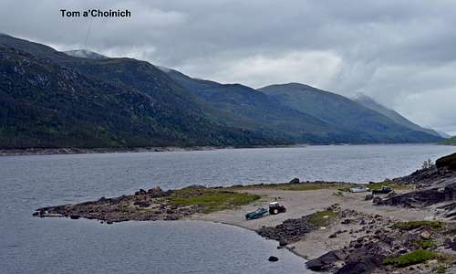
Another approximately 10 mile single track road heads initially north and then west from Cannich up into Glen Cannich to reach the remote Loch Mullardoch (see Lakes section below) at the big Dam at the far eastern end of this huge lake. There is free car parking here, near the foot of the impressive Dam wall. The northern aspect of the range can be accessed from here from all the way along the very rough terrain of the 8 mile southern shore of the lake. It is worth noting this is very little frequented and the occasional path marked on the map may well be far from evident on the ground. With knee deep heather and bogs to struggle through this is not a very easy way to access the range, but nevertheless it is well worth taking a drive up here just to look at the Dam and see what the back of the range looks like. There are good views of Tom a'Choinich and Toll Creagach.
It is worth noting that any bits of paths that are marked on the map around Loch Mullardoch are on the north shore, away from the Affric mountains and servicing the Mullardoch Munros round. This circuit is very tough and the return back along the north shore of Loch Mullardoch described as ‘exhausting’ on Walk Highlands. There are no marked paths at all on the southern or Affric side – apart from right at the extreme western end –where there is a connection out to the Kintail area, in the vicinity of the western end of the Affric to Kintail Way.
From Kintail (the west):
The final of the four stage 44 mile Affric to Kintail Way (assuming travel is east to west) goes from Alltbeithe in the western end of Glen Affric, passes the remote Camban Bothy and on down Glen Lichd in the Kintail region and out at a tiny village on the west coast called Morvich. Morvich can be reached by road and is roughly an hour and a half from Inverness (via Drumnadrochit on the shores of Loch Ness) and Fort William (via Invergarry and Spean Bridge). Buses service this route but are correspondingly slower. Thus the far western end of the Affric Range can be accessed from Kintail by walking from Morvich to Altbeithe.
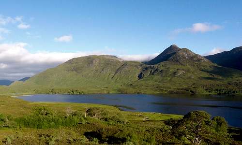
Having seen HOW to get to Glen Affric, this view explains WHY... Looking back east along the Loch
REDTAPE
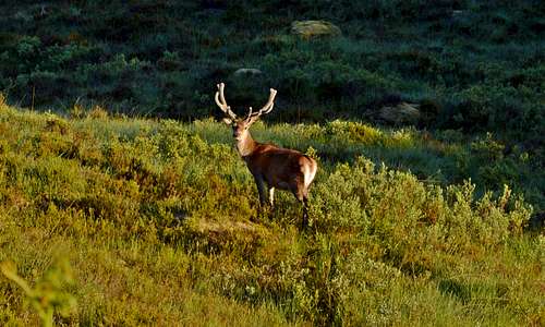
Deer a.k.a. Caledonian Bison in Glen Affric
As always common sense rules apply:
- Treat landowners, farm operators and livestock with due consideration and respect. If you have a dog, ensure he or she does the same.
- Be mindful of stalking season and ensure gates through deer fences are left closed. Deer fences are around two meters high for a reason (sad though it is to see these noble beasts stalked and excluded)
- Leave the countryside in same or better state as you find it, avoiding fires, taking care to pack out rubbish and ensuring bodily waste is buried well away from water sources and camping sites.
THE MOUNTAINS
At time of writing none of the Glen Affric Hills have Mountain Pages on SummitPost. Carn Eige 1183m and ‘twin’ Mam Sodhail 1181m(all of two meters lower) mark approximately the mid-point of the range as well as being the highest summits both in the Glen Affric range (and, as above, in all of the Scottish Highlands north of the Great Glen). The far western extremity is marked by the Sgurr nan Ceathreamhnan group and the eastern end by Toll Creagach 1054m. The range lends itself to all season mountaineering and hill-walking activities. It is not known as a good rock-climbing or technical ice-climbing area, besides which the very long distances required to reach crags and gullies will tend to be off putting for most hard core climbers. It's claim to fame is for long distance walking and for serious winter mountaineering, when ridges especially can become alpine in character and good crampon and ice-axe technique will be a must.
Pronunciations: knowing how to pronounce the weird Gaelic spellings of the names of these mountains is next to impossible. However, that excellent resource Walk Highlands offers a link to a recorded 'translation' for each mountain page. For example see link to Sgurr nan Ceathreamhnan page and click on the pronunciation symbol. I have therefore added my interpretation of the names of the major hills using this resource.
Disclaimer: the mountains described are all remote and major objectives in the summer but especially in the winter. Some of the places and routes described may become extremely hazardous in bad weather and with poor conditions. Operating in the area requires good general mountaineering skills including the judgement to know when to turn back or when not to venture out at all. Anyone planning a trip into the area should be experienced enough to know to check weather and (in winter) avalanche reports using the links provided and must take full responsibility for their own safety at all times.
The mountains divide into 3 distinct groups which will be described from west to east:
Sgurr nan Ceathreamhnan group
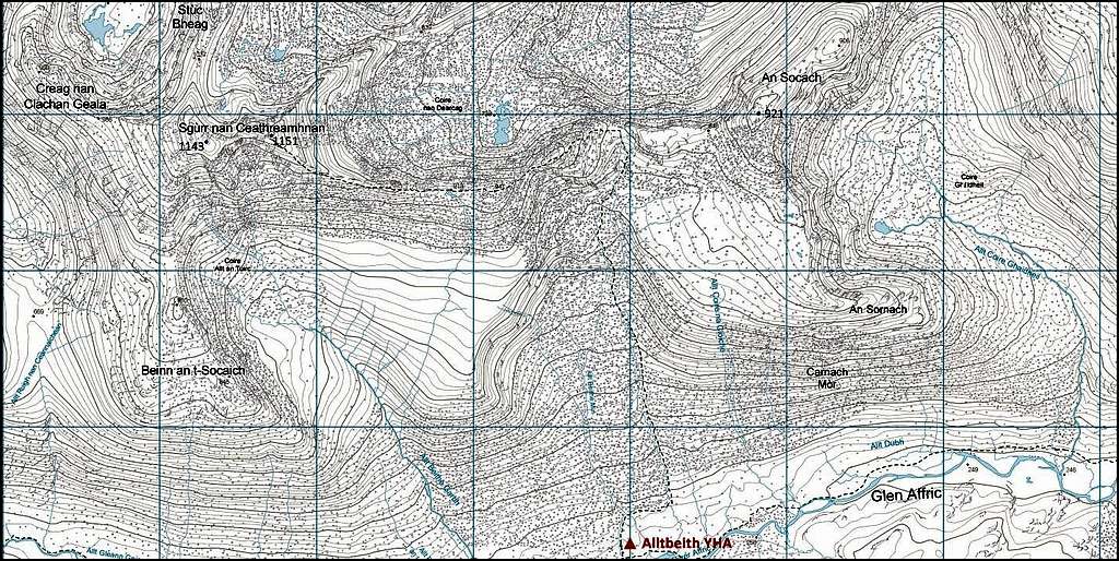
Map of Sgurr nan Ceathreamhnan & An Socach. Normal route of ascent from Alltbeith is shown.
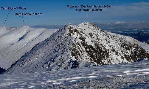
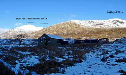 Sgurr nan Ceathreamhnan & An Socach with SYHA Alltbeithe in foreground | 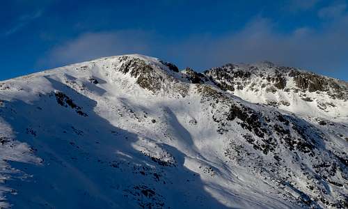 Twin summits of Sgurr nan Ceathreamhnan 1143m |
Sgurr nan Ceathreamhnan is pronounced: Skooth nun terravun,
Access:
The mountain is very remote and most will need a day to approach before completing the ascent the following day. The normal starting place for the ascent is Alltbeithe at 259m, which can be reached using the Affric to Kintail Way, in a moderate days walk from the west (Morvich) or east (Glen Affric main car park). There is good camping at Alltbeithe – or there is the option of staying at the Youth Hostel. There is a third option for staying overnight and this is the Camban Bothy, about 3km/2miles to the south west along the Glenn Affric Way towards Morvich.
Ascent:
- Normal route via East Ridge: from Alltbeithe a path heads north to a col at 843m between Sgurr nan Ceathreamhnan 1151m to the west and An Socach 921m (another Munro) to the east. The higher eastern summit of Sgurr nan Ceathreamhnan is 2km distance from the col along a narrow and undulating east ridge. There are 3 minor tops along the way, of 915m, 941m and 970m before the final summit is reached at 1151m. As above, the western summit can be reached by continuing along the crest for a further 500m.
- Ascent of the western summit: can also be accessed from Alltbeithe by heading west along valley floor and then climbing in a northwesterly direction to the minor top of Beinn an t-Socaich 846m and then on up a spur which eventually becomes the south ridge of Sgurr nan Ceathreamhnan leading up to the western summit at 1143m.
![Looking back at Sgurr nan Ceathreamhnan]()
rgg views taken May 2010..![Approaching Sgurr nan Ceathreamhnan]()
...of Sgurr nan Ceathreamhnan![Sgurr nan Ceathreamhnan summit ridge]()
...and summit ridge approaching east top
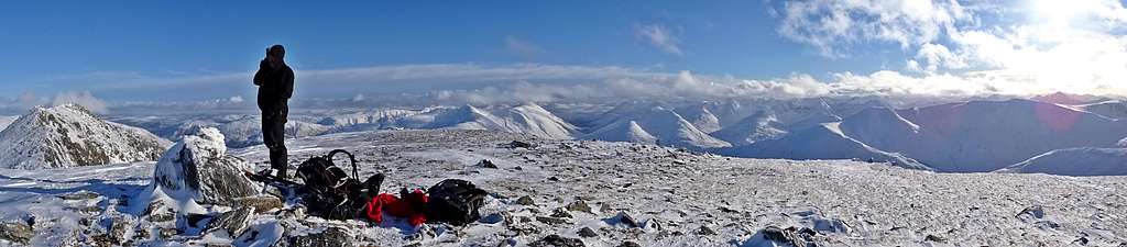
Panorama taken by Jon Watt from Western Top of Sgurr nan Ceathreamhnan in February 2017 - higher Eastern Top visible to left
An Socach 921m 3021ft is another one of the three Munros in this group. As above it is easy to combine an ascent with the ascent of the normal route to the eastern and higher summit of Sgurr nan Ceathreamhnan. An Socach commands impressive views down into Glen Affric.
An Socach is pronounced: Anne sokagh
Access:
From Alltbeithe as described above.
Ascent:
- Normal route: as above following Sgurr nan Ceathreamhnan normal route as far as the col at 843m and then climbing the final 80m of An Socach via the west ridge.
- South-south-east ridge: rising up out of Glen Affric east of Alltbeithe.
- North-east ridge: a third option is via the Bealach Coire Ghaidheil (Bealach means col/pass) at 717m and from where the north-east ridge of An Sochach can be reached. This col is actually one of two major passes crossing the range and connects upper Glen Affric with the remote far western end of Loch Mullardoch and Glen Cannich (see 'passes' below)
Mullach nan Dheiragain 982m 3221ft is the third and most remote of the three Munros in the Sgurr nan Ceathreamhnan group. It lies at the end of a 4km ridge projecting to the north from Sgurr nan Ceathreamhnan eastern top (the summit).
Mullach nan Dheiragain is pronounced: Mulloch na yeriganin
Access:
Die hard Munro baggers will combine ascent of this remote summit with a round taking in An Socach as well as Sgurr nan Ceathreamhnan. Thus access can be from Alltbeithe – or via the Bealach Coire Ghaidheil described just above and under 'passes' below. If via the Bealach Coire Ghaidheil then a starting point could be either Glen Affric (most likely) or Glen Cannich (a tougher expedition – and starting in Kintail).
Ascent:
- South Ridge: this is the most if not only realistic route of ascent and is from Sgurr nan Ceathreamhnan. A lot of up and down is involved before the final ascent to Mullach nan Dheiragain 982m. Then the same has to be done in reverse to return to Sgurr nan Ceathreamhnan – although the final climb maybe avoided by traversing across to the little lake of Loch Coire nan Dearcag – and on to re-join the crest between Sgurr nan Ceathreamhnan and An Socach.
![Sgurr nan Ceathreamhnan]()
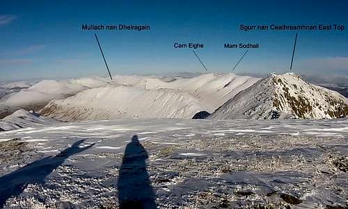
February 2017: Sgurr nan Ceathreamhnan east summit from west top...![Mullach nan Dheiragain]()
...and looking further north to Mullach nan Dheiragain 982m
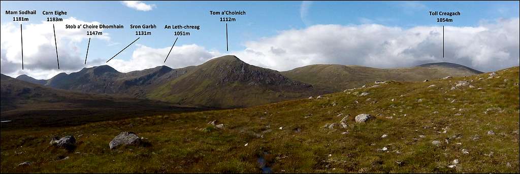
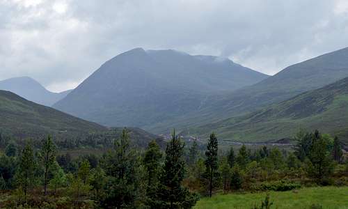
The Carn Eighe Group
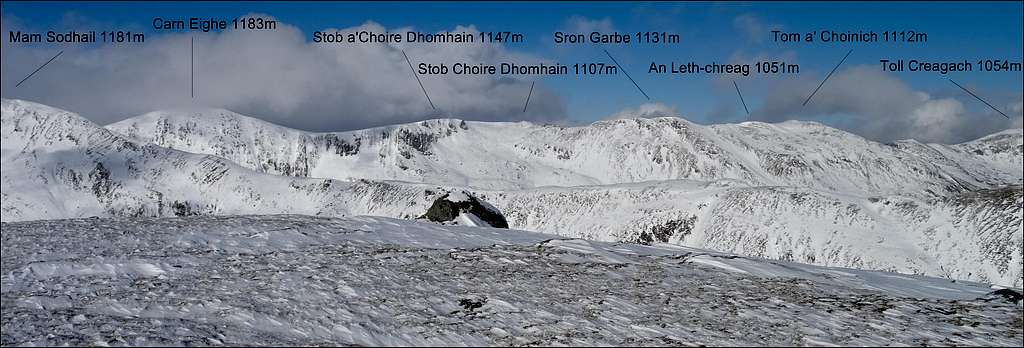
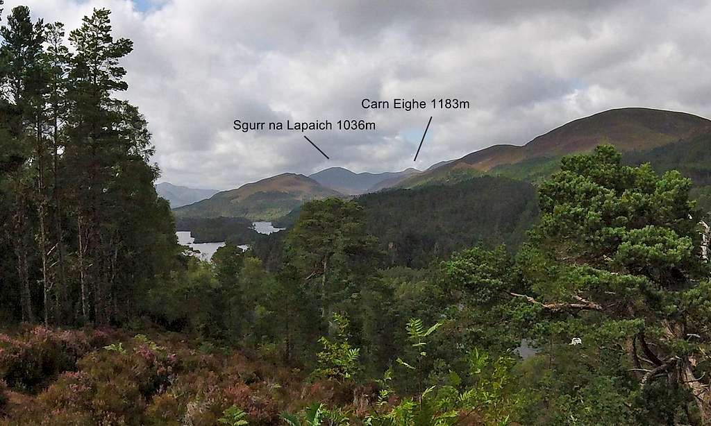
At 1183m 3880ft Carn Eighe is the highest peak in the range and the sea of summits north of Great Glen. Ascent is almost always combined with the (two meter lower) twin Mam Sodhail and can also be combined with (much more remote) the satellite peak of Beinn Fhionnlaidh, the third Munro in the group. The twins occupy roughly the middle of the main spine of the range with Beinn Fhionnlaidh at the end of a spur projecting away from the spine to the north. Two notable tops, An Tudair and Sgurr na Lapaich, are on spurs projecting to the south east. A succession of four other named tops are situated actually on the crest of the spine as it heads east away from the Twins and towards Tom a’Choinich.
 Glen Affric range from Am Meallan in August |
 Glen Affric range from An Tudair in February |
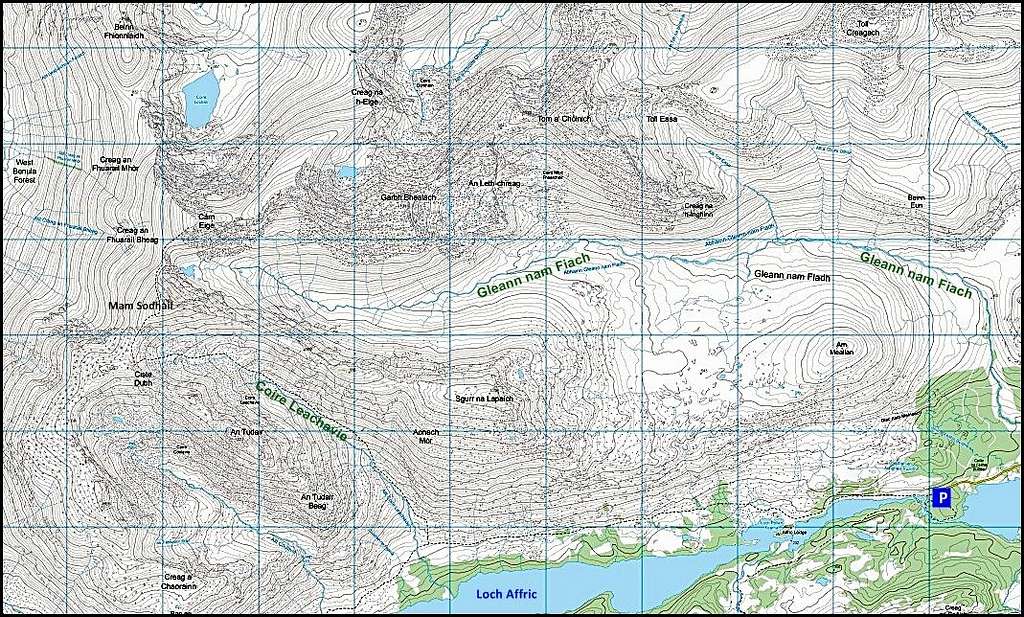
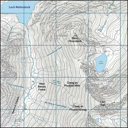
OS Map excerpt of Glen Affric Range from Mam Sodhail to Toll Creaghagh
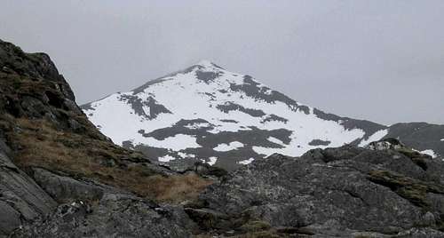
Mam Sodhail 1181m 3873ft is the most westerly summit in the Carn Eige group. The top is marked by a huge cairn.
Mam Sodhail is pronounced Mahm Soil
 Coire Leachavie and Mam Sodhail in October | 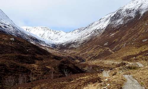 Looking up Coire Leachavie toward Mam Sodhail in February |
From the Bealach Coire Ghaidheil Pass 717m (see above), east of An Socach and the Sgurr nan Ceathreamhnan group in the west. From the south Mam Sodhail can be accessed via Coire Leachavie via a well-established path arising from the northern shore of Loch Affric. From the east Mam Sodhail can be reached in half an hour (in good conditions) from the summit of Carn Eige.
Ascent:
- Via south-west or south-east ridges: both can be accessed from upper Coire Leachavie.
- North Ridge: Mam Sodhail is reached from the north via the approximately one kilometer of easy ridge connecting to Carn Eige. This entails a descent and ascent of around 120m. In reasonable summer conditions this should take no more than half an hour.
![Mam Sodhail from An Tudair]()
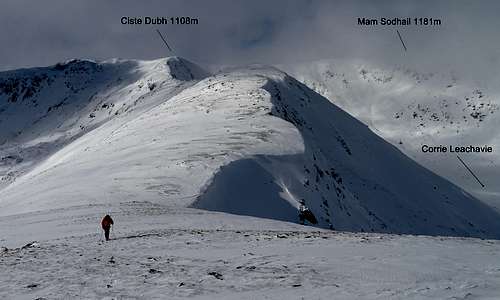
Mam Sodhail and the 'top' Ciste Dubh from An Tudair![Cairn on top of Mam Sodhail]()
Huge cairn on top of Mam Sodhail in a white-out in February
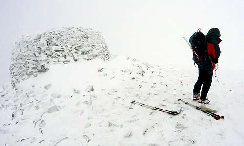
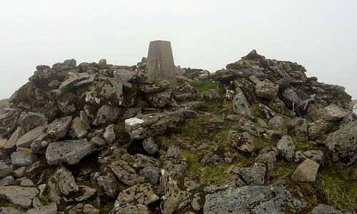
Carn Eighe 1183m 3880ft is the highest in the range and north of the Great Glen – by all of two meters, compared to near neighbor and twin Mam Sodhail. The summit is marked by a cairn and trig point. Given the size of the cairn on the tops of the lesser twin and Ciste Dubh it could be anticipated that the cairn would also be huge, but it is only modest sized, despite being crown of the range and of the far north-west of Scotland. Only the presence of the trig point provides the evidence of this special status.
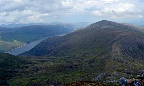
Distant view of Carn Eighe looking over Loch Beinn a'Mheadhoin from a view point on Affric to Kintail Way
Carn Eighe is pronounced Carn Ikigh
Access:
From Mam Sodhail to the south and via along ridge with several minor tops connecting with Tom a’Choinich to the east.To the north another ridge connects to Beinn Fhionnlaidh.
Ascent:
- South-west ridge: the summit of Carn Eighe can be reached in half an hour in good conditions from the summit of Mam Sodhail via the one kilometer of easy interconnecting ridge – losing and gaining about 120m of height.
- North Ridge: connects to the remote Munro of Beinn Fhionnlaidh 1005m 3296ft
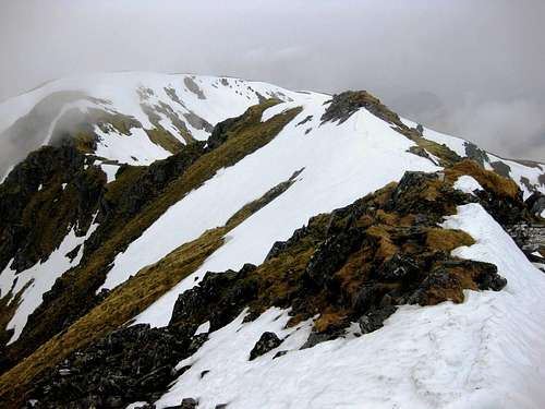
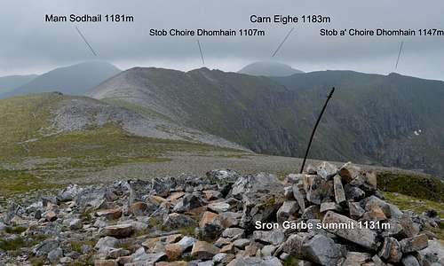
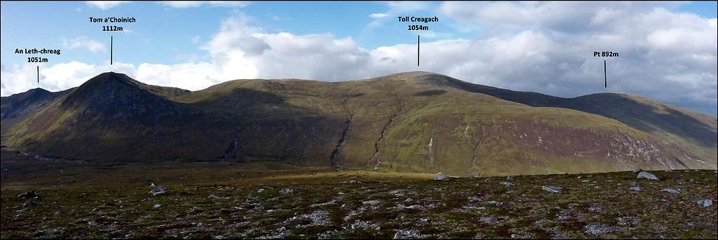
- East Ridge: some 3.5km of ridge connects Carn Eighe to the summit of Tom a’Choinich 1112m 3647ft. There are four subsidiary ‘tops’ along this ridge which can be traversed in either direction. From west to east the tops are: Stob a’Choire Dhomhain 1147m 3762ft, Stob Choire Dhomhnuil 1107m 3631ft, Sron Garbh 1131m 3710ft and An Leth-chreag 1051m 3447ft. An easy path follows the crest all the way along – with just one short section of scrambling just to the west of Stob a’ Choire Dhomhain.
![Carn Eighe summit]()
Carn Eighe summit, crown of the Glen Affric Range and of the far north![Looking back at Carn Eighe]()
Looking back at Carn Eighe from along the long east ridge
Beinn Fhionnlaidh 1005m 3296ft is a remote Munro to the north of Carn Eighe. Of all the Glen Affric range it commands by far the best view of Loch Mullardoch and the very remote extremities of Glen Cannich.
Beinn Fhionnlaidh is pronounced Bayne Yule-why
Access:
The only realistic access to this remote mountain is from Carn Eighe and the south. The northern (Glen Cannich) side is precipitous as well as extremely arduous to access.
Ascent:
- South Ridge: this 2.4km length of ridge connects to the summit of Carn Eighe. The outward traverse of this ridge to reach the summit of Beinn Fhionnlaidh involves crossing an intermediate top Stob Coire Lochan 917m, descending to a col Bealach Beag at 812m and finally climbing 133m to reach the summit. With the traverse of Stob Coire added in this gives a total ascent of around 160m to reach this remote summit – on the outward. With the return to Carn Eighe this comes to a total of around 5km of distance and 320m ascent. Given the time and energy required just to reach the twins and back (by shortest route about 20km and well over 1000m of ascent) it is likely that only a die-hard Munroist would tackle this significant add-on to an already tough day.
 Route to Beinn Fhionnlaidh | 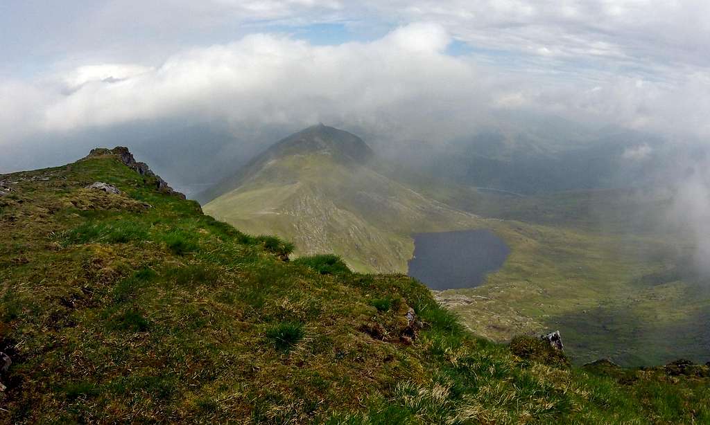 Beinn Fhionnlaidh from summit of Carn Eighe |
Three other summits are worth mentioning in the Carn Eige group. None are Munros although two are over 3000ft high. They are all excellent view points for looking down into Glen Affric and often seem to be clear of cloud when the higher summits of the Carn Eighe group are fogged up. Two summits are on spurs projecting out to the south-east from the main spine of the Glen Affric Range – and forming the side walls of Coire Leachavie. The third is a low stand-alone hill almost detached from the range.
An Tudair 1074m 3522ft: Can be climbed easily from upper Coire Leachavie. There is no path, but steep slopes can be ascended with care up to Pt 1068m (or headwall ascended to Ciste Dubh 1108m – where there is a large cairn). Thence the easy but undulating ridge can be followed south-east to access An Tudair. The best views are to be had by continuing on a little further towards An Tudair Beag – until it is possible to see all of Loch Affric, spread out below like the view from an aircraft.
 An Tudair and western end Loch Affric in June | 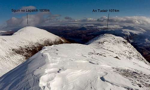 An Tudair and Sgurr na Lapaich in February |
Sgurr na Lapaich 1036m 3398ft: Coming into Glen Affric from the main car park this striking looking mountain is the first and, for a long time, only of the really big mountains to be seen and acts as a sort of Sentinel to the Glen. It is not a Munro but from appearances perhaps deserves to be (prominence only 100m when 150m is required to achieve this distinction). The precipitous and somewhat forbidding east face of the peak is the side that is visible on walking up the glen from the car park. It is worth a mention 1) since it is the best view point for looking south down into Glen Affric – and for views to the north of the main range between the twins and all the way as far as Toll Creagach. (Having said that, on the day I climbed it, it was in cloud!) 2) the long ridge from the summit heading north-west provides very good access to Mam Sodhail and indeed is one of the more popular starts to a long round taking in Mam Sodhail and Carn Eighe and then heading off towards Tom a’Choinich. It can be climbed from either upper Coire Leachavie or from the wide boggy beallach between it and the low top of Am Meallan (see below).
 Sgurr na Lapaich as sentinel of the Glen in summer | 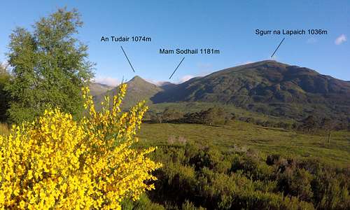 Sgurr na Lapaich, An Tudair and Mam Sodhail in June |
Am Meallan 652m/2138ft: this is a tiny little summit and a bit of an outlier to the main Glen Affric Range – albeit a close one. It is worth a mention since it is (also) a very good view point both for looking into Glen Affric and north towards the main range – where all the summits of the main chain can be seen with the exception of the Sgurr nan Ceathreamhnan group. On a good day the twins are clearly visible and all the way along the spine to Toll Creagach. There are more and excellent views of the near neighbour Sgurr na Lapaich to which it is connected via a wide boggy col at 543m. It is the closest mountain to the main Glen Affric car park and is accessed from the path described above – which starts near the Affric Lodge.
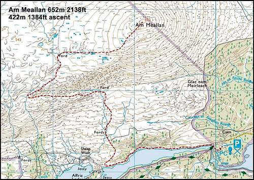 Am Meallan OS Map excerpt of route of ascent | 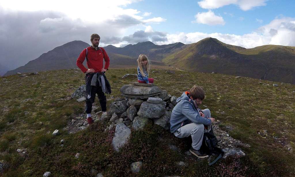 Am Meallan summit in August 2017. In background Sgurr na Lapaich on L, Carn Eighe beyond |
The next and final group (East) is composed of two mountains:
 Tom a' Choinich and Toll Creagagh and side valley of Gleann nam Fiadh from An Meallan. Bealach Toll Easa pass is at lowest point on interconnecting ridge. |
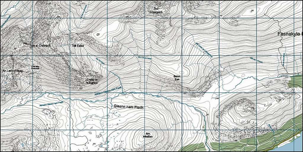 OS Map excerpt of Tom a' Choinich and Toll Creagagh. Again, Toll Easa pass can be seen marked on interconnecting ridge. Click on image twice to enlarge. |
Tom a’Choinich and Toll Creagach
Tom a’Choinich 1112m 3647ft and Toll Creagach 1054m 3457ft: are two big Munros which dominate the skyline above the northern shore of Loch Beinn a Mheadhoin. They are the last significant summits at the eastern end of main spine of the Glen Affric Range, which started 12 miles away with Sgurr nan Ceathreamhnan. The two large mountains can be described together since access is the same and they are usually climbed together.
 Tom a' Choinich as seen looking up from Gleann nam Fiadh... | 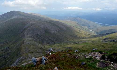 ...and view the other way from Tom a' Choinich down into Gleann nam Fiadh |
Tom a’Choinich and Toll Creagach are pronounced: Towm a’howney + Towl kriketh
Access:
Both mountains can be climbed from Gleann nam Fiadh. This side valley opens out into Glen Affric near to the western end of Loch Beinn a’Mheadoin and at the Chisholme Bridge, where there is a car park. Gleann nam Fiadh can also be reached from Glen Affric main car park by following the path from Affric Lodge which crosses the wide flat beallach between AmMeallan and Sgurr na Lapaich and descends into upper Gleann nam Fiadh. Finally the eastern side of Toll Creagach can be reached from another side valley which opens out near to the main Loch Beinn a’Mheadoin view-point car park. This side valley also connects to and is a branch of Gleann nam Fiadh – passing behind another small stand-alone hill Beinn a’Mheadhoin 613m and passing between it and the front of Toll Creagach.
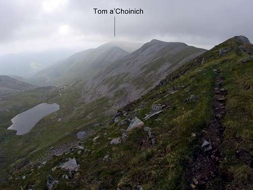 Approaching a distant Tom a' Choinich... | 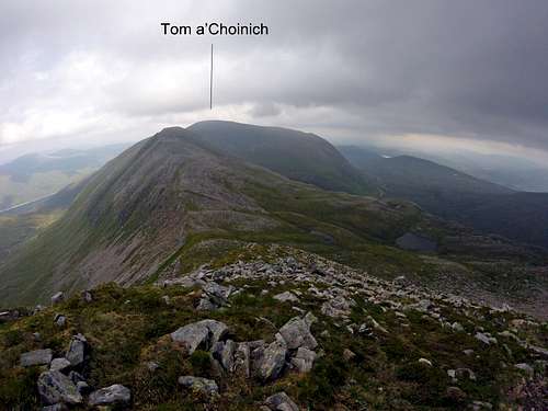 ...along the long interconnecting ridge from Carn Eighe.. | 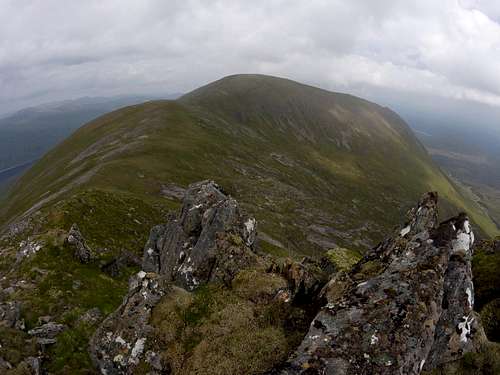 ...to final approach to Tom a' Choinich |
Ascent:
- From the west: Tom a’Choinich can be reached via the long ridge with 4 intermediate tops described above and coming all the way from Carn Eighe. This ridge may be joined at the western end after a traverse of Carn Eighe or in the middle from upper Gleann nam Fiadh – via a path rising up towards a tiny lake Loch a’ Gharbh-bhealich – from where the ridge can be joined at a col between the tops of Sron Garbh and An Leth-chreag.
- Interconnecting ridge: between Tom a’Choinich and Toll Creagach is 3.25km of ridge which dips to a low point at the Bealach Toll Easa 872m – another of two passes connecting Glen Affric with Glen Cannich. Bealach Toll Easa can be reached by following a path up from the mid section of Gleann nam Fiadh.
- From the east: Toll Creagach can be climbed via east ridge which in turn is accessed from lower Gleann nam Fiadh – or from the branch of this valley which ends at the main Loch Beinn a’Mheadoin view-point car park.
![Tom aâChoinich summit view]()
Tom a' Choinich summit view toward Loch Mullardoch and Toll Creagach...![Tom aâChoinich from Loch Mullardoch]()
...and looking the other way up from Loch Mullardoch
Passes
Two passes cross the Glen Affric Range and connect Glen Affric to Glen Cannich and are referred to in text above. Note Bealach means Col or Pass in Gaelic. They are:
Bealach Coire Ghaidheil Pass 717m: A path heads north from Glen Affric, from a point midway between the far western end of Loch Affric and Alltbeithe. It rises over the pass between An Socach to the west and Mam Sodhail to the east and then drops down to enter the long narrow valley of Gleann a’Choilich which emerges at the western end of Loch Mullardoch in the deeper recesses of Glen Cannich. The route is 8km (5 miles) long and passes through some of the most remote terrain in Scotland. There are connections between the Glen Cannich end of the path and Kintail.
Bealach Toll Easa Pass 872m: A fairly well established path connects Glen Affric at Affric Lodge to a rather remote place on the southern shore of Loch Mullardoch, a very long way from either end of the lake – at a point where the most realistic access would need to be by boat. At the Glen Affric side the path initially ascends to the wide flat beallach between Sgurr na Lapaich and Am Meallan before a small descent and crossing of Gleann nam Fiadh – before the final ascent up to the main pass at the Bealach Toll Easa 872m. On the other (northern) side the path continues on and descends over an approximately 5km distance to reach Loch Mullardoch. The total length of the path is 10km (6miles).
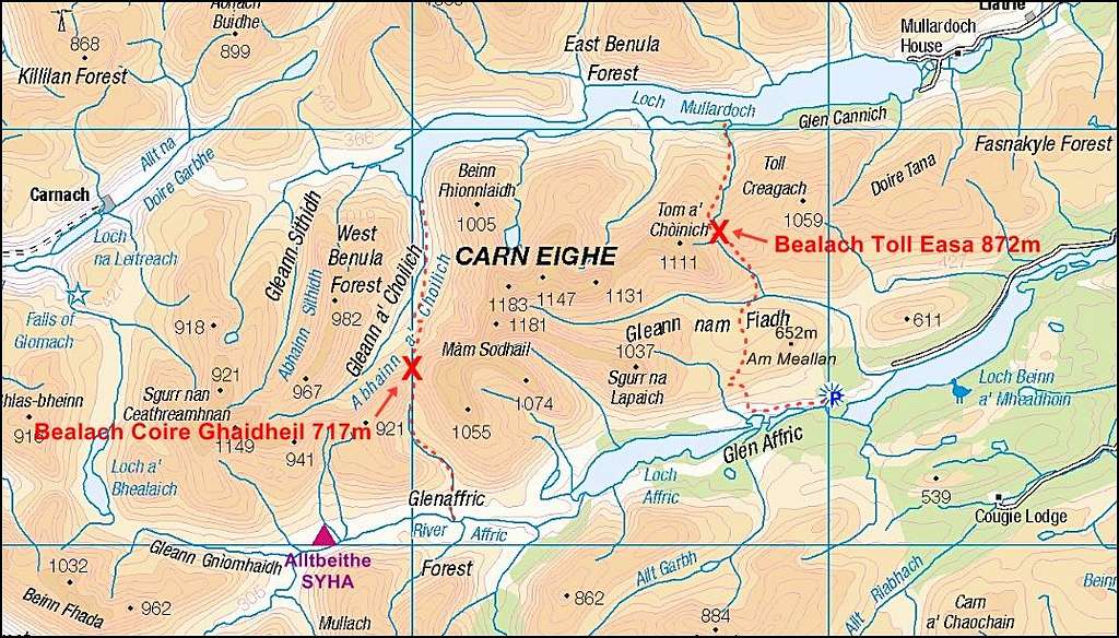
Glen Affric - Passes
THE LAKES
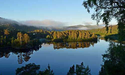
The Glen Affric Range is almost like an island with big expanses of water to the north and south (there is even another and smaller expanse to the west). To the north is the remote Glen Cannich and the largest of three lochs (Lakes) Loch Mullardoch. To the south, Glen Affric features two smaller lochs: Loch Beinn a’Mheadhoin and Loch Affric. Loch Mullardoch and Beinn a’Mheadhoin are not entirely natural, both being reservoirs with huge dams – and interconnected as part of the Affric-Beauly hydro-electric power scheme, which includes six power stations, two of which are underground. Loch Monar and the rivers of Farrar and Beauly are also part of the scheme. Loch Mullardoch is impressive but also rather bleak and windswept, but the two Glen Affric lochs are stunningly beautiful – set among what is said to be some of the last surviving remnants of Caledonian Forest. The much smaller lake to the west of the range is called Loch a'Bhealaich. The main lakes north and south are as follows:
Loch Mullardoch: 9 miles 14km long. A huge concrete dam is at the eastern end, which can be reached via a 10 mile 16km road running up the glen from Cannich. There was a 7km long lake in the valley before the dam was constructed – as recently as 1951 and resulting in a doubling of the length of the lake.
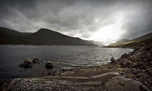 Loch Mullardoch and the 'back' of Glen Affric Range looking west | 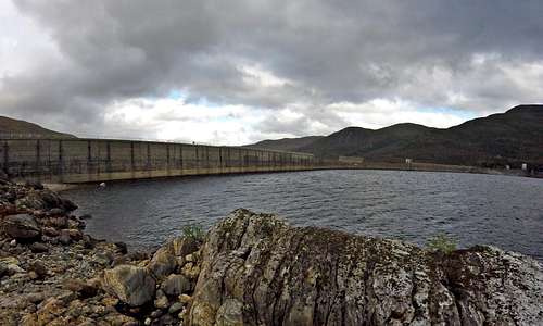 Loch Mullardoch Dam |
Loch Beinn a Mheadhoin: 5 miles 8 km long. An impressive dam is at the eastern end of this beautiful reservoir which, like Mullardoch, was developed in the 1950’s. However, unlike Mullardoch, this reservoir is surrounded by attractive pine and birch forest and is a beautiful place for enjoying water sports, walking around or just looking at. The Affric to Kintail Way follows the southern shore on the 2nd leg of this four stage long distance walk. The single track road heading from Cannich up to the main Glen Affric car park follows the northern shore. There is a car park at the Loch Beinn a’ Mheadoin view point, which is a good place to access the lake for water sports. There is another car park at the Chisholme Bridge 2.3 miles 3.5 km further to the west and near to the western end of the lake.
 Loch Beinn a' Mheadhoin at sunrise in June | 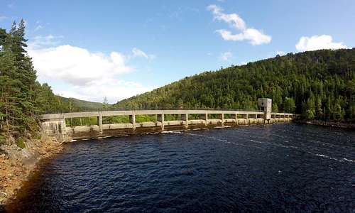 Loch Beinn a' Mheadhoin dam |
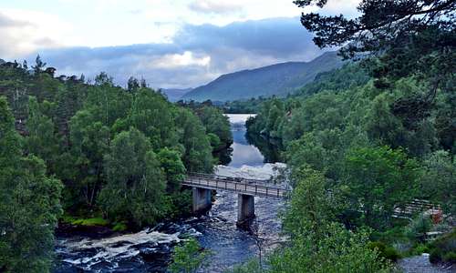
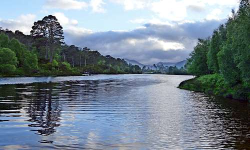
Loch Affric: 4 miles 6 km long – and the only one of the trinity to be a completely natural lake. Numerous streams and the western stretch of the River Affric are the water supply and a continuation of the River Affric the outlet at the eastern end. This wild one kilometer stretch of river can be easily observed from the main car park and connects Loch Affric with Loch Beinn a’Mheadhoin.
 Loch Affric - at the eastern end looking west | 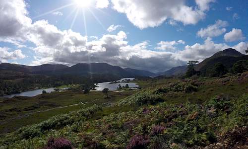 Looking down on Loch Affric and towards the west |
Loch Affric is perhaps even more beautiful than Loch Beinn a’Mheadhoin. At the near and eastern end it is similarly set about with pine and birch forest, but this gradually diminishes on both north and south shores until it is all much more open. But somehow there is not the bleakness of Loch Mullardoch. The terrain seems green and friendly with an impressive back cloth of the larger mountains of the range on one side and lower and more tree clad hills on the other.
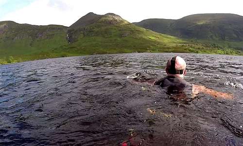 Swimming across Loch Affric near western end in June | 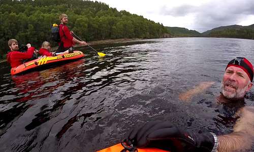 Swimming & rubber rafting in Loch Beinn a' Mheadhoin in August |
GOLDEN RETRIEVERS
Much of the Glen Affric area was part of the once vast Guisachan Estate which included a huge mansion, Tomich Village, the Affric Lodge and numerous other grand dwellings scattered around in addition to extensive areas of land given over to deer hunting and fishing. A certain Dudley Marjoribanks a.k.a Lord Tweedmouth made a major contribution to the development of the estate during the mid 1800’s – when the estate reached its zenith (and before a rather sad decline when money and appetite for the project ran out). Aside from all the buildings and the village, Lord Tweedmouth was responsible for the planting of magnificent Douglas Firs to be found in the Guisachan Forest near to Tomich and about 5 miles away from the village of Cannich. Many of these trees are now over 40m high and create a stunning backdrop to the sensational Plodda Falls (see below).
There is another legacy from the Guisachan Estate: the first of the much loved breed of dogs known as Golden Retrievers were bred here in 1868 – as another of Lord Tweedmouths projects. Nous, a wavy-coated retriever was introduced to Belle, a so-called Tweed Water Spaniel. The union was supposed to result in the most perfect gun-dog. Maybe it did - but it also resulted in one of the worlds most loved family pets. An organisation known as Friends of Guisachan, based in the USA, has researched a lot of the history, which is on display on their excellent website. They also erected a life-sized bronze statue of a Golden Retriever in the village of Tomich, next to a granite memorial to Lord and Lady Tweedmouth.
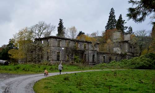 Sir Henry approaches the ruins of the place where he came from... | 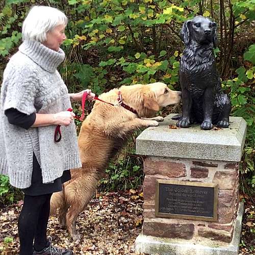 ...and sniffs the butt of his bronze ancestor... | 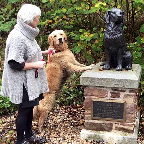 ...in Tomich in October 2017 |
Historical Walk: a wonderful 6 mile/10km walk can be started in Tomich which takes in various parts of the old Guisachan estate as well as following a circular route through the stunning Guisachan Forest. This will be of interest to dog (especially Golden Retriever) lovers but is a great experience to be enjoyed by any keen walker, passing as the route does through some of the finest scenery in Scotland. A start may be made by the Memorial and statue before following the main road to the west out of the village. After about a kilometer there is a fork, where there the single track un-metaled road continues to the left and is signed Plodda Falls and Cougie, but the route continues on the right fork (un-signed) along similar un-metaled road which, after a further kilometer, reaches the ruins of the old Guisachan mansion. The road passes the ruins and continues through open meadows surrounded by trees to reach the main Guisachan Forest, where a series of paths en-circle and cross the woodlands, taking in various view-points, including at the top and bottom of the Plodda Falls, a 40m 160ft high waterfall, which has to be seen to be believed. The best option is to follow the main path encircling the various features before a return is made to the ruins and ultimately Tomich. Note that there is a car park about 400m from Plodda Falls and various variants of the route described are possible. See map below in 'Other Low Level Walks'
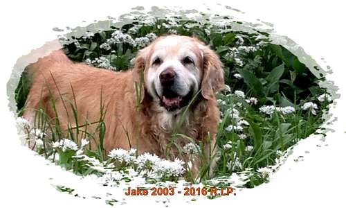 Jake 2003 - 2016 R.I.P. Sadly he never got to see Glen Affric... | 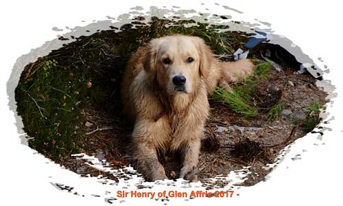 ...but Henry did, in October 2017, aged 10 months. |
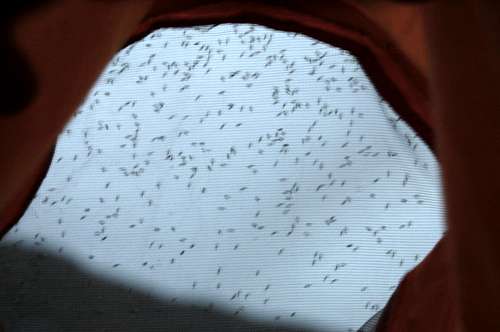
MIDGES
Yes there are midges in Glen Affric
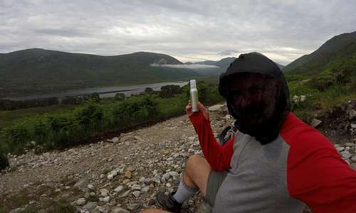
We are talking about The Highland Midge Culicoides Impunctatus, a tiny blood-sucking insect which attacks by the million in voracious swarms. Apparently only half of the midge population – the females – are the ones which bite. And most of them are said to be taken up attacking sheep, deer and other live-stock. But there always seem to be plenty left over to attack people, when the conditions are favorable. They are active from spring until autumn and prefer damp windless conditions especially around dawn or dusk. They are not deterred by either darkness or (strangely) rain. You would think that a rain drop to a midge would be like a car sized lump of water, travelling at very high speed. You would think (with some satisfaction) that being hit by such a thing would result in the midge being drowned in addition to being swatted out of the sky. No such luck. Midges are merely displaced by rain-drops - that is to say swept harmlessly to the side by the little bit of wind pushed in front of a rain-drop as it falls. So they can and do still get you - they just follow a more zig-zag course to reach you.
A single midge bite is somewhat less than a mosquito bite in severity. It may result in a tiny itchy bump which subsides after an hour or two - not too great a hardship. The problem is when bites are coming by the hundred/thousand/million. It sets off a maddening state of itching - breaking out all over the body. But the little brutes also seem to have a preference for particularly sensitive places like the eye-lids, lips and fingers - and even take to crawling into the eyes, up the nose and into ears – to the point of driving a victim howling into the nearest lake, if one were available (a good idea actually – they don’t seem to follow you out onto open water...)
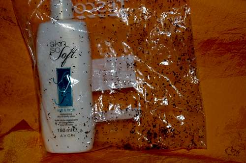
Defense:
- As little as 6mph breeze is enough to blow them all the way – and therefore breaking into a jog/run can be one form of defense, if you are very fit - you could have to run for several hours.
- They don’t apparently follow you into buildings (but they do follow you into tents).
- The best defense in my experience is a head-net (cost a mere £5-10) and Smidge which claims, with good reason, to be UK’s number 1 midge repellent. Spray all exposed skin – especially hands and wrists, ankles… noting that they do somehow bite through socks, so spray socks and/or skin underneath. Then whip out head-net to protect the face, ears and neck etc at first sign of itching (generally you feel the little sods before you see them)
Discredited defenses:
- Taking marmite or vitamin supplements, garlic etc – all useless.
- DEET - I think this works a bit, but it is foul stuff to put on, dissolves plastic and doesn’t work nearly as well as Smidge.
- Avon Skin So Soft – claimed used by the military (probably by Avon) – but in my experience useless other then maybe to try to drown the nasty wee beasties.
- Scotch Whisky... sometimes to be found up on shop shelves in among the DEET and Avon Skin So Soft bottles. I think the idea is you drink yourself so insensible that you no longer care - I doubt the brutes would stop biting you. You could also use the empty bottle to club a few to death. As a specialist in alcohol misuse I cannot condone this method.
![Scottish Highlands 2010]()
Midges trying to get through netting into the tent...![Scottish Highlands 2010]()
...some drowned in Avon Skin So Soft (2010)![Midge attack in Glen Affric!]()
How to survive: HEAD-NET & SMIDGE in Glen Affric 2017
Record Midge season - Summer 2010:
Summer (June to September) 2010 was thought by many (including me) to be likely to be a safe year for midges, with most of the little critters killed off in the unusually harsh, cold winter of 2009/10. Everyone was wrong. It turned out to be the worst year ever. For one thing they survived the winter (I don't know how or where you survive a winter if you are a midge, but take it that they do). But the crucial thing was that the predators which eat midges - bats, birds etc - took a big hit and so as midge-season 2010 got underway there were far fewer of them up in the sky - and so the midges thrived. I bore personal testament to this on a September trip to the Highlands... I have never known anything like it before or since. For a start I was attacked on the very summit of Ben Nevis! And then I experienced the most savage and relentless attack conceivable, down in the warm humid depths of Glen Nevis - see trip report: Of Vampires, Mountains & Men: Scottish Highlands 2010. It took me about 3 weeks to stop itching after this trip.
It is worth noting that the winter of 2010/11 was perhaps even harsher, with lowest temperatures recorded for 80 years. I never got to find out what the midges were like up in Scotland that summer, but they were horrible as far to the south as Yorkshire that year, which I have never known happen before or since...
AFFRIC TO KINTAIL WAY
This is a new long distance walk which opened in 2015. It is 44 miles/66km long, has four stages and goes from Drumnadrochit on the shores of Loch Ness in the east, all the way to the west coast of Scotland at Morvich, Kintail.
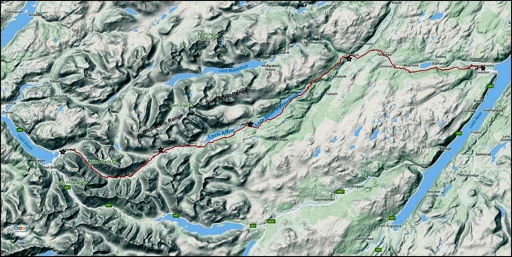
Affric to Kintail Way - also showing road connections between start and finish. Click on image twice to see enlarged view.
After leaving Drumnadrochit the first stage passes through Glen Urquhart to reach Glen Affric at Cannich. The second stage follows Glen Affric along forest trails, passes Loch Beinn a’Mheadhoin on the southern shore and goes on to reach the main Glen Affric car park. The third stage continues along Glen Affric following close to the southern shore of Loch Affric before going beyond and as far as Alltbeithe. In the fourth and final stage the route leaves Glen Affric to enter Glen Lichd and passes on through to reach Morvich, in the Kintail region, on the West Coast.
 Affric to Kintail Way on the 3rd stage | 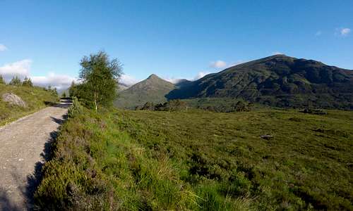 Affric to Kintail Way on the 3rd stage |
For further information see link to official Affric to Kintail Website
Walk Highlands has another good description for Affric to Kintail Way
 Affric to Kintail Way 3rd stage - looking west towards Alltbeithe | 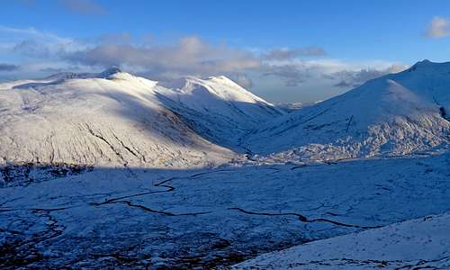 Affric to Kintail Way final stage - looking into Glen Lichd and exit toward Morvich |
OTHER LOW LEVEL WALKS
For low level walks (or indeed any kind of walk) an excellent resource is Walk Highlands. The following links go to appropriate pages on the Walk Highlands website.
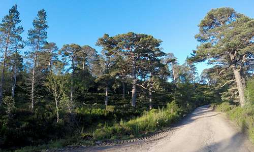
Loch Affric circuit Starting at the main Glen Affric car park this 11 mile/18km route follows the Affric to Kintail Way on south shore of the loch, crosses the River Affric at a foot-bridge a kilometer beyond the western end of the lake, before returning on an undulating path following the north shore initially though open moorland but coming to pass alongside and then through wonderful Caledonian Forest in the final section leading back to the car park.
 Caledonian Forest Glen Affric | 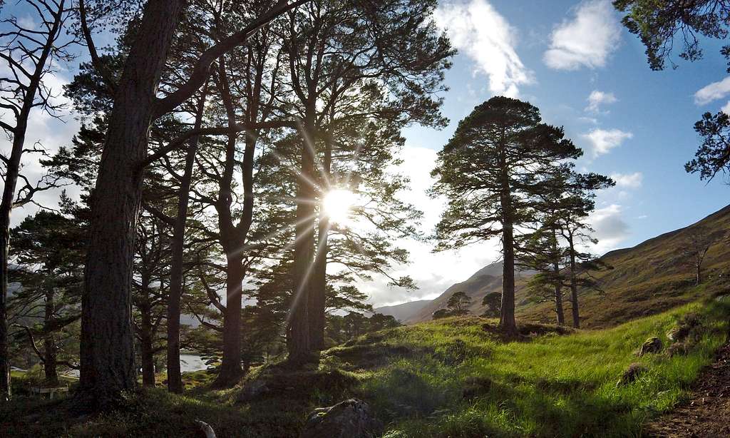 And more Caledonian Forest |
Dog Falls and Coire Loch A beautiful circular forest walk taking in a series of impressive cascades as the River Affric runs through a gorge downstream from Loch Beinn a'Mheadhoin and also a remote little lake.
Plodda Falls and the Guisachan ruin. Also see Golden Retrievers section above. This is a stunningly beautiful forest walk taking in 40m/160ft high waterfall and is impressive in any weather. Taken from Tomich all the way out past ruin and on to complete the woodland circuit taking in Plodda Falls comes to around 6 miles 10km distance and around 250m ascent. It actually makes for a wonderful 10k run as well as a walk.
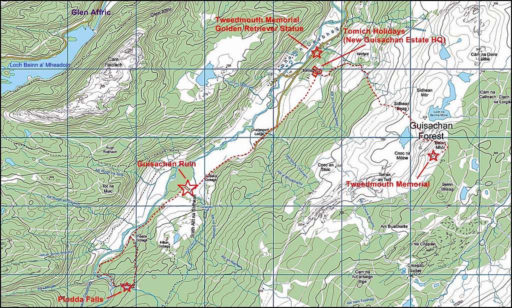
OS Map excerpt of Guisachan Ruin & Plodda Falls walk and also a walk to hill-top memorial - from starting point at Tomich Holidays
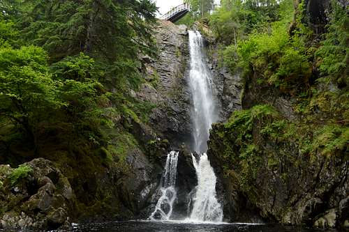 Plodda Falls from below - note viewing platform above the top | 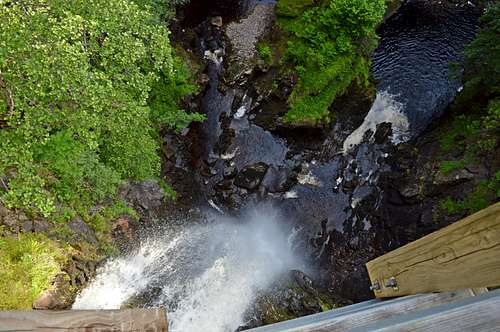 Plodda Falls from viewing platform above |
ACCOMODATION
Camping:
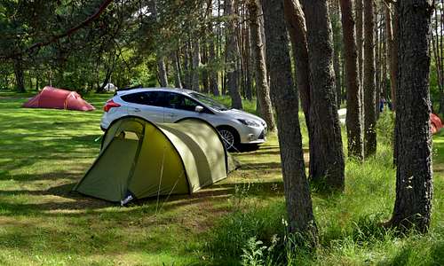
Cannich Woodland Camping - a beautiful site set among trees in Cannich and for catering for tents, caravans and fixed 'camping pods.
Youth Hostel - YHA:
YHA at Alltbeithe - situated in upper Glen Affric at the end of the third stage of the Affric to Kintail. Self catering and sleeping bag required. Check website for details around booking and what facilities are available. Only open in summer - but there is a winter room left open and made available for emergency use, but suggest OK for use so long as left in the same or better condition than at arrival.
 Cannich Camp Site | 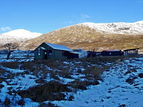 Alltbeithe YHA | 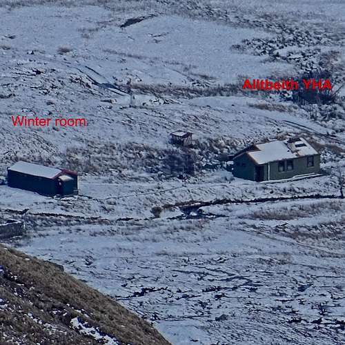 Alltbeithe YHA from above |
B&B:
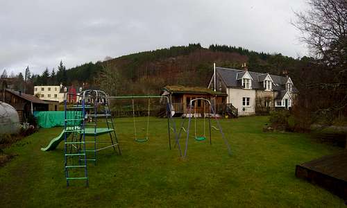
Westwood B&B - friendly couple providing comfortable accommodation in Cannich - and a great 'Highland Breakfast'! In addition to B&B they are now offering self catering 'Glamping' in a few new 'Eco-huts' built in the grounds of the B&B.
Other B&B - link to several other B&B's in the area.
Self-catering:
Tomich Holidays - Working Farm (and HQ to present day Guisachan Estate) - detached Woodland Lodges and 'Victorian Dairy' plus 'Courtyard Cottages'. Comfortable accommodation, well placed in Tomich.
Glen Affric Holiday Park - self catering cabins and located next to the campsite in Cannich.
 Westward B&B, Cannich | 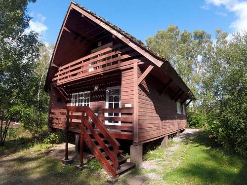 Tomich Holidays Forest Lodge |
Hotels:
Tomich Hotel - excellent (dog-friendly) bar or restaurant meals and friendly staff as well as accommodation provided, near center of Tomich.
Slaters Arms - accommodation and meals, in Cannich.
Beyond luxury…
Affric Lodge - beautiful location on shores of Loch Affric. Once part of the original Guisachan Estate, but now HQ to a new Glen Affric Estate. Luxury accommodation available to the tune of £900 (yes, nine hundred quid) per person per night. (I haven't stayed there but it appears... comfortable)
Basic:
Camban Bothy - at totally the other end of the accommodation spectrum, a rustic self catering stone cottage (Bothy) with no mod cons or facilities at all available to the tune of £0 per person per night but a requirement to leave it in same or better condition than you find it. No booking required - first come first served and it is necessary to bring sleeping bag and cooking equipment. Situated two miles away from Alltbethe and at the start of the final stage of the Affric to Kintail Way.
![Glen Affric maps]()
Glen Affric maps
![Glen Affric - Caledonian Forest]()
I hope you enjoy Glen Affric as much as I do...
 Affric Lodge, Loch Affric - sublime living at £900 pp per night | 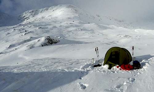 BEST OF THE LOT: Winter Camp in upper Coire Leachavie! |
FURTHER INFORMATION & LINKS
Weather & Avalanche:
Mountain Weather Information Service: select NW Highlands for the Glen Affric area.
Mountain Weather Information Service: Blogs - can be very useful following blogs by Scottish Mountain Guides - who give useful up to date information about weather, climbing conditions and avalanche danger
Steve Fallon: mountain guide - a particularly useful website with a lot of information and offering a guided service/instruction for those wishing to learn some skills
Walk Highlands:
Walk Highlands home page - extremely useful resource for planning any hill activity in Scotland
Walk Highlands Maps - has access to free OS mapping down to 1:50 000 scale without log-in, but setting up user name and password for a log-in (free) gives access down to 1:25 000.
Walk Highlands Safety - useful information, especially for new-comers and beginners.
SAFETY & MOUNTAIN RESCUE:
In an emergency call 999 or 112 and ask for POLICE, MOUNTAIN RESCUE
Scottish Mountain Rescue advice/who to call - the emergency numbers and other useful advice. Note that mobile reception is patchy in the area. Unlikely in the further depths of Glen Affric, but I discovered reception was available on some of the tops - not least being Sgurr nan Ceathreamhnan, the remotest in the range - where to my surprise I was able to phone my wife from the western summit in February 2017.
Emergency Text Messages - set your mobile/cell phone to be able to send an emergency text to 999 or 112. Will save time in an emergency.
MAPS:
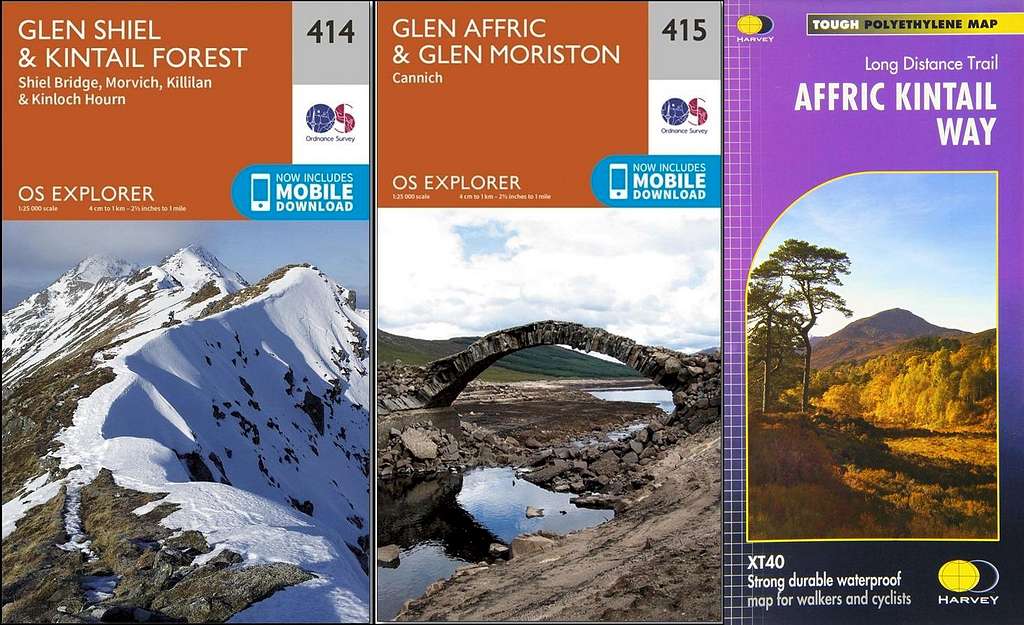
Glen Affric maps
Vimeo Movies:
Glen Affric - a winter's journey 2017: a 26 minute movie of winter mountaineering in Glen Affric including ascents of Sgurr nan Ceathreamhnan, Mam Sodhail and An Tudair and ending with a battering in a winter storm at a high camp in Corrie Leachavie.
Glen Affric 2017: all season journey ending with time travel with a dog: an 18 minute movie featuring highlights from my one year, all season study of Glen Affric. Highlights include winter mountaineering again, but going on to show completing traverse of the range in summer conditions, wild swimming, walks with two sons and a 4 year old granddaughter - and finishing with autumn colours and an exploration of Golden Retriever history in the glen with wife and dog.
I hope you enjoy Glen Affric as much as I do...