
|
|
Mountain/Rock |
|---|---|
|
|
46.65369°N / 11.30143°E |
|
|
Bolzano Alto Adige |
|
|
Hiking, Skiing |
|
|
Spring, Summer, Fall, Winter |
|
|
6936 ft / 2114 m |
|
|
Overview
Karkofel / Monte delle Vacche 2114 m
Karkofel 2114 m is the original Tyrolean toponym, while the italian name is Monte delle Vacche. It's a secluded roundish summit just over 2000 meters high belonging to the Monti Sarentini or Alpi Sarentine group, located on the Western ridge of the Val Sarentino, at a short distance from the large pass between Val Sarentino and Val Passiria called Giogo dei Prati (Auenjoch).
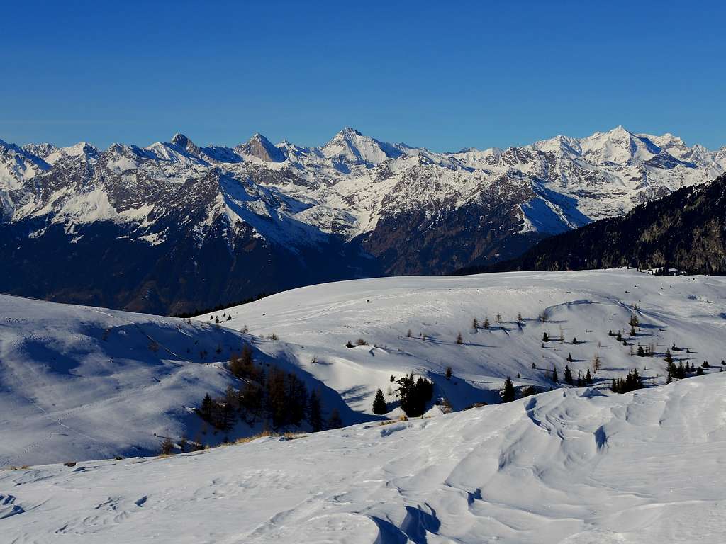
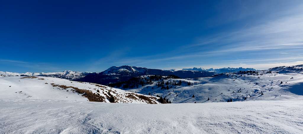
With its rounded shape, Karkofel is not a very flashy mountain but it absolutely offers a grandiose and breathtaking 360° panorama that embraces the main Dolomite groups of the region and extends southwards to the mountains of Trento and Garda. On the opposite side Brenta, Caré Alto, Adamello, Ortles-Cevedale and the Val Venosta mountains complete the spectacular horizon.
Getting There
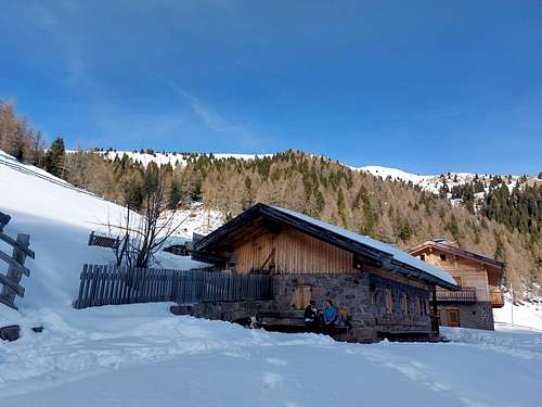
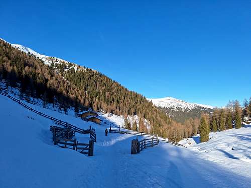
From the A22 highway exit Bolzano Sud and cross the town of Bolzano, following the signposts to Val Sarentino. Once you enter the valley, reach the village of Sarentino and drive up to the Rifugio Sarentino (Sarner Skihütte), a typical alpine hut located in a magnificent position, immersed in meadows and woods at 1641 m above Sarentino. Wide parking lot. The road is kept open and clear of snow up to the hut (7 km from Sarentino).
Normal Route
Summit quote: 2114 m
Difficulty: EI (in winter)
Difference in level: 475 m from the Sarner Skihütte
Starting point: Sarner Skihütte 1641 m
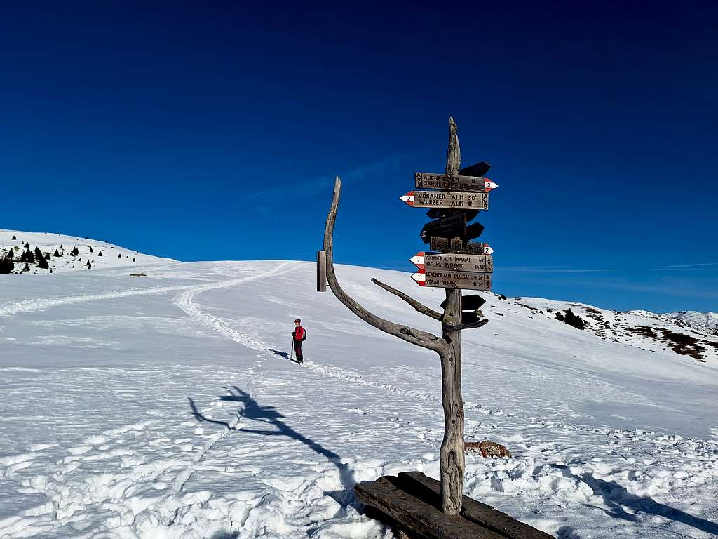
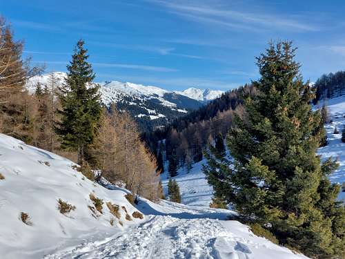
On the left of the refuge near a wooden capital it starts a flat forest road which crosses a bridge over the Almbach stream and proceed for about 100 metres. At the end, turn onto a path on the left (n. 2), following the signposts to Auener Alm, and ignore the path to Grosser Mittager (Monte Catino) on the right. After the first stretch in the woods the trail becomes gradually steeper going up into the sparsest woods alongside the stream and reaching the Auener Alm 1798 m.
Once past the mountain hut, keep to the right of the stream and continue on more open terrain with a moderate slope in a South-West direction, heading towards the signposts that identify the Auenjoch pass 1924 m.
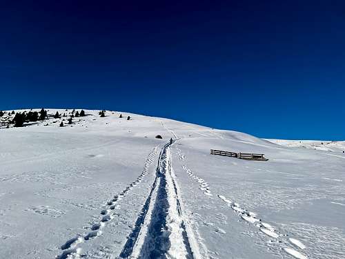
From the pass turn sharply right (itinerary n. 4, European n. 5, heading North), climbing up the slopes with a short steeper section.
Behind the rather rounded mountains in the foreground, the imposing peaks of Grosser Ifinger (Picco Ivigna) and Kleine Ifinger peek out.
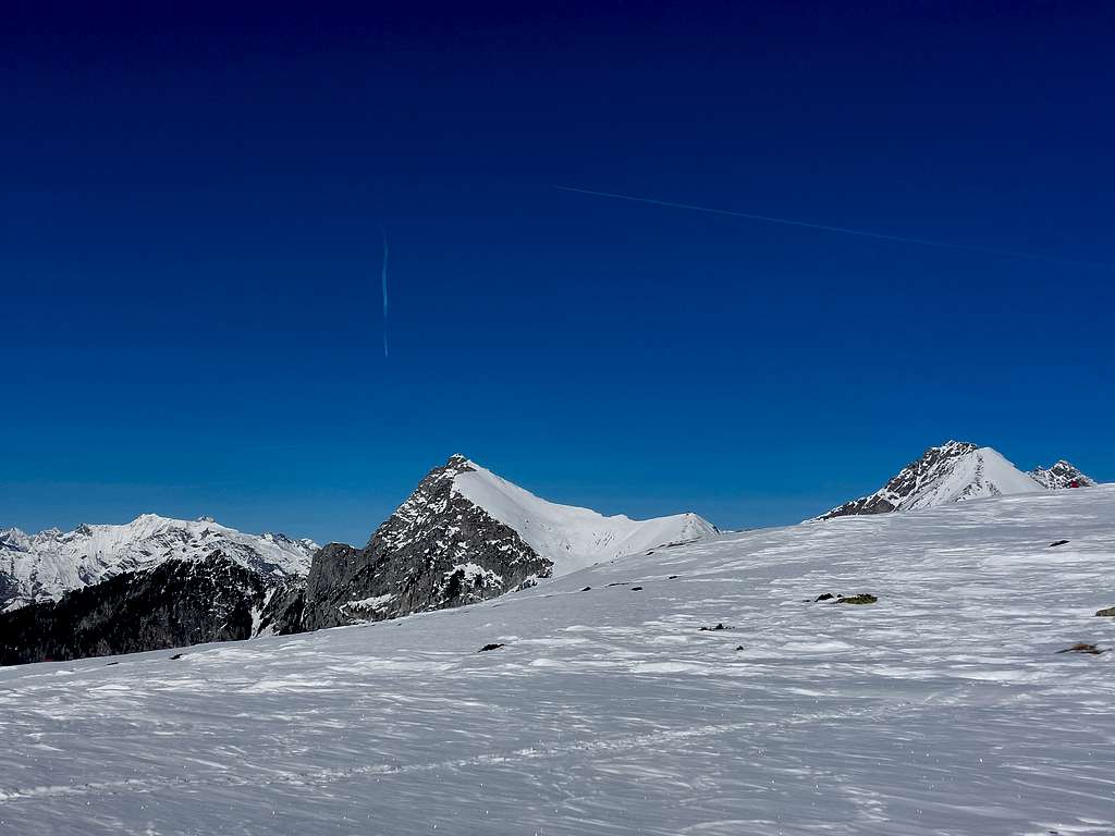
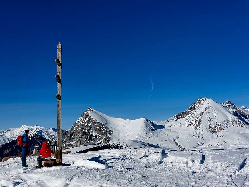
You reach the large plateau of the KreuzJoch / Giogo della Croce 2086 m, recognizable by the characteristic triple cross. In addition to the triple cross, on the plateau there is also a station with a fine orientation table which allows you to identify the surrounding peaks. Here the main ridge continues Northwards and joins Picco Ivigna, while to the left a slope descends to the Passiria valley floor.
On the right, towards the East, it branches off a short and large crest which on undulating terrain culminates with the rounded peak of Karkofel, our goal. From the KreuzJoch / Giogo della Croce we then turn sharply to the right, aiming for the clearly visible summit cross.
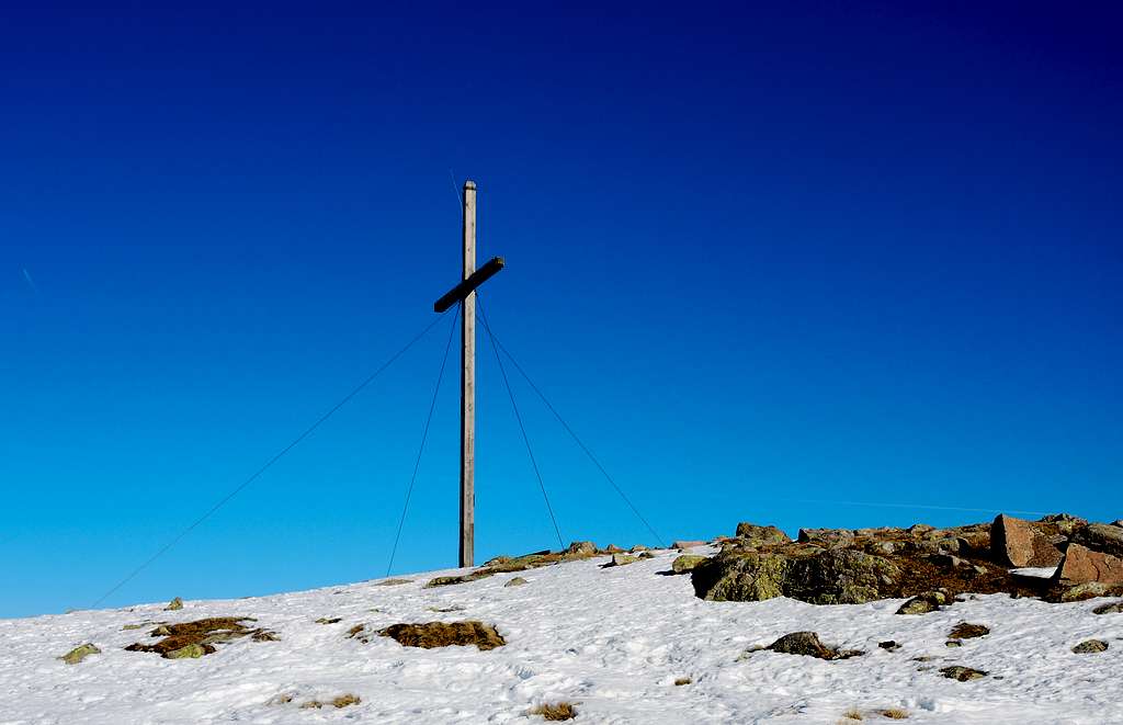
We walk along the undulating terrain with some rocky outcrops and with some ups and downs we climb up to the summit cross of Karkofel. Vast 360 degree panorama of the Dolomites with the Sella, Sassolungo and Catinaccio groups, the peaks of the Passirie Alps, the Ortles Cevedale, the Sarentine Alps and the nearby Sarner Scharte!
Descent: reversing the same route
Red Tape
No fees no permits required
When to Climb
All year round
Accomodation
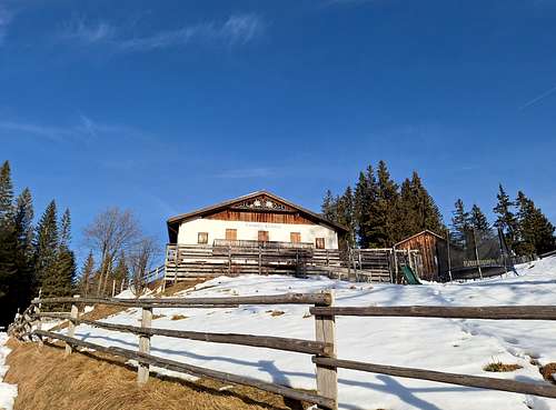
Sarner Skihutte - Rifugio Sarentino 1641 m is the closer accomodation, otherwise the town of Sarentino offers different other possibilities.
Bibliography
"Zaino in spalla con le racchette da neve" by Fausto Camerini - Ed. Franciacorta
Meteo Forecast
The weather conditions could be proofed here: