
-
 1125 Hits
-
 81.18% Score
-
 13 Votes
|
|
Mountain/Rock |
|---|---|
|
|
46.83396°N / 11.33394°E |
|
|
Bolzano Alto Adige |
|
|
Hiking, Mountaineering, Trad Climbing, Scrambling, Via Ferrata |
|
|
Spring, Summer, Fall |
|
|
8136 ft / 2480 m |
|
|
Overview
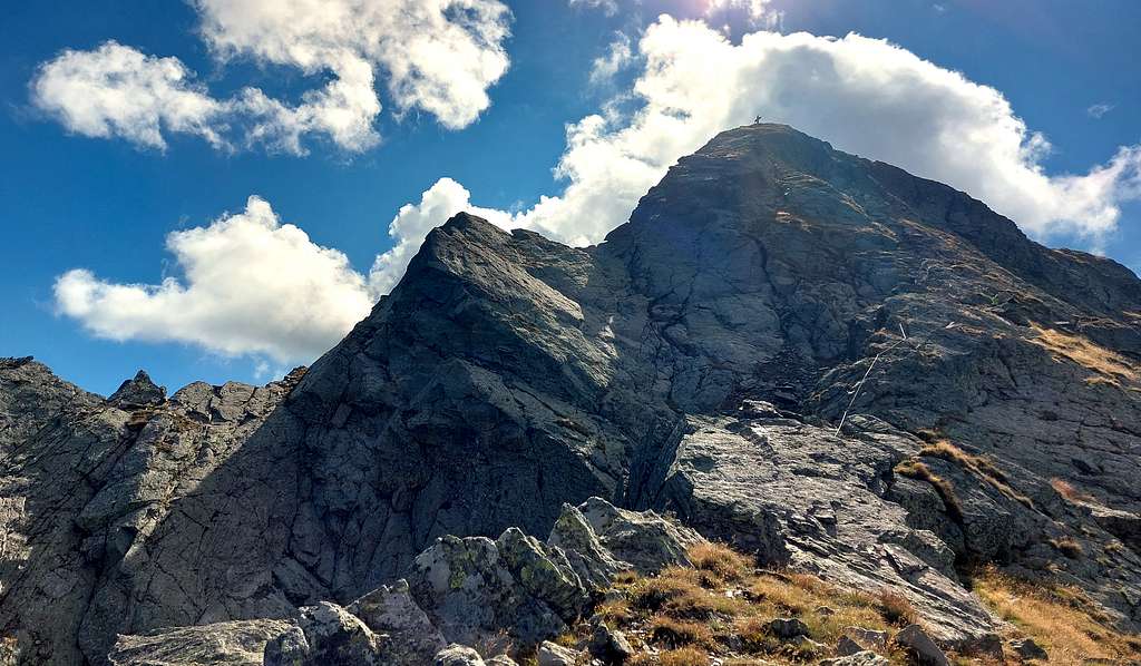
Jaufenspitz / Punta di Monte Giovo 2480 m
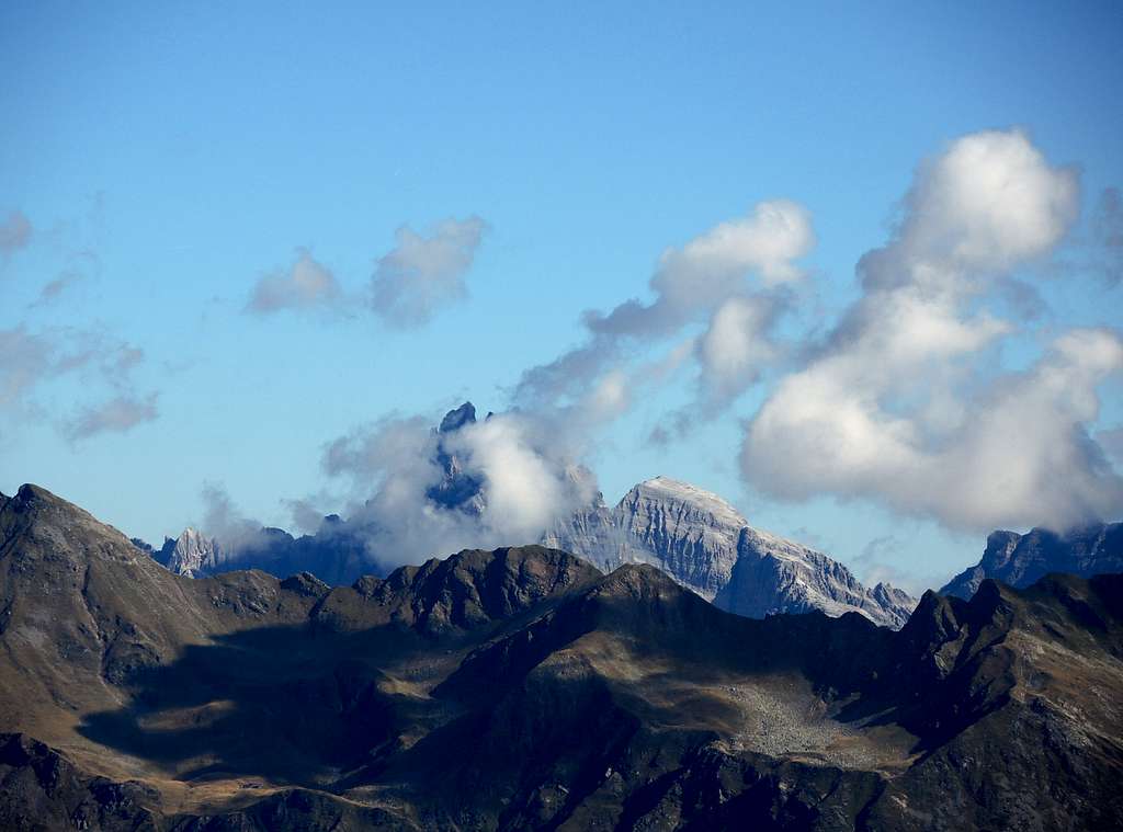
As all the mountains in the county South Tyrol/Bolzano Alto Adige, located near the boundaries between Italy and Austria, this peak has two names: Jaufenspitz 2480 m, in the original Tyrolean name, and Punta di Monte Giovo in italian. It is a prestigious but not very well known peak located in the Northern Alpi Sarentine - Sarntaler Alpen. With its sharp and attractive pyramid shape dominates the Passo di Monte Giovo 2094 m (Jaufenpass), an alpine pass in the Eastern Rhaetian Alps, Bolzano province, which connects the Val Passiria and the town of Merano with the upper Isarco valley and Vipiteno. From a geographical point of view the mountain divides the Stubai Alps to the North-West from the Alpi Sarentine to the South-East.
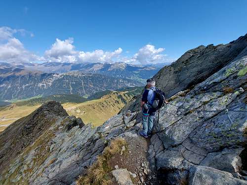
The standard route for summiting the mountain is an ascent with a stretch of Via ferrata starting from Passo Giovo - Jaufenpass, not too demanding and vertical. However, it requires a steady foot and adequate equipment (lanyard and carabiner, harness).The top of this mountain is beautiful and satisfying.
Getting There
The starting point to climb is Jaufenpass or Passo di Monte Giovo 2094 m. Passo di Monte Giovo can be reached both from Vipiteno on the Isarco side (for those coming from the North) and from Merano and Val Passiria (shorter access for those coming from the South). From a geographical point of view the pass divides the Stubai Alps to the North-west from the Sarentine Alps to the South-east.
Road access
- from Vipiteno follow the SS44 which with several hairpin bends, first in a dense forest, then among green meadows reaches the pass in about 10 km
- from Merano take the road to Val Passiria, pass Saltusio and San Martino in Passiria. Reach San Lorenzo in Passiria, where the road forks. Take the right direction to Passo di Monte Giovo, getting to the pass 2094 m
Normal Route
Jaufenspitz (Cima di Monte Giovo) Normal Route report
Summit altitude: 2480 m
Difficulty: Alpine F/EEA
Difference in level: 400 m from Passo di Monte Giovo
Exposure: West
Starting point: Passo di Monte Giovo /Jaufenpass 2099 m
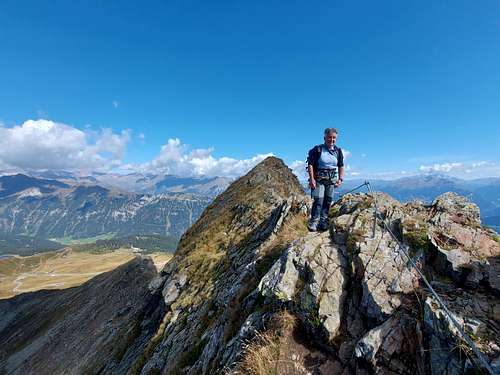
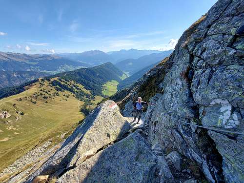
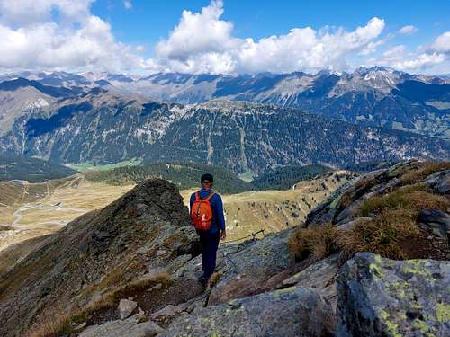
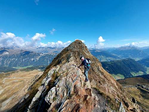
A very interesting and panoramic route, following at first a good path, then the West rocky ridge, aided with some fixed metal ropes.
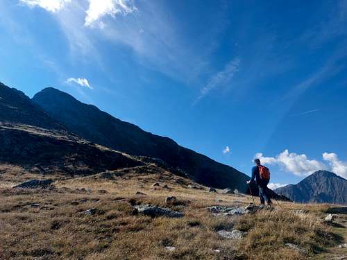
The Normal route starts from the Passo di Monte Giovo/Jaufenpass 2099 m, following the path 17 or, alternatively, from the Refuge located a few bends before the Passo di Monte Giovo on the side of the Valle Isarco (1990 m, refuge under renovation), following the path 17A, which a little further on converges with the path 17.
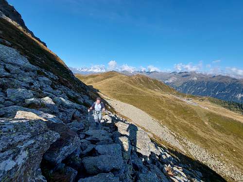
From the intersection, proceed on the path 17, at first going up a stony path through the meadows, crossing a steep slope and then passing a first very short aided section, followed by a steep rocky section that leads to a wide plateau. From the plateau, continue on a steep stony path that goes up a gully leading to a small saddle, the Jaufenscharte 2093 m.
From the saddle climb up the via ferrata equipped with iron ropes, short but exposed in some places, steep and with various technical passages, which leads to the final ridge.
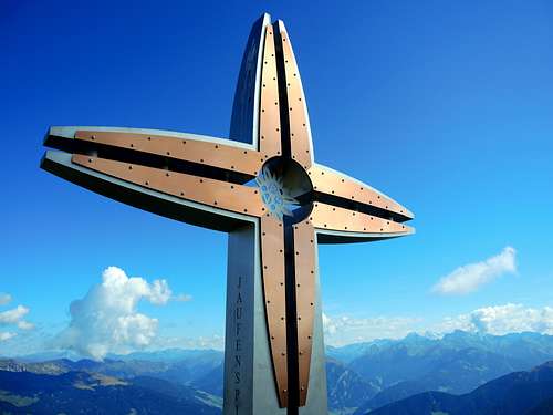
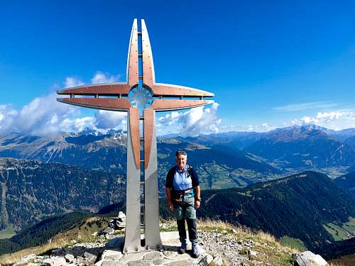
Turning to the left, walk along the last short exposed rocky ridge in view of the beautiful summit cross, which can be reached in a few minutes. Summit log and wide panorama.
Descent: reversing the same route
Red Tape
No fees no permits required
When to Climb
The best period goes from June to September
Accomodation
Various possibility of accomodation in Val Passiria and Vipiteno.