-
 14566 Hits
-
 79.15% Score
-
 11 Votes
|
|
Mountain/Rock |
|---|---|
|
|
46.73739°N / 11.27523°E |
|
|
Sarntaler Alpen |
|
|
Hiking, Mountaineering |
|
|
Summer, Fall |
|
|
9124 ft / 2781 m |
|
|
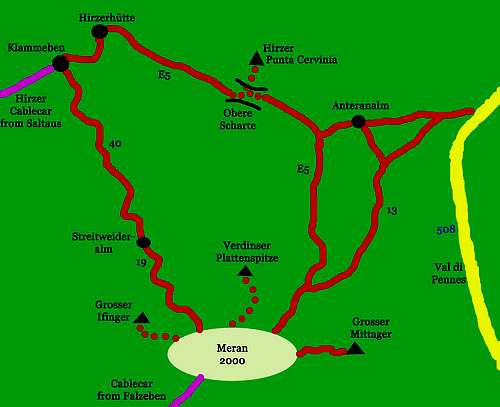
Overview
Punta Cervina/Hirzer 2781 m
As all the mountains in the region South Tyrol/Bolzano Alto Adige, located near the boundaries between Italy and Austria, this peak has two names: Punta Cervina, the italian name, and Hirzer, the original tyrolese place-name. It's a rocky mountain located in the Sarntal-Alps in the province of Bolzano. It dominates the skyline of the town of Merano, together with the southern mountains Grosser Ifinger 2581m and Verdinser Plattenspitze 2680m.
Punta Cervina/Hirzer 2781 m is located between Val Passiria/Passeiertal and Val Sarentino/Sarntal and in reason of its secluded position it presents a very broad summit panorama, that ranges from the Ötztal Alps to a large part of the central area of Alto Adige.
Punta Cervina is the highest mountain in this range (Sarntal Alps-Monti Sarentini) east of Merano and the Val Passiria. From the top of the mountain you have a wonderful view to the Dolomites, the eastern Ortler-Alps and the Texel-Group. The tour from Hirzer Hut to Obere Scharte is a part of the popular "Europäischer Fernwanderweg #E5".
The summit can be reached with various itineraries, here is described the classic routes starting from Klammeben, the mountain station of the Hirzer cable car, whose valley station is located in the lower Val Passiria in Saltusio/Saltaus, a hamlet of San Martino in Passiria. The Normal route from Klammeben is a beautiful mountain ascent to the highest peak of the Sarntal Alps, from where you can enjoy a splendid view of the mountain ranges of South Tyrol, the Dolomites and the mountains beyond the border. The tour from Hirzer Hut to the saddle Obere Scharte is a part of the popular "Europäischer Fernwanderweg #E5". There is a section equipped with metal ropes before the saddle and the final part on the summit crest is a little exposed.
If you go on holiday in Merano, you would enjoy this region in different forms of hiking. Very popular is the easy hiking of the famous "Waalweg", the water-pipeline of the river Etsch which was build to supply the apple fields and vineyard southwest of Merano. On this tour you can hike with less altitude difference. You can stop at the little huts and enjoy the famous wine, gammon and the view to the Sarntal Alps. While drinking wine you can make plans of trips for the next days, for example hiking around Meran 2000, Grosser Ifinger and Grosser Mittager or climbing Hirzer/Punta Cervina, the highest summit in the Sarntal Alps. Also you can hardly climb L'Orecchia di Lepre / Hasenöhrl (3.257m) or make a trip into the Texel-Group to the Spronserseen. All of this will be one of the highlights while staying in Meran.
|
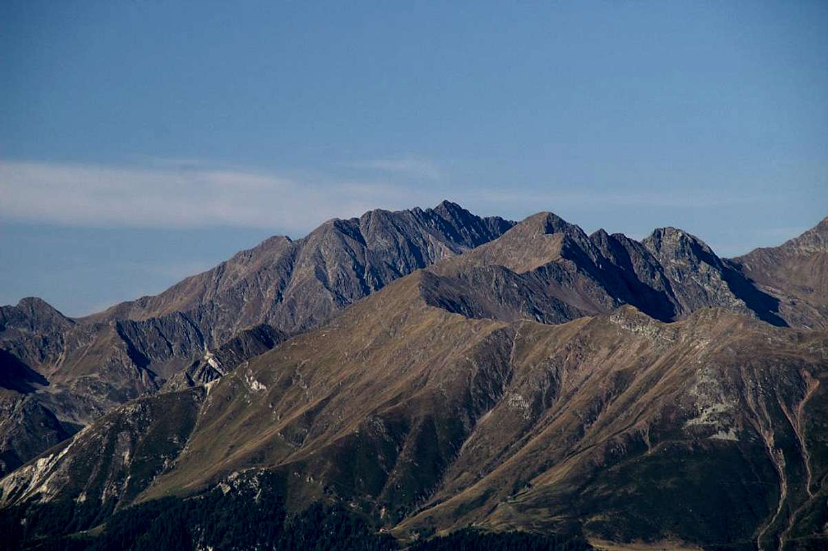
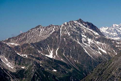
 Hirzer from West Hirzer from West |
 Hirzer from Sarner Weisshorn Hirzer from Sarner Weisshorn |
 Hirzer Hirzer |
|---|
Getting There
 Klammeben - Mountain station of Hirzer-Cablecar
Ascents from West start at the mountain-station KLAMMEBEN of HIRZER-Cablecar. The cablecar starts at SALTAUS in Passeier valley 10km North of Meran.
FROM AUSTRIA and GERMANY:
1) From INNSBRUCK you take Brenner motorway A13 and A22 to BOZEN. Leave the motorway at BOZEN and follow the S38 to MERAN. Now drive nothwards towards SAN LEONARDO through Passeier valley. After 10km you will reach SALTAUS.
(You have to pay toll on Austrian and Italian motorways except S38.)
2) From OETZTAL: From Soelden you drive over Timmelsjoch (toll: 10 Euro / closed in winter and early spring) to SAN LEONARDO and follow Passeier valley to SALTAUS or MERAN.
3) From ULM (Germany) and LANDECK (Austria): From LANDECK you drive over Reschenpass to SCHLUDERNS and eastward through the Vinschgau to MERAN and forward to SALTAUS.
FROM SOUTH: From Verona to Bozen on A22. Leave the motorway at BOZEN and follow the S38 to MERAN. Now drive nothwards towards SAN LEONARDO through Passeier valley. After 10km you will reach SALTAUS.
(You have to pay toll on Austrian and Italian motorways except S38.)
NEAREST AIRPORT:
AIRPORT BOZEN DOLOMITI
Railroad Company
Italian railroad company "TRENITALIA"
Normal route from Klammeben
Punta Cervina Normal route report
Summit altitude: 2781 m
Difficulty: hiking, a stretch equipped with iron ropes, an easy stretch exposed
Vertical gain: 850 m from Klammeben station
Starting point: Klammeben station
Fine mountain, of satisfaction and with a very broad panorama. The itinerary requires absence of vertigo and surefootedness. The route is in fact rocky, with some passages a little exposed.
The ascent itinerary starts from Klammeben, the mountain station of the Hirzer cable car 1976 m. (refuge). From the arrival of the cable car, quickly follow the dirt mule track, with a short downhill section, which leads to the Hirzer Refuge 1983 m., located on the NW edge of the Klammeben plateau. Along the mule track you go up to the Malga from where it starts a well-marked path (trail sign 4 as well as Sentiero Europeo 5) which begins towards the SE the ascent of the broad Alpe di Talle, initially along grassy clearings, then higher up between boulders and gravels, towards a ring of rocky walls. It begins an easy aided section, which climbs the rocks reaching the Giogo alto/Obere Scharte 2678 m, located along the ridge joining Punta Cervina on the left and Honig Spitze on the right. Continue to the left (North), along a small path at times on an exposed ledge which with a short downhill section reaches a crossroads. Leaving on the right the marked E5 track, which descends towards Merano 2000, you climb the slope above with finally some easy rocks, reaching the beautiful and panoramic summit of Punta Cervina 2781 m., cross).
Descent: reversing the same route
Routes to Hirzer / Punta Cervina
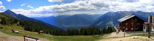
 |
 At Hirzer hut. At Hirzer hut. |
 Klammeben and Hirzer-Hut seen from Obere Scharte. Klammeben and Hirzer-Hut seen from Obere Scharte. |
 Hirzer seen from Obere Scharte. Hirzer seen from Obere Scharte. |
|---|
1)
From cable-car-station KLAMMEBEN via Hirzer-hut and "Gebirgsjaegersteig" a part of the European Hiking Track #E5 to Obere Scharte (2h). From Obere Scharte to Hirzer summit in 25 minutes. The last 30 meters to Obere Scharte is climbing with difficulty (I). The ascent from Obere Scharte to the summit goes on rubble.
2)
There are several ways to climb Hirzer from East. You could start hiking at MERAN 2000 and reach Obere Scharte via #E5 or you could start deep down in VAL DI PENNES (Penser Valley) at the road #508 (Altitude difference: 1600m!).
When To Climb: Weather, Webcam and general Informations
WEATHER IN THIS REGION
WEBCAM OF MERAN AND HIRZER/PUNTA CERVINA
DANGER OF AVALANCHES
Tourist Association Meran Tirol Algund
Freiheitsstraße 45
39012 - Meran
Southtirol - Italy
Tel +39 0473 239008
Fax +39 0473 258917
info@meran-tirol-algund.com
Hirzer Seilbahn (Cablecar) to Klammeben
Saltaus/Passeier
490 - 1980m (Middle Station "Prenn")
Ticket Up/Down: Adults ca. 18 Euro / Children 7,50 Euro
Tickets Oneway: Adults ca. 11 Euro / Children 5,00 Euro
Tel. 0473 645498
CAMPING PASSEIER / MERAN (nearby of Hirzer-Cablecar) "Untersaltaushof"
Pseirerstr. 10
I-39010 SALTAUS - ST. MARTIN
Telefon: +39 0473 645454
Telefax: +39 0473 645454
E-Mail: info@untersaltaushof.com
Hotels and Appartements in Meran
Accomodation
Meteo