| CENTRAL WASATCH LAKES |
| Photo | Lake | Topomap | Description |
|---|
![Dog Lake]() | Dog Lake | Map | Dog Lake is located northeast of Reynolds Peak and southwest of Little Water Peak. You can get there from the Butler Fork Trail or Mill D North Fork trail in Big Cottonwood Canyon or the Big Water Trail in Millcreek Canyon. It is a small lake in a forest and has no outlet. You may have already guessed that the lake is popular with hikers who have dogs. Dogs are only allowed on the Millcreek Canyon side of the ridge. |
![Desolation Lake]() | Desolation Lake | Map | Desolation Lake is located below Peak 9,990. It is also known as Lake Desolation. You can get there from Mill D North Fork by taking a right at the first junction with the Dog Lake trail. The most direct route is from Beartrap Fork in Big Cottonwood Canyon. You can also get there by hiking along Park City Ridge. |
![Willow Lake]() | Willow Lake | Map | Willow Fork is located in Big Cottonwood Canyon northeast of Silver Fork. A maintained trail goes to the lake which is also known as Willow Heights Lake. A smaller dry lake is located in the basin farther above. |
![Bloods Lake]() | Bloods Lake | Map | There are several lakes southeast of Guardsman Pass on Park City Ridge in an area that is sometimes referred to as Bonanza Flat. The four lakes include Bloods Lake, Lake Brimhall, Silver Lake, and Silver Lake Islet. Bloods Lake is located below the east ridge of Peak 10420. |
![Silver Lake]() | Silver Lake (Brighton) | Map | This is one of the easiest hikes in the Wasatch that is basically accessible to anyone. It is a short walk from the parking lot at Brighton Ski Resort. A boardwalk goes around the whole lake which makes it one of the busiest lakes in the area. The trail starts near the Brighton store which also goes toward Twin Lakes and Lake Solitude. |
![Lake Solitude]() | Lake Solitude | Map | Lake Solitude is a tiny lake located in a steep walled bowl. You can get there by hiking on the trail north of Silver Lake. It goes into the Mill F South Fork drainage and crosses beneath several ski runs. The area above the lake was used extensively during the mining era. The lake can also be reached by the Solitude Area Road. This trail branches off just north of Twin Lakes Reservoir. |
![Twin Lakes Reservoir]() | Twin Lakes Reservoir | Map | As the name says, this was originally two smaller mountain lakes that became one large lake. It is now a reservoir and there is a dam on its east side. You can hike there from Twin Lakes Pass in Alta. In Brighton, you can take the maintenance road up a series of switchbacks through many ski runs. The better way to get there is to take the Silver Lake trail and turn at the junction just north of the lake. |
![Dog Lake]() | Dog Lake (Brighton) | Map | Dog Lake is the small lake located east of Lake Mary and Lake Martha above Brighton. A signed spur trail leads to this lake that is northeast of Pioneer Peak. |
![Lake Martha]() | Lake Martha | Map | The Brighton Lakes trail can be taken to Lake Mary and it is a short hike in the area. Lake Martha is a smaller lake located southwest of Lake Mary in the same basin which is below Mount Tuscarora. |
![Lake Mary]() | Lake Mary | Map | Lake Mary is a large lake set in a glacial basin above Brighton near Mount Millicent. In 1916, the lake was made into a reservoir in order to create a water supply. A dam sits on the east end of the lake. |
![Lake Catherine]() | Lake Catherine | Map | Lake Catherine sits in a basin to the north of Sunset Peak and Pioneer Peak. You can get there from Alta or Brighton. From Alta, the route goes up Catherine Pass to the west of the lake and descends down to it. From Brighton, the trail goes passed the junctions with Lake Mary and Dog Lake and continues west. This lake was named after Catherine Brighton who was the wife of William Stewart Brighton. |
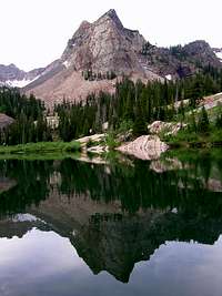
![Lake Blanche]() | Lake Blanche | Map | Lake Blanche is one of the classic lake hikes in the Wasatch Mountains. It is located at the end of the maintained trail in Mill B South Fork or more commonly known as the Lake Blanche Fork. The view of the surrounding mountains make the lake a popular destination. Sundial Peak is directly south of the lake and is a favorite subject for photographers. |
![Lake Lillian]() | Lake Florence and Lake Lillian | Map | These two lakes are located to the west of Lake Blanche. A short hike leads to Lake Florence and Lake Lillian which offers a lot more solitude. They are both smaller in size than Lake Blanche. |
![Lackawaxen Lake]() | Lackawaxen Lake | Map | Lackawaxen Lake is located below the east face of Clayton Peak (Mount Majestic). This lake is not as well known as other lakes in the area and is accessible from American Fork Canyon to the southeast. |
![Pittsburg Lake]() | Pittsburg Lake | Map | Pittsburg Lake is located in a small basin surrounded by forest south of Devils Castle. Most people view the lake from the summit of Devils Castle or Sugarloaf Peak. It is more easily reached by American Fork Canyon. The Pittsburg Lake trail is about a mile long hike from the trailhead. It starts off of the dirt road to Mineral Basin. |
![Cecret Lake]()
| Cecret Lake | Map | Cecret Lake is located north of Sugarloaf Peak and Devils Castle above Albion Basin. Its name can also be seen spelled as Secret Lake. It is an easy and short hike and a popular destination with the locals so it is not a secret. Albion Basin starts at a high elevation and is very pretty especially during summer when the wildflowers are out. There is also a lot of wildlife in the area. |
![Silver Lake]() | Silver Lake (Alpine Ridge) | Map | This lake is located on the south side of Alpine Ridge above American Fork Canyon. Silver Lake is the larger of the two lakes and can be reached by trail. Silver Glance Lake is located above Silver Lake. |
![Silver Glance Lake]() | Silver Glance Lake | Map | Silver Glance Lake is located in a high amphitheater surrounded by cliffs. The route to get there is all off trail. This lake isn't visited very much and offers a spectacular setting below Red Baldy and White Baldy. The south face of White Baldy can be climbed from this approach. Red Baldy can also be combined with this climb. |
![White Pine Lake]() | White Pine Lake | Map | White Pine Lake is located beneath the north face of White Baldy. It starts in Little Cottonwood Canyon from White Pine trailhead. The route follows the east side of the creek in White Pine Canyon. This is a long hike due to the many switchbacks on the trail. It is one of the highest lakes in the Wasatch Mountains. |
![Lower Red Pine Lake]() | Red Pine Lake | Map | Red Pine Lake is one of the most popular hikes on the Alpine Ridge. It starts from the White Pine trailhead and branches off at a junction about a mile from the trailhead. A long ridge separates it from White Pine Lake. This canyon is commonly used as an approach to the Pfeifferhorn or White Baldy. |
![Upper Red Pine Lake]() | Upper Red Pine Lake | Map | Upper Red Pine Lake sits in a basin just above lower Red Pine Lake. There may be two other lakes up there depending on snow level. The large boulder field above it leads to the ridgeline on top of Alpine Ridge. |
![Maybird Lakes]() | Maybird Lakes | Map | Maybird Lakes are a series of smaller lakes that are located in the canyon west of Red Pine Canyon. The reward for this hike is the great view you get of the north side of the Pfeifferhorn. The trail to Maybird Lakes diverges at a junction with Red Pine Canyon. The trail climbs around the ridge and enters Maybird Gulch. |
![Lower Bells Reservoir]() | Lower Bells Reservoir | Map | Lower Bells Reservoir is a low elevation lake. This is an easy hike with minimal elevation gain that the whole family can enjoy. The lake is located at the mouth of Bells Canyon. |
![Upper Bells Reservoir]() | Upper Bells Reservoir | Map | This lake is located at the end of the maintained trail in Bells Canyon. This canyon is northeast of Lone Peak on the Alpine Ridge. Lower Bells Reservoir is near the bottom of the canyon. The trail passes by the Bells Towers which have several rock climbing routes. The trail gains over 4,000 feet of elevation to the upper reservoir. To the east and southeast of the lake is North and South Thunder Mountain. |
![Lake Hardy]() | Lake Hardy | Map | Lake Hardy is a high alpine lake that is located beneath Chipman Peak, South Thunder Mountain, and Upper Bells Peak on the Alpine Ridge. There are cliffs that form an amphitheater around the lake. Lake Hardy is on the other side of the divide from Upper Bells Reservoir. You can routefind your way up through the cliffbands to reach Lightning Ridge above the lake. |














Comments
Post a Comment