-
 13145 Hits
-
 84.82% Score
-
 19 Votes
|
|
Mountain/Rock |
|---|---|
|
|
51.00684°N / 115.15045°W |
|
|
Scrambling |
|
|
Summer, Fall |
|
|
8038 ft / 2450 m |
|
|
Overview
Mount McGillivray is located back off of the Trans-Canada Highway before you reach “Dead Man’s Flats” just past Heart Mountain. You can see this large mountain if you look back south just before Pigeon Mountain on the way to Canmore, Banff and Lake Louise. It is not in the scrambles book. The South and South-east facings are quite imposing with crumbly steep slopes as seen from Heart Mountain. The north and western approaches are more inviting for the scrambler or climber. This large peak is not often climbed. The reason being, first, a very long approach to the base of the ridge (4 hours from the Trans-Canada) second, you must ascend this ridge which requires good route finding (1 hour at least). Lastly a hour and half-long ridge walk to reach the actual summit and return the same way. In best conditions it is a 12-hour day.Duncan McGillivray, along with David Thompson were two of the first white mapmaker-explorers to enter and explore the Bow Valley.
Getting There and more
The drive to the trailhead of Mount McGillivrayTo get to the trailhead travel west from Calgary (about 75 km) on the Trans-Canada Highway towards Canmore. You will see this peak ahead of you on the left as you pass “Val des Arcs the Heart Mountain exit. You must exit at Dead Man's Flats and cross over the Trans-Canada. Drive back east on the Trans-Canada till you see a small parking area to the right. There is room for 5 or 6 cars.
The trail to the ridge or base of Mount McGillivray
From this point take the fire road to the right 50 yards till you see a small trail the makes it way left into the forest. This trail will wind its way through the forest till you reach a creek of small river gully. You must follow this gully to the left or south. It is dry most of the year but would be troublesome of you were caught in major downpour. The amount of debris on this channel serves as warning to the possible force of the rush of water in the spring. (One account I have read has the trail 100 metres above the ravine. We found the drainage to be manageable).
Make you way up this drainage with its high walls rising up on either side. At one point you will pass some sport climbing to your left with its bolted routes. Looks like a fun spot. This would be the destination for most traveler of this trail. At this point you will see a huge bolder (25-30 foot) that is wedged into the canyon. There is space to walk under this object that serves as a portal to the rest of the trip.
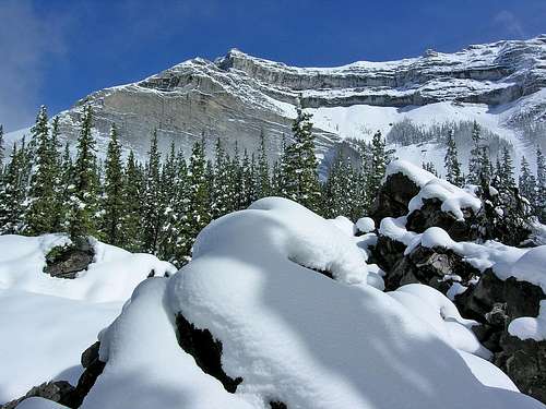
You will gradually make your way out of the drainage back into the forest, topping out into a large boulder field. You must make your way across this to the base of the mountain now visible on your left or to the east. These boulders fill the entire valley floor between Mount McGillivray and Pigeon Mountain to the west. At some point the a portion of the west face collapsed into the valley much the same way as the famous Turtle Mountain slide, called the “Frank Slide” in Crows Nest Pass. There was not mining town it its path fortunately but what ever was in its path was obliterated completely.
Once you have made over the bolder field your route finding skills will be put to the test to find your way to the top of the ridge. Then it is a ridge walk south to the true summit. The view will be your reward. Return the same way.
Red Tape
Look out for bear & fire postings. Other than that there are no rules of signs to follow for that matter.Other than these closures no other red tape for this “long” day trip.
Camping, lodging and weather conditions
I am not sure on regulations on camping in this area. While this has been treated here as a day trip, the length of the day would make this a good overnighter. I will try and find out. There are no sign posted either way.Spray Lakes West Shore Campground has 50 sites (403) 591-7226
Barrier Lake Visitor Centre 403-678-0760
Spray Lake Ranger Station. (403) 678-5533
Alberta Tourist Visitor Centre (403) 678-5277
The Alpine Club of Canada (403) 678-3200, ext 1
weather office or (403) 762-2088 for weather conditions
Alpine Club of Canada
Joining a club such as The Alpine Club of Canada is recommended when climbing in Canada. While it is not obligatory, useful information can be had at any of their Clubhouse in Canmore, or at their website which is open to everyone.www.alpineclubofcanada.ca
Staying at the club in Canmore is 21$ Canadian for members and 29$ for non-members. It can get quite crowded in the summer so a reservation is recommended.


