|
|
Mountain/Rock |
|---|---|
|
|
50.81500°N / 115.03°W |
|
|
Scrambling |
|
|
Summer, Fall |
|
|
10016 ft / 3053 m |
|
|
Overview
Fisher Peak in Kananaskis country (Elbow-Sheep Wildland Provincial Park) is not to be confused with Mount Fisher in British Columbia.
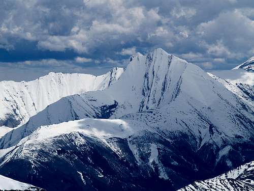
Fisher Peak is the closest mountain to Calgary which is over 10,000 ft. It is a prominent peak on the South West skyline and yet it is unknown to the average person. It is the highest peak in the Fisher Range which encompasses the mountains between Calgary and Kananaskis Highway # 40 but it is rarely climbed. There is no easy access to the peak from the Calgary side (East) and the best approach is from the West. The approach involves a strenuous 9 km mountain bike ride on a rugged horse trail covered in large rounded river rock and several creek crossings. From where you leave the bikes, there is an off trail suggested hiking route to a lower subsidiary summit (The Kananaskis Country Trail Guide - Volumes No.1 and No. 2 - Gillean Daffern – out of print) but there is no easy hiking route to the main summit. The scramble route along the NW and summit ridges is described as a difficult climbers scramble in Alan Kane’s Scrambles In the Canadian Rockies 3rd edition. (See Rocky Mountain Books)
Fisher Peak was first climbed in June, 1950 by J.F. Tarrant and party by the NW ridge, now the standard route.
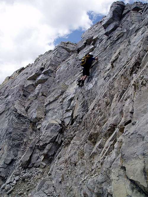
This is a climbers scramble and is one of the hardest scrambles in the book. The crux and two other steps are downclimbed on the way up.
The round trip is about 28 kilometers(17.5miles) and 1570 meters(5,150 ft) of elevation gain. We took 14 hours but there are reports of 10 to 18 hours.
Down climbing the crux by Kane route. We used the nose of the crux to be better than this route.
Access
Travel west from Calgary on the Trans Canada Highway #1 for 45 minutes. Turn South on highway #40 for 30 kilometers(x miles) to the Evan – Thomas Creek turn off which is on the left (East) just past the turn off for the golf course.
Mountain bike the trail along the left side of the Evan – Thomas Creek
Red Tape
This is in the Elbow-Sheep Wildland Provincial Park which is a protected or managed area. See Elbow-Sheep Wildland Provincial Park
for more details.
Current public safety information including fire bans, flooding, park construction, wildlife issues and avalanche reports
Alberta Parks Public Safety
Camping
There are many campgrounds in the Kananaskis valley. See
Travel Alberta
has links for all campgrounds in the Kananaskis, the National and Provincial parks as well as the commercial campgrounds.
Kananaskis Country Camping
External Links
Alberta Parks Public Safety
No matter the season, before you head out, you can always find up to date public safety information including fire bans, flooding, park construction, wildlife issues and avalanche reports
When to Climb
The season is late spring to early fall. Fisher Peak is lower elevation compared to many alpine objectives in the Rockies and can be climbed from June until October. Thunder storms can seriously drop the temperature and rain can turn to sleet or snow at any time of the season.
The best site for local conditions is the guide conditions site which has regular updates Association of Canadian Mountain Guides
Routes
Northwest ridge and summit ridge - see attached route.
NW Ridge 5.3
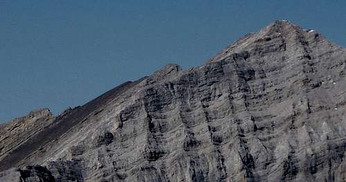
Picture of downclimbs along ridge from the East.
Guide books for climbing, scrambling, Hiking and reference for the area can be purchased through
Rocky Mountain Books
Great picture of Fisher from Mount Bogart taken by Ferenc Jacso which shows how the layers form the downclimbs along the summit ridge.


GMJ - Dec 18, 2019 10:02 am - Hasn't voted
Land management information correctionsFisher Peak actually is within a provincial park: Elbow-Sheep Wildland Provincial Park. Here is a link to the Alberta Parks website: https://www.albertaparks.ca/parks/kananaskis/elbow-sheep-wpp/information-facilities/ Generally speaking, Alberta provincial parks and wildland provincial parks impose almost no restrictions on non-motorized users (though sometimes there is a random camping ban in high-use areas (not here)). Also the link for the Kananaskis Country website is out of date. Here is the correct link: https://www.albertaparks.ca/parks/kananaskis/kananaskis-country/
Bill Kerr - Dec 18, 2019 4:16 pm - Hasn't voted
Re: Land management information correctionsThanks - corrections made.
GMJ - Feb 8, 2020 3:18 pm - Hasn't voted
Re: Land management information correctionsYou're welcome! Another thing: you mention Gillean Daffern's Kananaskis Country Trail Guide is out of print. It was, but its five full color volumes are now very much back in print: see https://rmbooks.com/book-author/gillean-daffern/
Bill Kerr - Feb 8, 2020 4:07 pm - Hasn't voted
Re: Land management information correctionsYes and I have all 5 volumes. The Daffern "hike" route to the sub peak of Fisher was a steep scramble up a rubble slope with no trail versus a hike. It was left out of the new volumes. The best access now uses the north fork of the creek and the NW drainage to attain the ridge saddle and is mostly a hike to that point. There is also a new long obscure route to Fisher summit that uses steep scree on the S or SW side that comes out near the summit so no climbing is required.