
|
|
Mountain/Rock |
|---|---|
|
|
39.13357°N / 119.80079°W |
|
|
Carson City |
|
|
Hiking |
|
|
Spring, Fall, Winter |
|
|
6345 ft / 1934 m |
|
|
Overview
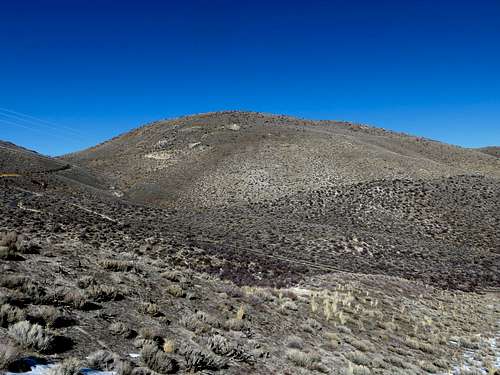 Peak 6345 from the south
Located in Southern Carson City is the Voltaire Canyon. Just north of US Highway 50, it leads up from the desert foothills west of town to the forests of the Sierra Nevada. \
Peak 6345 is a summit with approximately 340’ of prominence. It is unnamed and not even on topographic maps. The elevation comes from Google Earth™. Although not lofty, it is quite pretty, and has incredible views in all directions. In particular are the Pine Nut Mountains to the east-southeast and the Carson Range to the west. There are very interesting rock formations on its southern flank.
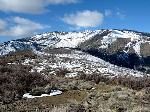 Summit view west towards the higher Carson Range peaks
A pleasant, but short hike, it offers a nice quick jaunt about 1,650’ above the Nevada State Capitol. It is completely accessible, with trail-heads just off the main road through town. Jeep roads lead to the summit and the area is popular with ATV riders. The best time to hike here is in winter. Late fall is also a good time; maybe in early spring if there are dry conditions. The roads can get quite muddy after a storm.
Getting There
The Voltaire Canyon is reached off of US 395. If coming from Reno, Nevada, take the Fairview exit (the termination of the freeway) and head west to US 395 South. Turn left and follow through the south part of town. Drive about 1 ½ miles to Clearview Drive, and take a right.
The simplest ways to approach are either from the Fandango parking lot or the water towers on Voltaire Canyon Road. It is very self explanatory once in the area. Take a right on Curry St. to reach the Fandango parking lot. If you wish to access Voltaire Canyon Road, pass Curry Street and turn right on Voltaire Street, then after 1/10th of a mile, a left on Voltaire Canyon Road.
About ¼ up Voltaire Canyon Road is a jeep road heading up the slope on the right. This leads to Peak 6345. From the water towers about 1/2 mile up Voltaire Canyon Road there is a parking area. There is a connector road about a tenth of a mile past the water towers that steeply leads up the hill to the ridge. Past that, there is another jeep road that leads into a small canyon, less than a quarter mile past the parking area at the water towers. This is preferred because it is more gradual.
These starting points range in distance and elevation gain. From Fandango, it is a little under 2 miles one-way and over 1,500’ to the summit. If starting at the road ¼ mile up Voltaire Canyon Road, it is about 1 ¾ miles one-way and about 1,425’. From the water tower routes it is about 1 ½ miles to the summit, with an elevation gain of about 1,250’. It is very steep at points.
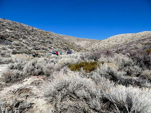 Entering the canyon north to Peak 6345
There are other opportunities to hike in the area beyond Peak 6345. A road heads down from the summit of Peak 6345 in the northwest direction. You can take it until it curves around to Kings Canyon Road, which leads into the forest.
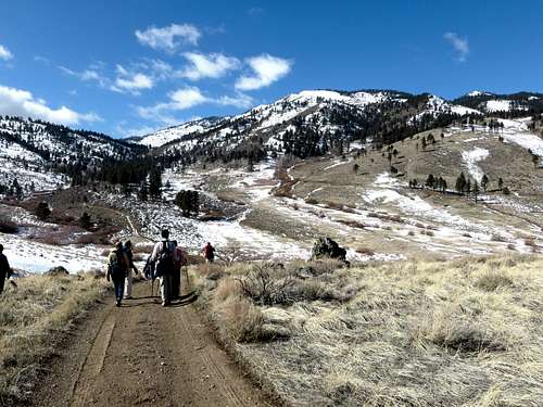 Back roads northwest of Peak 6345 leading up to the Carson Range
Red Tape
There is some private property further up Voltaire Canyon Road. Just be aware in case of any issues arising. If sticking to main roads and staying clear of properties, there should be no issues.
McCannster - Jul 6, 2022 1:18 pm - Hasn't voted
Voltaire Canyon Road accessAs of summer 2022, Voltaire Canyon Road is (seemingly) open to all forms of traffic, all the way up the hill. The beta on the main page seems outdated. I saw zero "No Trespassing" signs or any other indication that the area is private property. There are multiple forest roads signed as such that branch off from the paved section of the road on the way up. At the top of the hill, the pved road continues into 2 driveways, but you can turn off at this junction (to the right) to continue on dirt forest roads and public land. With 4WD, this makes this summit an easy drive-up.
hgrapid - Jul 6, 2022 2:24 pm - Hasn't voted
Re: Voltaire Canyon Road accessThanks! Noted