
|
|
Mountain/Rock |
|---|---|
|
|
39.10726°N / 119.8199°W |
|
|
Douglas |
|
|
Hiking, Scrambling |
|
|
Spring, Fall, Winter |
|
|
6460 ft / 1969 m |
|
|
Overvie
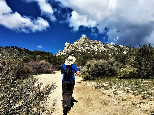
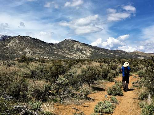
Jacks Valley Peak (aka Peak 6460) is the first mountain summit seen on the south side of US 50 en route to Lake Tahoe from Carson City, Nevada. It is an eastern foothill of the Carson Range. Surprisingly unnamed, trails lead to the summit, and white rocks adorning the mountainside make for a gorgeous trek to its summit. Reaching the summit doesn’t take long. It is easily reached by steep, sandy roads in just over 1 1/2 miles. However, the trail views, and summit views are very pleasing, and well worth the trip. There are plenty of opportunities for scrambling up the white rocks. Hiking Jacks Valley Peak, which has a respectable prominence of 720’, can be done all year. However, hiking is recommended between October and April. Late spring and summer months are far too hot, and you may run into rattlesnakes during that time or other hot weather desert critters.
Getting There
The primary approach is from Jacks Valley Road to the south. Take 395 South through the southern edge of Carson City. Go past US 50 and turn right on Jacks Valley Road. A small dirt parking area is adjacent to a trailhead sign, about 2 miles down the road on the right from Highway 395. You will pass a water tower on the way. The trailhead is at about 5,055’ at the Clear Creek Trail. There is parking along the road.
Route
From the trailhead, the road curves to the left. After 80 yards, take a right up the main road. Along the road, stay straight (right) at the first Y-junction, and 100 yards further, stay left. Once at the end of the road, about a mile from the trailhead, an obvious trail continues up towards the white rocks. The trail is steep and sandy, and weaves through the white rocks.
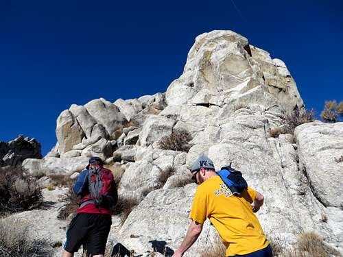 Walking up through the white rocks
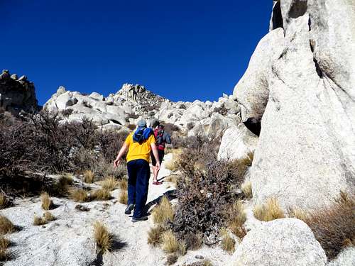 Sandy trail among the rocks
 Eventually the trail levels out, and seems to peter out, but does continue to the north (right) and eventually leads directly to the summit.
If taking the trail, the one-way distance is about 1.6 miles from the trailhead, with an elevation gain of about 1,420’. A good option is to take the Clear Creek Trail after you make the first right. This is about 150 yards from the trailhead. Take a right on the Clear Creek Trail, and take the loop, which gradually ascends. This is a good warm up, and adds only about 1/2 mile of total hiking distance.
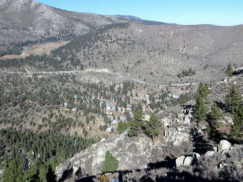 View from the summit down to US 50
Red Tape
There is no red tape on Jacks Valley Peak. The mountain is on public lands with no restrictions.