-
 15398 Hits
-
 83.1% Score
-
 16 Votes
|
|
Mountain/Rock |
|---|---|
|
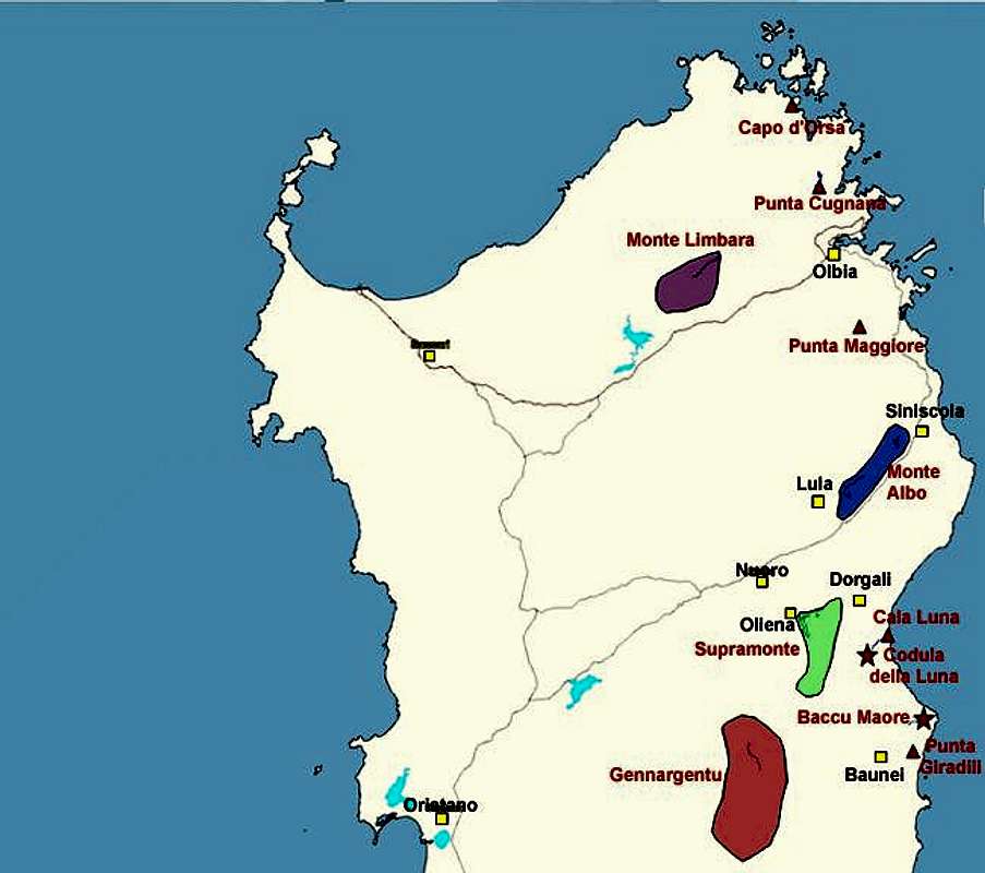
|
41.02000°N / 9.47000°E |
|
|
2133 ft / 650 m |
|
|
Overview
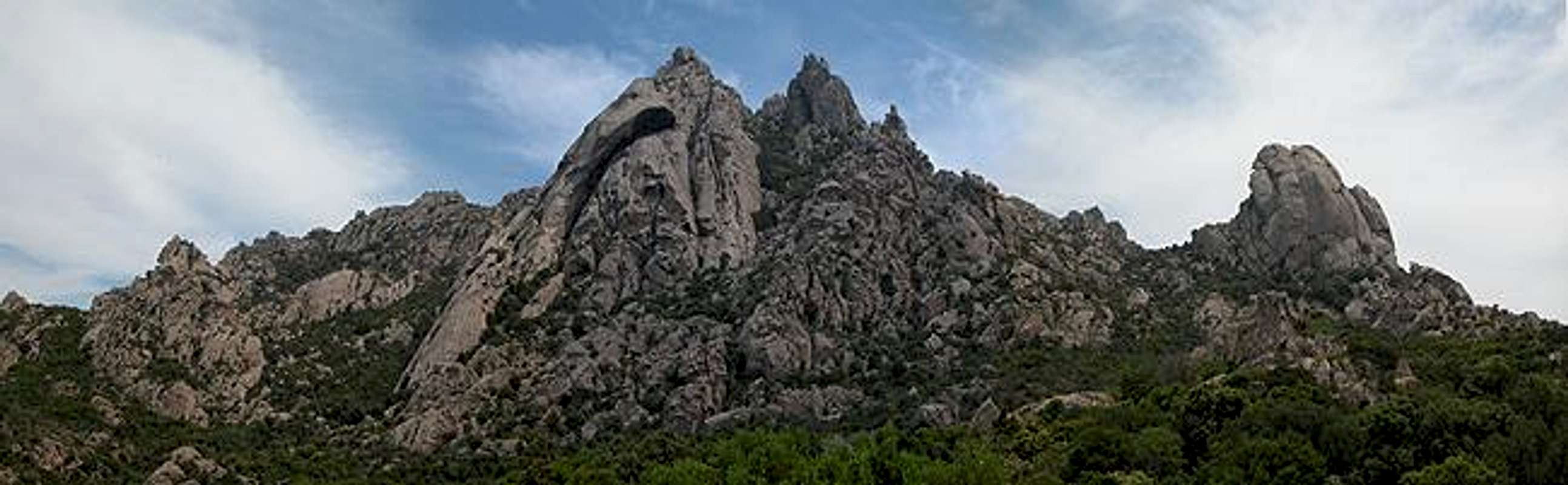
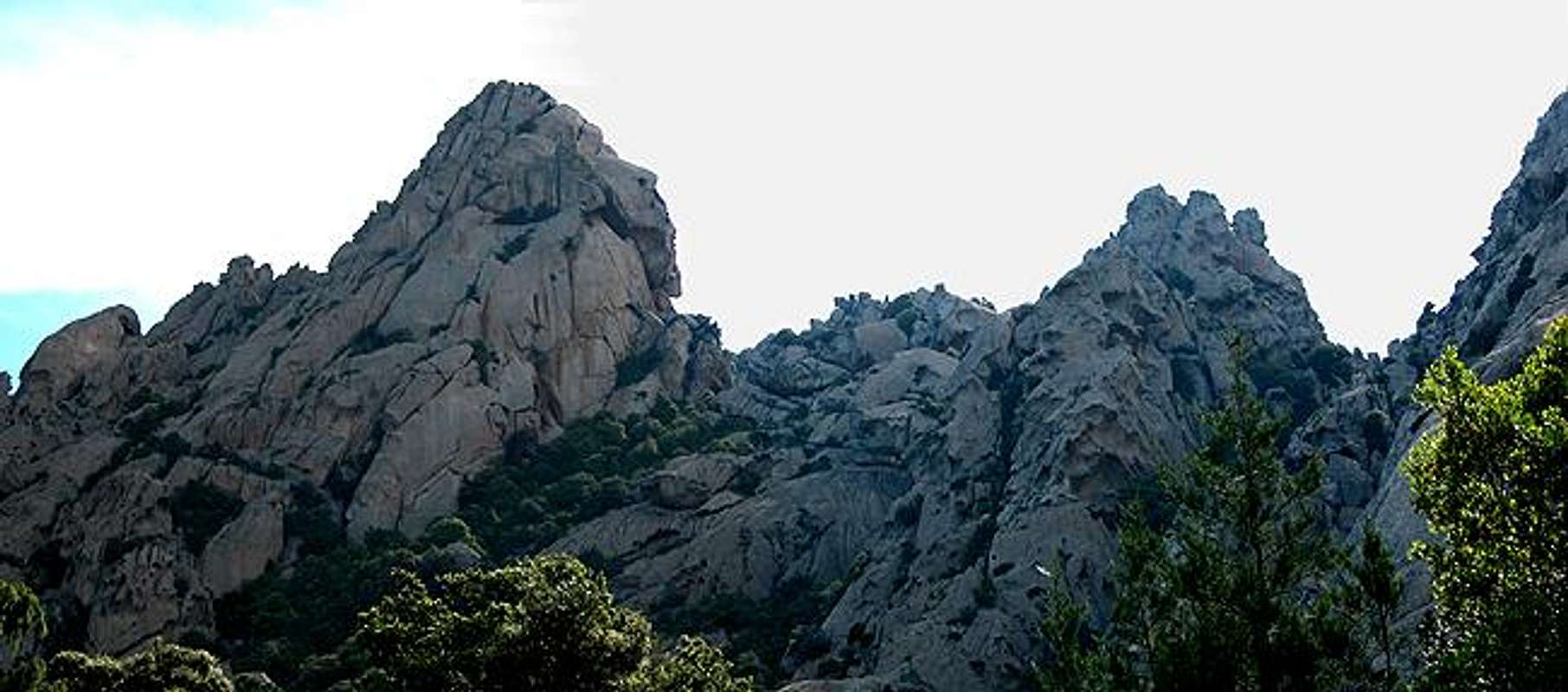
Punta Cugnana (650m) and neighbouring Punta Balbacanu (420m) are typical mountains for the northeastern part of the island of Sardinia (Sardegna). Built from red granite they form bizarre formations due to a typical erosion form called Tafoni (see the section below for an explanation). These erosion forms are typical for the islands of Corsica and Sardinia but of course occur in other places as well (like Gem Canyon in Utah. They are a tourist attraction in Corsica where a narrow road winds through one of the most pitturesqe regions I know, the Calenche de Piana. You can admire a couple of the formations on the Capo d'Orto and Capo di u Vitullu pages.
I selected Punta Cugnana not because it is remarkable in its height but rather because it offers some very typical views of the bizarre, masklike formations and is very easily accessible. Climbing these formations sure is fun. You'll be able to reach the tops with class III climbs and there are a lot of bouldering possibilities. Nevertheless the area is not so much known for climbing, probably due to the fact that many of the formations have razor sharp edges. You'll probably better stay back and admire. (The Calenche de Piana in Corsica, on the other side is a climbing region with a lot of short climbs for beginners).
One more note: the trails wind through the Sardinian macchia - the undergrowth typical for the mediterranean islands of this area. It consists mainly of wild roses, raspberries, thistles, nettles but also spice bushes like rosemary, thyme and sage. This should give you an inclination of what I want to say: you better wear long pants just to reduce the bloodletting. I didn't and just barely survived :-)
 |  |  |  |  |
Punta Balbacanu
Having missed our way to Punta Cugnana - don't follow any blue marks!!!) we climbed halfway up on Punta Balbacanu before we found out. Unfortunately that meant struggling through the Macchia undergrowth with short pants - and consequently lots of scratches and bruisses. Nevertheless it meant many pictures :-)
 |  |  |  |
Tafoni - the typical erosion structures of Corsica and Sardinia
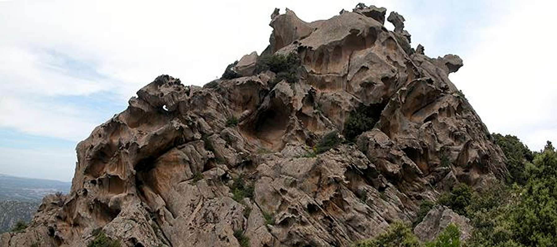
The northeastern part of Sardinia is composed of a large variety of strange looking rock formations, all having been formed by ages of erosion. Similar structures can be seen in the Calenche de Piana in Corsica and through pictures at SP I have recognized them in faraway parts of the world as well. For example see the elephant structure in Gem Canyon that Scott Patterson posted. In Corsica this kind of erosion is called Tafoni, derived from the Corsican word tafonare for "perforate". In most of the cases Tafoni have been hollowed out in a semi circular fashion.
The actual process occurs mainly in very hard rock like granite and porphyry. Usually these rocks show what in Germany is called "Cotton Sack Erosion" - smooth and round surfaces the best examples of which are Half Dome or Moro Rock. The rock erodes in sheets since moisture can only penetrate the uppermost skin of the rock.
On the contrary Tafonis occur when water is permitted (by porousness) to penetrate deep inside the rock. The process is a combination of physical and chemical erosion forms. Through capillary forces moisture within the rock is allowed to climb to the surface of the rock. Since the fluids dissolve part or the inner rock structure they can deposit these minerals on the surface which form a very hard but also very thin outside crust. In the course of time the effect weakens (or softens) the inner rock structure while the outside crust gets harder and harder.
Once the crust (mainly iron and manganese oxide) is broken and wind and rain can erode the inner and softer rock, the latter is eaten away rapidly (at least on a geological scale) like the innards of your regular breakfast egg. Since moisture will stay longer and since evaporation is occurring less on the shadowy northern parts of the rocks the crusts there remain very thin and can get broken much more easily.
The whole Tafoni process takes very long and today's Tafonis have been being created since the last ice ages.
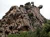 |  |  |  |  |
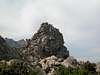
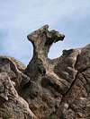
Your average nightmare
When voting on the Capo d'Orto page desainme wrote:This mountain is a real attention grabber with great photos of rocks that could have taught P. Picasso or Henry Moore about sculpture!
Right he was but I would rather compare these structures with the paintings of Breughel and Bosch: nightmarish structures that resemble the average gargoyle on gothic cathedrals. Perhaps the medevial archithects got inspired here ....
 |  |  |  |  |
More weird rocks
 |  |  |  |  |
 |  |  |  |  |
Getting There
Sardinia can be reached either by plane or by ferry. The main ports are Porto Torres and Olbia in the north and Arbatax and Cagliari in the south. Airports are at Alghero and Olbia in the north as well as (again) Arbatax and Cagliari in the south. For exploring the northeastern part of the island where most of the mountains are the best entry point is Olbia, which is where most flights go anyway.Approaching the mountain from Olbia airport
Get on motorway SS131 north around the city of Olbia on the western side. At the intersection with SS125 turn north onto it and follow it until the village of Santa Lucia where you turn northwest on SP73. This will lead you eventually to the village of San Pantaleo, where the trail around Punta Balbacanu and Punta Cugnana starts.