
-
 7121 Hits
-
 85.87% Score
-
 21 Votes
|
|
Mountain/Rock |
|---|---|
|
|
40.11959°N / 9.41313°E |
|
|
Sardinia |
|
|
Hiking |
|
|
Spring, Summer, Fall |
|
|
4318 ft / 1316 m |
|
|
Overview
Geographical classification: Sardegna - Sardinia > Supramonte > Monte Novo San Giovanni
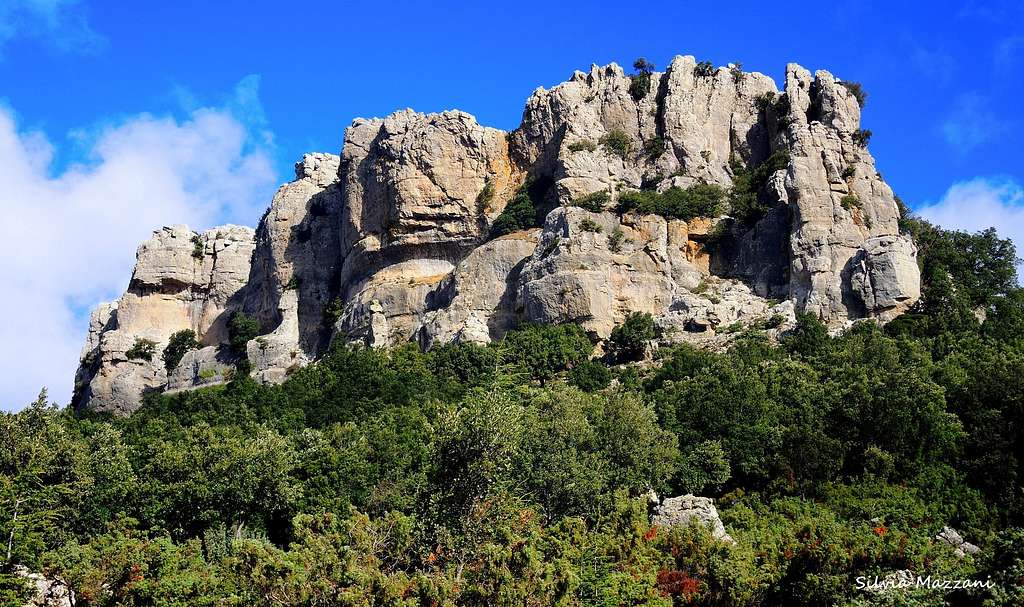
Monte Novo San Giovanni 1316 m
An interesting itinerary in a context of a landscape of rare beauty leads to the peculiar summit of Monte Novo San Giovanni, a table mountain rising with its 1316 meters of altitude from the ancient Forest of Montes. Like Perda 'e Liana, Monte Novo San Giovanni is an imposing "tacco" - meaning "heel" – an isolated limestone formation which name derives from the characteristic shape similar to a "shoe heel".

This beautiful table mountain provides a few incredibly large views over the Supramonte and the Gennargentu mountain areas. Monte Novo San Giovanni is located on the Pratobello plateau, extending at about 1000 meters above sea level, in the wide Forest of Montes, Supramonte of Orgosolo.


There are several hiking trails in this forest, but the absolute highlight is the trail to the summit of Monte Novo San Giovanni table mountain.
Getting There
Access to the island of Sardinia
Sardinia, the Westernmost region of Italy, can be reached by plane or by ferry-boat from Livorno, Civitavecchia and Genova harbors. The most convenient destination in Sardinia to visit the Supramonte di Baunei, one of the wildest region of the island, is the airport of Olbia if you’re getting there by plane; the same Olbia or the near Golfo Aranci harbors if you’re getting there by ferry-boat.

Road approach
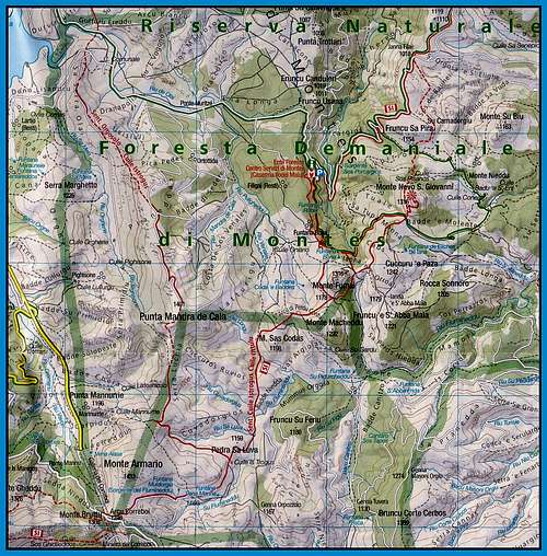
At the Western end of Orgosolo take the road to Mamoiada and soon leave it, turning left at the signpost Foresta di Montes, taking the concrete road SP48 through the Pratobello plateau. After about about 18 km the road reachs the red buildings of the fine Forest Station “Ilodei Malu”, within the dense forest of tall trees. Parking lot.

Monte Novo San Giovanni from Caserma Forestale “Ilodei Malu”
Monte Novo San Giovanni from Caserma Forestale “Ilodei Malu”
Difficulty: E
Difference in level: 350 m.
Starting point: Forest Station “Ilodei Malu" parking lot (Foresta di Montes)
This itinerary is an advisable and easy hike on a well marked route, absolutely not to be missed in reason of the natural beauties, the landscape and the 360° views offered by the top of Monte Novo San Giovanni table mountain.
From the “Ilodei Malu" Forest Station take the uphill dirt road, rising gently inside the dense forest, passing nearby the foot of Monte Fumai and getting after about 1.6 Km the source of Funtana Bona, where it takes origin the river Cedrino, one of the most important waterways of Sardinia.

|

|
From the stone fountain, the itinerary continues in the thick of the beautiful forest, reaching a great clearing at the foot of the rocky wall. Here continue straight in the direction of the rocks, taking a path that immediately reaches a signposted fork: to the left it starts the “Sentiero dei Pisani”, to the right it starts the trail to the summit. Take the right path, passing below spectacular limestone towers and getting quickly a wooden gate at about 3.5 km. from the start, near a boulder with the words “Monte Novo San Giovanni” engraved in the stone.

|

|
Here it starts a wonderful trail that could even date back to the prehistoric times. Beyond the wooden gate, climb up the staircase dug into the rock, from where it begins a spectacular and breathtaking view, ranging from the blue sea to the Supramonte with Monte Corrasi and Monte Oddeu with the Gorropu Gorge to the Gennargentu Massif and closer to the Forest of Montes and the Forest of Sas Baddes, a primary holm oak forest among the most important in Europe.


The magnificent track climbs quickly to the different and airy summit blocks, peaking over the underlying rock walls, where the view extends further. As well as a wooden lodge just below the highest point, on the top the mountain houses a fire-guard, able to monitor the whole territory, thanks to the extraordinary amplitude of the sight. Enjoy it!
Descent - from the top reverse the path engraved in the rock in order to return to the base of the walls. From here it is possible to return for the same route, or from the big stone fountain passed Funtana Bona you may leave the dirt road and take on the right of the road the "Sentiero in Foresta" (signpost), leading to Funtana Rubia and to the Vivaio Forestale, from where shortly back to the Forest Station.

|

|
Red Tape
No particular restrictions in hiking and climbing inside this area, inserted inside Parco Nazionale del Gennargentu e del Golfo di Orosei.
The wild territory of the park belongs to the Nuoro, Ogliastra and Cagliari provinces and had been established in 1998. Its 73.935 hectares' extension includes 18 communes: Aritzo (NU), Arzana (OG), Baunei (OG), Belvi (NU), Desulo (NU), Dorgali (NU), Fonni (NU), Gadoni (NU), Gairo (OG), Oliena (NU), Orgosolo (NU), Seui (OG), Seulo (CA), Talana (OG), Tonara (NU), Urzulei (OG), Ussassai (OG), Villagrande Strisaili (OG).
Nature and climate

The forest of Montes extends for 4500 hectares on elevations around a thousand metres above sea level, from the first spurs of the Gennargentu Massif, passing through the high valley of the Cedrino river and the Orgosolo Supramonte area, as far as the Rio Flumineddu river, on the eastern border. The forest is an oasis of protected wildlife: the symbol of Montes is the moufflon, but the wild boar is the species with the most numerous population. Numerous other animal species live here, like wild cats, dormice and martens. Hares, partridges and foxes live on the edges of the forest, while the golden eagle dominates the scenery. Inside the forest of Montes there is one of the oldest and largest Holm-oak forest of the whole Mediterranean area: the "Sas Baddes" primary forest, whose secular Holm-oaks live together with other botanical species, including great specimens of Minor Maple, Yew, Phillyrea and Holly. The forest of Montes has the climate conditions typical of the Mediterranean area with rain falls which are mainly concentrated in autumn and winter, few snowfalls and hot and dry summers with temperatures that can reach the thirty degrees in July and August. From the geological point of view, the area is made up of Mesozoic limestones, whose the most spectacular erosion-shapes are the heels of Monte Novo S. Giovanni, Monte Fumai and Monte Su Biu.
Summit views


When to Climb
The best period goes from May to middle November
Accomodation
B&B and hotels in Orgosolo
Meteo
Guidebooks and maps
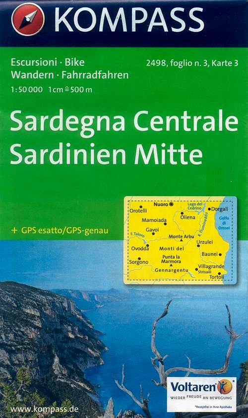 |
Sardegna Centrale
Kompass
Map 2498 sheet 3 - 1:50000
|
 |
Sardegna
Maurizio Oviglia
Guida dei Monti d'Italia
Club Alpino Italiano - Touring Club Italiano 1997
|