
|
|
List |
|---|---|
|
|
North Carolina Geography
I've been to few states that have the variety of terrain that you can find in North Carolina. County highpointing in North Carolina is sure to be just as varied. There are 100 counties in North Carolina. These counties can be divided up fairly neatly into three geographic regions. These are the Mountains, Piedmont, and Coastal regions. The mountain county highpoints contain some of the highest summits in the east. Most high points in this area have established trails leading to them. The piedmont counties have a more gently rolling topography so highpoints here can be less obvious. The coastal plain is flat as a pancake and in most places the county highpoints are all but unnoticable. Highpoints in the coastal plain may not be of much interest to the summitpost community but I include them here just for a complete comprehensive list.Mountain County Highpoints
The mountain counties easily have the most interesting terrain(at least to the SummitPost community) of all the regions. Eight have highpoints in excess of 6000’ and another 10 top 5000.’| County | Highpoint | Elevation |
| Alleghany | Peach Bottom Mt.  | 4175’ |
| Ashe | The Peak  | 5208’ |
| Avery | Grassy Ridge Bald 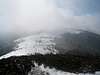 | 6189’ |
| Buncombe | Potato Knob 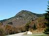 | 6400’ |
| Burke | Long Arm Mt. | 4280’ |
| Caldwell | eastern summit of Calloway Peak 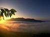 | 5920’ |
| Cherokee | 600' NW of benchmark NY 76(Tri-County Knob), S ridge of Laurel Knob on TN line | 5040'- 1, 2 |
| Clay | Standing Indian Mt. 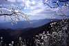 | 5498’ |
| Graham | Huckleberry Knob  | 5560’ |
| Haywood | Mt. Guyot  | 6621’ |
| Henderson | Little Pisgah Mt. | 5280’ |
| Jackson | Richland Balsam  | 6410’ |
| Macon | Standing Indian Mt. | 5498’ |
| Madison | Sandymush Bald 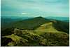 | 5152’ |
| McDowell | The Pinnacle  | 5665’ |
| Mitchell | Roan High Knob  | 6286’ |
| Polk | Tryon Peak | 3280’ |
| Rutherford | Sugarloaf Mt. | 3965’ |
| Surry | Fisher Peak | 3580’ |
| Swain | Clingmans Dome 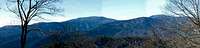 | 6643’ |
| Transylvania | Chestnut Bald 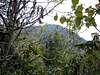 | 6040’ |
| Watauga | Calloway Peak | 5920’ |
| Wilkes | Thompkins Knob 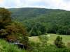 | 4079’ |
| Yancey | Mt. Mitchell 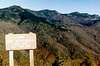 | 6684’ |
Piedmont County Highpoints
The piedmont counties have high points that vary from high monadnocks to insignifigant crossroads.| County | Highpoint | Elevation |
| Alamance | Cane Creek Mountains | 970’ |
| Alexander | Hickory Knob | 2564’ |
| Anson | Gordon Mt.(SW Summit) | 636’ |
| Cabarrus | 200' and 3400' SW of intersection of SR 1612 and 1613 | 890’ |
| Caswell | Stony Creek Mt. | 880’ |
| Catawba | Baker Mt. | 1780’ |
| Chatham | 4200' NW of intersection of SR 1003 and 1333 | 774’ |
| Cleveland | Benn Knob 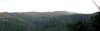 | 2894’ |
| Davidson | High Rock Mt. | 1188’ |
| Davie | ridge along SR 1317, 5900' NW of intersection of SR 1317 and 1319 | 1010’ |
| Durham | Red Mt. | 770’ |
| Forsyth | two points on SR 1636 <500' S of Stokes Co. | 1100’ |
| Franklin | intersection of NC 96 and SR 1144 | 562’ |
| Gaston | King's Pinnacle 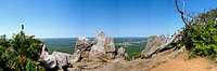 | 1690’ |
| Granville | a point 1.3 mi SE of intersection of SR 1140 and 1141 | 743’ |
| Guilford | point 1/4 mile south of NC150 at Forsyth line | 1000’ |
| Iredell | Fox Mt. | 1740’ |
| Lee | 2500' SW of intersection of US 1 and SR 1181 | 540’ |
| Lincoln | Buffalo Knob | 1480’ |
| Mecklenburg | point 1 mile east of Brockenbrough Airport | 890’ |
| Montgomery | Dark Mt. | 953’ |
| Moore | three points centered around an area 1200' N of NC 211 and SR 1146 | 730’ |
| Orange | Occoneechee Mt.(west summit) 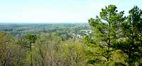 | 860’ |
| Person | 2000' SW of intersection of 501 Byp and SR 1152 in Roxboro | 888’ |
| Randolph | Shepherd Mt. | 1150’ |
| Richmond | broad area 1000' W of Norman | 620’ |
| Rockingham | point on SR 1352 <1000' E of Stokes Co, area on south side of SR 1501, 2500' NE of intersection of SR 1504 and 1505 | 1040'- 1,2,3 |
| Rowan | Youngs Mt. | 1090’ |
| Stanly | Morrow Mt. 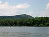 | 900’ |
| Stokes | Moores Knob 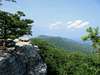 | 2579’ |
| Union | west side of SR 1357 in Stallings | 786’ |
| Vance | four points in Dabney just west of intersection of SR 1304 and 1305 | 570’ |
| Wake | 3500' N of intersection of SR 1839 and 1840 | 545’ |
| Warren | on both the east and west sides of US 1/158, 2000' E of Warren/Vance county line | 480’ |
| Yadkin | Brushy Mountains | 1755’ |
Coastal County Highpoints
The coastal counties are the most vertically challenged of the North Carolina counties. Many have numerous highpoints(Edgecombe and Martin have over 30!) As far as the SummitPost community is concerned they are of very little interest. I used the NC Geological Survey to get most of my info. For a more official picture of all the highpoints in this region visit the County Highpointers page here.| County | Highpoint | Elevation |
| Beaufort | point approx. 700' S of intersection of US 17 and SR 1131 | 66’ |
| Bertie | 3600' W of intersection of SR 1249 and 1207 | 103’ |
| Bladen | area 3500' E of intersection of SR 1336 and 1339 | 170’ |
| Brunswick | 1.6 mi W of intersection of SR 1409 and 1410, several areas centered 2 mi NW of intersection of SR 1401 and 1402, 1600' W of intersection of NC 87 and SR 1414, 4.2 mi NW of intersection of US 17/74/76 | 75’- 1,2,3,4 |
| Camden | intersection of Corapeake Ditch and Sherrill Ditch | 24’ |
| Carteret | point 300' SE of intersection of NC 24 and SR 1124 | 51’ |
| Chowan | two points 3700' and 5500' E of intersection of NC 37 and SR 1300, two points 1500' and 2700' N of intersection of SR 1418 and SR 1002 | 52’- 1,2,3,4 |
| Columbus | intersection of NC131 and SR 1519 in NW part of county | 132’ |
| Craven | intersection of US 70 and NC 41 | 76’ |
| Cumberland | 4000' SW of Coolyconch Mtn. | 486’ |
| Currituck | Luark Hill | 66’ |
| Dare | Jockey's Ridge (sand dune) | 138’ |
| Duplin | 0.5 mile N of intersection of SR 1500 and SR 1004 | 170’ |
| Edgecombe | several areas just E of RR tracks/county line south of Rocky Mount between SR 1154 and Sharpsburg | 140’ |
| Gates | point 150' E of intersection of railroad tracks and NC 37 in Gates | 85’ |
| Greene | area along SR 1140 between SR 1132 and SR 1142 | 138’ |
| Halifax | point 1900' NE of intersection of SR 1001 and SR 1400 in Roper Springs | 391’ |
| Harnett | 1500' SE of Mt. Moriah church on the south side of NC 24/27 | 490’ |
| Hertford | point 2000' SE of intersection of SR 1300 and US 158/258, point 2000' NW of intersection of SR 1180 and SR 1182 | 95’- 1,2 |
| Hoke | centered on largest building in McCain | 550’ |
| Hyde | Sand dune west of NC 12 between Knoll House Cr. and Try Yard Cr. | 27’ |
| Johnston | 2000' W of intersection of SR 1553 and 1700, 1800' E of intersection of SR 1553 and 1700 | 370’- 1,2 |
| Jones | area 1.4 mi NE of intersection of SR 1147 and SR 1148 | 125’ |
| Lenoir | Area on SR SR 1111 between SR 1165 and SR 1112 | 164’ |
| Martin | area 2500' SW of intersection of Martin, Halifax, and Edgecombe counties | 92’ |
| Nash | point 4500' N of intersection of SR 1325 and NC 58 | 360’ |
| New Hanover | 3500' NNW of intersection of US 421 and SR 1524, 2400' N of intersection of SR 1101 and 1218 | 75’- 1,2 |
| Northampton | point 2000' SW of Gaston Church in NW part of county | 370’ |
| Onslow | 1 mile long ridge 1.3 mi W of Haw Branch | 34’ |
| Pamlico | point 1400' E of New Hope Church in Reelsboro | 50’ |
| Pasquotank | point 1.2 mi NW of intersection of County Line Ditch and Insurance Ditch, point 2.0 mi NW of intersection of County Line Ditch and Insurance Ditch, point 4700' W of intersection of US 158 and SR 1367 | 21’- 1,2,3 |
| Pender | 1 mi. W of Lake Ann | 115’ |
| Perquimans | portion of a ridge 2000' SE of Joppa in NW corner of county | 52’ |
| Pitt | 1600' N of intersection of SR 1239 and US 258 | 127’ |
| Robeson | several points centered on an area 1.3 mi NE of intersection of SR 1308 and 1310 | 240’ |
| Sampson | 2500' and 3000' NW of intersection of NC 55 and SR 1005, 1700' NE of intersection of NC 55 and SR 1005 | 230'- 1,2,3 |
| Scotland | 1600' E of intersection of US 1 and SR 1346 in NW Scotland Co. | 480’ |
| Tyrell | point 2.7 miles N of Washington/Tyrrell/Hyde Co. intersection | 16’ |
| Washington | Three points in SW corner of county west of SR 1100/Long Ridge Rd | 50’- 1,2,3 |
| Wayne | 1800' NW of intersection of SR 1219 and SR 1223 | 195’ |
| Wilson | point 600' S of intersection of SR 1131 and SR 1132 | 320’ |