-
 139020 Hits
-
 95.67% Score
-
 54 Votes
|
|
Area/Range |
|---|---|
|
|
34.73570°N / 98.5838°W |
|
|
Hiking, Trad Climbing, Sport Climbing, Toprope, Bouldering, Scrambling |
|
|
Spring, Summer, Fall, Winter |
|
|
2464 ft / 751 m |
|
|
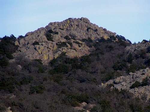
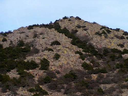
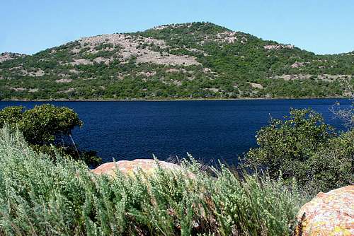
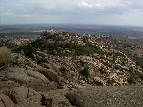
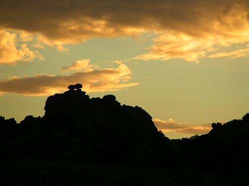
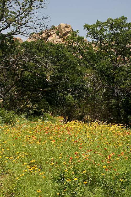
Signature image, Quartz from Baldy in Evening Light, imaged by The Lower Marmot.
Overview
| "... wilderness is ... an area where the earth and its community of life are untrammeled by man, where man himself is a visitor who does not remain ... an area of undeveloped Federal land retaining its primeval character and influence, without permanent improvements or human habitation, which is protected and managed so as to preserve its natural conditions, and which ... generally appears to have been affected primarily by the forces of nature, with the imprint of man's work substantially unnoticeable; ... has outstanding opportunities for solitude or a primitive and unconfined type of recreation ..." |
| – The Wilderness Act of 1964 |
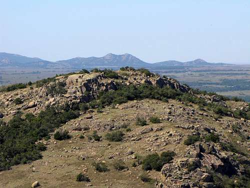
Rising dramatically from the plains of southwest Oklahoma, the Wichita Mountains are quite possibly the last thing that the casual traveler would expect to see amid the rolling “hills” and expansive fields for which the state is known. They stretch from Granite, Oklahoma to Lawton, Oklahoma. In contrast to the typical perception of the state as a climber’s wasteland, a place so flat that the state’s highest point is a stone throw from higher ground in the next state over, the Wichitas offer terrific granite peaks and crags in abundance.
There are two main regions of the Wichita Mountains of interest to climbers — the Wichita Mountains Wildlife Refuge in the east and Quartz Mountain Nature Park in the west. The Wichita Mountains Wildlife Refuge (WMWR) is located near Lawton and is managed by the United States Fish and Wildlife Service (USFWS). Included within the WMWR is Charon's Garden Wilderness. Quartz Mountain, located near Altus, is the namesake of Quartz Mountain Nature Park. Since 2002, the Oklahoma State Regents for Higher Education have managed Quartz Mountain Nature Park. Both regions are open to the public year-round for rock climbing, camping, hiking, nature observation, photography, and environmental education and interpretation.
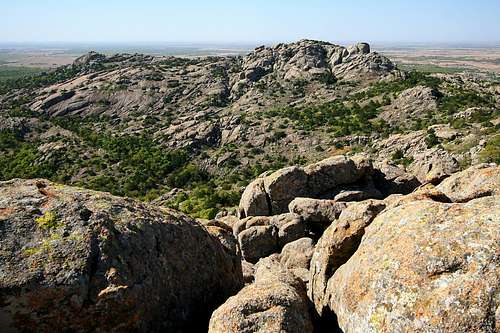
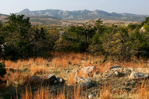
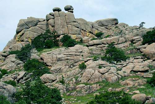
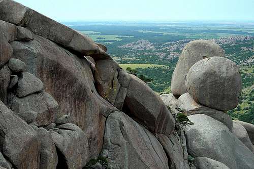
 The Crab Eyes in the Charon's Garden Wilderness. Imaged by Splandswest.
Geological History and Geography
The geological history of the Wichita Mountains began with the deposition of late Precambrian to early Cambrian sandstones. These sandstones were intruded by coarse gabbro sills about 575 million years ago as the region began to rift apart in a failed continental breakup. The gabbro intrusion was followed by erosion and further intrusion of granite accompanied by volcanic eruptions of rhyolite lava and explosive volcanic breccias some 50 million years later. Following these igneous episodes the region subsided and shallow sea sediments consisting of sandstones and limestones were deposited over the area.
During the Pennsylvanian Period (330-290 million years ago) the region was subjected to intense pressure during the continental collision that produced the Ouachita Mountains to the east. This resulted in faulting and folding along with up to 20,000 feet of local uplift. This uplift created rugged mountains which have been reduced to their present state by erosion. At 2,464-feet, Mt. Scott is the second tallest mountain in the Wichita Mountains Wildlife Refuge (WMWR); Mt. Pinchot in the WMWR Special Use Area is twelve feet taller. Other noteworthy peaks are Mt. Sheridan (2450'), Baker Peak (2423'), Mt. Marcy (2420'), Mt. Lauramac (2430'), Mt. Tarbone (2390'), Elk Mtn. (2280'), Cedar Mtn. (2269') and North Mtn. (2232').
For more information, visit the Wikipedia page (from which much of the preceding information was obtained):
o Wikipedia Wichita Mountains Entry
Human History
The human occupation of the Wichita Mountains region begins in prehistory. It was a favored hiding place of both Comanche and Kiowa Indians. The Spanish are known to have traded with the Indians, and legends of Spanish gold hidden amongst the rocks of the mountains still persist. French traders passed through the area in the 1770s. It is from them the name Wichita is derived. (Wichita is from two archaic Wichita Indian words: "Weets", which means "man" and "ee-taw" which signifies "of the north". The Wichita Indians felt that their original ancestors issued from the rocky points of the mountains. The French traders likely ascribed the name to the mountains.)
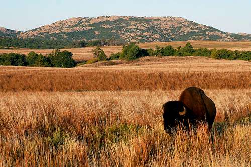 A bison grazes in the morning light below Elk Mountain. Imaged by Mark Doiron.
The first American to enter the range was Colonel Henry Dodge, who dickered with Indians in the Wichitas in 1834, while trying to halt raiding on the Santa Fe Trail. In 1843, Texas Republic President Sam Houston authorized negotiations to take place between the Texans and the Comanches. The Texan delegations found the Comanches in the Wichitas and it was there that the treaty was drafted and signed. The Marcy surveying expedition explored the Wichita Mountains during the same expedition that took them to the Caprock Canyonlands.
The Wichita Range was eventually brought under the jurisdiction of the Fort Sill Agency, located just south of the mountains. Fort Sill was the reservation to which the Comanche, Kiowa and some of the Apache were relocated. The Kiowa chief, Lone Wolf, the Comanche Quanah Parker, and the Apache Geronimo, were residents of the Fort Sill Reservation.

Mining took place in the Wichitas, although it petered out at the beginning of the 20th century. Doris Campground began its life as a mining camp. In 1901 the refuge was split off of the Fort Sill Agency and established as the Wichita Forest Reserve. In 1905 President Theodore Roosevelt altered its status to a game preserve when he visited the Wichitas. It was then added to the fledgling National Wildlife Refuge system. Bison were introduced in 1907 and elk were transferred from the Elk Refuge in Jackson, Wyoming shortly thereafter.
The Wichita Mountains Wilderness was established in 1970. It is located on 59,020 acres. 22,400 acres are open to public use, including the Charon’s Garden Wilderness (5,723 acres). The remainder of the wilderness is found in the North Mountain Unit (designated a special use area), which is a part of the refuge reserved for the wildlife (unescorted public access is not permitted, but special tours are conducted).
Quartz Mountain was established as a CCC camp in late 1935 under the direction of the National Park Service. The Oklahoma State Park Commission was created March 1, 1935 as a subdivision of the Oklahoma Game and Fish Commission. The commission learned the National Park Service was willing and anxious to assist the state in developing a state park system. One of the requirements was that the state must own the land on which parks were located. The City of Altus and private citizens donated 3,000 acres of land at Quartz Mountain to create one of the seven original Oklahoma state parks.
Climbing using modern techniques at Quartz Mountain began in the late 1960s and early 1970s. The majority of climbing routes were established netween 1978 and 1982. At that time the property where the mountain is located was privately owned by Ted and Margaret Johnson, who allowed climbers access for several decades. To ensure the area was preserved, it was purchased by the Access Fund and the Wichita Mountains Climber's Coalition in 2001. Six days later it was donated to the State of Oklahoma. In 2002 the area was designated the Quartz Mountain Nature Park.
Getting There

Wichita Mountains Wildlife Refuge is located west of Medicine Park, OK on Oklahoma Highway 49. From I-44 take Highway 49 (exit 45). Go west 10 miles to the refuge gate. If coming from Highway 62, take Highway 115 (Cache exit) north to the refuge gate.
Baldy Point is located in the Quartz Mountain Nature Park, 17 miles north of Altus, OK. From I-40, take Highway 44 (Exit 53) south approximately 45 miles to Quartz Mountain Resort entrance. If coming from Highway 62, turn north near Altus on State Highway 283.
Use the map above to help determine the best driving directions based on your departure point.
Wichita Mountains Wildlife Refuge
The 59,020-acre Wichita Mountain Wildlife Refuge hosts a rare piece of the past -- a remnant mixed grass prairie. Included within the refuge are the 5,723 acre Charon's Garden Wilderness, and the 36,620 acre Special Use Area. Charon's Garden Wilderness was designated by the Wilderness Act of 1964 to provide a remote, pristine environment offering visitors a chance to discover the solitude and adventure offered by wilderness lands. The Special Use Area is set aside for research, breeding of animals and preservation of endangered species. With the exception of the occasional guided tour (e.g., bugling elk tours in the fall), entry to the general public is not allowed.
WMWR is an island where the natural carpet of grass escaped destruction because the rocks underfoot defeated the plow. This prairie community hums with life. More than 50 mammal species, 240 bird species, 64 reptile and amphibian species, 36 fish species, and 806 plant species thrive at the refuge. It provides habitat for large, native grazing animals and Texas Longhorn cattle (which are allowed to roam wild because of their historical significance to the region). Bison, elk, deer, coyotes, red-tailed hawks, prairie dogs, turkey, bunch grasses, post oak and blackjack oaks are present in abundance.
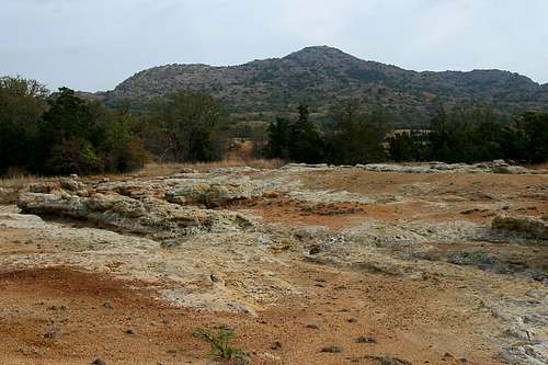
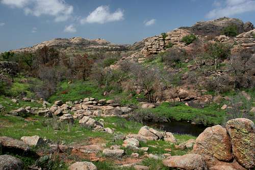
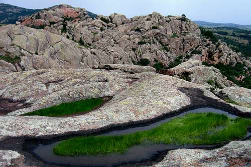 Pothole ecosystems in Charon's Garden. Imaged by Mark Doiron.
Hiking
There are nine designated hiking trails in the Wichita Mountains Wildlife Refuge, ranging in length from about 0.3 to 5.7 miles. Some of these trails are suitable for making more extended hiking adventures. However, backcountry camping is limited to designated off-trail areas in Charon's Garden Wilderness. You can learn more about Charon's Garden Wilderness on the SP page:
o SP Charon's Garden Wilderness Page
A map of all of the WMWR hiking trails is available here:
o Hiking Trails of the Wichita Mountains Wildlife Refuge (map)
Charon's Garden in the spring imaged by Mark Doiron.
Camping and Lodging
There are two campgrounds in the Wichita Mountains Wildlife Refuge. Doris Campground has 90 sites including 23 electrical sites (RVs or tents) 47 non-electrical sites (RVs or tents), and 20 walk-in sites (tents only). All of these sites are first-come/first-served. The cost is $8.00-18.00/night, depending on location and electricity. There are also three group campsites, suitable for tents or RVs. These sites are available for reservation up to three months in advance (see more information below). The cost is $28.00-40.00/night, depending on amenities. Doris Campground is approximately eight miles west of the refuge entrance on the main road (highway 49). It has bathrooms, showers, drinking water and a telephone. There is a campground host at the entrance. If arriving after hours (10:00 pm), do not occupy a site without prior registration. Individuals not camping at Doris Campground may use the showers for $2.00. For more information on Doris Campground, visit the site below:
o Doris Campground
Fawn Creek Campground is set aside for youth groups up through the university level. Reservations are accepted up to three months in advance. The rate ($5.00/group/stay) is very appealing, if your group qualifies. Groups may be from 8-30 persons. The campground is located on the eastern flank of Elk Mountain, adjacent to the Charon's Garden Wilderness. There are fire grates and picnic tables at each of the four campsites. A men's/women's pit toilet is shared by all of the sites. A water spigot is available at the park headquarters, a few minutes drive away. These sites are available for reservation up to three months in advance (see more information below). For more information on Fawn Creek Campground, visit:
o Fawn Creek Campground
Backcountry camping is allowed by permit in a designated area of Charon's Garden Wilderness. The backcountry camping is excellent due to the scenery and the solitude (no more than ten persons per night). You can reserve a backcountry camping permit up to three months in advance. Here is the backcountry camping information brochure as provided by the Wildlife Refuge. Highly recommend that you bring all your own water. There are several water sources nearby including a running stream and a pond near Sunset Peak. However, the Charon's Garden Wilderness hosts longhorn steer, bison, and elk, all of which frequent the water sites. These sites are available for reservation up to three months in advance (see more information below). For more information on camping in Charon's Garden, visit:
o Backcountry Camping
Outside the refuge, Lawtonka Campground, run by the city of Lawton, offers tent sites, full hook-ups, bathrooms and showers, and groceries approximately two miles north of Medicine Park on highway 58.
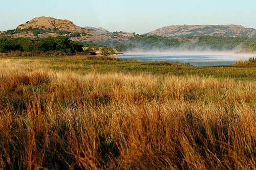
 Mt. Scott, Mt. Wall and Mt. Sheridan as seen from Latonka Campground.
Lodging: The best place to stay if you are not camping is the Stardust Inn Bed and Breakfast located at the entrance to the refuge. They feature western style accommodations and each room has a two-person Jacuzzi tub. Pegi and Clark Brown, innkeepers, have welcomed climbers for years. They are located at the refuge entrance on Haskell’s Way, which is on the north (right) side of Highway 49. For reservations at the Stardust Inn Bed and Breakfast, call (580) 529-3270. For more information, visit:
o Stardust Inn Bed and Breakfast
Dining
This section is here only because there are two special places to eat when at the WMWR. The first is at the Meers Store and Restaurant, about 3-1/2 miles north of the refuge.

Take Hwy. 115 to the town of Meers. The town is little more than the restaurant. But it's here that they serve the world famous "Seismic Meers Burger", a 7-inch diameter, 1-pound hunk of longhorn beef that comes on its own plate, divided into fourths. Of course, being world famous means that this place will be quite crowded at times. Don't be surprised if you have a 30-minute or more wait to be seated. For more information, call them at (580) 429-8051, or visit their website:
o Meers Store and Restaurant
For just as good a meal, with no wait, turn right at Meers on Meers-Porter Hill Road, and travel four miles until the road ends. Across the highway will be Ann's Country Kitchen (26020 State Highway 58). The moderately priced dinners are great with large portion sizes; the Indian taco is highly recommended. Be sure to check out the dessert selection when you first arrive and to reserve one: They're outstanding and sell out quickly, even while you're enjoying the main portion of your meal. For more information, contact the restaurant at (580) 492-4087.
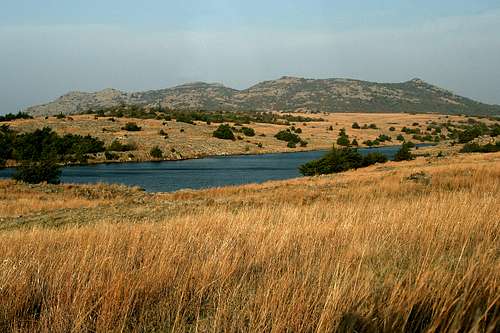
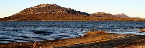
 Quanah Parker Lake, Little Baldy and Elk Mountain. Imaged by Mark Doiron.
More Information
For more information about the Wichita Mountains Wildlife Refuge, please contact:
U.S. Fish and Wildlife Service
Wichita Mountains Wildlife Refuge
Route 1, Box 448
Indiahoma, OK 73552
Telephone: (580) 429-3222 (including camping reservations)
E-mail: wichitamountains@fws.gov (not for camping reservations)
Official Website: Wichita Mountains Wildlife Refuge
Quartz Mountain Nature Park
Located next to Lake Altus-Lugert, Quartz Mountain Nature Park is surrounded by rough granite hills and outcroppings. The park consists of 4,284 acres, plus 6,260 lake acres. Much of the area was formerly known as Quartz Mountain State Park (it was one of Oklahoma's original seven state parks). Today, it is officially known as Quartz Mountain Arts and Conference Center and Nature Park, though locals usually refer to the mountain as Baldy Point. While the arts and conference center plays host to a number of artistic events throughout the year, the nature park has plenty of outdoor adventure opportunity. During BioBlitz 2006, a total of 1,192 species were inventoried, including 16 mammals, 96 birds, 18 reptiles and amphibians, 27 fishes, and 272 plants.
Hiking
There are more than a dozen short trails in Quartz Mountain Nature Park. They are in length from a few hundred feet to about 0.7-miles. None are particularly challenging for the typical SPer. Worth noting, however, is Blackjack Pass Trail. This 0.7-mile trail begins in the northeast corner of Cedar Valley, where it splits from the Cedar Creek Trail. It gains nearly 300 feet of vertical elevation as it climbs up and over Blackjack Pass to the upper portion of Rock Creek Canyon. From the top of the pass, visitors can scramble off-trail to the top of Quartz Mountain (2040-feet). Because of hunting on adjacent private property, some trails are occasionally closed. You can learn more about the park's trails, and whether they're open for hiking, here:
o Quartz Mountain Nature Park Trails
Camping and Lodging
At Quartz Mountain Nature Park there are five camping areas. Eighteen have full hookups and 101 have electric/water hookups (5 handicap accessible). There are also 84 primitive sites, and a group camp with a capacity of 125. Restrooms, showers and sanitary dump stations are provided. For more information on camping, use the contact information below, or visit here:
o Quartz Mountain Nature Park--Camping
For more information on the group camp, use the contact information below, or visit here:
o Quartz Mountain Group Camp
There are also a lodge with 118 guest rooms and suites; 8 two-bedroom cabins (with kitchenettes); one three-bedroom, two-bath family cabins (with kitchen); 2 two-bedroom, two-bath cabins (with kitchenettes); and the Mountainview Bunkhouse (a 64-person dormitory). For more information on the lodge and cabins, use the contact information below, visit here:
o Quartz Mountain Arts and Conference Center Lodge and Cabins
For more information on the lodge, call them toll free at (877) 999-5567, ext. 1, or visit their website here:
o Quartz Mountain Resort
More Information
For more information about Quartz Mountain Nature Park, please contact:
Quartz Mountain Nature Park
Route 1, Box 40
Lone Wolf, OK 73655
Telephone: (580) 563-2238
E-mail: quartz@onenet.net
Official Website: Quartz Mountain Nature Park
Climate and Weather
Fall is the best time for outdoor activity in the Wichita Mountains. Springs can be nice, and have the advantage of a great wildflower display to delight the senses. However, springtime thunderstorms are a frequent threat. Summers are usually very hot, so morning and evening activities are recommended. Winters can be nice, though cool. Winter temperatures will occasionally drop below freezing at night, but will often be pleasant for outdoor activities during the day. Regardless of what season one plans to travel to the Wichitas, it's best to keep an eye on the near-term forecast:
o Seven-Day Forecast for Indiahoma, OK (WMWR)
o Seven-Day Forecast for Altus, OK (Baldy Point/Quartz Mountain)
Peaks, Rocks and Canyons
Climbing in the Wichita Mountains offers opportunities from easy Class 1 hikes to highly technical, 5.13 and higher climbs. Much of the hiking is characterized by bushwhacking through dense scrub brush to reach a desired summit or crag. The benefit of that is often solitude that may be missing from other, more easily accessed destinations. The granite rock for technical climbs has been likened to that at Joshua Tree and Yosemite. Duane Raleigh, Jon Frank, Bill Thomas, Mike Hankins, Rick Thomas, Jimmy Ratzlaff and Mark Herndon cut their teeth here. Much of the credit for development and continued access to these climbs belongs to both the Access Fund and the Wichita Mountains Climbers Coalition.
What follows is a listing of the peaks and crags that have pages on SP. Each one has a link to the USGS quad topo that shows that particular feature. These topos are used under the Creative Commons License. There are many other lessor summits and rocks in this fascinating area. You can use the topos to find other destinations of interest. For an interactive map that shows the relative location of the following formations, click here. For additional information on technical routes in the Wichita Mountains, check out the following links:
o Rockclimbing.com Wichita Mountains Page
o Rockclimbing.com Baldy Peak/Quartz Mountain Page
Wichita Mountains Maps
The following are maps of the Wichitas showing the geography of the range as well as the public access areas.

Wichita Mountains West

Wichita Mountains East

Charon's Garden Wilderness
Additional Resources
The following books may prove useful to hikers and climbers in the Wichita Mountains:
o Hiking the Wichitas: Now YOU Can Find It! by Alan Thode Lots of information on hiking in the Wichita Mountains.
o Oklahoma Select--A Climber's Guide by Tony Mayse Includes easy to read topo's, gear lists, route lengths, anchor stations and first ascent information for the Wichita Mountains.
o Outdoor and Trail Guide to the Wichita Mountains of Southwest Oklahoma by Edward Charles Ellenbrook A quaintly written book about outdoor recreation in the Wichita Mountains. Includes fascinating descriptions of area history. However, some of the trail/feature descriptions are cryptic at best, making finding things that much more challenging.
o The Oklahoma Climber's Guide by Chuck Lohn Out of print and may be difficult to find, but definitely worth the effort.
External Links
o Wikipedia Wichita Mountains Entry Lots of info about the geology and history of the Wichita Mountains.
o Wichita Mountains Wildlife Refuge Official home page of the Wichita Mountains Wildlife Refuge (WMWR).
o Hiking Trails of the Wichita Mountains Wildlife Refuge (map) A .pdf map of the hiking trails in the WMWR (will open in new window).
o Doris Campground Official website with information about campsites at Doris Campground in the WMWR.
o Fawn Creek Campground Official website with information about Fawn Creek Campground in the WMWR.
o Backcountry Camping Official website with information about backcountry camping in Charon's Garden Wilderness in the WMWR.
o Stardust Inn Bed and Breakfast Website for a bed and breakfast near the WMWR that caters to climbers.
o Meers Store and Restaurant Website for a local restaurant that serves the world famous "Meers Seismic Burger".
o Quartz Mountain Nature Park--Park and Camping Official website for information about camping at Quartz Mountain Nature Park.
o Quartz Mountain Group Camp Official website for information about group camping at Quartz Mountain Nature Park.
o Quartz Mountain Arts and Conference Center Lodge and Cabins Official website for information about the lodge and cabins at Quartz Mountain Arts and Conference Center.
o Quartz Mountain Resort Official website with information and to make reservations for the lodge at Quartz Mountain Nature Park.
o Seven-Day Forecast for Indiahoma, OK (WMWR) National Weather Service website with seven-day forecast for Indiahoma, and current weather for Lawton-Fort Sill Regional Airport.
o Seven-Day Forecast for Altus, OK (Baldy Point/Quartz Mountain) National Weather Service website with seven-day forecast for Altus, and current weather for Altus/Quartz Mountain Regional Airport.
o Rockclimbing.com Wichita Mountains Page A comprehensive listing of technical climbing routes in the WMWR is linked from this page.
o Rockclimbing.com Baldy Peak/Quartz Mountain Page A comprehensive listing of technical climbing routes on Baldy Point is linked from this page.
o Access Fund Official website of the Access Fund, a national advocacy organization that keeps climbing areas open and conserves the climbing environment.
o Wichita Mountains Climbers Coalition Official website of the Wichita Mountains Climbers Coalition, whose mission is to insure that the climbing resources and natural environment of the Wichita Mountains are protected.
|
SP Image |
SP |
USGS |
| Mountain Description |
||
|
|
||
|
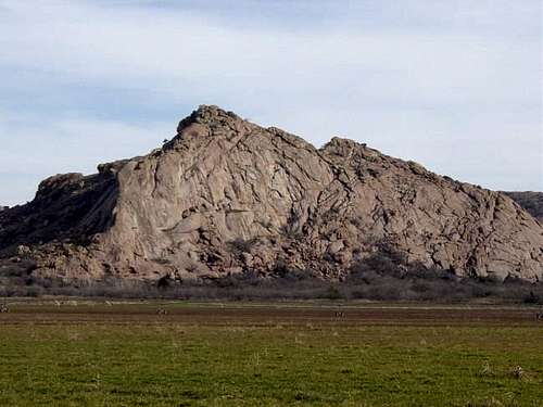
Haley Peak (2475 feet) is located on private property about 3/4-mile from the northwest corner of the Wichita Mountain Wildlife Refuge. Officially the peak is unnamed, while locals refer to the mountain range as the "AX" mountains. From the west you can see the outline of trees on the side of the mountain which look like the letters "AX". Because it is located on private property, permission is required before climbing it. |
||
|
|
||
|
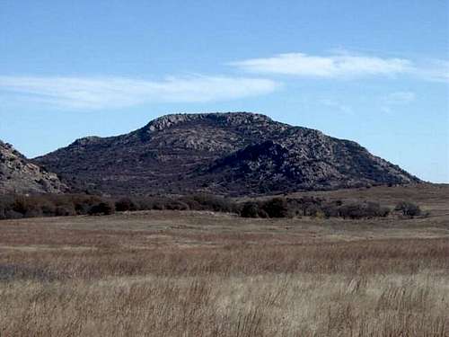
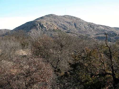
Mount Scott (2464 feet) is probably the most well known peak in Oklahoma next to the high point of Black Mesa. For climbers, Mt. Scott is famous not for its summit, but for its outstanding cragging on the granite walls on the north side of the mountain. However, if you wish to forego the crags and reach the summit, the easiest way is to drive to the top via the paved road. |
||
|
|
||
|
Mt. Sheridan (2436 feet) is very noticeable from the east, north and west with distinct features that resemble Diamond Head in Hawaii. If standing below the north face of Mt Sheridan, you will notice an ominous vertical rock cliff near the top of the mountain. Unfortunately, the southernmost part of the mountain, including the most gentle approach from the southwest, is located in the special use area of WMWR; hiking/climbing are not permitted. The northernmost portion of the mountain, with its very steep approaches and including the actual summit, is on private property. |
||
|
|
||
|
King Mountain (2411 feet) stands proudly over Lake Altus-Lugert and the Quartz Mountain Massif as the highest point in a 40 mile radius. It is the fourth highest point in the Wichita Mountains and the Kiowa County high point. The route to the top is an easy class 2 scramble, possibly with some minor class 3 moves. The summit provides excellent views of the surrounding area, including Quartz Mountain, Baldy Point, Lake Altus-Lugert, Hicks Mountain, Williams Peak, Mount Lugert and Flat Top Mountain. |
||
|
|
||
|
Gordon Peak (2382 feet; unofficial name) is the southernmost of two peaks in what are known locally as the Christmas Mountains. Directly to the north of Gordon Peak is Cooper Peak (identified on the quad topo). Gordon Peak is in the shape of a gentle cone and is an easy, non-technical climb involving mostly boulder-hopping and easy to moderate scrambling. It is located on private property; obtain permission before attempting to climb. |
||
|
|
||
|
Elk Mountain (2270 feet), located within the WMWR, is another jewel in the chain of granite domes that make up the Wichita Mountains. For technical climbers, the object is not to get to the summit, but to climb its wonderful granite slabs and cracks. Elk Mountain hosts four climbing areas: Elk Slabs, The Treasure Cove, Apple and Pear, and Secret Agent Dome, all with over 55 routes from 5.5 to 5.11c. There is also a class 1 trail to the summit via the Sunset picnic area on the north side of the mountain. |
||
|
|
||
|
Mount Lincoln (2201 feet) rises in the southeastern part of Charon's Garden Wilderness. It is the closest major peak to the south trailhead, and is just south of the more popular Elk Mountain. There are no trails to the summit, and the climb is very rocky and rugged. During the climb there are stunning views of the south walls of Elk Mountain, a substantial portion of Charon's Garden Wilderness, and east into the eastern Wichita Mountains. Wildlife, including elk and longhorn, are often seen in the area. Once you start your bushwhack, humans will virtually disappear. |
||
|
|
||
|
Twin Rocks Mountain (2192 feet) is one of six 2,000 ft. peaks (there are several more minor peaks over 2,000 ft.) located within the Charon's Garden Wilderness. It is the most central peak in the wilderness, and offers some great 360 degree views from its summit. This granite peak offers typical class 3 and class 4 scrambling. Because of its difficult access, you will likely be alone on its summit. |
||
|
|
||
|
Sunset Peak (2180 feet) is actually a small massif with three summits. The southern-most summit is the highest. Located within Charon's Garden Wilderness, Sunset Peak is a gem of a day hike. Solitude, brought on by a lack of trails, is the attraction of this little peak. The lack of trails means that a climb of Sunset Peak will involve a lot bushwhacking. Regardless, a hike to Sunset Peak is accompanied by the joy of meandering across scrub oak prairie and granite domes, often with an occasional sighting of deer, bison and elk. Technical rock climbing opportunities also exist; there are several very difficult (5.11 and above) bolted routes established on the wall of the west side of the north summit. |
||
|
|
||
|
Granite Mountain (2177 feet) rises on the remote and very rugged western side of Charon's Garden Wilderness, making it a great wilderness climb with very little chance of seeing anyone on or near the summit. As with other locations within the wilderness, Granite Mountain offers plenty of bouldering, and probably contains some walls high enough for some technical rock climbing. There are no trails to the summit. |
||
|
|
||
|
Mt. Wall (2175 feet) is located toward the eastern end of the WMWR. It is eclipsed in prominence by nearby Mt. Scott and Mt. Sheridan. Its relative remoteness means that you will likely run into few other parties during an ascent. If bushwhacking and a lack of crowds suit your fancy, Mt. Wall provides a wonderful wilderness experience. The easiest route is Class 2+, but technical ascents are readily available if desired. |
||
|
|
||
|
Mount Mitchell Massif (2145 feet, unofficial name) is a collection of unnamed peaks in the more remote section of Charon's Garden Wilderness. Of the six 2000 foot+ summits that are in the wilderness, Mount Mitchell Massif is the the only one that is officially unnamed. There are five major points on the massif itself, along with two more nearby summits (Pt. 1928 and Pt. 1860). |
||
|
|
||
|
Central Peak (2082 feet) is a rather unnoticed mountain situated between Rush Lake and Lake Jed Johnson in the central part of the WMWR. The western base of the mountain extends into the Special Use Area. The summit consists of two points, an east and west point. The view is well worth the effort to reach the summit. From the east point you can see Mt. Scott, The Holy City, and Lawton. From the west point you can see Little Baldy, Mt. Lincoln, Elk Mountain and Sunset Peak. Here you are also afforded a fabulous view of the Special Use Area. |
||
|
|
||
|
Crab Eyes (1920 feet) are a unique rock formation in the northern part of Charon's Garden Wilderness. The name comes from two large boulders delicately balanced on a thin column of granite. One of the two boulders is actually balanced on top of a third boulder, rather than the column itself. Technical climbing (5.8 through 5.12a) is popular on Crab Eyes, and there are numerous routes established on the east, west and south walls. The north side of Crab Eyes tapers off gradually, providing a route to the top for non-technical climbers willing to brave some exposure. |
||
|
|
||
|
Charon's Garden Mountain (1905 feet) is less than distinct from the summits of nearby peaks, and there are a number of unnamed summits to the west that are higher. It would be an easy mountain to completely miss, however it takes on a new dimension of ruggedness and grandeur when viewed from its foot. Despite its proximity to some roads and buildings, the approach is quite long, and the mountain is the epitome of isolation. It is very rarely climbed; you are unlikely to see another person once you get away from the seething crowds of easier summits. Composed of the excellent granite characteristic of the Wichita Mountains, a plethora of class 3 and class 4 routes await the casual scrambler. Enormous slabs of virgin rock await the more serious. |
||
|
|
||
|
Bat Cave Mountain (1855 feet) is located in the southeastern corner of Charon's Garden Wilderness. It should not be confused with the unofficially named Bat Cave Peak, which is adjacent to Bat Cave Mountain. Bat Cave Mountain is named after the easily seen, but less easily accessed, Bat Cave (sometimes called Wind Cave) located on its southern flake. On its northern side, Bat Cave Mountain also has the easily viewed Arch Cliff Dwelling, which is also known as Natures Dwell. |
||
|
|
||
|
Bat Cave Peak (2070 feet), formally referred to as Unnamed 2070, is located in the western portion of the Wichita Mountain National Wildlife Refuge. Not to be confused with the officially named Bat Cave Mountain, Bat Cave Peak is generally located at the end of the higher ridge extending south from Mt Lincoln. Bat Cave Peak is one of the most prominent, eye-catching formations in the refuge, especially if you are viewing it from east to west. It has the appearance of a thumb or knob protruding toward the south. It is the most dominating point at the confluence of the three mountains in the immediate area ... Bat Cave Peak, Bat Cave Mountain and Phantom Mountain. |
||
|
|
||
|
Lawtonka Mountain (2040 feet), unofficially renamed from Peak 2040, is located to the NW of Mount Scott. From the summit of Lawtonka Mountain there are commanding views of Lake Lawtonka, Hunting Horse Hill, Mount Wall, and the west face of Mount Scott. |
||
|
|
||
|
The Narrows is a beautiful canyon in the WMWR. Although not a mountain, The Narrows hosts some of the best granite face and crack climbing in the Midwest. This area should be on everyone's Wichita Mountains climbing list. The approaches are relatively short and the views are spectacular. There are over 100 routes from 5.4 to 5.12c. Most of the routes are traditional climbs; however, there are many quality sport routes. |
||
|
|
||
|
Styx Canyon, not quite 1.5 miles in length, is the longest and largest canyon in Charon’s Garden Wilderness. The canyon has two very different portions. The upper canyon, beginning just over a ridge from the infamous Crab Eyes, extends about 0.6 miles to the southwest. This section of the canyon is very narrow and filled with massive truck sized boulders. Where the boulders do not choke the upper canyon, one finds small groves of post oak and juniper. By the time it passes beneath Twin Rocks Mountain, upper Styx Canyon is about 400 feet deep, with high, sheer granite walls, particularly on the east side. The lower portion of Styx Canyon stands in stark contrast to the upper section of the canyon. Where the upper half was a narrow, boulder clogged fissure, the lower half is a broad, lush valley, nestled between the towering Twin Rocks and Granite Mountains on the east and Charon’s Garden Mountain in the west. Unnamed, high granite walls complete the encirclement of this isolated vale. A small, seasonal creek drains the valley, flowing out into the farmland at the foot of the mountains. |
||
|
|
||
|
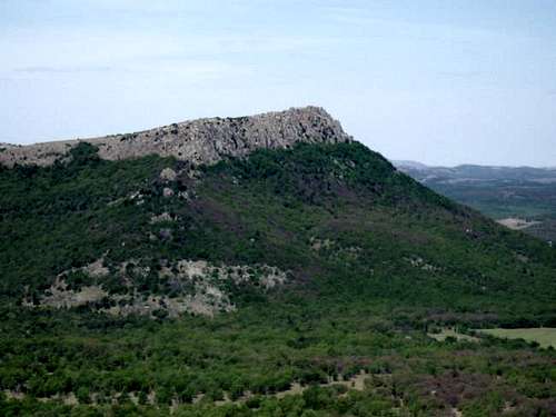
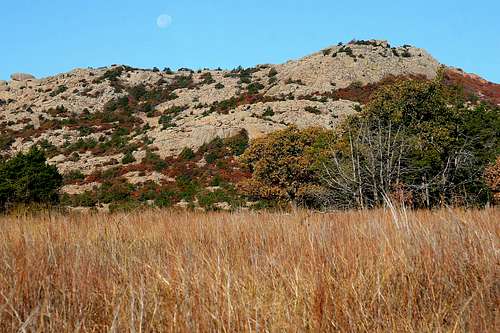
Quartz Mountain (2040 feet) in Quartz Mountain Nature Park rises 500-feet out of the southwestern Oklahoma wheat fields at the far west end of a long chain of granite domes that make up the Wichita Mountains. Rising up to 300 feet on Quartz Mountain granite face is Baldy Point (local name). It offers one of the best examples of granite face climbing outside of Yosemite. With up to 180-foot walls, the rock has been compared to that at Joshua Tree and is considered some of the most challenging around. Quartz has over 87 routes of mostly sport climbs, with some trad lines sprinkled in, as well as several RX solo routes. With climbs from 5.5 RX to 5.13, Quartz is not considered a beginner area. Although bolted, most routes require nerve and boldness not normally needed for your average crag. Visit Quartz and you will come away with a sense of accomplishment. |
||
|
Wichita Mountains West, Public Access 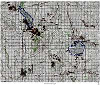 Click to enlarge |
Wichita Mountains East, Public Access 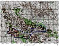 Click to enlarge |
|