
-
 19845 Hits
-
 85.87% Score
-
 21 Votes
|
|
Area/Range |
|---|---|
|
|
36.17000°N / 117.0883°W |
|
|
Hiking, Mountaineering, Scrambling |
|
|
Spring, Summer, Fall, Winter |
|
|
11049 ft / 3368 m |
|
|
Overview

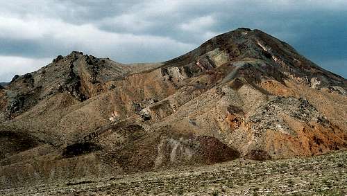
From the Emigrant Canyon approach
Welcome to the roof of Death Valley National Park (DVNP). From the summit of Telescope Peak, the highpoint of this great range, one can look more than two vertical miles down to the basement of the Western Hemisphere, the salt flats of Badwater Basin, and then turn around to see what was once the roof of all the United States and is still the ceiling of the Lower 48, Mount Whitney. Along the way, climbers and hikers can enjoy sweeping views of a landscape so surreal that it has been the backdrop of more than one sci-fi/fantasy film, including the original Star Wars. A lucky few will spot bighorn sheep, and the details-oriented will admire the time-ravaged forms of bristlecone pines, earth’s oldest living organisms. Some bristlecones in California’s White Mountains and in Nevada’s Great Basin National Park were mere saplings when the great pyramids of Egypt were under construction. A few were already ancient. Take that for a little bit of perspective.
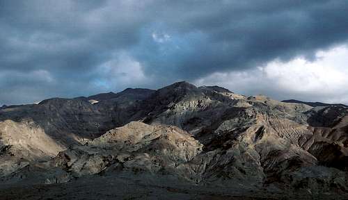
This is the Panamint Range, the higher of DVNP’s two great mountain ranges, the other being the Amargosa Range. The two ranges run roughly parallel to each other, the Panamints being the western range, and together they share some of the geologic responsibility for Death Valley proper, the lowest and hottest place in the United States. In fact, Death Valley now holds the record for the highest temperature ever recorded by accurate instruments (134 F). I once experienced 130 F at Badwater, and that was quite hot enough. At that kind of point, just forget what people say about the desert’s dry heat.
Near Towne Pass
The Panamint peaks on SP are already attached to the Death Valley and California Desert Peaks pages, but I thought making a page grouping just these peaks would be useful. If you’re visiting DVNP and want to get into this range, perhaps this page will save you some research time and will provide some helpful information. Also, I hope this page helps people navigate the Death Valley page (a nice page), which covers a national park that is approximately equal in size to the state of Connecticut and is the largest national park in the Lower 48. DVNP is a vast and varied landscape that offers at least a lifetime’s worth of exploring.
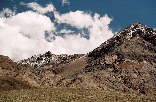
Tucki Mountain
CA 190 artificially but conveniently splits this range into two sections, the southern being the more impressive and the better-known. The northern section includes the subrange called the Cottonwood Mountains, the highest of which is Tin Mountain, which more or less marks the northern end of the Panamints. Although this area is not as high and dramatic as the peaks well to its south, it offers rugged solitude to adventurers who want to explore places that see little or no human traffic.
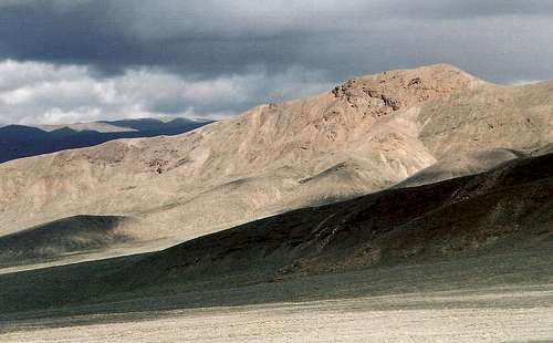
Tin Mountain
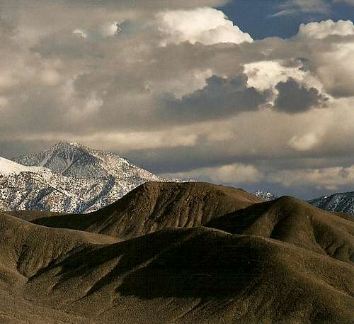
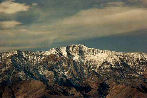
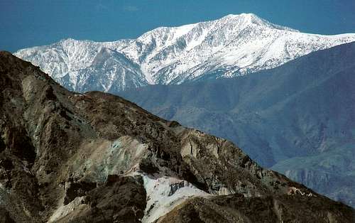
The southern part, especially the area around Telescope Peak, is the headline-grabbing one, and deservedly so. The eastern and western faces of the southern Panamints provide some of the greatest vertical relief to be found anywhere in the world (over 11,300 vertical feet from Death Valley to Telescope’s summit). And Telescope and Wildrose Peaks are, quite simply, beautiful mountains. Telescope in particular is visible from many different areas of the park and always draws the eye when it is (please see the Perspectives section).
Near the Wildrose area
Getting To Know the Panamints
If seeing the Panamints from the car is enough for you, then there are three areas that are probably better than all others are to do so: Zabriskie Point, where there is a classic view over the badlands of Golden Canyon, across the salt pan of Death Valley, and to the highest of the Panamints; Dantes View, about a vertical mile above Badwater and offering an in-your-face view of Telescope Peak (although I am not certain, I am almost sure that this was the spot from which the Star Wars scene in which Luke Skywalker and Obi-Wan Kenobi overlook Mos Eisley was filmed); and the drive south from the Furnace Creek area to Badwater and beyond. Note: although I’ve now alluded to Star Wars twice, I am not one of those people who dress up like the characters or camp out (in costume, too) for movie tickets, but I did grow up with the original movies and did/do love them.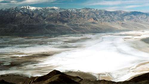
From Dantes View
But SP members seem not to be given to windshield tourism. The easiest and probably the best way to get one’s feet into and on the Panamints is to drive past Wildrose Campground (see Getting There, two sections below) and hike either to Wildrose Peak or Telescope Peak. Wildrose Peak is about 8.4 miles RT and 2200’ of elevation gain. Telescope Peak, almost two thousand feet higher than Wildrose, requires about 14 miles RT and 3300’ of elevation gain. The last part is quite steep and may require some scrambling, and an ice axe, crampons, and snowshoes/skis may be required in winter and early spring.
When To Go
The Panamints are accessible in all seasons. In summer, Telescope Peak and its immediate neighbors, Rogers and Bennett, may provide the only reasonable respite from the deadly heat in all of DVNP. But don’t count on it--- since temperatures drop approximately 3 degrees F for every 1000’ up, the summit of Telescope Peak is likely to still be in the upper 80s or even the 90s on the hottest days, and that’s 3000’ up a trail that has you exposed to the sun almost every step of the way. Winds may cool you off some, but they may not--- DVNP is subject to what in the Sahara people call the sirocco, which is a hot desert wind. On the day I experienced 130 F at Badwater, a strong wind was blowing, and it was just plain hot.Winter is a nice time to experience the Panamints, but see the section above for precautions about climbing Telescope Peak during this season. The other peaks are rarely inaccessible except immediately after storms that cause road closures.
Late spring and early fall are the best times to go. In most years, there will be little or no snow and temperatures will be pleasant, even a bit chilly around the mountaintops. But those are also the times when the trails will be their busiest.
Getting There

Northern section...

Southern section...


Aguereberry Point-- by lisae.
To get to the northern parts of the range, drive to the Ubehebe Crater area, and head down Racetrack Road, which is rocky and rutted in places but is usually passable for most cars. The paved road to the Ubehebe Crater area takes off about 9 miles east of Stovepipe Wells and 19 miles west of Furnace Creek off CA 190. Another way is the long approach from Big Pine, CA, via the Big Pine Road. This route, much of which is unpaved but is passable for most vehicles, leads for about 73 miles to the turnoff for Ubehebe Crater.
-------------------------
To reach the southern parts of the range, where the trails and the highest peaks are, look for the road up Emigrant Canyon; this road is 8 miles west of Stovepipe Wells off CA 190. This paved road goes for 21 miles to a road junction where the left fork leads to Wildrose and Mahogany Flat. It is about 8 more miles to Mahogany Flat. After passing the trailhead for Wildrose Peak, the road becomes steep, rocky, and rutted. 4WD is not necessary in dry conditions, but high clearance is unless you are very patient and very skilled or just don’t give a damn about your car.
Along the way to Mahogany Flat, take time to visit Skidoo, an abandoned townsite from the area’s mining days; Aguereberry Point, which perches high above the salt pan far below; and the charcoal kilns, where charcoal was manufactured for the now-defunct mining industry in Panamint Valley.
The road up Emigrant Canyon can sometimes be closed due to weather-related conditions. If that is the case, take the Panamint Valley Road, about 3 miles east of Panamint Springs, south for 15 miles to its junction with the road to and through Wildrose Canyon. This road climbs 9 miles to the junction described two paragraphs above. Be aware that the last few miles to the junction are unpaved, rough, steep, and winding, and this section is closed to vehicles longer than 25’. High clearance is nice but not imperative.
Beyond the Wildrose junction, vehicles longer than 25’ are prohibited.
Some Different Perspectives of Telescope Peak
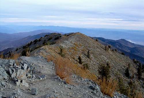
Looking down the summit ridge; check out the Bristlecones. Photo by Eleutheros.
Camping
Mesquite Springs is a small campground near Ubehebe Crater and charges a fee. It has flush toilets and water.Near the trails for Telescope and Wildrose Peaks, there are three campgrounds, all of which are small, and all of which are free. From lowest to highest, they are Wildrose (4100’), Thorndike (8200’), and Mahogany Flat (8200’), which is at the Telescope Peak trailhead. None have flush toilets, and only one, Wildrose, has water, and then only from April to November.
Red Tape
There is a $20 entrance fee for the park. There are no entrance stations, but be honorable and stop at a visitor center, ranger station, or self-pay station to pay the fee.Distances are long and help is often far away. Before heading out, have plenty of water (one gallon per person per day is recommended) and fill your gas tank at the nearest station. The closest gas stations are at Panamint Springs and Stovepipe Wells.