
|
|
Area/Range |
|---|---|
|
|
38.88860°N / 119.5025°W |
|
|
Hiking, Scrambling |
|
|
Spring, Fall, Winter |
|
|
9451 ft / 2881 m |
|
|
Overview
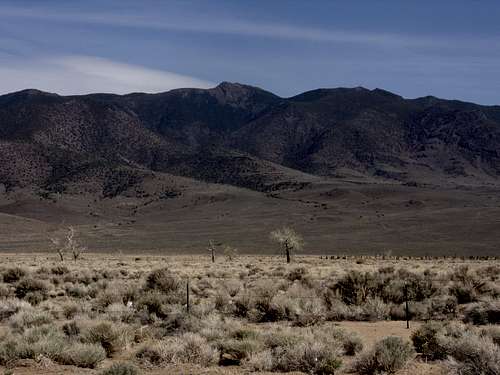
The Pine Nut Mountain Range is located in Northwestern Nevada, stretching over 30 miles north-south from Dayton, Nevada to Nevada State Route 208, about 4 miles north of Topaz Lake. The mountains spread only about 10-12 miles wide throughout most of the range. It is bordered on the west by the Carson Valley, which stretches 14 miles to the Sierra Nevada. The western part of the range is about 20 miles east of Lake Tahoe.The Pine Nut Mountains top out at 9451’ in the southern part of the range at Mount Siegel. Although these are desert peaks, there is plenty of foliage and the lower slopes are covered in thick brush, Pinyon Pine and Juniper trees. There is usually snow on the higher peaks from December through April. However, most of the heavy snowfall is absorbed by the Sierra Nevada to the West. Snowmelt comes fast in May when temperatures heat up in the region.
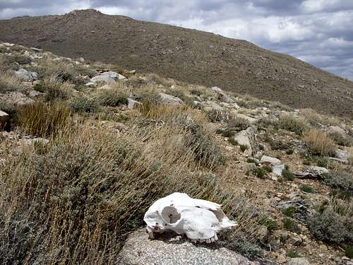
Skull below Mount Siegel
The name of the range comes from the Pinyon Pine trees that grow throughout the forest below, especially in the southern part. These trees yield edible pine nuts still picked today from its slopes.
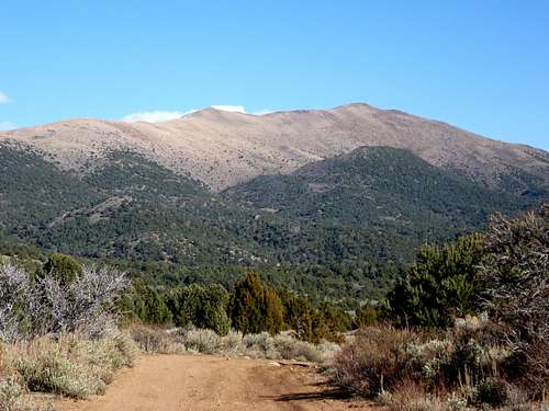
There are no hiking trails in the Pine Nut Mountains and no established trailheads. However, plenty of dirt roads make their way up and down the slopes of these mountains. This is due in part to the history of mining throughout the range.
Getting to many of the peaks of the range is challenging, including its highest summits, Oreana Peak 9346’, and Galena Peak 9416' and Mount Siegel 9451'. Dirt roads predominate in this area, and 4WD high clearance vehicles are recommended if traveling to any of these peaks.
Perhaps one reason the Pine Nuts don’t get much attention is their proximity to the Sierra Nevada. Located only 20 miles away, and full of hiking trails and pine forests, the Sierra Nevada are a far more attractive location for the 300,000+ residents of Northwestern Nevada.
So, why bother with the Pine Nut Mountains in the first place?
Well, one reason is solitude. The range has far less visitors. Another is diversity of geology and geography. The Pine Nut Mountains are far different than their western counterparts. Far from barren brown hills, the Pine Nuts are home to enormous granite cliffs, gigantic rock formations, and are topped by wide treeless meadows. In fact, the highest summits of the Pine Nuts are actually higher than all of the highest summits directly east of Lake Tahoe! (Only the lower slopes of Monument Peak are approximately the same elevation as Mount Siegel, reaching about the same height directly east of the southernmost tip of the lake. The highest summit directly east of Lake Tahoe, however, is Snow Valley Peak at 9214’.)
The more adventurous traveler can find numerous rock formations to explore. There are a number of rocky points along the way, and steep formations just begging for new routes to be pegged.
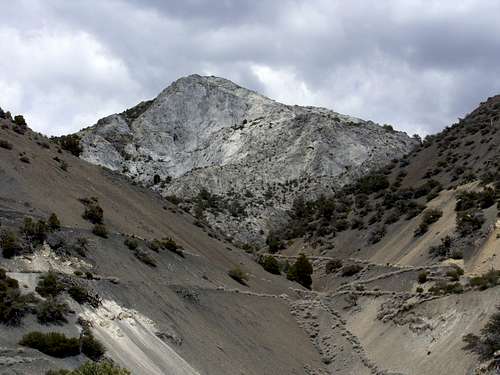
Large granite cliff in the southern Pine Nut Mountains
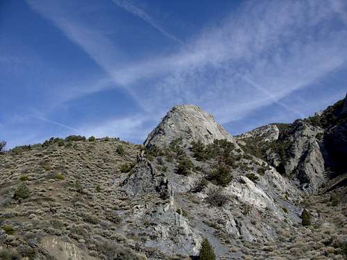
Granite boulder along the jeep road to Oreana Peak
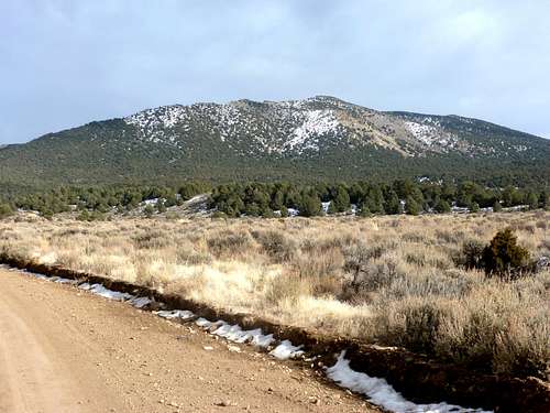
Hiking in the Pine Nut Mountains can be done as early as February, depending on the amount of snowfall in any given year. The best times to hike here are generally March, April, May, late October, November, and early December. June through most of October is generally too hot and too dry, and the Sierra Nevada are preferred during this time.
Of critical importance - DO NOT HIKE THE PINE NUT MOUNTAINS WHEN GROUND IS WET! Often times, Search and Rescue has been called to pull cars out of the mud. Wait until at least a few days of dry, relatively warm conditions predominate before driving the back roads in the Pine Nut Mountains.
The southern 2/3rds of the range is in Douglas County, with the rest mostly in Lyon County. A small portion in the western part of the range is considered part of Carson City, although none of the major summits are in Carson City, just foothills.
Primary mountains
As noted above, the highest summit in the Pine Nut Mountains is Mount Siegel at 9451’. It shares a ridge with Galena Peak, the only other named summit in the range above 9400’. Oreana Peak 9346’ is two miles away from Mount Siegel. All three can be hiked together in an simple day hike; albeit by a 4WD road up the Red Canyon.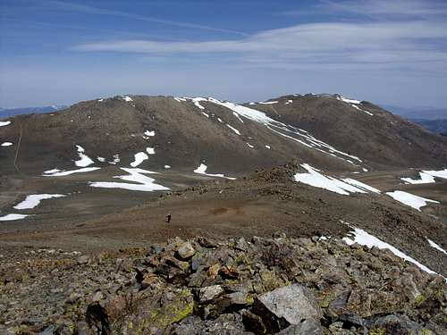
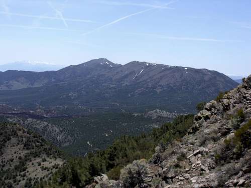
Galena Peak (left) and Mount Siegel (right) seen from Oreana Peak
A string of 9,000’ + summits are located just south of Galena Peak and Mount Siegel. None of them are very prominent, although Bald Mountain 9,228' is the highest in the southern edge of the range.
Mount Como represents the only 9,000’+ summit outside of the southern part of the mountain range. At 9,005’ it is a worthy summit to reach. It is bald at the top, and has excellent views. Getting within close proximity isn't too bad. There are a few options from an off-shoot from the Sunrise Pass Road that are fairly accessible from Johnson Lane, south of Carson City (details in the next section and on the Mount Como page). A trailhead further south (and requiring more significant drive time) allows hikers to add Rice Peak 8872' about 2 3/4 miles to the south. This can be achieved via a ~12 mile loop using existing jeep roads.
Mount Como seen from the northwest.
One of the more accessible summits in the Pine Nut Mountains, Mineral Peak, is on the way to Mount Como. At 8319’, Mineral Peak is a respectable summit, and can be climbed most of the year (aside from summer when it is quite sweltering).
Mineral Peak West face from Sunrise Pass Road
One of the more accessible mountains is probably Rawe Peak 8,328'. The northernmost summit in the Pine Nut Mountains, Rawe Peak rises almost 4,000 feet above the town of Dayton on US Highway 50. The primary access road to Rawe Peak is located about 15 miles east of Carson City, and requires an additional 2-4 miles of driving up a moderately rough road to get to the recommended starting points. Rawe Peak is covered in thick mahogany trees, so finding the most straightforward route is important to avoid getting stuck in them.
Rawe Peak from Dayton, NV
The Como Ghost Town Trail, reachable from the west side of Dayton, heads 11 miles south to the old mining town of Como, where a shorter route to Rawe Peak and a primary route to Lyon Peak 8763’ can be hiked.
Primary Access Roads
US Highway 50US Highway 50 is the access point for Rawe Peak. From US Highway 50 in Dayton, Dayton Valley Road follows east for about 4.5 miles to a BLM access gate. From here, a dirt road follows up the slope to the east side of the mountain. Any decent 4WD vehicle will easily make it up this road, which is mostly smooth, with a few rough sections where 2WD low clearance vehicles will encounter some trouble.
Lyon Peak 8763’ can be reached from the ghost town of Como, Nevada. This is reached by taking Old Como Road off Dayton Valley Road about ¼ mile from US 50, and following it for about 3 miles south past the Eldorado Canyon Reservoir, where a slight left takes you about 7 ½ miles to the ghost town of Como, Nevada. This road is referred to as the Como Ghost Town Trail. A 4WD is recommended to get to Como. It is about 3 ½ to 4 miles and 1500+ feet up to Lyon Peak, depending on whether you want to follow old roads, or do some bushwhacking.
Lyon Peak seen from Rawe Peak May 2009
Sierra Vista (East Carson City)
There is access towards the lower-elevation northwest section of the Pine Nut Mountains from Sierra Vista Road which runs along the east side of the Carson River. There is the Carson River Park, and about 1 1/2 miles south there is a dirt road leading towards McTarnahan Hill 6,856'. You get there by taking Fairview Road east towards Carson River Road, crossing the river and going south.
McTarnahan Hill
Johnson Lane (State Route 209)
Mineral Peak and Mount Como can be reached by taking Johnson Lane (State Route 209) off of 395, 6 miles south of the junction with US Highway 50 West. Johnson Lane heads east for about 4 miles, after which Sunrise Pass Road (a dirt road) follows east, and is suitable for 2WD vehicles for about 9 miles to a canyon, near Mineral Peak. A high clearance 2WD can easily drive another mile to get to the base of Mineral Peak. From here, there are a number of routes that head up towards Mineral Peak, reaching the summit in about 3 to 4 miles one way. The recommended route is to take roads that follow on the west of Mineral Peak, and heading up a scree slope to the summit. The east side is also fairly accessible and easy to hike.
Mount Como from Sunrise Pass Road
A 4WD is recommended to continue on towards Mount Como. Another 4 miles further is a road heading up to the north ridge of Mount Como via a 5 mile route. 3 miles further, there is a road heading east directly up the west face of Mount Como from which the summit can be reached by hiking up 2700 feet in about 3 miles.
Lone Pine Canyon Road
Lone Pine Canyon Road is the best way to approach Mount Siegel from the west. No other major summits in the range are reached via this road. To get there, take Pine Nut Road off US 395 at the south end of Gardnerville. After about 6 miles, Pine Nut Road heads to the right, while Slater Mine Road heads straight east. Follow Slater Mine Road, until it becomes Lone Pine Canyon Road. Follow this as far as possible (likely 1-2 miles). A 4WD high clearance is needed to get any further up the Lone Pine Canyon Road. If the road is relatively dry, a 4WD can make it up to the north side of the big meadow, about 7 miles up, without too much trouble. This meadow heads directly up towards Mount Siegel. If you can drive all the way to the meadow, Mount Siegel, Galena Peak, and Oreana Peak can all be reached within a few hours of easy hiking. However, it may take quite some time to drive up there, depending on road conditions.
Red Canyon Road
The Red Canyon Road is the best way to hike Oreana Peak, Galena Peak and Mount Siegel all in one day. It involves a 4 mile dirt road that is pretty rough once you get into the hills. However, it is as straightforward as it gets. 4WD high clearance is basically required and you need to watch for other vehicles, since the road is very narrow. To get to Red Canyon, follow US 395 for about 16 miles south from Gardnerville to Nevada State Route 208E. Follow Route 208E for about 9.5 miles to Upper Colony Road. Follow that north for 4.4 miles to Pinon Drive on the left. After 0.8 miles turn left at Day Lane, and then take the first right onto Red Canyon Road. Follow it for about 4 miles and park at a turnabout on the left side of the road at about 6500 feet. There are no other good parking areas further up. From here, all three peaks can be hiked (over 90% on dirt jeep roads) in 11 miles round trip with about 3,800 feet of elevation gain. More details on this route are found on the Galena Peak and Mount Siegel and Oreana Peak pages.
Oreana Peak and the Red Canyon seen from Wellington, NV
Looking up at the false summit below Galena Peak from the south ridge
Canyon Drive off Nevada State Route 208E
Canyon Drive off Nevada State Route 208E is a way to reach Bald Mountain 9228’ and Eagle Mountain 8930’. To get to Canyon Drive follow Nevada State Route 208E for about 2 miles and take a left on Topaz Ranch Drive, and follow for 1.6 miles. Turn left on Canyon Drive, which is paved for another ¼ mile or so. Then it turns to dirt and heads up into Minnehaha Canyon. A 4WD is recommended, although not necessarily required to get to the desired location.
About 3 1/2 miles in, at about 6680’, there is a worn out jeep trail heading steeply up the slope towards Bald Mountain. Peak 8130 (with about 300' of prominence) can also be hiked via this route.
A hike up Bald Mountain is only about 2 1/2 miles up from this point with an elevation gain of about 2680 feet. Other minor summit bumps can be explored along the meadow like plateau if you want to add mileage, as well as Peak 8130.
Eagle Mountain 8,980 is also reachable from here. Assuming you drove 3 1/2 miles up and parked, you can walk up the same road for another 3 ½ miles or so until it forks at a plateau and the forested summit of Eagle Mountain is just ¾ miles further.
Red Tape
For the most part, there aren’t any major access issues to get into the Pine Nut Mountains. The major obstacle is the rough roads which make access more difficult, and mud during snowmelt and wet seasons. Certain areas on the east side, primarily areas south of Red Canyon Road are part of a Wilderness Study Area. Please note any restrictions in this area to vehicles. Some areas on the west side of the range are on private land. Make sure to stay on primary access roads, and don’t expect to take any shortcuts through private land. Nevada landowners are known for their intolerance of trespassers. Don’t test them.External Links
Pine Nut Mountains – Wikipedia PagePine Nut Mountains Trail Association