
-
 72279 Hits
-
 85.36% Score
-
 20 Votes
|
|
Mountain/Rock |
|---|---|
|
|
40.03300°N / 77.267°W |
|
|
1250 ft / 381 m |
|
|
Overview
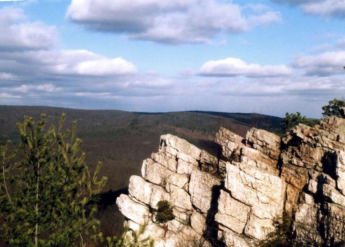
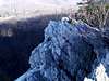
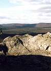
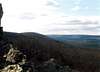
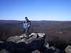
Pole Steeple is probably the second most dramatic summit in Pennsylvania behind The Pinnacle . Similar in form, Pole Steeple's summit area is composed of an eighty foot high cliff. In the center you'll see the outcropping that gives this mountain its name. It is the highest vertical spire on the band of cliffs and is the true Pole Steeple.
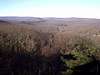
Pole Steeple is a part of the very large South Mountain Group located within Pine Grove Furnace State Park and just west of Gettysburg . This tiny summit offers one of the most rewarding views for the short but steep hike required to gain its summit. Though not very high, Pole Steeple provides an excellent viewpoint for the central part of the South Mountain Massif. Looking southwest you can see Sunset Rocks on Little Rocky Ridge. In the valley, nearly five hundred feet below, lies Laurel Lake with its sandy beaches and dam. Also, to the west you can see the central ridge of South Mountain as it reaches heights of just over two-thousand feet.
In its formation, this summit along with the rest of South Mountain was created during the collision of the last Pangaea as North America slammed into the continent of Africa. Made up of a beautiful white and maroon colored quartzite, Pole Steeple has a similar geologic composition to that of The Pinnacle. In fact the only real difference between the two is that The Pinnacle's cliff face is nearly twice as high as that of Pole Steeple.
The Pole Steeple Trail is the main trail used to reach the top, but I also found a longer trail which heads out around the cliffs to the south side. This trail is for those who can't handle the short rock scramble up the Steeple Colouir. The one good thing about this is that Pole Steeple is made accessible to everyone by this trail. Also, there is a link trail between Pole Steeple Trail and the Appalachian Trail . If the three quarter mile trail that leads to the top is not enough, there are plenty of other trails in the area that are sure to satisfy your needs. Sunset Rocks and Rocky Knob are two of the better places in the area.
If anyone has any technical climbing information please feel free to let me know and I'll add it with your credit!
 |  |  |  |  |
Getting There
The most common ways of getting to Pole Steeple are either from Harrisburg or Gettysburg. If you're heading the Gettysburg way, from Route 15 take any exit and head into town. Follow the signs for the Lincoln Highway and head west.
From Harrisburg:
Take Interstate 81 South towards Carlisle. When you see the Carlisle exits look for Rt. 34 south to Mt. Holly Springs. Take this exit and head the five miles to Mt. Holly Springs and continue on 34S to the intersection with PA 94 which will branch left after you pass through town. Turn right and follow Rt. 34 and the signs for Gettysburg. You will then want to prepare yourself in looking for Pine Grove Road/PA 233 which will branch to your right after approximately three miles. It comes up fast so keep a sharp eye. After six miles you'll see the sign for Pine Grove Furnace State Park on your left. There are three roads which go left just before you get to the sign. Take the one closest to the sign and drive back behind Laurel Lake where you'll see signs for Pole Steeple's trailhead. There is parking for about twenty cars.
From Gettysburg:
Head west on the Lincoln Highway (Route 30) for fifteen miles until you reach the turnoff for Pine Grove Furnace State Park and Caledonia State Park. Head north on PA 233 for approximately twelve miles until you pass Laurel Lake. After you drive by the stand of pines along the north side of the lake you'll see the back of the huge state park sign on your right with three roads just beyond it. Take the first one which will head back behind the lake and past the dam. From here you'll be able to follow the signs for the Pole Steeple Trailhead. There is parking for about twenty cars.
 |  |  |  |  |
Red Tape
There are no permits required to hike or climb here and the parking is free. The lot does close at sundown so if you hike in the winter or late fall be out of there by sunset. There is no hunting allowed in the area so you're safe from that. Otherwise just follow the "LEAVE NO TRACE" program and you'll be fine as will the area in use.
 |  |  |  |  |
When To Climb
Pole Steeple is climbable at all times of the year. My recommendation for the best time to climb would be in the fall or late winter. This is a nice place to go with a couple of inches on the ground. Be careful in the Steeple Colouir with wet or snowy conditions though because it can get very slick. In summer time you'll find a lot more people on the trail than expected. It is a pretty heavily used area so I'd advise waiting for the cooler weather.
 |  |  |
Camping
There is camping around Pole Steeple but only in the two designated areas. These locations are at Tagg Run Campground and Mountain Creek Campground which you'll see signs for if you head in from the north. They are located only about two miles from Pole Steeple.
Mountain Conditions
For up to date and current weather conditions click on the link below!
weather.com
External Links
- Appalachian Trail
This page has everything to do with the Appalachian Trail.
- Pole Steeple Trail Information
This is a short excerpt with a little information on the trail and distances.
- Trip Report for Pole Steeple
This is a "High Adventure" trip report that has a gallery with some pictures. It also shows a different route that uses the Appalachian Trail and creates a longer but just as easy hike.
Cascade Scrambler - Jun 2, 2011 11:09 am - Hasn't voted
broken linkYour link "Pole Steeple Trail Information" is broken.