
|
|
Mountain/Rock |
|---|---|
|
|
39.38324°N / 120.30122°W |
|
|
Nevada |
|
|
Hiking |
|
|
Spring, Summer, Fall, Winter |
|
|
7896 ft / 2407 m |
|
|
Overview
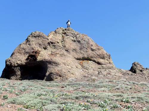
False summit of Red Mountain
Red Mountain is a prominent mountain rising above the Euler Valley north of Truckee, California in the northern part of the Lake Tahoe Basin region.
Situated east of Castle Peak and behind the Tahoe-Donner ski area, it is seldom seen from a distance, but is commonly viewed by skiers and mountain bikers who frequent the Euler Valley.
Dirt roads lead up to the slopes of Red Mountain from the trailhead at the end of Alder Creek Road in north Truckee.
The approach to Red Mountain is pretty gradual, and most of the elevation gain is going up the actual slopes of the mountain.
Red Mountain is typically snow-covered from mid-November through early May. However, it can be hiked all year, and is probably a good snow shoe hike or cross country ski mountain. Typically it is a late spring/autumn destination.
Getting There
The trailhead is at the end of Alder Creek Road. This can be reached either by driving north from I-80 in Truckee onto Northwoods Boulevard or driving west from Highway 89 north of Truckee on Alder Creek Road. If coming from Northwoods Boulevard, head north on Fjord Road and take a left on Alder Creek.The trailhead is a popular mountain biking area, and there aren’t too many parking spaces right at the trailhead. A dirt road continues past the trailhead, but a barrier blocks automobiles.
If you want to get closer to the peak and avoid the approach, take Carpenter Valley Road, which is 2 ½ miles from Highway 89 if coming from the east, and 1 ¼ if taking a right on Alder Creek Road from the end of Fjord Road. The road will come in from the east and eventually become 4WD roads to get up into the Euler Valley. However, I cannot guarantee there aren't private land restrictions via this route.
Route
The route information is provided from the main trailhead at the end of Alder Creek Road. The most direct legal approach appears to start here. Head up the road for a quarter mile, heading straight, and the road curves to the right and then switches back heading left. Continue on the road straight (avoid a road heading left at a Y junction. After about a mile the road turns rights and heads north.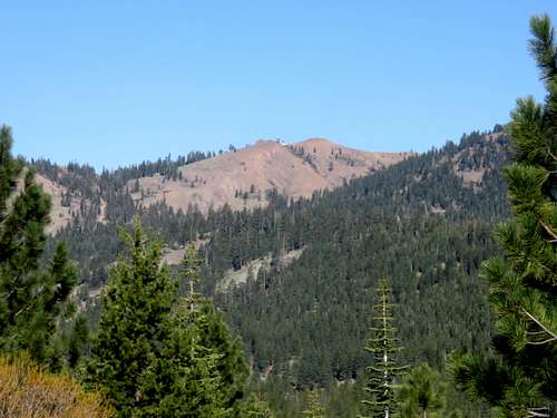
Red Mountain from the Euler Valley
Continue on this road, pass a gate, and you enter Crabtree Canyon. After about three miles from the trailhead, the road heads north, while a side road heads steeply up Red Mountain. Take this road. Continue up the road until you reach the top of the ridge. Don’t be fooled by Red Mountain rising to the north. It is easier to just gain the ridge. A large rock near the summit is the false summit. The true summit is just 400 feet further.
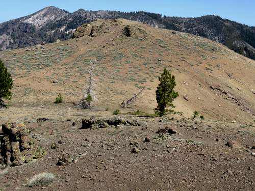
Red Mountain true summit
The total hike distance is about 4 miles one way, with an elevation gain of about 1,400'.