-
 546 Hits
-
 75.81% Score
-
 6 Votes
|
|
Route |
|---|---|
|
|
45.49484°N / 7.07452°E |
|
|
Hiking |
|
|
Summer, Fall |
|
|
Overview
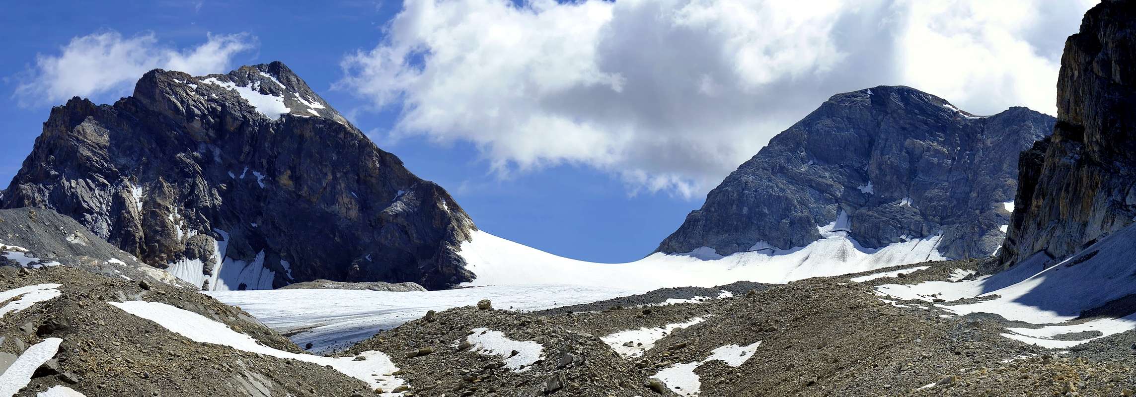
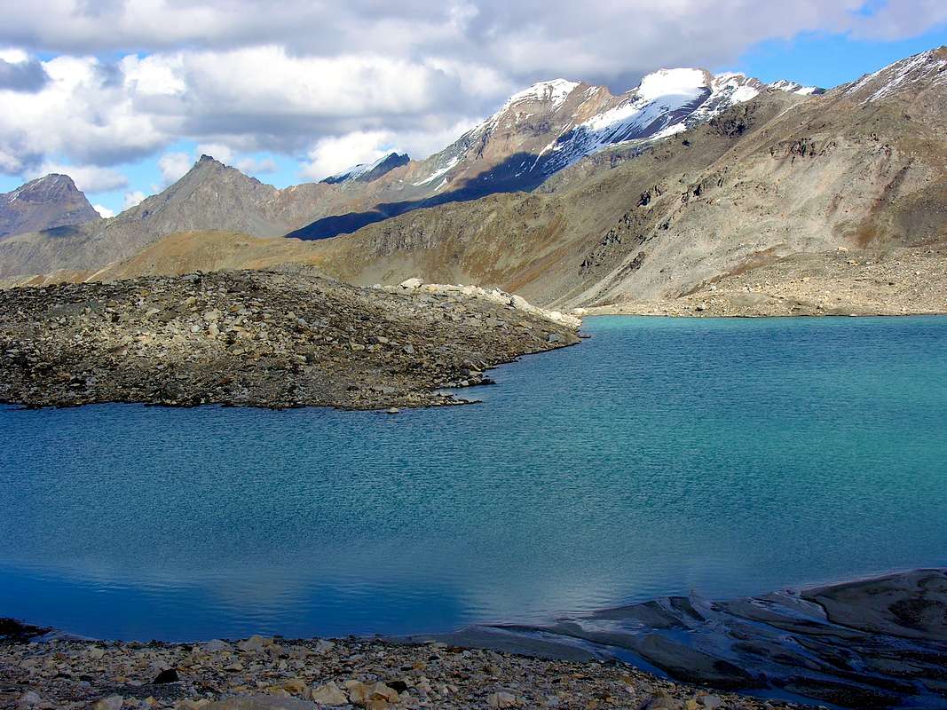
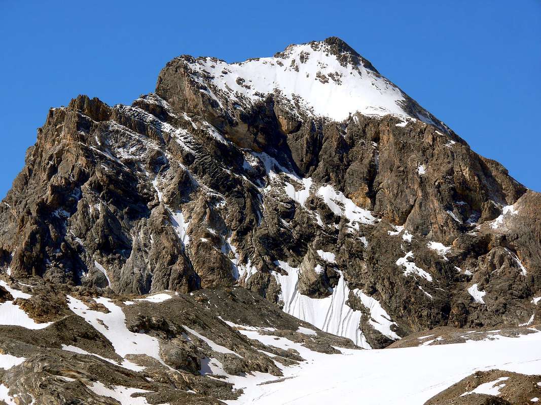
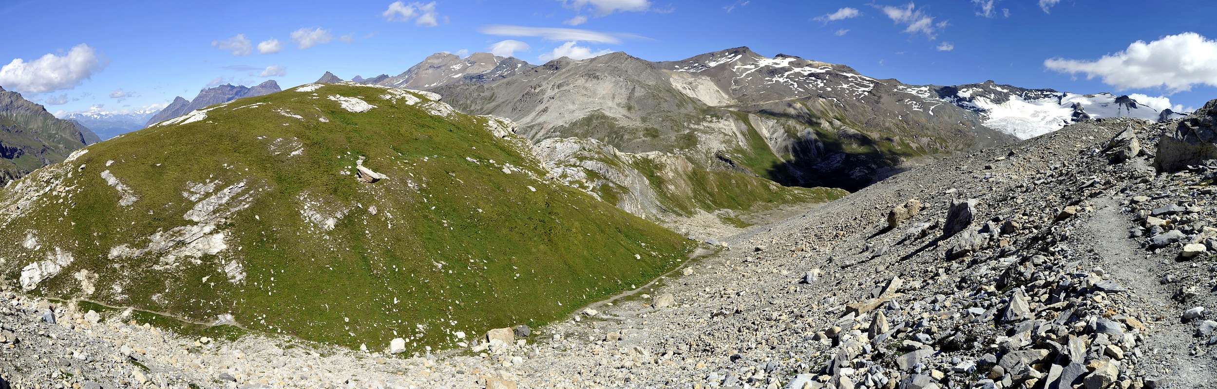
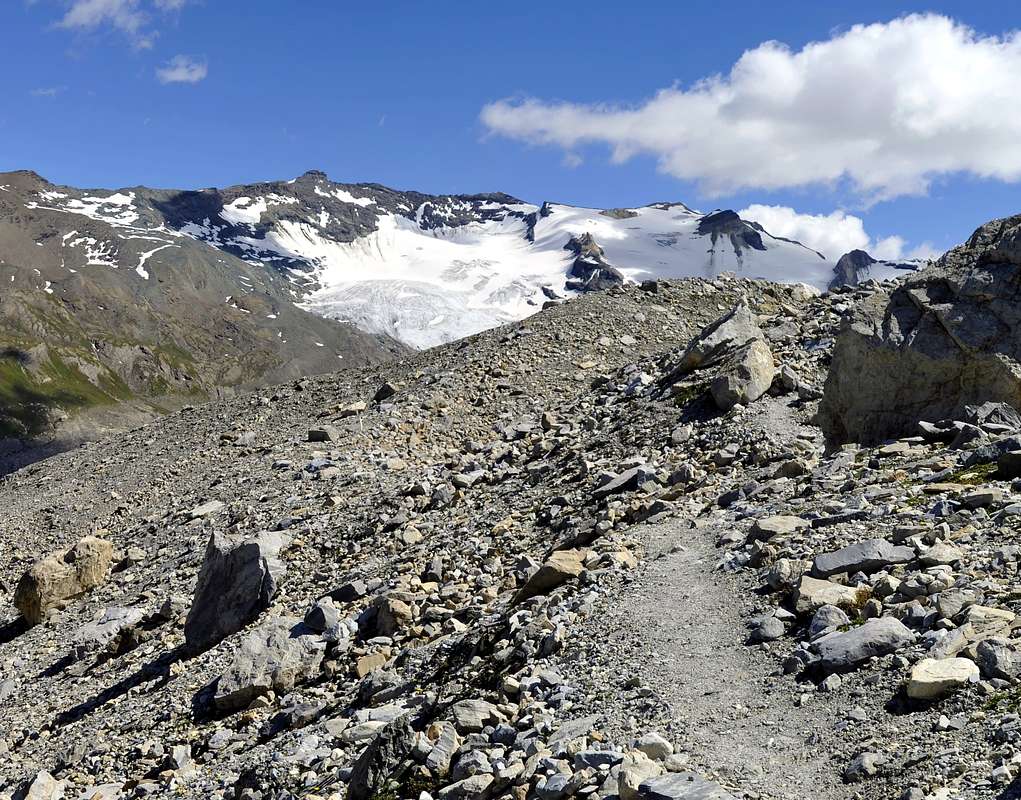
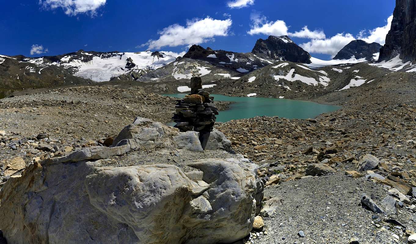
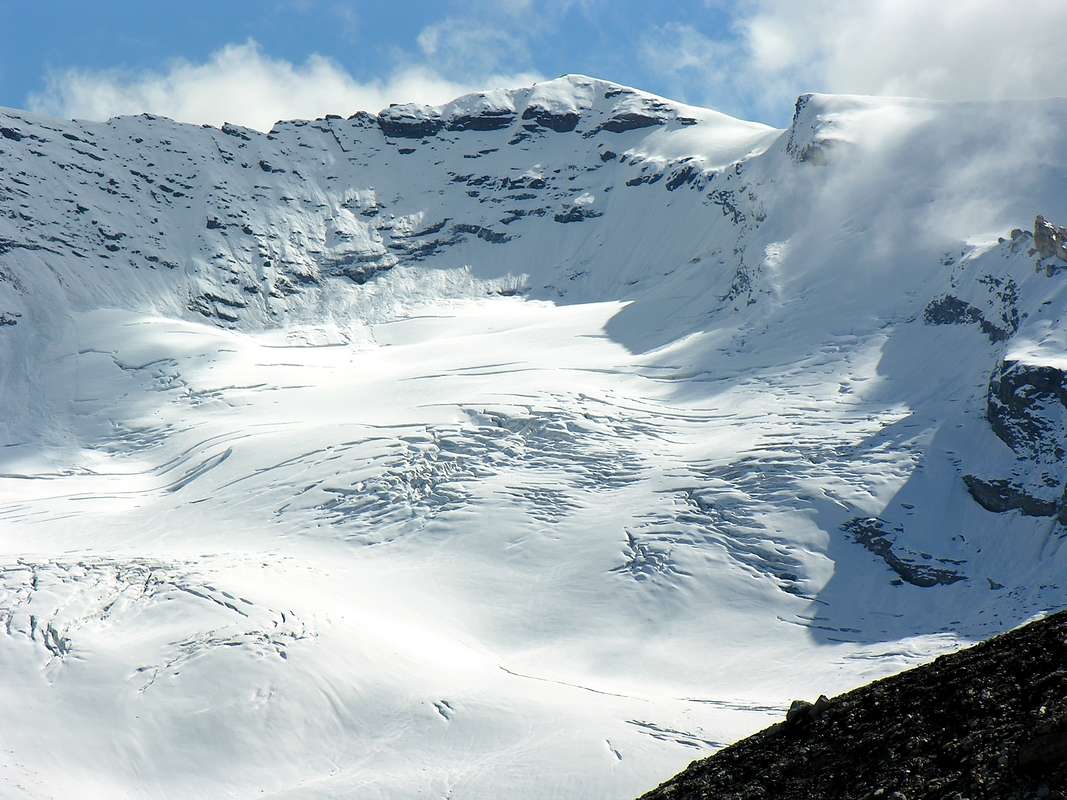
Lake Tsantelèina (2.696m) located at the foot of the Sauches and Tsantelèina glaciers and from the point of the same name and from the Pointes Couart-Dessus Sud (3.468m), Couart-Dessus Centrale (3.434m) and Couart-Dessus Nord (3.489m) and from the Pointe de Calabre (3.440m), it offers an excellent panorama over the whole head of the Rhêmes Valley, from the Roc de Fond (3.348m) to the Roc de Bassage (3.219m) from Punta Galisa (3.346m) to Punta Basey (3.338 m) with the glaciers of Fond and Lavassey, its waters have a color that goes from grayish to pale blue due to the fusion of overlying glaciers. The place is less frequented than the Lago della Goletta but it is certainly worth a visit given the relative distance from the Gian Federico Benevolo refuge (2.285 m).
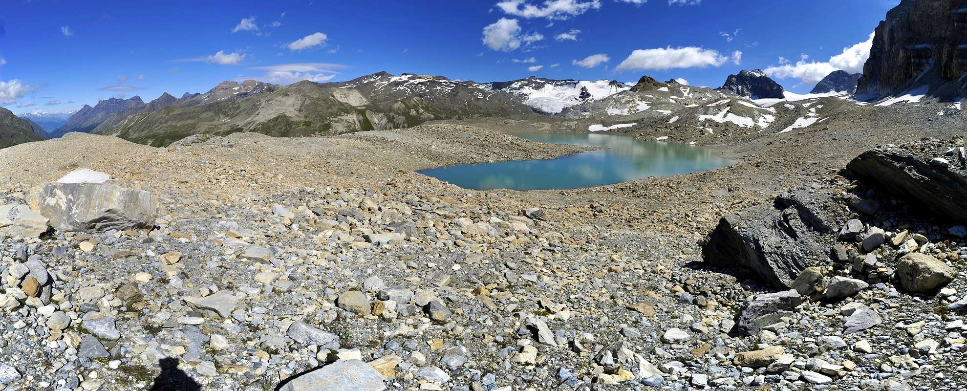
Il Lago di Tsantelèina (2.696 m) posto ai piedi dei ghiacciai di Sauches e di Tsantelèina e dall'omonima punta e dalle Pointes Couart-Dessus Sud (3.468 m), Couart-Dessus Centrale (3.434 m) e Couart-Dessus Nord (3.489 m) e dalla Pointe de Calabre (3.440 m), offre un ottimo panorama su tutta la testata della Valle di Rhêmes, dal Roc de Fond (3.348 m) al Roc de Bassage (3.219 m) dalla Punta Galisa (3.346 m) alla Punta Basey (3.338 m) con i ghiacciai di Fond e di Lavassey, le sue acque hanno un colore che dal grigiastro vanno a un azzurro tenue dovuto alla fusione di sovrastanti ghiacciai. Il luogo e meno frequentato del Lago della Goletta ma merita sicuramente una visita visto la relativa distanza dal rifugio Gian Federico Benevolo (2.285 m).
Getting There
- From France: through the Mont Blanc Tunnel or the Col du Petit Saint Bernard: you can drive on SS.26, following directions for Aosta and, before arriving in Villeneuve, turn right towards Introd. Alternatively, you can take Motorway A5 (at Courmayeur or Morgex) and exit at Aosta Ovest.
- From all the other directions: get to the Aosta Ovest exit of Motorway A5. Then drive on SS.26 Aosta, in the direction of Courmayeur; just after Villeneuve turn left towards Introd. Enter the valley and, at the fork between Valsavarenche and Val di Rhêmes turn to the right (Rhêmes).


Specific Road
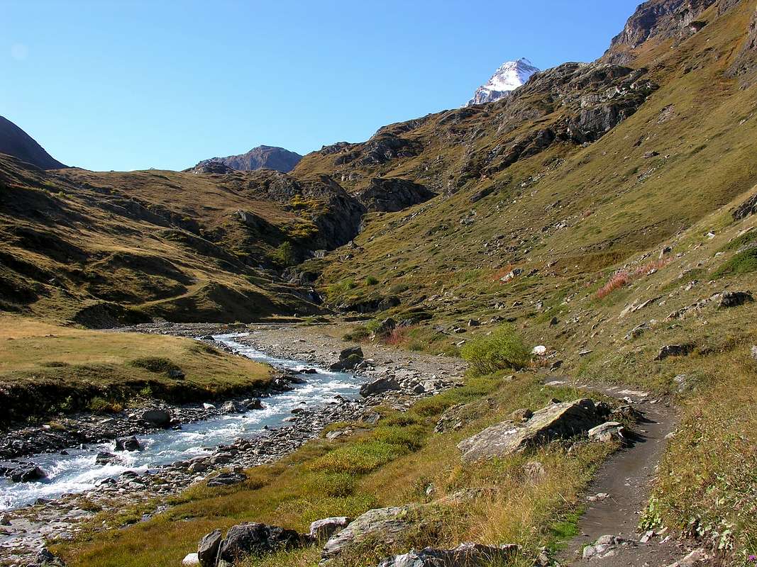
After passing all the towns in the Valley and reaching Rhêmes Notre Dame (1.725m), continue along the road until you reach Thumel (1.853 meters about, large car park), from here, following the dirt road on the right side (uphill) of the valley, or a path on the left that crosses some magnificent woods, continue until you reach the Gian Federico Benevolo Refuge (2.285m).
Dopo aver superato tutte le località della Valle e aver raggiunto Rhêmes Notre Dame (1.725 m) si continua lungo la strada sino a raggiungere Thumel (1.853 metri circa, grande parcheggio per le auto), da qui, seguendo la strada sterrata sul lato destro (in salita) della valle, o un sentiero sulla sinistra che attraversa alcuni magnifici boschi si prosegue fino a raggiungere il Rifugio Gian Federico Benevolo (2.285 m).
Route
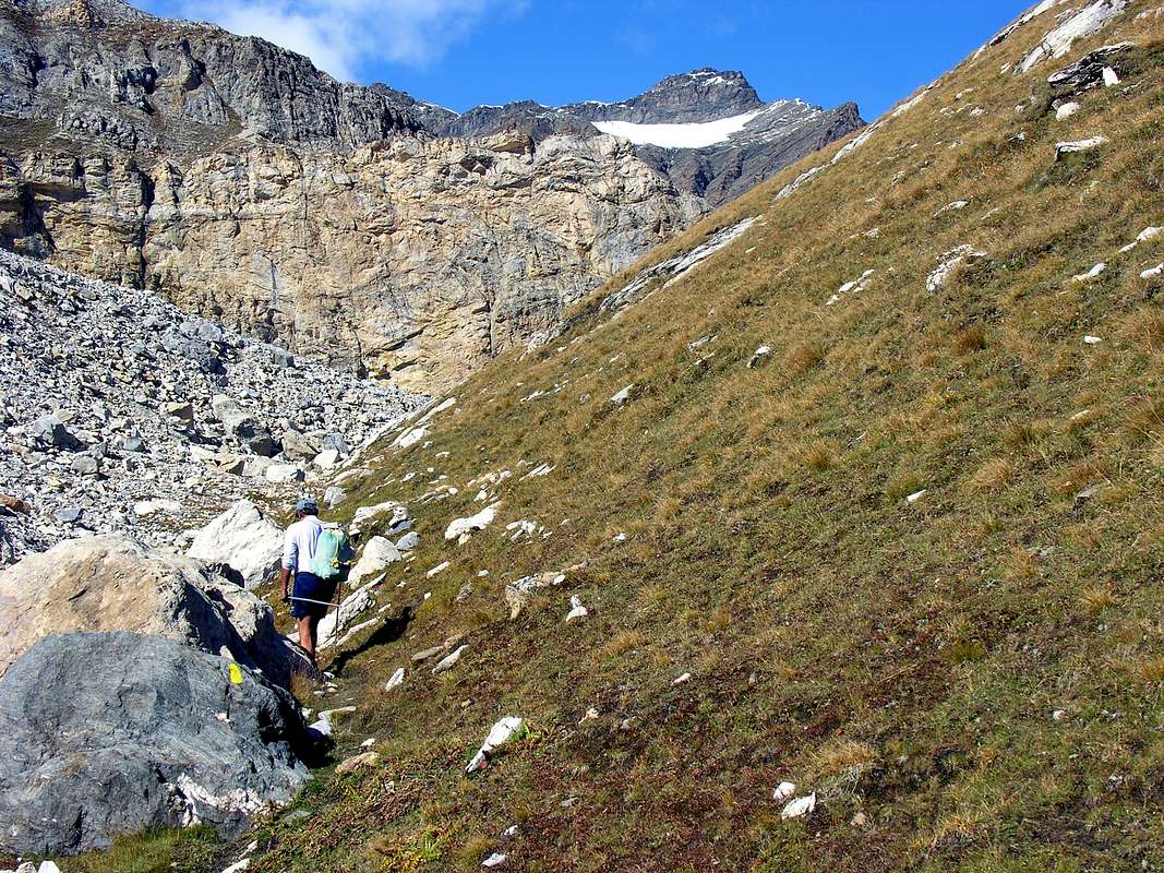
From the Rifugio Gian Federico Benevolo (2.285m) take the farm road for a few hundred meters which leads to the Fond pasture (about 2.330 meters). From near the Apeggio continue on the path bearing the n° 13C continue for about 1h'00/1h'10 and then turn right bypassing a large hillock known as the Truc de Tsantelèina (2.640m), then go up again on the left until you reach a small hill located at (about 2.630 meters). From this point, after leaving path n° 13C, turn left and on barely evident traces of the path you reach Lake Tsantelèina. Estimated times 2h'30/3h'00 from the Thumel car park, 1h'30/1h'50 from the Benevolo refuge.
Dal Rifugio Gian Federico Benevolo (2.285 m) percorrere la strada poderale per quache centinaio di metri che porta all'apeggio du Fond (2.330 metri circa). Dai pressi dell'Apeggio continuare sul sentiero riportante il n° 13C proseguire per circa 1h'00/1h'10 per poi svoltare a destra aggirando un grande dosso conosciuto come il Truc de Tsantelèina (2.640 m), risalire poi sulla sinistra fino a raggiungere un piccolo colle situato a (2.630 metri circa). Da questo punto dopo aver abbandonato il sentiero n° 13C svoltare sulla sinistra e su morena tracce di sentiro poco evidenti si raggiunge il Lago di Tsantelèina. Tempi stimati 2h'30/3h'00 dal parcheggio di Thumel, 1h'30/1h'50 dal Rifugio Benevolo.
Difficulty
The route can be classified as E.
L'itinerario è classificato E.
Equipment
For Hikings.
Da Escursionismo.
 |
 |
 |
External Links
- REGIONE AUTONOMA VALLE D'AOSTA the official site.
- FONDAZIONE MONTAGNA SICURA Villa Cameron, località Villard de la Palud n° 1 Courmayeur (AO) Tel: 39 0165 897602 - Fax: 39 0165 897647.
- SOCIETA' GUIDE ALPINE DEL GRAN PARADISO Comune di Valsavarenche.
- A.I.NE.VA. (Associazione Interregionale Neve e Valanghe).
Useful numbers
- Protezione Civile Valdostana località Aeroporto n° 7/A Saint Christophe (Ao) Tel. 0165-238222.
- Bollettino Meteo (weather info) Tel. 0165-44113.
- Unità Operativa di Soccorso Sanitario Tel. 118.
![]()