
-
 8786 Hits
-
 72.08% Score
-
 2 Votes
|
|
Mountain/Rock |
|---|---|
|
|
46.69208°N / 11.25609°E |
|
|
8467 ft / 2581 m |
|
|
Overview
If one day you have the idea to travel to SüdTirol in Italy and you explore Merano, one of the biggest cites in this region you will see the Grosser Ifinger and its big brother Hirzer surmounting the other mountains prevailing this valley. The Großer Ifinger forms the border of the Sarntaler Alpen to the west side of this massif.Reinhold Messner, one of the most famous alpinists of the world lives in Naturno, where he owns a little castle 2km away from Merano.
This mountain is not very spectacular but the view you get from the top is very amazing and you could stay there for hours if the wind was not that glacial even in summer terms. You have an overall view starting with the valley of Meran (Merano) over to the swiss alps and even to the Ortler.
 |  |  |  |  |
Technical Equipment
If you want to climb this mountain you can also call a big hill you really do not need any material. Climbing shoes can be very useful but even without them you probably will not have any problems.Technical Problems
I think this one of the easiest mountains I have ever "climbed".Refering to the UIAA scale I would say that the most difficult part has to be rated III. This part lasts only 20m but the rest of the technical route is ll. There you just have to watch your step.
The first attached photo shows the "easy" part of the technical route and as you see you can also use fixed ropes. The 20m high section is very steeply as you see at the third picture I added but saw no one who did not achieve the summit. A few people had the vertige but nevertheless they all got to the top.
 |  |  |
Routes-Overview
If you want to reach the summit there is only one way to the top you cannot miss. Signs will guide you to the bottom of the ascent and then you only follow the chains or the path you can see easily.Starting at the ski-station (2000m) you will need minimum 2 hours to reach the summit. If you start at the parking place you should calculate approximately 4-5 hours.
But if you want to do a few hikes around the massif of the Grosser Ifinger, then you have several possibilities from different places.
 |
Getting There
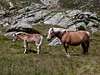
First of all you should be in SüdTirol (SouthTirol) in Italy. The famous city called Merano with its small village Tirolo is right at the bottom of the Großer Ifinger. Coming from Bressanoe, Bolzano or Merano you always have to follow the road till you pass a small village called Hafling. Yes, this is the village where those kind of horses are from originally. You follow this road up to the end. It ends at the ski-station called Merano 2000 and has a big parking place in Hafling-Falzeben which costs 1 € for the whole day. There you can decide wether you go up from this spot or if you first take the ski lift to reach the higher station at 2000m.From Germany: via the Brenner, and the Jaufenpas (Passo di Giovo, 2099 m). The Jaufenpas can be closed due to heavy snow at any point in time, but particularly in october.
A nice alternative might be to drive via Fernpas, Otztal and Timmelsjoch (Passo di Rombo). However, keep in mind that the Timmelsjochpas is closed after 8 hours in the evening!
Jaufenpas and Timmelsjoch are closed between november / october respectively and may.
Merano can be reached by train. Buses run frequently through the entire valley.
 |  |
When To Climb
I have done this trip in summer and I'm not quite sure if it is possible to reach the mountain in winter. My personal opinion is that it is possible to climb it in winterterm but I consider it to be too dangerous and irriesponsible.Mountian Conditions And Infos
The weather forecast is given in the radio but if you want more information just ring up the tourism info center in Merano or in Tirolo.Tel.: +39 0473 923314
Fax: +39 0473 923012
@ : info@dorf-tirol.it
Of course you can also visit www.wetter.com. Just type "Merano" or "Tirolo" and you will get the newest weather forecast.
Map
You really do not need any map for this mountain, the way is given perfectly on the way up to the top.If you require a map than look for example at the KOPASS Collection:
- Passeiertal/Val Passiria, nr. 044, 1:35000
- Vinschgau/Val Venosta, nr. 52, 1:50000
- Meran/Merano, nr. 53, 1:50000
Nrs. 52 en 53 are sold together with a little tourist guide
If you favour a guide by Kompass:
- Wanderbuch Meran Burggrafenamt, nr. 951, ISBN 3-87051-386-1
- Wanderbuch Vinschgau Ortlergruppe, nr. 950, ISBN 3-87051-404-3
Camping
Camping is NOT allowed because this place mainly consists of nature protection area. Signs often remember this to the "visitors" and also show that the environment would appreciate if you leave no rubbish on the hills.But I think nobody on this pages has to be instructed regarding this problem.
Different photos
During the ascent you will notice the variousity of the landscape surrounding it.The following photos have been taken on the way up to the summit as well as on the way down.
 |  |  |  |  |