
-
 7546 Hits
-
 85.87% Score
-
 21 Votes
|
|
Mountain/Rock |
|---|---|
|
|
42.71218°N / 103.0267°W |
|
|
Dawes |
|
|
Hiking, Scrambling |
|
|
4118 ft / 1255 m |
|
|
Overview
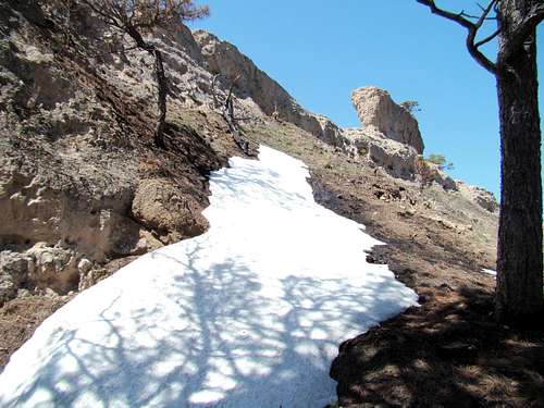 Winter on the Steamboat Butte summit block
Steamboat Butte is probably the most prominent landmark in Nebraska’s Chadron State Park. Though not the highest or most difficult rock to climb in the park, it is nevertheless a named summit that provides hikers and climbers an easy-to-access base for a challenging scramble to the top. Climbers will be treated to great views of the surrounding buttes, rock formations and the canyon below.
 Lower Steamboat Loop Trail
A deep canyon drops from west of Steamboat Butte and the canyon ends at Chadron Creek at the east side of the state park. The canyon floor lies about 220 feet below the west and north sides of this rock. There is a rocky highpoint that is the true summit, but due to it being composed of unstable rock, it is probably not advisable to attempt to scale it unless you are an experienced rock scrambler. If you think you must, the only access would be from the north end. There is no margin for error on such an attempt, though. Steamboat Butte is long and narrow, with a north-south axis. The east side provides easier access routes. Any attempt to scramble up the west side should be done with great caution, due to the very steep side down to the canyon floor. Usually, most hiking groups that try the west side from the canyon floor eventually re-adjust their route to go around the south end and complete their scramble on the east side.
Getting There
To get to Chadron State Park, drive south from the town of Chadron, Nebraska on Highway 385, eight miles south of the junction of Highways 385 and 20. At the park entrance, you will see the office next to a very small lake. If you are planning to camp or rent a cabin, or you need a park permit, you will need to stop there. At the office, you can pick up a free park trails map that shows where Sawmill Shelter is at. Once you arrive at Sawmill Shelter, you will see at the back of the clearing the sign for the Steamboat Loop Trail.
Route Information
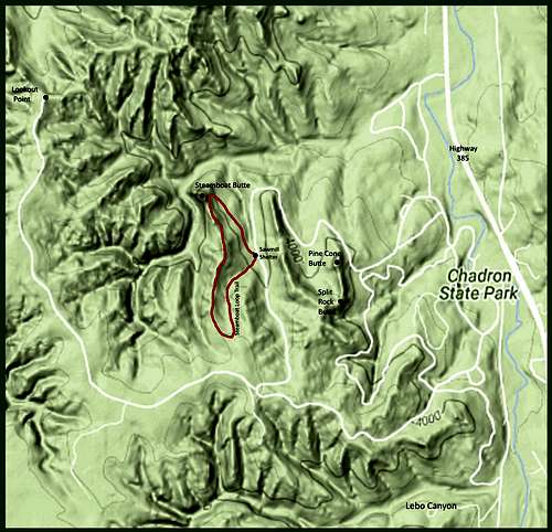 Steamboat Loop Trail Map
The Steamboat Loop Trail is about 1.4 miles total. If you travel around it in a counter-clockwise manner, it is about.4 mile to the summit block. The trail loop continues on back to the trailhead, so it is up to you at that point to choose your route to scramble the rest of the way up the rock. For more on the Steamboat Loop Trail, check out the SummitPost page at this link: SummitPost: Steamboat Loop Trail
 Steamboat Point
The state of Nebraska offers an interactive trails map online. This map not only shows the Steamboat Loop Trail, but also how the trail connects to the Chadron State Park Trails System. You can access the interactive map at this link: Nebraska Interactive Trails Map
Red Tape
Anyone driving into Chadron State Park will need a daily or annual state park permit. There are strict campfire regulations and firearms are not allowed in the park. For any other questions, please call the park office at: (308) 432-6167.
Safety
Even though this is a state park, it is adjacent to other state land, national forest lands and private property. Wildlife does not recognize park boundaries, including mountain lions, rattlesnakes, and ticks. Please take appropriate precautions. Summer lightning storms and winter storms can both be threatening. Climbing on the soft rock in this region always poses some risks, especially when it is wet, icy or the weather is threatening.
Camping, Lodging and Information Resource Links
 Steamboat Loop Trailhead
 Canyon Overlook
The best camping in the area is right at Chadron State Park. If tenting or sleeping under the stars is not for you, the state park has some excellent cabins, as well as a dorm. For reservations or for questions, you can reach their office by phone at (308) 432-6167. If your preference is a nearby hotel, you can contact the Chadron Chamber of Commerce at: (308) 432-4401 for up-to-date information. For more information on hiking and climbing in western Nebraska, check out Panhandle Trails.