
|
|
Mountain/Rock |
|---|---|
|
|
39.87420°N / 107.1373°W |
|
|
Garfield |
|
|
Hiking, Mountaineering, Scrambling |
|
|
Summer, Fall |
|
|
11980 ft / 3652 m |
|
|
Overview
W Mountain is the thirteenth highest peak in the Flat Tops. It is tucked away in an isolated and forgotten section of the Flat Tops. You can expect solitude here.W Mountain is said to resemble the letter “W” when viewed from the area of Toponas, thus the name. The mountain is gentle from most directions, but the north face is rugged and steep with some pretty high cliffs. The east side also has steep slopes.
W Mountain is an easy climb from its south side, but the road to the Big Springs Trailhead is rough and slow and 4wd is required (the road to Crescent Lake is even rougher). To climb W Mountain you either need a tough vehicle or a few days available at your disposal. The climb itself is easy, so if access was easier it would undoubtedly be a more popular peak.
The area is rich in wildlife. We saw many grouse along the climb as well as elk, deer, marmots, and pikas.
The Flat Tops are more of a huge elevated plateau rather than a typical mountain range, but the plateau has been eroded into many individual peaks and summits, and most of them are flat-topped, or dome-like as is this one. The mountain area composing the Flat Tops contains over 110 lakes full of fish, and also has some of the most extensive areas above timberline in Colorado.
Flat Tops: 11,000+ Foot Peaks with 300+ feet of Prominence
 The highest ridge of W Mountain as seen from the southeast. The mountain is quite gentle from this direction.
  The north side of W Mountain is fairly steep with cliffs.
Getting There
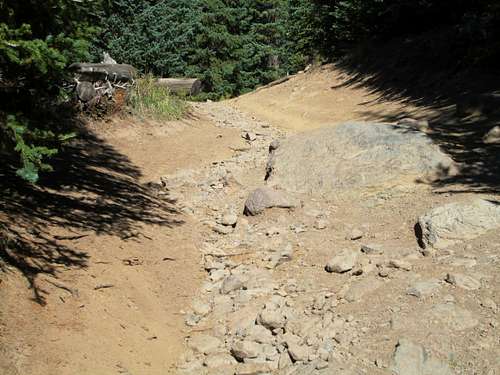
Big Springs TrailheadThe access road is fairly rough. This road is for high clearance 4wds with a low range, and not for Subarus, Rav4s, or Explorers, et al. We made it to the trailhead in our old Pathfinder, and it wasn’t too bad. If you can make it the first two miles on the 4wd section, you should be able to make it to Big Springs. The road isn’t nearly as rough as the one going to Crescent Lake though.
To get to the access road, you first want to make your way to the community of Burns, which is one of the few communities in Colorado with no paved roads leading to it. Burns is along the Colorado River Road between McCoy on Highway 131 and Dotsero on I-70. If coming from the east or north, driving in by way of Highway 131 and McCoy is more expedient, but if driving in from the south or west, then coming in from Dotsero and I-70 is faster.
It is recommended that you have a map, such as the White River National Forest Map or a Colorado Atlas to find the trailhead. From Burns, you want to take the Derby Mesa Loop Road. You can catch the north end of this right at Burns, but it is faster to catch the south end of the loop road just southwest of Burns and at Burns Junction.
From Burns Junction, take the Derby Mesa Loop road to the west and follow this good road for 6.3 miles to FR 613. Passenger cars can make it here with no problem.
Turn left (west) on FR 613 and follow the rough road to another junction at mile 10.05 (from Burns Junction). Turn left onto FR 606 at the signed junction for Big Springs and the W Mountain Trail. Follow the 4wd road about 2.0 miles to the Big Springs area.
The trailhead can be tricky to find. As soon as the road descends to the meadows containing Big Springs, look for a side road just past a grove of pine trees on the right. This indistinct track (obscured by grass) just after the grove leads to the trailhead. If you reach the sign pointing out Big Springs, you overshot the trailhead. Maps are somewhat misleading.
At the trailhead should be a bulletin board and trail register.
 Sign right near the correct trailhead.
South Derby Creek Trailhead
The access road is very rough. This road is for high clearance 4wds with a low range, and not for Subarus, Rav4s, or Explorers, et al. I made it to above Still Water (not to be confused with Stillwater Reservoir which is farther north and on a good road) in our old Pathfinder, but we wearied of the punishing ride. If you can make it to Stillwater, you can probably make it to Crescent Lake, but the road is very slow and is used more by ATV’s than 4wds.
To get to the access road, you first want to make your way to the community of Burns, which is one of the few communities in Colorado with no paved roads leading to it. Burns is along the Colorado River Road between McCoy on Highway 131 and Dotsero on I-70. If coming from the east or north, driving in by way of Highway 131 and McCoy is more expedient, but if driving in from the south or west, then coming in from Dotsero and I-70 is faster.
It is recommended that you have a map, such as the White River National Forest Map or a Colorado Atlas to find the trailhead. From Burns, you want to take the Derby Mesa Loop Road. You can catch the north end of this right at Burns, but it is faster to catch the south end of the loop road just southwest of Burns and at Burns Junction.
From Burns Junction, take the Derby Mesa Loop road to the west and follow this good road for 6.3 miles to FR 613. Passenger cars can make it here with no problem. Turn left (west) on FR 613 and follow the increasingly rough road to another junction at mile 10.05 (from Burns Junction). Turn right, still following FR 613. Signs say that it is 7 miles to the trailhead.
The road gets increasingly rough and gets even rougher at the stream crossing of South Derby Creek. The road from here on is rough and punishing on your vehicle and there are big rocks and usually big mudholes as well. Drive as far as you dare and don’t get stuck. This area is out in the middle of nowhere and towing a vehicle would be a costly affair.
 The access road to Crescent Lake is very rough and has some big rocks.
Trappers Lake Trailhead
There are four main ways to reach the trailhead. I have only driven to two of them. The trailhead is near Trappers Lake.
There is a road from the west and Meeker, one from the east and Yampa or Phippsburg, one from the northeast and Oak Creek, one from the north and Hayden, and one from the northeast and Pagoda (village) and Hamilton. I know only the roads from Hamilton and Pagoda, but very few Coloradoans will be coming from that direction (Craig), so it seems rather pointless to describe the drive in detail. Most people will be driving in from the Meeker or Yampa areas. After Pagoda or not far past Buford, all roads are gravel and in good condition in summer.
From Meeker:
From just north of Meeker and along Highway 13, turn east on County Road 8. Follow County Road 8 to Buford. Follow the road another 17 miles and turn right (south) on FS Road 205 to the Trappers Lake Lodge. There are several roads here, but they are well marked. Follow the road (FR 209) marked for the Wall Lake Trailhead and Park there.
From Yampa or Oak Creek:
I haven’t come in this way, so directions will be brief. Use a map. Briefly put you can reach country road 8 (see above) from either CR 25 from Oak Creek or CR 21 from Yampa. From there, you follow the road all the way over Ripple Creek Pass and down to FR 205. Turn left and follow the directions above.
From Hayden:
I haven’t come in this way, so directions will be brief. Use a map. Briefly put you take CR 53 south to CR 29. Turn left (east) and follow CR 29 to CR 55. Turn right (south) and follow the road to the junction with CR 8. Take CR 8 over Ripple Creek Pass and follow the route above.
From Hamilton:
Unless you live in Craig, few Coloradoans will use this route and thus the directions won’t be detailed. From Hamilton (13 miles south of Craig and along Highway 13), drive east on Highway 317 to Pagoda. Highway 13 turns into county road 29. Turn right on CR 55 and follow the remaining directions from the route from Hayden.
 Trappers Lake.
Routes Overview
Via Big Springs TrailheadIf you have a 4wd, this may be the best access route. From the Big Springs Trailhead, the sometimes indistinct W Mountain Trail climbs up the East Fork Red Dirt Creek drainage before topping out at a small saddle. The trail is pretty easy to find to this point, but it fades in several places between here and timberline, especially in the sections with willows and grass.
See the Route Page for details.
 The south ridge of W Mountain is in the background.
Via South Derby Creek Trailhead
This route is one of the shortest routes up W Mountain and is about the same length as coming in from Big Springs. Keep in mind however, that the access road is extremely rough.
Maps show the trail west of Crescent Lake climbing up to the ridge. It's a sure bet that the trail is little used and it might be indistinct in places. From there, you can follow the ridge and trail south to W Mountain (the summit is actually off trail, but the terrain is not difficult).
 The north ridge of W Mountain as viewed from Crescent Lake.
 Via Trapper Lake
This route is much longer than the other two above, but the access road is good for all vehicles. A series of trails accesses W Mountain from the north. See maps for details. This route might require two days for most hikers.
Via Sweetwater
The Ute and West Fork Sheep Creek Trails can be used to access W Mountain from the south. The West Fork Sheep Creek Trail is probably indistinct. W Mountain could be climbed in one long day from this route.
Red Tape
No permits are required.Standard Wilderness Regulations apply within the wilderness boundary.
Directly from the National Forest Service:
Basic Rules
• Entering or being in the area with more than 15 people per group, and a maximum combination of 25 people and pack or saddle animals in any one group is prohibited.
• There is no permit system in place in the Flat Tops Wilderness but we do ask that visitors sign in on provided trailhead registration forms.
• Camping within one hundred feet of any lake, stream or trail, or any “No Camping” or “Wilderness Restoration Site” sign or within ¼ mile of Trappers, Hooper, Keener or Smith Lakes is prohibited.
• Building, maintaining, attending or using a campfire within one hundred feet of any lake, stream, or trail or within ¼ miles of Trappers, Hooper, Keener or Smith Lakes is prohibited.
• Storing equipment or personal property or supplies for longer than 10 days is prohibited.
• Hitching, tethering or hobbling any pack or saddle animal within one hundred feet of any lake, stream or trail is prohibited.
• Possessing any pack or saddle animal within ¼ mile of Trappers Lake except for watering or through travel is prohibited.
• Possessing a dog or other animal that is harassing wildlife or people or damaging property is prohibited. There is no leash law in the Flat Tops, however dogs must be kept under verbal control at all times.
• Possessing or using a wagon, cart or other vehicle including a wheelbarrow or game cart is prohibited.
• Shortcutting a switchback in a trail is prohibited.
 Summit of W Mountain. Tread lightly in this area.
When to Climb
W Mountain could be climbed year-round by an experienced climbing party, but the roads to the Big Springs Trailhead is only open after mid-July or so. The road to the trailhead Stillwater Reservoir is open only from around Memorial Day or early June to sometime in November, so outside this time period, this would be a very long trip.The route from Big Springs should have little avalanche danger (if you avoid steep slopes), but a snowmobile would provide much easier access to the summer trailhead. Once above timberline, the rolling country should provide great cross country skiing.
The Flat Tops (especially the northern and western section) receive much snow, so despite the lower altitude than the 14'ers, the peaks remain buried in snow until mid-July. Snowshoes are recommended in June.
The Flat Tops have many mosquitoes in July, and sometimes into early August.
Mid August to mid September is good because the mosquitoes are gone.
From September and into December is hunting season, so wear blaze orange and use extreme caution. On the plus side, hunter traffic usually keeps the roads open to Stillwater Reservoir until around Thanksgiving weekend. Late November might be the best time to make a “winter conditions” ascent because after the road closed, this would be very, very long trip.
 The rolling summit area of W Mountain as seen in mid August.
Camping
South Derby AccessThere are many excellent campsites along the South Derby Access Road, including at the Big Springs Trailhead.
Stillwater Reservoir and Trappers Lake Accesses
CLICK HERE for current campground information for official Routt National Forest campgrounds. The ones in the Yampa River district are in the same general area.
The Cold Springs and Horseshoe campgrounds are located near Stillwater Reservoir. The Bear Lake campground is located near Bear Lake. And the East Marvine campground is located near Trappers Lake.
 Campsite near Big Springs.
Mountain Conditions
Contact the Yampa Ranger District for up-to-date road, trail, and wildfire conditions:PO Box 7
300 Roselawn St.
Yampa, Colorado 80483
970-638-4516
CLICK HERE FOR WEATHER FORECAST OF THE AREA
Weather and climate data for Marvine Ranch at 7800 feet elevation is below. *National Weather Service Data 1972-1998. Expect much wetter conditions at higher elevations. The area around W Mountain will average around 10-15 degrees colder in the daytime than Marvine Ranch; nighttime temperatures won't have as big of a difference.
| MONTH | AVE HIGH | AVE LOW | REC HIGH | REC LOW | AVE PRECIP (in) |
| JAN | 33 | 1 | 59 | -38 | 2.43 |
| FEB | 36 | 3 | 56 | -42 | 2.30 |
| MAR | 42 | 11 | 63 | -32 | 2.55 |
| APR | 49 | 18 | 75 | -16 | 2.20 |
| MAY | 61 | 27 | 78 | 5 | 2.41 |
| JUN | 72 | 33 | 92 | 15 | 1.57 |
| JUL | 77 | 38 | 89 | 23 | 1.94 |
| AUG | 75 | 38 | 90 | 21 | 1.91 |
| SEP | 68 | 31 | 87 | 11 | 2.16 |
| OCT | 57 | 22 | 76 | -10 | 2.16 |
| NOV | 40 | 11 | 65 | -30 | 2.26 |
| DEC | 33 | 2 | 63 | -44 | 2.53 |