
|
|
Mountain/Rock |
|---|---|
|
|
46.55030°N / 9.06106°E |
|
|
Hiking, Mountaineering, Trad Climbing, Sport Climbing, Scrambling |
|
|
Spring, Summer, Fall |
|
|
9508 ft / 2898 m |
|
|
Overview
The Zerfreilahorn is one of the most striking mountains in Switzerland. It is located in the northwest of the Swiss Kanton Graubünden. To be more precise: at the end of the Valservalley. The mountain belongs to the Adula group which lies in the eastern part of the Lepontine Alps. The Mountain has three main summits (South, Middle and North). The South summit is the highest of them: 2898 meters.A lot of people propably saw the mountain on a bottle of Valser Mineralwater, without knowing the mountain used is the Zerfreilahorn. The mountain is the landmark for the Valservalley region, which is known for it's mineral water and health resort. The region isn't very busy with climbers and mountaineers, therefore you'll find beautiful quiet mountains in a pure Swiss mountain landscape.
The view from the Chappeli, over the Zerfreilasee, towards the Zerfreilahorn is unique. Almost 400 meters of (close to) vertical gneis rises high above the grassy slopes. The Gneis is very rough, which makes the climbing very granite like. There is not really an easy way to the summit, although the acces is much shorter (and easier) from the less impressive south side. Especially the NE-side and SE-side are climbed pretty often. Here you'll have some very hard rock climbing routes, mostly relative new and well bolted. The classic route follows the NE-ridge.
 The Zerfreilahorn above the Zerfreilasee
Getting There
To the Valservalley (Vals)Vals lies at the end of a side valley in the Surselva area (Bündner Oberland). Vals is located in the middle of the Alps, or to put it simply: it lies between Milan and Zürich (Zürich – Vals 170 km).
By car: Autobahn (A 13 Chur - San Bernardino), take the Reichenau - Flims exit. Follow Flims – Laax to Ilanz, turn off towards the Vals Valley [Valsertal]. Follow the twisting road to Vals. 60km from Chur to Vals.
By public transport: Ilanz has the nearest trainstation. It is located on the Chur - Oberalppass connection of the Rhätische Bahn. From Ilanz there is a Postbus connection to Vals, wich runs quite often.
To the Zerfreilasee (Chappeli - 1900m)
You can easily reach the Zervreila Restaurant by car and bus. It lies 8 km above Vals (1840m) along the road the the Zerfreilasee. From the Restaurant you can drive for about 5 minutes to Chappeli where the road ends. It has a small Chapel and a parking. It also possible to take the Zervreila Shuttle bus.
To the Lampertschalp and the Läntahütte
From the parking at Chappeli it is possible to approach the Lampertschalp and Läntahütte. Follow the wide track pass the Zerfreilasee and cross the Kanalbrigde. Reach the Lampertschalp shortly after you've finished walking pass the lake. About 1.5 hours. From here follow a well marked path to the Läntahütte, about 2.5 hours from the Chappeli.
 Classic view of the Zerfreilahorn from Chappeli
Routes
The Zerfreilahorn has several hard climbing routes. The longest routes are up to 400 meters long, like the classic NE-ridge. Thanks to some local mountain guides most of the routes are re-bolted and therefore pretty safe to climb. Still a climb on the Zerfreilahorn can be a serious alpine climb.Zerfreilahorn - Northsummit: 10 Routes (UIAA: V+ / VIII+)
Zerfreilahorn - Southsummit: 2 Routes (UIAA: III-IV)
Zerfreilahorn - Middlesummit: 9 Routes (UIAA: II-VII+)
See the Guidebook section for Guidebooks and topos. Or check www.adventure.ch for News and topos!


Valser
The Zerfreilahorn is the offical sign of Valser Mineral Water. For more information about Valser Mineral Water: www.valser.ch
Zerfreilahorn as sign of Valser mineral water
Maps and Guidebooks
Unfortunatly the Zerfreilahorn lies on the intersection of three SAC-maps. Choose the map wich suites your approach and climb!Map 1:25 000:
- SAC Map: 1234 Vals
- SAC Map: 1253 Olivone
- SAC Map: 1254 Hinterrhein
- SAC Map: 266 Valle Leventina
- SAC Map: 267 San Bernardino
- SAC Map: 257 Safiental
Online Maps:
Guidebook:
- Guidebook Climbing Valsertal, Michael Illien, ISBN 978-3-936740-22-6
- SAC Guidebook: Bündner Alpen 2, Manfred Hunziker, ISBN 978-3859021549
- Plaisir OST, Jürg von Känel, ISBN 3-906087-28-X
To order SAC Maps: www.toposhop.ch
To order SAC Guidebook: www.sac-cas.ch
To order Plaisir OST: www.filidor.ch
To order the Valsertal Guidebook: www.panico.de
External Links
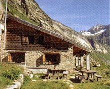
Läntahütte SAC 2090mThomas Meier
Haus Bellavista
CH-7132 Vals
Phone (hut): +41 (0)81 935 17 13
Homepage:www.laenta.ch/
Other useful links:
WSL Institute for Snow and Avalanche Research SLF - Avalance Bulletin
Vals / Valsertal - Information about the village Vals
Läntaclimb - News about climbing in the Valservalley area
Weather Forecast - Weather Forecast for Vals
Weather Forecast - Detailed weather forecast
Railroad information - Railroad schedule
Bus information - Postbus schedule
Zervreila Restaurant - Zervreila Restaurant
Trip report - Climbing the NE-ridge