is acknowledged as the best Alpine type excursion in the whole of the UK. This report describes our adventures in doing this brilliant route by means of attempts in two consecutive seasons. The mountaineers involved were a group of five friends from various parts of the UK who share the love of Scotland and Skye in particular.
The writer's first experience of Skye was in 1992 and was the first year that I attempted to do the ridge with Colin, Ken, Andy and Trevor. The season chosen for our trip was Spring as this takes advantage of the very long hours of daylight in these northern lattitudes. In fact it never really gets dark in May and we experienced around three hours of 'dim' light that passed for night. May is also generally one of the months when the weather becomes a little more settled, but don't quote me because out of four visits to Skye in May, two have been dry and two wet!
Another advantage of this season is that the fiendish midges are not quite as severe as in summer. However, if the breeze drops completely, be warned, they rise in clouds from the ground and eat you alive.
As Ken and I found out to our cost in one of the wet years, the winds can get pretty wild. We came back from a coastal walk one wet day to find that the tent that Ken had borrowed from his son Steven was completely flattened. (all peg rubbers snapped down one side) We couldn't repair it then so we retreated to Portree and found a B&B for the night. So if the same happens to you, don't worry there we always be a welcome for you and someone else to cook your breakfast.
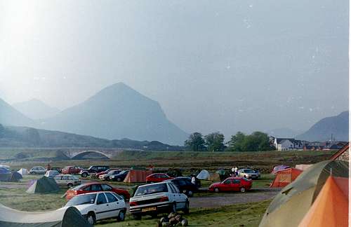
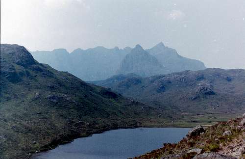
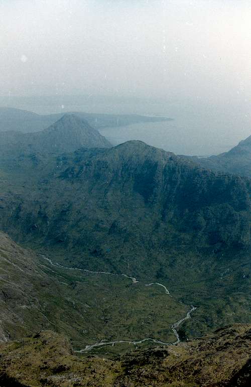
The 'sliggy' campsite, with the impressive Marsco (738m.) in the background is shown in the adjacent foto.
Day 1. Getting to the Route
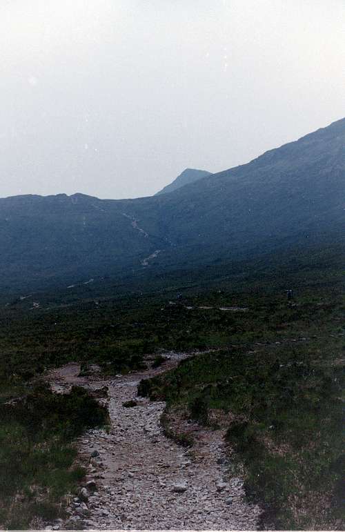
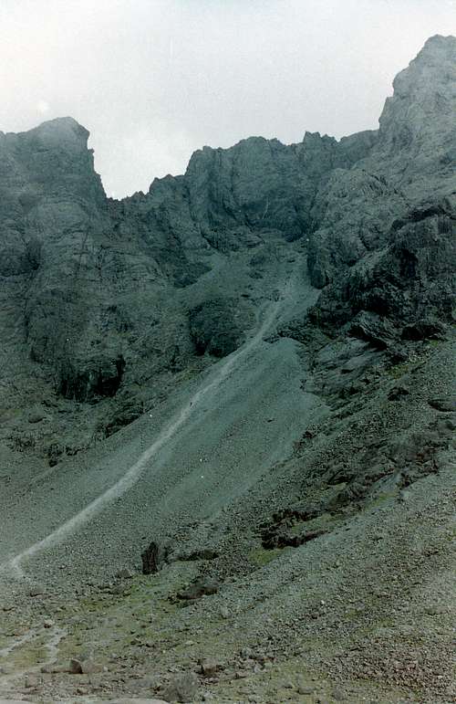
![Glen Sligachan]() nearing Drum Hain
nearing Drum Hain![Start of the trail in Glen Sligachan]() Start of the trail in Glen Sligachan
Start of the trail in Glen SligachanThere are two main choices for doing the ridge depending on where you start and finish, we chose to start from the west coast side of Skye.
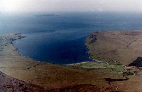
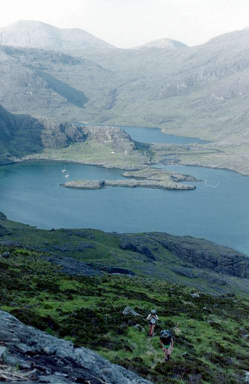
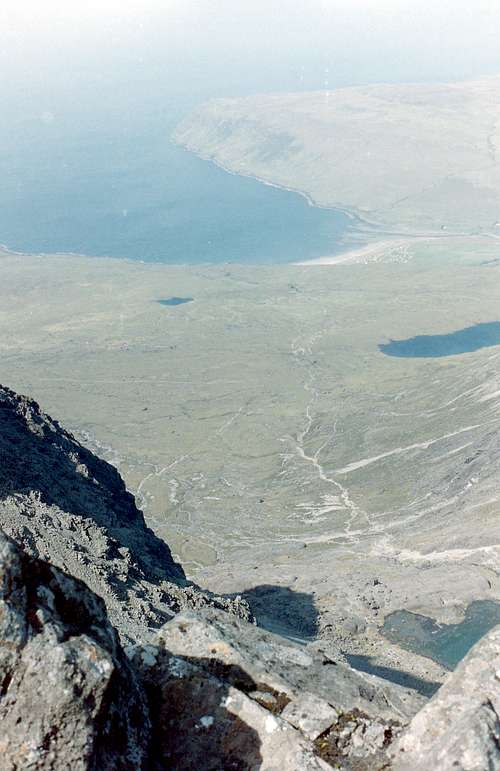
The trail down Glen Sligachan to reach the west coast is fairly straightforward and it is about 14 Kilometres from the Sligachan campsite to the summit of Gars Bheinn. Then the return over the ridge is around 10Km and the way back from Sgurr nan Gillean to the Sligachan campsite is about 6Km making it a 30Km round trip. That doesn't sound too bad I guess, but the first mountain Gars Bheinn, is 895 metres straight up from the sea and the ups and downs on the ridge make for a lot of height to be gained before the end is reached.
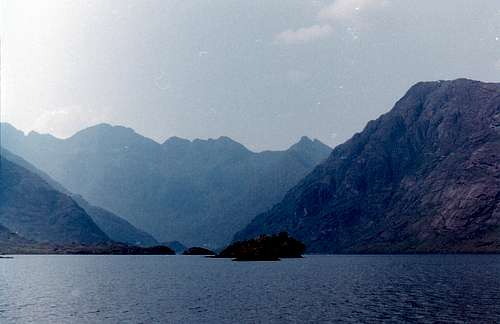
On our first attempt, our plan was to walk across the island and bivvy half way up Gars Bheinn, giving us an 'easy' ascent first thing next day. Not having done the ridge before it seemed like a reasonable idea at the time. After a few hours walking and going over the edge of Drum Hain we were pleased to see a small loch ahead. Off came the clothes and in we went, it was freezing but so refreshing. We soon dried off in the scorching sunshine. Passing on we came to the coast and the "Stepping Stones", a series of slabs down which the waters of Loch Coruisk drain down into Loch Scavaig and on to the Atlantic Ocean.
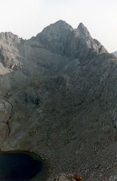
![Loch a'Choire Riabhaich]() Loch a'Choire Riabhaich
Loch a'Choire Riabhaich![Loch Coruisk]() Loch Coruisk
Loch Coruisk
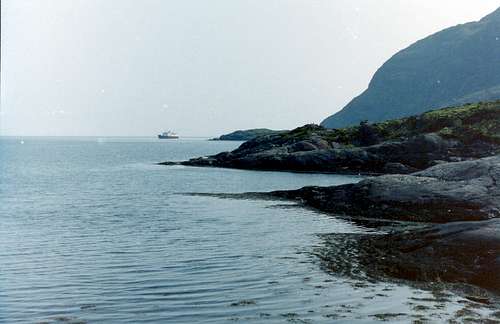
Scrambling down the "stepping stones" we arrived at the sea and made our way along the coast towards Gars Bheinn, looking back we could see the bothy of the Coruisk Memorial Hut in a beautiful isolated situation, you either walk there as we did or get a boat, there are no roads in.
![Loch Scavaig]() Loch Scavaig
Loch Scavaig![The Coruisk Memorial Hut]() The Coruisk Memorial Hut
The Coruisk Memorial HutAfter a lot of huffing and puffing following 2000 feet of height gain, we finally arrived at a small lochan.
Colin was most delighted to find that it was populated by newts. We decided to bivvy there, so at least we could get water for a brew without depleting the water bottles that we would need on the ridge. All your water supplies for at least 24 hours need to be carried with you as there is nowhere on the ridge with a reliable source. That means that each person has to carry at least 4 litres of drinking water.
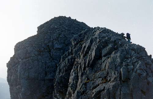
![Climbing Gars Bhein]() Climbing Gars Bhein
Climbing Gars BheinDay 2 - Doing the ridge
![Gars Bheinn]() Gars Bheinn
Gars Bheinn![Gars Bheinn]() Gars Bheinn
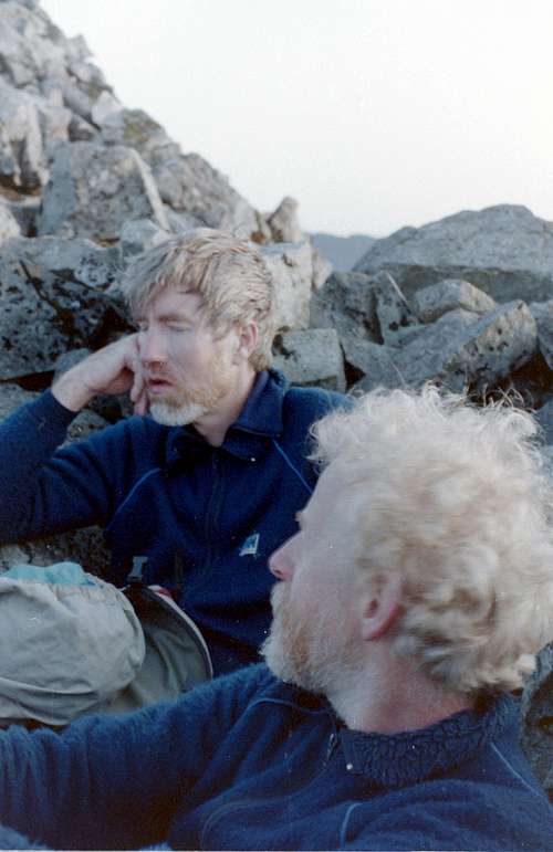
Gars BheinnOur decision to bivvy halfway up Gars Bheinn didn't seem so clever in the morning, 2000 feet of climbing before dawn and breakfast left us a bit queasy as you can see from Ken's expression. On our second attempt the following season, we changed the plan and climbed Gars Bheinn on the first day to bivvy at the top. This proved to suit us much better as we had some horizontal travelling to do whilst we warmed up.
It was around 5am as we made our way along the ridge enjoying the fine weather, it was quite cool initially and slightly hazy but the rock was dry and our feelings of exhilaration were starting to rise.
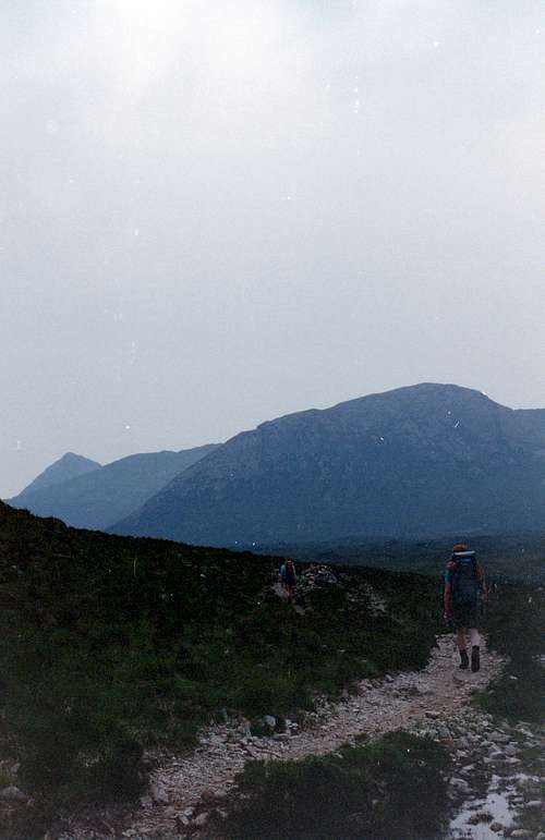
![A long way ahead]() A long way ahead
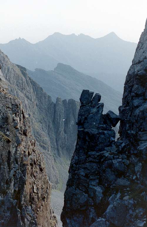
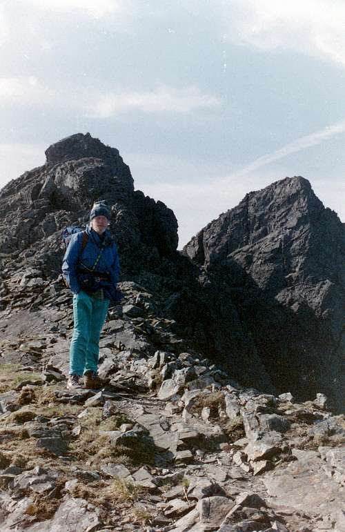
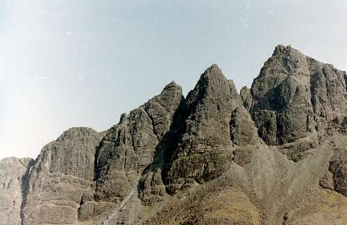
A long way aheadAs we came to the first bealach, we could see far ahead, our final mountain Sgurr nan Gillean (965m.) and to its left "The bastards tooth" (Basteir tooth 916m.)
The ridge kind of stays horizontal if you don't count 700 foot dips and the odd bealach (Gaelic for pass). The first bealach we came to was the Bealach a'Garbin Choire, we abseiled into this and climbed out without difficulty.
![Colin descends on the Cuillin ridge.]() Colin descends on the Cuillin ridge.
Colin descends on the Cuillin ridge.
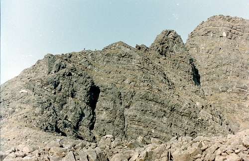
Our first real mountaineering test came when we arrived at the Thearlaich Dubh Gap.
Whilst it is possible to downclimb most of bealachs we decided to abseil wherever possible to save time.
![The Bealach a' Garbh Choire]() The Bealach a' Garbh Choire - Ken abseils down.
The Bealach a' Garbh Choire - Ken abseils down.
So we abseiled down into "The Gap" but then we had to wait in a queue to climb out, so much for our cunning plan to save time.
During the wait we were watching a couple of lads who were camping near us at Sliggy, we nick-named them the "umbilical boys" as they always seemed to be joined by a short rope.
I suspect that the leader must have been a guide or imitating one as he had the largest sac we'd ever seen on his back. There was room enough inside it for another second if his first one had managed to lose the umbilical.
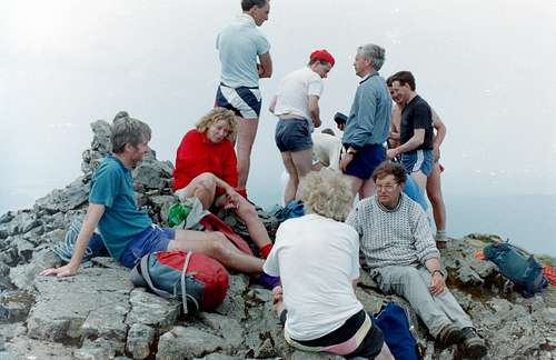
One of the nice things about doing the ridge was the banter between parties who we met up with along the way. Of course our own group was not short of a sense of humour, which we needed at times when we were required to crawl along ledges or scuttle down loose rocks.
I don't describe these things in detail as it is better to experience the fun yourselves.
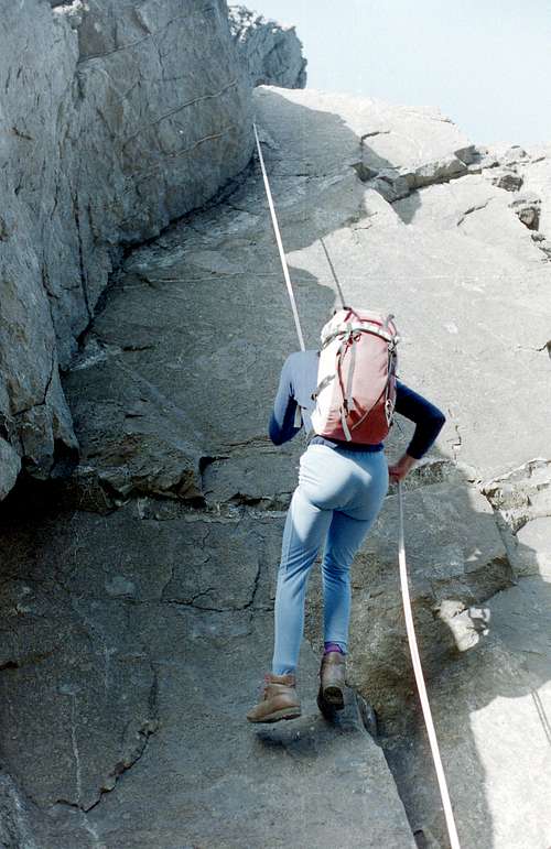
![Thearlaich Dubh Gap]() Andy climbs out of "the Gap"
Andy climbs out of "the Gap"![Sgurr Alasdair]() Sgurr Alasdair
Sgurr Alasdair
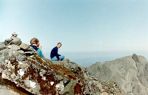
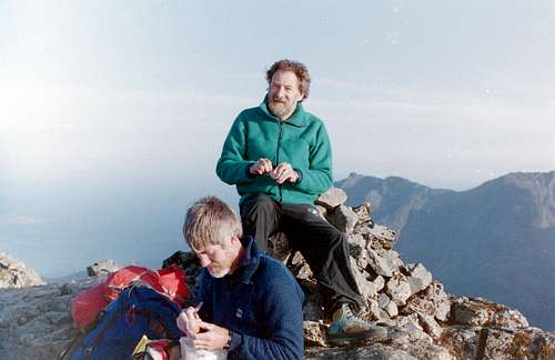
After the fun in "The Gap" we walked steadily along the ridge towards Sgurr Alasdair, arriving on the summit and the highest point of Skye at around 10:30am.
This is a point on the ridge where a retreat can be made by going down "The Great Stone Chute" into Glen Brittle. This feature has got to be the biggest scree run in the UK by a long chalk.
After deciding against a retreat, we moved on past Alasdair towards An Stac and the "In Pin" which we could now clearly see in the distance.
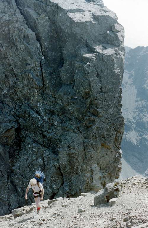
Before we got to An Stac we had to negotiate our way around Sgurr Mhic Choinnich (948m.). There are a number of ways of achieving this but we chose the Collie ledge, a narrow passage way below the crest.
This decision was based upon the time element and the number of people waiting to do the constrained section. We didn't want to lose time or momentum by waiting around. We had to make this kind of decision a few times.
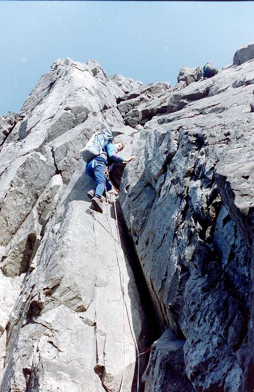
![On the way to An Stac]() Andy on the way to An Stac
Andy on the way to An Stac![The Great Stone Chute]() The Great Stone Chute
The Great Stone Chute![Trevor sees The In Pin ahead]() Trevor sees The In Pin ahead
Trevor sees The In Pin ahead
Travelling further along the ridge we were approaching
the halfway
![The Inaccessible Pinnacle]() The Inaccessible Pinnacle
The Inaccessible Pinnaclepoint, as after crossing An Stac, we reached the "In Pin". There are no particular technical difficulties along this section, although at times the exposure seems so inescapeable. At this stage on our first attempt, fatigue was beginning to take effect as we toiled up the inclines with our heavy sacs.
![Behind the 'In Pin']() Behind the 'In Pin'
Behind the 'In Pin'
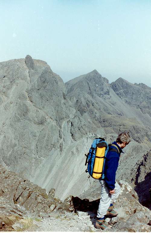
There are great views on this section of the ridge, to the left lies Coire Lagan and Glen Brittle, to the right Loch Coruisk and the distant black bulks of Bla Bheinn and Garb Bhein, joined by an airy ridge that we would cross in another later season to add to our climbing collection of the Munros on Skye.
![Glen Brittle]() Glen Brittle and shoreside campsite.
Glen Brittle and shoreside campsite.
The views from Bla Bhein and Garb Bhein back to the Cuillin ridge are equally stunning and well worth the climb up Coire Ueigneich from the Torrin to Elgol road.
Passing the In Pin and topping Sgurr Dearg (978m.) we then moved down the ridge over Sgurr na Banachdich (965m.), Sgurr a' Mhadaidh and some lesser tops and by this time Colin, Ken & Johnnie were starting to flag a bit. By the time we reached Bidean Drum nan Ramh we were completely knackered and thought that we could not possibly complete the ridge.
After a lot of soul searching and discussion, the party split, Andy and Trevor continuing along the ridge and took a second bivvy whilst Colin, Ken and Johnnie retreated down Harta Coire.
We were to later realise that this was a big mistake, as it took as much effort to descend the coire and walk back to the campsite at Sliggy as it would have done to continue and complete the ridge.
![Andy and Trevor continue towards the summit of An Caisteal (830m.)]() Andy and Trevor continue towards the summit of An Caisteal (830m.)
Andy and Trevor continue towards the summit of An Caisteal (830m.)![Colin strolls on Towards An Caisteal.]() Colin strolls on Towards An Caisteal.
Colin strolls on Towards An Caisteal.![Lunch break]() Lunch break
Lunch break![Harta Corrie]() Harta Corrie
Harta Corrie
Following the fateful decision, Colin, Ken and Johnnie descended Harta Coire and walked back along Glen Sligachan. We were close to exhaustion walking down the Glen and Colin reported that he must be halucinating after he spotted a giant chicken and a articulated lorry on the path.
We finally got back to the Campsite at around 11:30pm disgustingly late as the pub was closing and we didn't get our commiseration beer.
Following their second bivvy, Andy and Trevor completed the ridge the next day whilst Colin, Ken and Johnnie were having a rest.
Season 2
![Pinnacle Ridge]() Pinnacle Ridge
Pinnacle Ridge![Bruach na Frithe]() Johnnie, Colin & Ken on Bruach na Frithe.
Johnnie, Colin & Ken on Bruach na Frithe.Although we (Colin, Ken & Johnnie) did the final part of the ridge that we had retreated from a couple of days later, we still wanted to do it in one expedition, so back we went to Skye in May 1993.
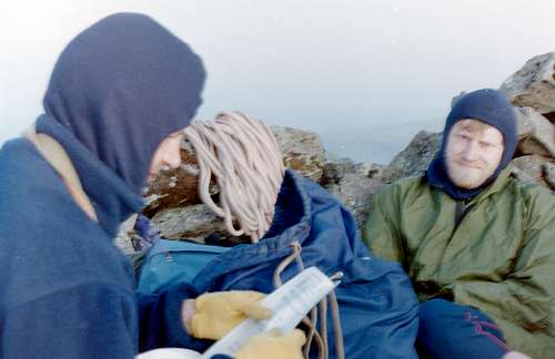
Our valuable lesson learned meant that although we followed the previous year's route as far as the newt filled pond on Gars Bhein, we decided to continue on up to the summit and bivvy on a rocky ledge. We did this and arrived at about 7:15pm.
After getting something to eat and drink we rolled enough stones aside to allow a semi-comfortable rest and tried to get to sleep. Sleep was very difficult anyway, as the light was bright as day until about 11pm and then slightly dimmed until about 3:00am the next day.
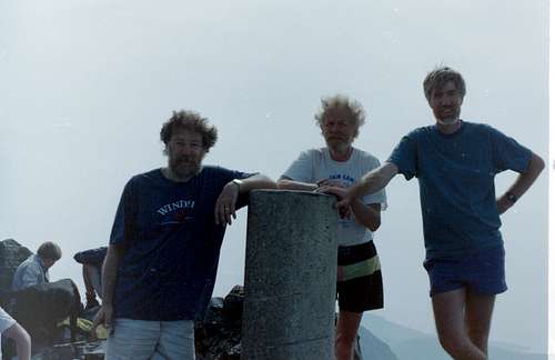
We set off along the ridge again next day at 4:00am in perfect daylight and with the experience gained from the previous season we made good progress. I don't duplicate the reportage here to avoid boring the reader but we did break into a few smiles as we passed our retreat point of the last attempt. As we got to Bruach na Frithe (958m.) we remembered our last visit when we had finally completed all the munros on the ridge a couple of days after our retreat. (The foto shows us sunburned and windswept in at the summit trig station in 1992).
![Sgurr nan Gilliean]() Sgurr nan Gillean -Ken & Colin entertain fellow summiters
Sgurr nan Gillean -Ken & Colin entertain fellow summiters
We all felt quite fresh, it was amazing the difference that the first 2000 foot avoidance on Gars Bhein had made.
We finally arrived on Sgurr nan Gillean at 8:15pm to much elation and celebrated for a few minutes before taking the tourist track back to Sligachan. true to our previous form, we didn't arrive at Sliggy until 11:30pm, closing time at the Sliggy Hotel again and no celebration beers.
We collapsed into bed at last and had to be content with slaking our ridge thirsts at The New Inn in Carbost the next day.
![A well earned beer]() Celebration beers at Carbost
Celebration beers at Carbost


Comments
Post a Comment